Northam, Southampton

Last updated

Northam
Northam park and tower.jpg
The Millbank Tower dominates the Northam skyline
Southampton from OpenStreetMap.png
Red pog.svg
Northam
Location within Southampton
Unitary authority
Ceremonial county
Region
Country England
Sovereign state United Kingdom
Post town SOUTHAMPTON
Postcode district SO14
Dialling code 023
Police Hampshire and Isle of Wight
Fire Hampshire and Isle of Wight
Ambulance South Central
UK Parliament
List of places
UK
England
Hampshire
50°54′45″N1°23′28″W / 50.9124°N 1.391°W / 50.9124; -1.391

Northam is a suburb of Southampton in Hampshire. On the West bank of the River Itchen, it shares borders with St Mary's, Bitterne and Bevois Valley. Beside the border with St Mary's is the Chapel area, which has been home to some recent apartment building developments in Northam. [1] The A3024 road runs through the suburb and crosses the Northam Bridge, which links Northam with Bitterne via Bitterne Manor. Although St Mary's Stadium takes its name from the neighbouring St Mary's, the stadium itself is in Northam, and home to Southampton F.C.

Contents

History

In 1549 it was decided that the inhabitants of Northam had no rights of common over Southampton Common. [2] A map of the area from 1560 shows a building on the site of what is now the Old Farmhouse pub. [3] An engraving in the brickwork dates part of the buildings to 1611. [3]

Northam shipyard was established in 1693 after John Winter purchased the Manor of Northam for that purpose. [4] [5]

The first Northam Road Bridge was built in 1796. [6] The original bridge was made of wood. [7] During Victorian times, much of Southampton's industry was based around the banks of the Itchen

From 1840 Northam was home to the Northam iron works owned (along with Millbrook foundry) by Summers and Day. [8] [9] The first ship was launched from the yard 14 October 1840. [8] Named Pride of the waters (later Ruby) the ship was noted at the time to be the first ship to be constructed from iron in the various shipyards of the river Itchen. [8] Shortly afterwards (by 1842) John Rubie opened a third shipyard just downstream of the Summers and Day yard. [10]

Steamship companies (such as the White Star Line and the Cunard Line) were major employers in the district in the early 20th century. Over 350 Northam residents died aboard RMS Titanic when it foundered off the coast of Newfoundland in 1912; 125 students at one school alone were orphaned. [11]

In the early to mid 20th century the road bridge was rebuilt and strengthened, reopening in 1954. [12] In 1957 Southampton city council began the construction of a housing estate that including the 16 floor Millbank House tower. [13] The tower was opened 1 November 1960 by the Mayor of Southampton and was re-clad in 1988 in aluminium. [14] [13] At the same time the balconies were enclosed. [13] Construction of the wider estate finished in 1965. [15]

In 1965, further work was undertaken on the A3024, the dual carriageway which runs through Northam, to coincide with the opening of the M27 motorway.

Railways and tramways

The London & Southampton Railway reached Northam in 1839. [16] For few months the line terminated at a temporary station at Northam until the Southampton Terminus station was completed. [16]

In order to continue to Southampton Terminus railway station the line had to cross Northam road. [17] Originally a level crossing was constructed but after a dispute with the Northam bridge company the railway agreed to build a bridge to carry the road over the railway. [17] Construction of the bridge in brick began some time before 1840. [17] In 1858 new junction was added connecting the line to what is now Southampton Central railway station. [17] This required the extension of the bridge which was done by added a cast iron section [17] The junction was altered in 1902 to reduce the sharpness of the curve which had previously limited trains to 7MPH. [18] The sharpness of the curve was further reduced in 1980 when the number of lines down to Southampton Docks was reduced from two to one. [18]

The first part of the Northam Quay tramway was built around the start of the 1840s. [19] The first line connected Northam Quay to the site of the coke overns. [19] Over the following decades the tramway was connected to other industrial sites in the area as well as the mainline railway. [19]

The area regained a railway station when Northam railway station was opened on 1 December 1872. [20]

The London & South Western Railway opened a large motive power depot at Northam in 1840, which remained the principal locomotive servicing facility in the area until 1903 when it was replaced by a new depot at Eastleigh. [18] The area previously occupied by the shed then became a goods yard. [18]

Work to replace the bridges that took Northam road over the railway began in 1907 and the new bridge opened in 1908. [17] The New bridge was of steel construction supported by girder lattices [17]

Northam station closed on 3 September 1966 and was demolished by the end of the decade. [18] Northam Quay tramway closed in 1984. [19]

In 2001, South West Trains chose Northam as the location for the maintenance facility for its new Siemens Desiro fleet of trains on the site of the former goods yard. [18] The Northam Carriage Servicing Depot was constructed by Turner & Townsend and opened in 2003. [21]

Places of worship

The Augustine Centre was originally a Church of England church, and subsequently home to Northam Pentecostal Church. The church was built as St Augustine between 1881 and 1884 to a design by Henry Woodyer. [22] It was purchased by Riverside Family Church in the early 1980s and given its new name. [23] The building is a Grade II listed building. [24]

Northam Primitive Methodist Church was opened in 1874. [25] The church held its first wedding in September 1911 and it expanded to include a Sunday school in the late 1920s. [26] [25] By 2022 the church was no longer in use and proposals were being made to turn it into housing. [26]

Television Centre, Southampton

The television studios, demolished in 2009 Meridian studios Southampton.jpg
The television studios, demolished in 2009

Northam was home to Television Centre, Southampton, run by ITV franchises Meridian Broadcasting, TVS (Television South) and Southern Television, before Meridian moved their operations to Whiteley. As well as the regional news magazine programme Meridian Tonight, the studios were originally home to the very first series of the popular game show Catchphrase (before it moved to Maidstone Studios) and handled transmission of Meridian, Anglia and HTV West. The first attempt to redevelop the site failed in 2009 when the developer went into administration. [27] In 2014, Inland Homes announced plans to develop the site as a residential area. [27]

Related Research Articles

<span class="mw-page-title-main">River Itchen, Hampshire</span> River in Hampshire, England

The River Itchen in Hampshire, England, rises to the south of New Alresford and flows 26 miles (42 km) to meet Southampton Water below the Itchen Bridge. The Itchen Navigation was constructed in the late 17th and early 18th centuries to enable barges to reach Winchester from Southampton Docks, but ceased to operate in the mid-19th century and is largely abandoned today.

<span class="mw-page-title-main">Hedge End</span> Human settlement in England

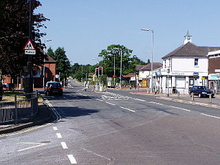
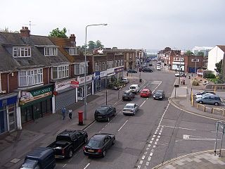
Hedge End is a town and civil parish in Hampshire, England. Situated to the east of the City of Southampton, it adjoins the districts of West End and Botley. Hedge End lies within the Borough of Eastleigh and is part of the Southampton Urban Area. The original hamlet developed on Botley Common after 1250 when it was granted to the men of Botley as common pasture. In 1267, royal charters allowed Botley to hold an annual fair and a weekly market on the common which eventually became a market town.

<span class="mw-page-title-main">Netley</span> Village in Hampshire, England

Netley, officially referred to as Netley Abbey, is a village on the south coast of Hampshire, England. It is situated to the south-east of the city of Southampton, and flanked on one side by the ruins of Netley Abbey and on the other by the Royal Victoria Country Park.

<span class="mw-page-title-main">Bitterne</span> Suburb in England

Bitterne is an eastern suburb and ward of Southampton, England.

<span class="mw-page-title-main">Bitterne Manor</span> Human settlement in England

Bitterne Manor is a suburb of Southampton surrounding the manor house of the same name. It is located on the eastern bank of the River Itchen, across Cobden Bridge from St Denys.

St Denys is a partially riverside district of Southampton, England, centred 1.5 miles (2.4 km) north north-east of the city centre facing variously Bitterne Park and quay across the River Itchen estuary. The river is here spanned in the mid-east extreme of the district by Cobden Bridge, one of five within the city's broad boundaries, six including the railway bridge 100 m south. It is separated from the city centre by the districts sometimes known as Bevois Valley and New Town, in turn and to the south a riverside boardwalk allows pedestrian and bicycle access to the Mount Pleasant Industrial Estate and Northam.

<span class="mw-page-title-main">Sholing</span> Human settlement in England

Sholing, previously Scholing, is a district on the eastern side of the city of Southampton in Southern England. It is located between the districts of Bitterne, Thornhill and Woolston.

<span class="mw-page-title-main">Woolston, Southampton</span> Human settlement in England

Woolston is a suburb of Southampton, Hampshire, located on the eastern bank of the River Itchen. It is bounded by the River Itchen, Sholing, Peartree Green, Itchen and Weston.

<span class="mw-page-title-main">Southampton</span> City in Hampshire, England

Southampton is a port city in Hampshire, England. It is located approximately 80 miles (130 km) south-west of London, 20 miles (32 km) west of Portsmouth, and 20 miles (32 km) south-east of Salisbury. Southampton had a population of 253,651 at the 2011 census, making it one of the most populous cities in southern England. Southampton forms part of the larger South Hampshire conurbation which includes the city of Portsmouth and the boroughs of Havant, Eastleigh, Fareham, and Gosport. A major port, and close to the New Forest, Southampton lies at the northernmost point of Southampton Water, at the confluence of the River Test and Itchen, with the River Hamble joining to the south. Southampton is classified as a Medium-Port City.

Southampton is a city in Hampshire, England. The area has been settled since the Stone Age. Its history has been affected by its geographical location, on a major estuary on the English Channel coast with an unusual double high-tide, and by its proximity to Winchester and London; the ancient and modern capitals of England. Having been an important regional centre for centuries, Southampton was awarded city status by Queen Elizabeth II in 1964 .

<span class="mw-page-title-main">Port of Southampton</span> Passenger and cargo port in Southampton, England

The Port of Southampton is a passenger and cargo port in the central part of the south coast of England. The modern era in the history of the Port of Southampton began when the first dock was inaugurated in 1843. After the Port of Felixstowe, Southampton is the second largest container terminal in UK, with a handled traffic of 1.5 million twenty-foot equivalent units (TEU). It also handles cruise ships, roll-on roll-off, dry bulk, and liquid bulk.

<span class="mw-page-title-main">Southampton Corporation Tramways</span>

Southampton Corporation Tramways were in operation from 1879 to 1949. They were initially horse-drawn, but latterly powered by electricity.

<span class="mw-page-title-main">Northam Bridge</span> Bridge in Northam, Bitterne Manor

The Northam Bridge is a road bridge across the River Itchen in Southampton, England, linking the suburbs of Northam and Bitterne Manor. The current bridge was the first major prestressed concrete road bridge to be built in the United Kingdom. The bridge carries the A3024 road as a dual carriageway, with two lanes on each carriageway.

National Cycle Route 23 is a route of the National Cycle Network, running from Reading to Sandown. The partially signed route passes through Basingstoke, Eastleigh and Southampton; once across the Solent, it continues through Cowes and Newport.

<span class="mw-page-title-main">Woolston Floating Bridge</span>

The Woolston Floating Bridge was a cable ferry that crossed the River Itchen in England between hards at Woolston and Southampton from 23 November 1836 until 11 June 1977. It was taken out of service after the new Itchen Bridge was opened.

<span class="mw-page-title-main">Peartree Green</span> Human settlement in England

Peartree Green is an open space on high ground on the east bank of the River Itchen in Southampton. A 16/17th century building, Peartree House, still stands, though is today concealed by private housing. The house and the green take their name from a pear tree that grew near the parish church. Some of the original open space has been built on, but a large proportion remains as a recreational area. It contains a church and the remains of a boarding school. It overlooks the River Itchen to St Mary's Church in Southampton.

<span class="mw-page-title-main">Northam railway station (Hampshire)</span> Former railway station in Southampton, England

Northam railway station served the suburb of Northam in Southampton, England.

<span class="mw-page-title-main">Clausentum</span> Town in Roman Britannia

Clausentum was a small town in the Roman province of Britannia. The site is believed to be located in Bitterne Manor, which is now a suburb of Southampton.

History of Woolston, suburb of Southampton, Hampshire.

The following is a timeline of the history of the city of Southampton, Hampshire, England.

References

  1. "Highwood enjoy life on the beach! - Highwood Group, Romsey, Hampshire" . Retrieved 13 October 2014.
  2. Davies, J. Silvester (1883). A history of Southampton: partly from the MS. of Dr. Speed, in the Southampton Archives. Gilbert & Co. p. 49.
  3. 1 2 "THE OLD FARM HOUSE PUBLIC HOUSE". Historic England. Retrieved 16 January 2018.
  4. Rance, Adrian (1986). Southampton An Illustrated History. Milestone Publications. p. 74. ISBN   0903852950.
  5. Rance, Adrian B (1981). Shipbuilding in Victorian Southampton. Southampton University Industrial Archaeology Group. p. 3. ISBN   0905280024.
  6. "Itchen Bridge :: History of the Bridge and its Locality". Archived from the original on 14 March 2007. Retrieved 14 December 2006.
  7. "A History of Southampton" . Retrieved 13 October 2014.
  8. 1 2 3 Rance, Adrian B (1981). Shipbuilding in Victorian Southampton. Southampton University Industrial Archaeology Group. p. 13. ISBN   0905280024.
  9. "J&G; Maritime History Society |". Archived from the original on 3 May 2006. Retrieved 14 December 2006.
  10. Rance, Adrian B (1981). Shipbuilding in Victorian Southampton. Southampton University Industrial Archaeology Group. pp. 16/17. ISBN   0905280024.
  11. Titanic Voices by Donald Hyslop et al. Published by Southampton City Council, 1994.
  12. "History of the Itchen Bridge". Archived from the original on 27 September 2007. Retrieved 14 December 2006.
  13. 1 2 3 Barclay, M; Mason, M (May 1994). "The overcladding of Millbank House, Southampton". Proceedings of the Institution of Civil Engineers - Structures and Buildings. 104 (2): 125–134. doi:10.1680/istbu.1994.26323 . Retrieved 20 March 2021.
  14. Douch, Robert (1968). Monuments and memorials in Southampton (Southampton papers, no.6). City of Southampton. p. 11.
  15. O’Brien, Charles; Bailey, Bruce; Pevsner, Nikolaus; Lloyd, David W. (2018). The Buildings of England Hampshire: South. Yale University Press. pp. 659–660. ISBN   9780300225037.
  16. 1 2 Drummond, Ian (2011). Southern Rails Around Southampton: Including the Fawley Branch. Holne Publishing. p. 14. ISBN   9780956331724.
  17. 1 2 3 4 5 6 7 Moy, S. S. J; Tedstone, N. M (February 1998). "Northam Railway Bridge: an unusual bridge in Southampton" . Proceedings of the Institution of Civil Engineers - Transport. 129 (1): 20–27. doi:10.1680/itran.1998.30089 . Retrieved 22 March 2021.
  18. 1 2 3 4 5 6 Drummond, Ian (2011). Southern Rails Around Southampton: Including the Fawley Branch. Holne Publishing. p. 40. ISBN   9780956331724.
  19. 1 2 3 4 Marden, Dave (2009). A Further Look at Southampton's Quayside Railways. Kestrel Railway books. p. 137. ISBN   9781905505128.
  20. Drummond, Ian (2011). Southern Rails Around Southampton: Including the Fawley Branch. Holne Publishing. p. 38. ISBN   9780956331724.
  21. Siemen's Southampton smart depot is completed and ready for new Desiro units Rail issue 466 23 July 2003 page 75
  22. O’Brien, Charles; Bailey, Bruce; Pevsner, Nikolaus; Lloyd, David W. (2018). The Buildings of England Hampshire: South. Yale University Press. p. 610. ISBN   9780300225037.
  23. [ permanent dead link ]
  24. Southampton City Council: Listed buildings in Southampton Archived 7 February 2012 at the Wayback Machine Accessed 13 September 2007.
  25. 1 2 "Sundays were the Lord's Day". Southern Daily Echo. 26 May 2005. Retrieved 26 March 2021.
  26. 1 2 Hatherley, Sam (6 April 2022). "New home plans for Northam Methodist Church in Southampton". Southern Daily Echo. Retrieved 6 April 2022.
  27. 1 2 Franklin, James (24 July 2014). "Plans revealed for £40m development on former Meridian TV site in Northam area of Southampton". Southern Daily Echo. Retrieved 28 March 2021.