Olmsted, Illinois

Last updated

Olmsted
Caboose at Olmstead Depot.jpg
Caboose at Olmstead Depot
Pulaski County Illinois Incorporated and Unincorporated areas Olmsted Highlighted.svg
Location of Olmsted in Pulaski County, Illinois.
Illinois in United States (US48).svg
Location of Illinois in the United States
Coordinates: 37°10′51″N89°5′11″W / 37.18083°N 89.08639°W / 37.18083; -89.08639
CountryUnited States
StateIllinois
County Pulaski
Area
[1]
  Total3.50 sq mi (9.05 km2)
  Land3.37 sq mi (8.71 km2)
  Water0.13 sq mi (0.34 km2)
Elevation
[2]
381 ft (116 m)
Population
 (2020)
  Total285
  Density84.70/sq mi (32.70/km2)
Time zone UTC-6 (CST)
  Summer (DST) UTC-5 (CDT)
ZIP Code(s)
62970
Area code 618
FIPS code 17-55899
GNIS feature ID2399571 [2]
Wikimedia CommonsOlmsted, Illinois

Olmsted is a village in Pulaski County, Illinois, along the Ohio River. The population was 299 at the 2000 census.

Contents

Geography

Olmsted is located at 37°10′51″N89°5′11″W / 37.18083°N 89.08639°W / 37.18083; -89.08639 (37.180733, -89.086431). [3]

According to the 2010 census, Olmsted has a total area of 3.496 square miles (9.05 km2), of which 3.37 square miles (8.73 km2) (or 96.4%) is land and 0.126 square miles (0.33 km2) (or 3.6%) is water. [4]

Demographics

Historical population
CensusPop.Note
1880 57
1890 203256.1%
1900 26832.0%
1910 2887.5%
1920 31810.4%
1930 56076.1%
1940 5925.7%
1950 525−11.3%
1960 475−9.5%
1970 453−4.6%
1980 439−3.1%
1990 358−18.5%
2000 299−16.5%
2010 33311.4%
2020 285−14.4%
U.S. Decennial Census [5]

As of the census [6] of 2000, there were 333 people, 139 households, and 85 families residing in the village. The population density was 178.0 inhabitants per square mile (68.7/km2). There were 173 housing units at an average density of 103.0 per square mile (39.8/km2). The racial makeup of the village was 80.94% White, 18.06% African American, 0.33% Native American, 0.67% from other races. Hispanic or Latino of any race were 0.67% of the population.

There were 139 households, out of which 23.7% had children under the age of 18 living with them, 47.5% were married couples living together, 11.5% had a female householder with no husband present, and 38.8% were non-families. 36.7% of all households were made up of individuals, and 20.1% had someone living alone who was 65 years of age or older. The average household size was 2.15 and the average family size was 2.79.

In the village, the population was spread out, with 21.4% under the age of 18, 7.0% from 18 to 24, 24.4% from 25 to 44, 26.4% from 45 to 64, and 20.7% who were 65 years of age or older. The median age was 43 years. For every 100 females, there were 76.9 males. For every 100 females age 18 and over, there were 80.8 males.

The median income for a household in the village was $19,833, and the median income for a family was $32,188. Males had a median income of $26,875 versus $23,750 for females. The per capita income for the village was $13,615. About 16.9% of families and 21.7% of the population were below the poverty line, including 32.8% of those under the age of eighteen and 16.9% of those 65 or over.

See also

Related Research Articles

<span class="mw-page-title-main">Tucson Estates, Arizona</span> CDP in Arizona, United States

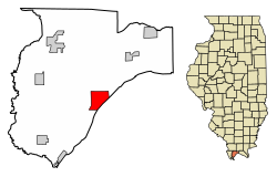
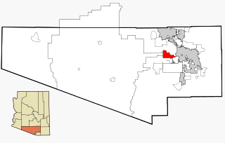
Tucson Estates is a census-designated place (CDP) in Pima County, Arizona, United States. The population was 9,755 at the 2000 census.

<span class="mw-page-title-main">Biscayne Park, Florida</span> Village in Florida

Biscayne Park is a village in Miami-Dade County, Florida, United States. It's also part of the Miami metropolitan area of South Florida. As of the 2020 census, the population was at 3,117 residents.

<span class="mw-page-title-main">Campbell Hill, Illinois</span> Village in Illinois, United States

Campbell Hill is a village in Jackson County, Illinois, United States. The population was 309 at the 2020 census.

<span class="mw-page-title-main">Elkville, Illinois</span> Village in Illinois, United States

Elkville is a village in Jackson County, Illinois, United States. The population was 928 at the 2010 census, down from 1,001 at the 2000 census. As of 2018 the estimated population was 871.

<span class="mw-page-title-main">Vergennes, Illinois</span> Village in Illinois, United States

Vergennes is a village in Jackson County, Illinois, United States. The population was 298 at the 2010 census, down from 491 at the 2000 census.

<span class="mw-page-title-main">Standard City, Illinois</span> Village in Illinois, United States

Standard City is a village in Macoupin County, Illinois, United States. The population was 135 at the 2020 census.

<span class="mw-page-title-main">Brimfield, Illinois</span> Village in Illinois, United States

Brimfield is a village in Peoria County, Illinois, United States.

<span class="mw-page-title-main">Rockwood, Illinois</span> Village in Illinois, United States

Rockwood is a village in Randolph County, Illinois, United States. The population was 32 at the 2020 census. It is the headquarters of the Middle Mississippi River National Wildlife Refuge.

<span class="mw-page-title-main">Alto Pass, Illinois</span> Village in Illinois, United States

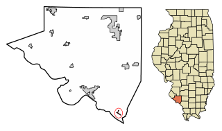
Alto Pass is a village in Union County, Illinois, United States. The population was 342 at the 2020 census, a decrease from 391 in 2010. The Bald Knob Cross and Bald Knob Wilderness are nearby. Alto Pass lies roughly 5.1 miles to the northwest of downtown Cobden, Illinois. Illinois Route 127 runs just west of the village's downtown area.

<span class="mw-page-title-main">Bush, Illinois</span> Village in Illinois, United States

Bush is a village in Williamson County, Illinois, United States. As of the 2000 census, the village population was 257.

<span class="mw-page-title-main">Crainville, Illinois</span> Village in Illinois, United States

Crainville is a village in Williamson County, Illinois, United States. The population was 1,254 at the 2010 census.

<span class="mw-page-title-main">Lambert, Missouri</span> Inactive Village in Missouri, United States

Lambert is an inactive village in Scott County, Missouri, United States. The population was 48 at the 2020 census.

<span class="mw-page-title-main">Browntown, Wisconsin</span> Village in Wisconsin, United States

Browntown is a village in Green County, Wisconsin, United States. The population was 280 at the 2010 census.

<span class="mw-page-title-main">South Wayne, Wisconsin</span> Village in Wisconsin, United States

South Wayne is a village in Lafayette County, Wisconsin, United States. The population was 489 at the 2010 census.

<span class="mw-page-title-main">Endeavor, Wisconsin</span> Village in Wisconsin, United States

Endeavor is a village in Marquette County, Wisconsin, United States. The population was 468 at the 2010 census.

<span class="mw-page-title-main">Big Falls, Waupaca County, Wisconsin</span> Village in Wisconsin, United States

Big Falls is a village in Waupaca County, Wisconsin, United States. The population was 61 at the 2010 census.

<span class="mw-page-title-main">Wyocena, Wisconsin</span> Village in Wisconsin, United States

Wyocena is a village in Columbia County, Wisconsin, United States. The population was 768 at the 2010 census. The village is located within the Town of Wyocena. It is part of the Madison Metropolitan Statistical Area.

<span class="mw-page-title-main">Arena, Wisconsin</span> Village in Wisconsin, United States

Arena is a village in Iowa County, Wisconsin, United States. The population was 834 at the 2010 census. The village is located within the Town of Arena. It is part of the Madison Metropolitan Statistical Area.

<span class="mw-page-title-main">Aniwa, Wisconsin</span> Village in Wisconsin, United States

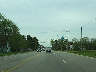
Aniwa is a village in Shawano County, Wisconsin, United States. The population was 260 at the 2010 census. The village is located within the Town of Aniwa. U.S. Route 45 runs north–south through the village.

<span class="mw-page-title-main">North Olmsted, Ohio</span> City in Ohio, United States

North Olmsted is a city in Cuyahoga County, Ohio, United States. The population was 32,442 as of the 2020 census. It is a western suburb of Cleveland and part of the Cleveland metropolitan area.

References

  1. "2020 U.S. Gazetteer Files". United States Census Bureau. Retrieved March 15, 2022.
  2. 1 2 U.S. Geological Survey Geographic Names Information System: Olmsted, Illinois
  3. "US Gazetteer files: 2010, 2000, and 1990". United States Census Bureau. February 12, 2011. Retrieved April 23, 2011.
  4. "G001 - Geographic Identifiers - 2010 Census Summary File 1". United States Census Bureau. Archived from the original on February 13, 2020. Retrieved December 25, 2015.
  5. "Census of Population and Housing". Census.gov. Retrieved June 4, 2015.
  6. "U.S. Census website". United States Census Bureau . Retrieved January 31, 2008.