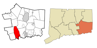
East Lyme is a town in New London County, Connecticut, United States. The town is part of the Southeastern Connecticut Planning Region. The population was 18,693 at the 2020 census. The villages of Niantic and Flanders are located in the town.

The Mechanic Street Historic District encompasses a historic 19th-century mill and mill village in a 14-block area of the Pawcatuck section of Stonington, Connecticut. Extending along the Pawcatuck River and south of West Broad Street, the area includes a large brick mill complex on the banks of the river, and a neighborhood of well-preserved worker housing on the road grid to its west. The district was listed on the National Register of Historic Places in 1988.

Jordan is a village in the town of Waterford, Connecticut, and the historic center of the town. It was named from the Jordan River. The village was listed on the National Register of Historic Places as Jordan Village Historic District in 1990.

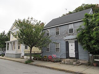
The Noank Historic District is a historic district encompassing the historic main part of the village of Noank in the town of Groton, Connecticut. The district contains a distinctive assortment of mid-to-late 19th-century residential architecture that is notable for its often picturesque woodwork. At the time of their construction, the village was primarily a worker village for nearby shipyards. The district was listed on the National Register of Historic Places in 1979.

The Prospect Hill Historic District encompasses a large residential area in the Willimantic section of Windham, Connecticut. Located north of the Main Street commercial district, it was developed between about 1865 and 1930, and is one of the state's largest historic districts, with more than 800 contributing buildings. It is roughly bounded by Valley, Jackson, Bolivia, Washburn, Windham, and High Streets, and contains one of the state's largest single concentrations of Victorian-era residential architecture. It was listed on the National Register of Historic Places in 2003.
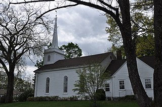
The Round Hill Historic District encompasses the village center of Round Hill, a formerly rural area in northwestern Greenwich, Connecticut. Centered on the junction of John Street and Round Hill Road, the district includes a church, cemetery, two houses, and a former district school, the latter dating to 1750. Established as a center for local farmers in the 18th century, it was transformed in the early 20th century into a center for suburban and summer estate residents. The district was listed on the National Register of Historic Places in 1996.

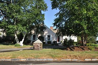
The Graniteville Historic District is a mainly residential historic district in Waterford, Connecticut. It is ranged along Rope Ferry Road, near granite quarries that were once a major industry in the town. Most of the 31 historical buildings in the district are plain residences occupied by quarry workers; also included are the c. 1878 Graniteville School at 239 Rope Ferry Road, and the house of John Palmer, one of the proprietors of the quarries, at 218 Rope Ferry Road. His house, a c. 1860 Italianate updating of an older house, is the most elaborate house in the district. The district was listed on the National Register of Historic Places in 2003.
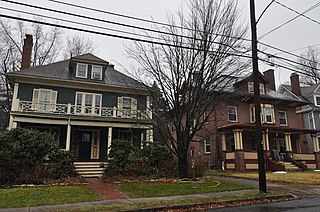
The Coit Street Historic District in New London, Connecticut is a historic district that was listed on the National Register of Historic Places in 1988. It includes 33 contributing buildings over a 4 acres (1.6 ha) area, located just southwest of the city's central business district. The area included in the district was formerly known as Bream Cove, which was filled in and developed in the 19th century. The area includes four out of twelve surviving 18th-century buildings in the city. It includes all of the properties on Coit and Brewer Streets, as well as those on Blinman Street between those two streets.

The Williams Memorial Park Historic District is located in New London, Connecticut, roughly bounded by Hempstead, Broad, Mercer and Williams Streets, with houses on Broad Street south to Cottage Street included. Williams Memorial Park – which was designed by Frederick Law Olmsted – is also included, as is the Civil War monument located there; 16 houses are part of the district, while two buildings – a brick office building at 43 Broad Street and an apartment building at 127 Hempstead Street, are non-contributing properties. Four of the six outbuildings in the district are contributing. Nine different architectural styles are represented in the district.

The Post Hill Historic District encompasses the oldest settled area of New London, Connecticut.

The Hempstead Historic District of New London, Connecticut encompasses a residential area north of the city's harbor and central business district, extending mainly along three roughly parallel streets: Franklin and Hempstead Streets, and Mountain Avenue. The area was settled in the 17th century, and has three centuries of architecture depicting an increasingly urban area. The district was listed on the National Register of Historic Places on July 31, 1986.
The North Cove Historic District encompasses a historic waterfront community on North Cove Road in Saybrook, Connecticut. Laid out in the 17th century, the area has housing stock mostly built between 1700 and 1855, a period in which it flourished as a port and shipbuilding community. The district was listed on the National Register of Historic Places in 1994.

The New London and East Lyme Street Railway was a streetcar line that operated in southeastern Connecticut. Its main line ran from New London to Niantic with a later extension to Crescent Beach and a branch to Old Saybrook.

The Canal Street–Clark Street Neighborhood Historic District encompasses a compact 19th-century working-class neighborhood of Brattleboro, Vermont. Most of its buildings are modest vernacular wood-frame buildings, erected between 1830 and 1935; there are a few apartment blocks, and one church. The district was listed on the National Register of Historic Places in 1993.

The Jefferson-Seymour District is a historic district encompassing a residential area on the south side of Hartford, Connecticut. Covering portions of Cedar, Wadsworth, Seymour and Jefferson Streets, it contains a well-preserved collection of late 19th and early 20th-century middle-class residential architecture, primarily executed in brick. It was listed on the National Register of Historic Places in 1979.

The Naubuc Avenue-Broad Street Historic District encompasses a largely agrarian village area of southwestern East Hartford, Connecticut. Extending along Naubuc Avenue from the Glastonbury line to Broad Street, and along Broad to Main Street, its architecture encapsulates the area's history between the 18th and early 20th centuries. It was listed on the National Register of Historic Places in 1998.
The Oxford-Whitney Streets District is a historic district encompassing an early-20th century residential area in the West End neighborhood of Hartford, Connecticut. It extends along the east side of Oxford Street between Elizabeth and Cone Streets, and along the west side of Whitney between Fern and Elizabeth, and includes the north side of Fern Street between Whitney and Oxford. Most of the housing, a combination of single and multi-family residences, was built between 1906 and 1919, a period later than the surrounding areas, and is predominantly Colonial Revival in character. It was listed on the National Register of Historic Places in 2010.

The Morris Cove Historic District encompasses a former summer resort area in eastern New Haven, Connecticut. Bounded in the north by Myron Street, the south by Morris Causeway and Lighthouse Road, and on the east by the East Haven town line, the area was developed as a coastal summer community before being transformed into a streetcar suburb in the second quarter of the 20th century. It contains a high concentration of quality residential architecture from the first half of the century, and was listed on the National Register of Historic Places in 1985.

The Cove Street Historic District encompasses a small 19th-century neighborhood area of Duxbury, Massachusetts. Located along Cove Street north of the town center, it was developed in the early 19th century to provide housing for workers in nearby shipyards. The architecture of the district includes a variety of single-family housing styles common to the region and time period. The district was added to the National Register of Historic Places in 2019.

Dudley St. Clair Donnelly (1870-1937) was an American architect practicing in New London, Connecticut in the late nineteenth and early twentieth centuries.


