
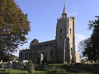
Naseby is a village in West Northamptonshire, England. The population of the civil parish at the 2011 Census was 687.
Burwell is a village and civil parish in Cambridgeshire, England, some 10 miles north-east of Cambridge. It lies on the south-east edge of the Fens. Westward drainage is improved by Cambridgeshire lodes (waterways), including Burwell Lode, a growth factor in the village. A population of 6,309 in the 2011 census was put at 6,417 in 2019.

Ramsey is a market town and civil parish in the Huntingdonshire district of Cambridgeshire, England. The town is about 9 miles (14 km) north of Huntingdon. Ramsey parish includes the settlements of Ramsey Forty Foot, Ramsey Heights, Ramsey Mereside, Ramsey Hollow and Ramsey St Mary's.

Orton is a suburb of the City of Peterborough, in Cambridgeshire, England, about 3 miles (4.8 km) south west of Peterborough city centre to the south of the River Nene. It is located on the route of the A1.

March is a Fenland market town and civil parish in the Isle of Ely area of Cambridgeshire, England. It was the county town of the Isle of Ely which was a separate administrative county from 1889 to 1965. The administrative centre of Fenland District Council is located in the town.
Fulbourn is a village in Cambridgeshire, England, with evidence of settlement dating back to Neolithic times. The village was probably established under its current name by 1200. The waterfowl-frequented stream after which it was named lies in the east, close to the division between arable and fenland.

Knighton is a residential suburban area of Leicester, England. It situated between Clarendon Park to the north, Stoneygate to the east, Oadby and Wigston to the south and the Saffron Lane estate to the west.

Lytchett Matravers is a large village and civil parish in Dorset, England. The 2011 census recorded the parish as having 1,439 households and a population of 3,424.
Kingsthorpe is a suburb and civil parish of Northampton, England. It is situated to the north of Northampton town centre and is served by the A508 and A5199 roads which join at Kingsthorpe's centre. The 2011 Census recorded the population of the district council ward as 4,477.

Cottenham is a village in Cambridgeshire, England. Cottenham is one of the larger villages surrounding the city of Cambridge, located around five miles north of the city. The population of the civil parish at the 2011 Census was 6,095. Cottenham is one of a number of villages that make up the historical Fen Edge region in between Cambridge and Ely, which were originally settlements on the shore of the marshes close to the city of Cambridge, then an inland port.

Stoney Stanton is a large village in the Blaby district of Leicestershire, England with a population of over 3,454 in 2001, increasing to 3,793 at the 2011 census. It constitutes a civil parish. The village lies five miles east of Hinckley, just to the east of the M69. Nearby villages include Croft and Sapcote. It is ten miles from Leicester. As may be gathered from its name it is set on rocky outcrops of igneous rock, granodiorite, a fact which has had its influence on its history. Even in the eighteenth century, Parish records show that gravel and stone were being removed from Carey Hill in the centre of the village. That would later, in the nineteenth and twentieth centuries be quarried for its valuable stone, along with Lanes Hill, Clint Hill, and Hall's Court. Carey Hill and Hall's Court quarries were later filled in, but Clint Hill remains, a relic of the village's industrial heritage, now filled with water and a haven for wild-life.

Bitterne is an eastern suburb and ward of Southampton, England.

Barton Bendish is a civil parish and small ancient village in the English county of Norfolk located 10 miles (16 km) south of King's Lynn and 90 miles (140 km) North East of London. It has two medieval parish churches, and once had three. The parish includes the old hamlet of Eastmoor, and covers 3,936 acres (1,593 ha). The village has been settled since Neolithic times and was expanded during the Saxon period. Today the village has a population of 210 as recorded at the 2010 census and contains eight listed buildings, with the two medieval parishes churches being Grade I.
Benwick is a village and civil parish in the Fenland district of Cambridgeshire, England. It is approximately 15 miles (24 km) from Peterborough and 30 miles (48 km) from Cambridge. The population of Benwick was recorded as 1137 in the United Kingdom Census 2011 with 452 households. The River Nene passes through the village, which is thus accessible by boat from the inland waterways network in England.
Cherry Hinton is a suburban area of the city of Cambridge, in the Cambridge district, in the county of Cambridgeshire, England. It is around 3 miles (4.8 km) southeast of the Cambridge city centre.

Fen Ditton is a village on the northeast edge of Cambridge in Cambridgeshire, England. The parish covers an area of 5.99 square kilometres (2 sq mi).

Little Thetford is a small village in the civil parish of Thetford, 3 miles (5 km) south of Ely in Cambridgeshire, England, about 76 miles (122 km) by road from London. The village is built on a boulder clay island surrounded by flat fenland countryside, typical of settlements in this part of the East of England.
Papworth St Agnes is a village and civil parish in South Cambridgeshire, England. The population of the village is included in the civil parish of Graveley It has also been known as Papworth Magna, to distinguish it from the adjoining Papworth Everard and Papworth Parva. The name of the village does not come from any church of St Agnes, but from a certain Agnes de Papewurda, c1160.

Hardwick is a village and civil parish in the county of Cambridgeshire, England with a large housing estate located about 6 miles (9.7 km) west of the city of Cambridge, England. The village lies immediately south of the A428 road between Cambridge and St Neots. It is about 4 miles (6.4 km) east of the newly developed town of Cambourne. The village is nearly on the Greenwich Meridian. The northern border of the village is St Neots Road, now largely bypassed by the A428, with no houses or property on the north side of the road. In the 2001 census, the population was 2,630 in 946 households, increasing to 2,670 in 1,017 households at the 2011 Census.

Tydd Gote is an English village, partly, at the north, in the civil parish of Tydd St Mary of the South Holland District of Lincolnshire, and partly, at the south, in the civil parish of Tydd St Giles of the Fenland District of Cambridgeshire.


