
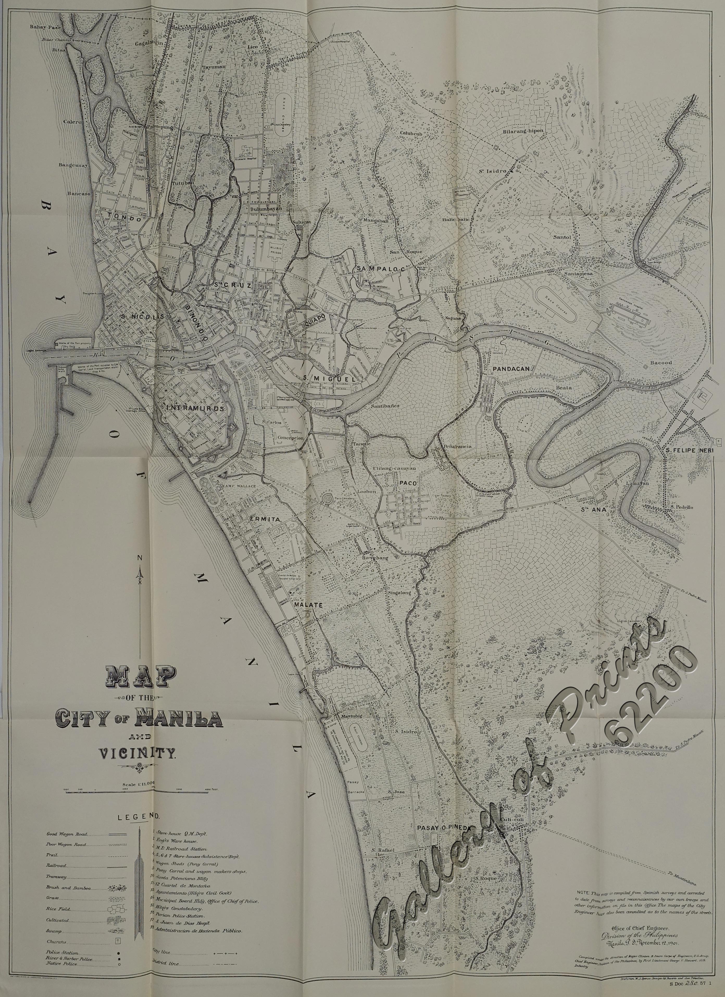
Ermita is a district in Manila, Philippines. Located at the central part of the city, the district is a significant center of finance, education, culture, and commerce. Ermita serves as the civic center of the city, bearing the seat of city government and a large portion of the area's employment, business, and entertainment activities.

Rizal Park, also known as Luneta Park or simply Luneta, is a historic urban park located in Ermita, Manila. It is considered one of the largest urban parks in the Philippines, covering an area of 58 hectares. The site on where the park is situated was originally known as Bagumbayan during the Spanish colonial period. It is adjacent to the historic Walled City of Intramuros.

España Boulevard is an eight–lane major thoroughfare in Manila, the capital city of the Philippines, named after Spain, the country that formerly held the Philippines as an overseas territory. True to its name, several Spanish names abound the street. It starts at the Welcome Rotonda near the boundary of Quezon City and Manila and ends with a Y-intersection with Lerma and Nicanor Reyes Streets in Manila.
Anastacio Tanchanco Caedo was a Filipino sculptor. His style of sculpture was classical realist in the tradition of his mentor, Guillermo Tolentino.

Radial Road 1 (R-1), informally known as the R-1 Road, is a network of roads and bridges that all together form the first arterial road of Metro Manila in the Philippines. Spanning some 42.67 kilometers (26.51 mi), it connects the cities and municipalities of Bacoor, General Trias, Imus, Kawit, Las Piñas, Manila, Naic, Noveleta, Parañaque, Pasay, and Tanza in Cavite and Metro Manila.

Circumferential Road 3 (C-3), informally known as the C-3 Road, is a network of roads and bridges that all together form the third beltway of Metro Manila in the Philippines. Spanning some 14.93 kilometers (9.28 mi), it connects the cities of Caloocan, Makati, Navotas, Pasay, Quezon City, and San Juan.
Taft Avenue is a major road in the south of Metro Manila. It passes through three cities in the metropolis: Manila, Pasay, and Parañaque. The road was named after the former Governor-General of the Philippines and U.S. President, William Howard Taft; the Philippines was a former commonwealth territory of the United States in the first half of the 20th century. The avenue is a component of National Route 170 (N170), a secondary road in the Philippine highway network, and anchors R-2 of the Manila arterial road network.
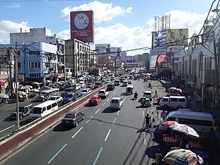
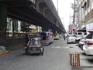
Quezon Boulevard is a short stretch of highway in Manila, Philippines running north–south through the district of Quiapo. It is a six- to ten-lane 1.1-kilometer-long (0.68 mi) divided boulevard designated as a component of National Route 170 (N170) of the Philippine highway network, except for its service roads, and Radial Road 8 (R-8) of Manila's arterial road network which links the center of Manila to North Luzon Expressway in Quezon City in the north. The boulevard is the main access to the popular Quiapo Church and is one of the main thoroughfares of the University Belt area.

The Manila East Road, also known as National Road and National Highway, is a two-to-four lane primary and secondary highway connecting Metro Manila to the provinces of Rizal and Laguna in the Philippines.

Senator Gil J. Puyat Avenue, also known simply as Gil Puyat Avenue and by its former official name Buendia Avenue, is a major arterial thoroughfare which travels east–west through the cities of Makati and Pasay in western Metro Manila, Philippines. It is one of the busiest avenues in Metro Manila linking the Makati Central Business District with the rest of the metropolis.

Kalaw Avenue is a short stretch of road in the Ermita district of Manila, Philippines. It forms the southern boundary of Rizal Park running east–west from San Marcelino Street to Roxas Boulevard near the center of the city. It begins as a four-lane road at the intersection with San Marcelino widening to an eight-lane divided roadway along the stretch of Rizal Park from Taft Avenue west to Roxas Boulevard. It has a short extension into the reclaimed area of Luneta and Quirino Grandstand as South Drive. The avenue's main section between Taft Avenue and Roxas Boulevard is assigned as National Route 155 (N155) of the Philippine highway network.

Blumentritt Road is a major road in Manila, Philippines. It runs through the border of the City of Manila with Quezon City from Rizal Avenue in Santa Cruz district to G. Tuazon Street in Sampaloc district. The road also forms the southern boundary of the Manila North Cemetery. It is named after Bohemian professor and filipinologist, Ferdinand Blumentritt.

Bonifacio Drive is a road running for approximately 1 kilometer (0.62 mi) in a north-south direction between Intramuros and Port Area in Manila, Philippines. The boulevard is also designated as Radial Road 1 (R-1) of Manila's arterial road network, National Route 120 (N120) of the Philippine highway network and an auxiliary route of Asian Highway 26 (AH26).

Mel Lopez Boulevard is a 6.2-kilometer (3.9 mi), six-to-ten lane divided highway in northern Manila, Philippines, connecting Bonifacio Drive in Port Area in the south with Radial Road 10 (R-10) in Navotas in the north. The highway is the main component of the R-10 network, which runs north of the Pasig River until Anda Circle, and is an extension of Bonifacio Drive, running north–south through the Manila North Port area serving the coastal districts of Tondo and Port Area, as well as San Nicolas and Intramuros.

The Liwasang Bonifacio, also known by its former name, Plaza Lawton, is a city square and transport hub in front of the Manila Central Post Office in the Ermita district of Manila, Philippines. It lies at the south end of Jones Bridge, MacArthur Bridge, and Quezon Bridge that link the northern districts of Binondo, Santa Cruz, and Quiapo to the central district of Ermita. The plaza straddles the dividing line between Ermita and Intramuros and is the starting point of Padre Burgos Avenue which connects to Taft Avenue and Roxas Boulevard in Rizal Park.

Circumferential Road 1 (C-1), informally known as the C-1 Road, is a network of roads and bridges that all together form the first and innermost beltway of Metro Manila in the Philippines. Spanning some 5.98 kilometers (3.72 mi), it connects the districts of Ermita, Intramuros, San Miguel, Quiapo, Sampaloc, Santa Cruz, Binondo, San Nicolas, and Tondo in Manila.

The following is an alphabetical list of articles related to the Philippine capital region of Metro Manila.
National Route 170 (N170) is a national secondary road of the Philippine highway network. It passes through the northern part of Metro Manila, traversing through the cities of Quezon City, Manila, and Pasay.


