
Le Parcq is a commune in the Pas-de-Calais department in the Hauts-de-France region of France.
Drancy is a commune in the northeastern suburbs of Paris in the Seine-Saint-Denis department in northern France. It is located 10.8 km (6.7 mi) from the center of Paris.

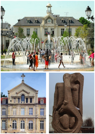
Montreuil, sometimes unofficially referred to as Montreuil-sous-Bois, is a commune in the eastern suburbs of Paris, France. It is located 6.6 km (4.1 mi) from the centre of Paris, in the Seine-Saint-Denis department and in the Métropole du Grand Paris. With a population of 111,367 as of 2020, Montreuil is the third most populous suburb of Paris after Boulogne-Billancourt and Saint-Denis. It is located north of Paris's Bois de Vincennes, on the border with Val-de-Marne.

La Chapelle-Agnon is a commune in the Puy-de-Dôme department in Auvergne-Rhône-Alpes in central France.
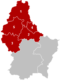
The District of Diekirch was one of three districts of the Grand Duchy of Luxembourg. Immediately prior to its abolition on 3 October 2015, it contained five cantons divided into 43 communes:
- Clervaux
- Diekirch
- Redange
- Vianden
- Wiltz

Hosingen is a small village and former commune in northern Luxembourg.
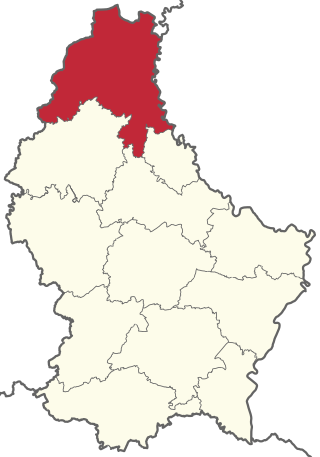
Clervaux is a canton in the north of Luxembourg. Its capital is Clervaux.

Bettembourg is a commune and town in southern Luxembourg. The country's eighth-most populous commune, it is part of the canton of Esch-sur-Alzette.

Luxembourg's 100 communes conform to LAU Level 2 and are the country's lowest administrative divisions.

Consthum is a village and a former commune in northern Luxembourg, in the canton of Clervaux.

Hoscheid is a small town in north-eastern Luxembourg. It was a commune, part of the canton of Diekirch, which was part of the district of Diekirch.

The arrondissement of Évreux is an arrondissement of France in the Eure department in the Normandy region. It has 103 communes. Its population is 140,039 (2016), and its area is 958.7 km2 (370.2 sq mi).
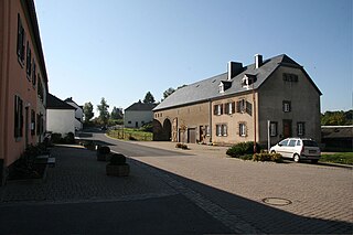
Hoscheid-Dickt is a village in the commune of Parc Hosingen, in northern Luxembourg. As of 2024, the village has a population of 390. Nearby is the source of the Blees.
Wahlhausen is a village in the commune of Parc Hosingen, in northern Luxembourg. As of 2023, the village has a population of 487.
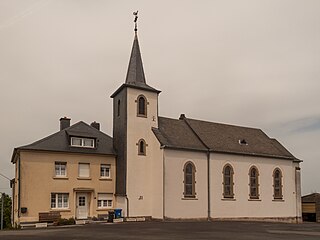
Holzthum is a village in the commune of Parc Hosingen, in northern Luxembourg. As of 2023, the village has a population of 327.

Untereisenbach is a village in the commune of Parc Hosingen, in northern Luxembourg. As of 2005, the village has a population of 217.
La Grand-Croix is a commune and the seat of a canton in the Loire department in central France. It lies in the Gier valley.
Le Brugeron is a commune in the Puy-de-Dôme department in Auvergne-Rhône-Alpes in central France.
Tamou is a village and "Rural commune" in Niger. The town is capital of its Rural Commune in the Say Department of Tillabéri Region, in the far southwest of the nation. It is southwest of Niamey, on the right (western) bank of the Niger River, between the departmental capital Say and the border of Burkina Faso. Tamou Commune is home to the Tamou Total Reserve, a wildlife reserve which is part of the larger W National Park and Transborder Reserve. The Tamou Reserve, in which local people also live, is primarily dedicated to the protection of African Elephant populations which migrate through the region.

The Canton of Perpignan-8 is a French former canton of Pyrénées-Orientales department, in Languedoc-Roussillon. It was created 25 January 1982 by the decree 82–84. It had 13,589 inhabitants (2012). It was disbanded following the French canton reorganisation which came into effect in March 2015.

