Parks and open spaces in Wrexham

Last updated

The city of Wrexham has two main city parks, these being Bellevue Park and Acton Park. On the outskirts of the city there is also open parkland on and surrounding the Erddig estate. There is also a city centre green and various smaller parks and open spaces.

Contents

A total of 13 parks and green spaces in Wrexham city have been, or are in the process of being, legally protected with green space charity Fields in Trust ensuring they can never be built on, nor lost to development. A further 24 parks and open spaces have also been awarded the protection in the wider Wrexham County Borough. [1]

Parks

Bellevue Park

Bellevue Park (Parciau; 53°02′36″N2°59′59″W / 53.0434°N 2.9997°W / 53.0434; -2.9997 (Bellevue Park, Wrexham) ) – opened in 1910. It is located to the south-east of Wrexham city centre in Offa. It hosts a Queen Victoria statue originally from Gulidhall Square on Chester Street, [2] and a bandstand pavilion opened in 1915. [3] The park has hosted the National Eisteddfod of Wales twice in 1912 and 1933. [2] The park was neglected during the 1970s, and many of the amenities were in a poor state of repair.[ citation needed ] A major project was undertaken to refurbish the Park back to its original splendour. This was funded by the Heritage Lottery Fund, Urban Parks Project, Welsh Development Agency, and the European Regional Development Fund.[ citation needed ] The park reopened in its restored original Edwardian condition in June 2000. [2] It now boasts children's play areas, a bowling green constructed in 1914 [2] which is home to the Parciau Bowling Club, tennis, and basketball courts and an original Edwardian bandstand set in an amphitheatre. In the summer months social events take place in the park, such as music concerts, and children's outdoor activity events.

Acton Park

The lake at Acton Park Acton Park lake, Wrexham.jpg
The lake at Acton Park

Acton Park ( 53°03′42″N2°58′46″W / 53.0616°N 2.9795°W / 53.0616; -2.9795 (Acton Park, Wrexham) ) is 0.5 miles (0.8 km) north of Wrexham city centre, between the communities of Acton and Borras Park and the suburb of Garden Village. [4] The site of the park was originally the landscaped grounds of Acton Hall, created in the 1790s. [5] [4] The grounds and hall were transferred to Wrexham Municipal Borough Council in 1947, with the hall demolished in 1954. [4] The park covers approximately 64 acres (26 ha). [5]

Acton Park features a bowling green, tennis courts, a children's play area, a Japanese-style garden and a large lake which has attracted diverse wildlife. [5] The general layout of the park has remained unchanged since it was laid out in the 18th century and now boasts many mature trees. The park also is home to Gorsedd stones, originally constructed for the National Eisteddfod in Bellevue Park, until they were moved to Acton Park. [2] [4]

Open spaces and smaller parks

Llwyn Isaf

Llwyn Isaf ( 53°02′52″N2°59′36″W / 53.0477°N 2.9932°W / 53.0477; -2.9932 (Llwyn Isaf, Wrexham) ), – which is situated alongside Wrexham Guildhall, is a popular green area within the city centre. The green was originally the landscaped grounds of a mansion house of the same name. It now lies at the centre of Wrexham's civic centre just off Queens Square and near Wrexham Library, with it sometimes known as "Library Field". The Welsh Children in Need concert was held at this location in 2005. Council-sponsored events such as Christmas fairs [6] and the Wrexham Food and Drink Festival (Wrexham Feast) are held on the site. [7] [8] The green hosts a bandstand. [9]

Dean Road Field

Dean Road Field is a playing field in Rhosnesni, located off Dean Road and Holt Road. The council considered changing the status of the field into a "town or village green". [10] Proposals to construct housing on the site have faced local opposition. [11]

Nine Acre Field

Nine Acre Field (sometimes partly Welsh: Cae Nine Acre) is an open space in Wrexham. In September 2022, the council proposed it become the Queen Elizabeth II Park, following her death a few weeks prior, in which the council would also protect the site as a permanent green space. [12] In June 2023, it was announced the site would be re-opening for public use. [13]

Morgan Llwyd Memorial Park

The Morgan Llwyd Memorial Park, also formerly known as the Dissenters' Burial Ground, (or the Dissenters' Graveyard [14] or The Bun Hill Fields of North Eastern Wales), [15] is a former nonconformist graveyard in Rhosddu, Wrexham.

The site was originally a quillet ("small tract of land"), possibly the field called Talar-y-geifr, [15] that was part of the Wrexham Regis "common fields" [16] (an open-field system on common land) [15] and was used as a burial ground for two centuries by Wrexham Dissenters, [16] also termed nonconformists. [14]

The Royal Commission on the Ancient and Historical Monuments of Wales and Monmouthshire used the term "Dissenter's Graveyard" and compared it as the Bunhill Fields of Wrexham. [14] In 1655, the site appeared in the will of Daniel Lloyd, the possible original donor of the land, which Lloyd allocated for a "new churchyard", and the site covered 212 roods (0.625 acres (2,530 m2)). [14] The site was acquired around 1655, during the Commonwealth of England [15] and Interregnum, [17] by a congregation under Morgan Llwyd O Wynedd, who was later buried on the site in June 1659. [16] [14]

After Llwyd's death, the congregation's successors from Chester Street Baptist Church later managed the burial ground. [16] The last record of the site belonging to the Dissenters was in 1697. [15] Although by 1779, the successors could not locate the papers proving the transfer, nevertheless it was not doubted that they had full ownership rights by the start of the 18th century. [15] Other dissenter groups were also allowed to be buried on the site. [16] In 1820, it was claimed there was a gravestone on the grounds engraved with "1656" as the date; although later surveys could not locate the stone to verify it, there was no suspicion that the original claim was a mistake. [15]

On one night in 1848, the brasses on almost all the ground's tombstones (except one) were vandalised and destroyed, as their brasses were removed, which was possibly linked to Wrexham races that night. There are no full burial records of the site. [15]

In 1857, the perimeter hedge around the graveyard was replaced with a wall, while in 1883 part of it was given up to allow the widening of Rhosddu Road. [15] [14]

The ground was officially closed in 1888 by an order of the council, [15] although some later burials were permitted, with the last occurring in 1901. [16] In April 1912, a memorial to Morgan Llwyd was unveiled at the graveyard's entrance by Margaret Lloyd George. [17] In 1960, the ground was acquired by Wrexham Borough Council, [17] and laid out to be a park for the wider use of the borough. [16] The grounds reopened on 1 May 1963 as the "Morgan Llwyd Memorial Park". [17] [18] It is now regarded as a public park. [19]

Rhosddu Park

Located opposite the memorial park, on the other side of Rhosddu Road, is Rhosddu Park. It was noted to potentially be the first park in the UK, alongside the opposite former cemetery, to put up signs discouraging human defecation, alongside other notices to discourage anti-social behaviour. [20] [21] [22] In Summer 2019, a community event fair "fun day" was held in the park. [23] It is also known as the “Rhosddu Recreation Ground”. It was created through the generosity of owners of the Island Green Brewery, William and John Jones. Some consider it as Wrexham’s first public park. [19]

Other protected fields

There are other protected open spaces across Wrexham, including open spaces at Anthony Eden Drive, [24] Rosewood Avenue, [25] Wyndham Gardens, [26] and Tanycoed. [27] Recreation grounds at Queen's Park (Caia Park), [28] playing fields and play areas at Brickfield (Court Road, Erddig Road), [29] Ashfield (next to Wrexham Tennis Centre), [30] and Coed Aben. [31] As well as Owain Glyndwr Fields at Maesgwyn, [32] Rhosnesni (the Rhosnesni playing fields, coloquially Spider Park) [33] [34] [35] and Tanydre. [36] All protected by Fields in Trust and managed by Wrexham council.

Other minor open spaces

There is also a green in Garden Village. [37]

Open parkland

The 'Cup and Saucer' at Erddig Park WXM-SDSC0055.jpg
The 'Cup and Saucer' at Erddig Park

Erddig Park ( 53°01′50″N3°00′10″W / 53.0306°N 3.0027°W / 53.0306; -3.0027 (Erddig Park, Wrexham) ) is two miles (3 km) south of the city centre, where the city meets the Clywedog Valley. The park is owned and managed by the National Trust, and is home to Erddig Hall and its formal gardens. [38] The park is also home to a number of notable historic features. These include a hydraulic ram known as the "Cup and Saucer", [39] which is used to pump water from the park to Erddig Hall, and the remains of Wristleham motte and bailey [39] which is thought to be the beginnings of Wrexham as a city in the 12th century.

Allotments

There are three allotments in the city of Wrexham, and an additional one in Tanyfron, in the wider county borough. The three within Wrexham city are located on Erddig Road, Victoria Road, and Prices Lane. [40]

Nearby country parks

There are seven parks and country parks on the outskirts of Wrexham, in the wider Wrexham County Borough, at Tŷ Mawr (Cefn Mawr), Alyn Waters (Gwersyllt), Minera Leadmines (Minera), Bonc-yr-Hafod (Hafod), Moss Valley (Moss), Nant Mill (River Clywedog trail) and Stryt Las (Johnstown); as well as two other country houses at Brynkinalt and Iscoyd Park.

See also

Related Research Articles

<span class="mw-page-title-main">Wrexham</span> City in north-east Wales

Wrexham is a city and the administrative centre of Wrexham County Borough in Wales. It is located between the Welsh mountains and the lower Dee Valley, near the border with Cheshire in England. Historically in the county of Denbighshire, and later the county of Clwyd in 1974, it has been the principal settlement of Wrexham County Borough since 1996.

<span class="mw-page-title-main">Wrexham County Borough</span> County borough in Wales

Wrexham County Borough is a county borough, with city status, in the north-east of Wales. It borders the English ceremonial counties of Cheshire and Shropshire to the east and south-east respectively, Powys to the south-west, Denbighshire to the west and Flintshire to the north-west. The city of Wrexham is the administrative centre. The county borough is part of the preserved county of Clwyd.

<span class="mw-page-title-main">Wrexham (UK Parliament constituency)</span> Parliamentary constituency in the United Kingdom, 1918 onwards

Wrexham is a parliamentary constituency centred on the city of Wrexham in the preserved county of Clwyd, Wales in the United Kingdom. It was created in 1918, and is represented in the House of Commons of the UK Parliament from December 2019 by Sarah Atherton of the Conservative Party.

<span class="mw-page-title-main">Parks and open spaces in the London Borough of Islington</span>

The London Borough of Islington is short of large parks and open spaces, given its status in recent decades as a desirable place of residence. In fact, Islington has the lowest ratio of open space to built-up areas of any London borough. The largest continuous open space in the borough, at 11.75 hectares, is Highbury Fields.

<span class="mw-page-title-main">Acton, Wrexham</span> Community in Wrexham County Borough, Wales

Acton is a suburb and community in Wrexham, Wrexham County Borough, Wales. It spans the north-eastern part of Wrexham. The area is largely residential and at its centre, lies Acton Park, the location of the former Acton Hall.

<span class="mw-page-title-main">Erddig</span> Country house and estate in Wrexham, North Wales

Erddig Hall is a Grade-I listed National Trust property near Wrexham, North Wales. Standing 2 miles (3.2 km) south of the city centre, it comprises a country house built, during the 17th and 18th centuries, amidst a 1,900-acre (770 ha) estate, which includes a 1,200-acre (490 ha) landscaped pleasure park and the earthworks of a Norman motte-and-bailey castle.

<span class="mw-page-title-main">Wrexham (Senedd constituency)</span> Constituency of the Senedd

Wrexham is a constituency of the Senedd. It elects one Member of the Senedd by the first past the post method of election. Also, however, it is one of nine constituencies in the North Wales electoral region, which elects four additional members, in addition to nine constituency members, to produce a degree of proportional representation for the region as a whole.

Wrexham was a rural district in the administrative county of Denbighshire from 1894 and 1974.

<span class="mw-page-title-main">Ysgol Morgan Llwyd</span> School in Wrexham, UK

Ysgol Morgan Llwyd is a Welsh-medium comprehensive school in Wrexham, in north-east Wales, UK. It is the first, and is the only Welsh-medium secondary school in Wrexham County Borough. It is named after the seventeenth-century preacher and author Morgan Llwyd. The school has been open at its present location in Cefn Road since 2000. Previously it was located on Stockwell Grove. The Headteacher is Ms. Catrin Prichard.

<span class="mw-page-title-main">Rhosddu</span> Community in Wrexham County Borough, Wales

Rhosddu is a suburb and community in Wrexham County Borough, Wales, covering the north-western parts of the city of Wrexham and comprises the wards of Grosvenor, Garden Village and Stansty.

<span class="mw-page-title-main">Stansty</span> Area of Wrexham, Wales

Stansty is an area and electoral ward in Wrexham County Borough, Wales, lying to the immediate north-west of the city of Wrexham. It is a former civil parish and township. Stansty is also an electoral ward to Wrexham County Borough Council. The ward population as taken at the 2011 Census was 2,114.

<span class="mw-page-title-main">Garden Village, Wrexham</span> Suburb and ward of Wrexham, Wales

Garden Village is a suburb of the city of Wrexham and an electoral division (ward) in the community of Rhosddu in Wrexham County Borough, Wales. The population of the ward at the 2011 census was 2,035 It lies to the west of Chester Road and borders the wards of Stansty to the south and east, Gwersyllt East and South to the north west, Little Acton and Acton to the west, and a small section of Gresford to the north.

<span class="mw-page-title-main">Plas Coch</span> Area of Wrexham

Plas Coch is an area of the community of Rhosddu, in the city of Wrexham, Wales. A major retail and educational area of Wrexham, it lies to the north-west of Wrexham city centre. Formerly known as Lower Stansty, the term has fallen out of use in preference for Plas Coch in recent years, likely due to the popular retail area which shares its name.

<span class="mw-page-title-main">Caia Park</span> Community in Wrexham County Borough, Wales

Caia Park is a suburb and community in Wrexham, Wrexham County Borough, Wales. It was created in 1985 after a Boundary Commission review of the four community areas within Wrexham, of which Caia Park occupies its east, with the others being Acton, Offa, and Rhosddu. At the 2001 census, the community had a population of 11,882 in 5,019 households, increasing to 12,602 in 2011.

<span class="mw-page-title-main">Wrexham city centre</span> Central district of Wrexham, north Wales

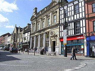
Wrexham city centre is the administrative, cultural and historic city centre of Wrexham, in North Wales and is the area enclosed by the inner ring road of the city. It is the largest shopping area in north and mid Wales, and the administrative centre of Wrexham County Borough. Many of its streets are pedestrianised.

<span class="mw-page-title-main">Offa, Wrexham</span> Community in Wrexham County Borough, Wales

Offa is a community and electoral ward in Wrexham County Borough, Wales, covering most of the south-western portion of the city of Wrexham. It is bordered by the communities of; Rhosddu, and Caia Park to the north, Abenbury to the east, Esclusham, and Marchwiel to the south, and Broughton, Coedpoeth, and Gwersyllt to the west.

<span class="mw-page-title-main">Pentre Maelor</span> Village in Wrexham County Borough, Wales

Pentre Maelor is a housing estate near Wrexham Industrial Estate in Wrexham County Borough, Wales. In the 2011 census, its built-up area had a population of 305.

References

  1. "Protecting Wrexham's Green Spaces for Good". Fields in Trust. Fields in Trust. Retrieved 3 April 2022.
  2. 1 2 3 4 5 "Wrexham park celebrates 100 years". 2010-07-14. Retrieved 2022-04-05.
  3. "Bellvue Park (y Parciau), Wrexham". Coflein. Retrieved 2022-04-05.
  4. 1 2 3 4 "Acton Park". 2009-07-24. Retrieved 2022-04-05.
  5. 1 2 3 "Acton Park | Wrexham County Borough Council". www.wrexham.gov.uk. Retrieved 2022-04-05.
  6. "Final Christmas event to come to Wrexham this weekend". The Leader. Retrieved 2022-04-05.
  7. "FAQ – Wrexham Feast" . Retrieved 2022-04-05.
  8. "More than 60 producers confirmed for Wrexham Food Festival next weekend". Deeside.com. Retrieved 2022-04-05.
  9. "Bandstand Marathon on Llwyn Isaf". Wrexham.com. Retrieved 2022-04-05.
  10. "Wrexham councillors to consider granting Dean Road field 'town or village green status'". Wrexham.com. Retrieved 2024-01-13.
  11. "Developer advertising homes to be built on controversial Dean Road field site". The Leader. 2023-05-26. Retrieved 2024-01-13.
  12. "Nine Acre field to be 'protected' as green space and renamed as "Queen Elizabeth II Park"". Wrexham.com. Retrieved 2024-01-13.
  13. "Nine-Acre Field reopening to public for community use, Wrexham Council confirms". The Leader. 2023-06-14. Retrieved 2024-01-13.
  14. 1 2 3 4 5 6 An Inventory of the Ancient Monuments in Wales and Monmouthshire: IV - County of Denbigh. Vol. 4. Royal Commission on the Ancient and Historical Monuments in Wales and Monmouthshire. 1 Jan 1914. pp. 186, 187.
  15. 1 2 3 4 5 6 7 8 9 10 "Dissenters Burial Ground 1655". wrexham-history.com.
  16. 1 2 3 4 5 6 7 "Dissenters Burial Ground, Rhosddu, Wrexham". wrexham-history.com.
  17. 1 2 3 4 Davies, Christopher (15 October 2023). A-Z of Wrexham: Places-People-History. Amberley Publishing Limited. ISBN   9781445699066.
  18. "Morgan Llwyd – Hero or Heretic? — by Gwyn Davies". Evangelical Magazine. Retrieved 2024-01-13.
  19. 1 2 Ebsworth, David (2023). Wrexham Revealed: A Walking Tour with Tales of the City’s History. Compact Cymru. Wrexham Carnival of Words. Carreg Gwalch. ISBN   9781845245245.
  20. Bagnall, Steve (2016-04-20). "You wouldn't believe what Wrexham cemetery and park users are being banned from doing". North Wales Live. Retrieved 2024-01-13.
  21. "Talks ongoing over dog attack concerns in Wrexham park". The Leader. 2023-07-25. Retrieved 2024-01-13.
  22. "Wrexham council set to renew anti-social crackdown". BBC News. 2023-03-03. Retrieved 2024-01-13.
  23. "Summer fun day in Rhosddu Park shows Wrexham at its best". Wrexham.com. Retrieved 2024-01-13.
  24. "Anthony Eden Drive Open Space". Fields in Trust. Retrieved 2024-01-13.
  25. "Rosewood Avenue Open Space". Fields in Trust. Retrieved 2024-01-13.
  26. "Wyndham Gardens Open Space". Fields in Trust. Retrieved 2024-01-13.
  27. "Tanycoed Open Space". Fields in Trust. Retrieved 2024-01-13.
  28. "Queen's Park Recreation Ground". Fields in Trust. Retrieved 2024-01-13.
  29. "Brickfield Sports Field". Fields in Trust. Retrieved 2024-01-13.
  30. "Ashfield Playing Field". Fields in Trust. Retrieved 2024-01-13.
  31. "Coed Aben Play Area". Fields in Trust. Retrieved 2024-01-13.
  32. "Owain Glyndwr Field (Maesgwyn)". Fields in Trust. Retrieved 2024-01-13.
  33. "Owain Glyndwr Field (Rhosnesni)". Fields in Trust. Retrieved 2024-01-13.
  34. "Teams in fitting tribute to football referee from Acton". The Leader. 2015-05-28. Retrieved 2024-01-13.
  35. Live, North Wales (2011-11-22). "Three more Wrexham fields could be protected from development". North Wales Live. Retrieved 2024-01-13.
  36. "Owain Glyndwr Field (Tan-y-dre)". Fields in Trust. Retrieved 2024-01-13.
  37. "Praise After Travellers Forced To Vacate Garden Village Green". Wrexham.com. Retrieved 2024-01-13.
  38. "Erddig". National Trust. Retrieved 2022-04-05.
  39. 1 2 "Discover the parkland at Erddig". National Trust. Retrieved 2022-04-05.
  40. "Allotments | Wrexham County Borough Council". www.wrexham.gov.uk. Retrieved 2024-01-13.