Hutchinson Municipal Airport, also known as Butler Field, is a public airport located two miles (3 km) south of the central business district of Hutchinson, a city in McLeod County, Minnesota, United States. It is owned by the City of Hutchinson. The airport is home to the Civil Air Patrol. The FBO is operated by ASI JET.
Longville Municipal Airport is a city-owned public-use airport located one nautical mile (1.85 km) northeast of the central business district of Longville, a city in Cass County, Minnesota, United States.
South St. Paul Municipal Airport, also known as Richard E. Fleming Field or simply Fleming Field, is a city-owned public-use airport located two miles (3 km) south of the central business district of South St. Paul, a city in Dakota County, Minnesota, United States. It is named for Richard E. Fleming, a United States Marine Corps Naval Aviator during World War II who was posthumously awarded a Medal of Honor. It is the only reliever airport for Minneapolis–St. Paul International Airport that is not operated by the Metropolitan Airports Commission.
Waseca Municipal Airport is a public airport located two miles (3 km) west of the central business district of Waseca, in Waseca County, Minnesota, United States. It is owned by the City of Waseca.
Ely Municipal Airport is a public airport located in Saint Louis County, Minnesota, United States, four miles south of the city of Ely, which owns the airport.
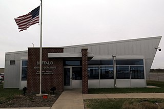
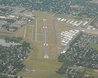
Buffalo Municipal Airport is a city-owned public-use airport located two miles (3 km) southeast of the central business district of Buffalo, a city in Wright County, Minnesota, United States.
Cambridge Municipal Airport is a city-owned public-use airport located two miles (3 km) southwest of the central business district of Cambridge, a city in Isanti County, Minnesota, United States.
Tower Municipal Airport is a city-owned public-use airport located one nautical mile (2 km) northwest of the central business district of Tower, a city in Saint Louis County, Minnesota, United States. It is located on Lake Vermilion and is also known as Tower Municipal Airport & Seaplane Base.
Aitkin Municipal Airport, also known as Steve Kurtz Field, is a public use airport located two nautical miles (4 km) northeast of the central business district of Aitkin, a city in Aitkin County, Minnesota, United States. It is owned by the County & City of Aitkin.
Chetek Southworth Municipal Airport, also known as Chetek Municipal–Southworth Airport, is a city-owned public-use airport located one nautical mile (2 km) southeast of the central business district of Chetek, a city in Barron County, Wisconsin, United States.

Crookston Municipal Airport, also known as Kirkwood Field, is a city-owned public-use airport located four nautical miles (7 km) north of the central business district of Crookston, a city in Polk County, Minnesota, United States.
Alexandria Municipal Airport, also known as Chandler Field, is a city-owned public-use airport located two nautical miles (3.7 km) southwest of the central business district of Alexandria, a city in Douglas County, Minnesota, United States.
Long Prairie Municipal Airport, also known as Todd Field or Todd Field Airport, is a public use airport located four nautical miles (7 km) south of the central business district of Long Prairie, a city in Todd County, Minnesota, United States. The airport is owned by Todd County and the City of Long Prairie.
Milaca Municipal Airport is two miles northeast of City of Milaca, in Mille Lacs County, Minnesota.

Princeton Municipal Airport is a city-owned public-use airport located one nautical mile southwest of the central business district of Princeton, a city in Mille Lacs County, Minnesota, United States. This airport is included in the FAA's National Plan of Integrated Airport Systems 2015–2019, which categorizes it as a general aviation airport.
The Le Sueur Municipal Airport is an airport on the south side of Le Sueur, Minnesota, United States. It is located on Minnesota State Highway 112. The airport hosts a variety of events, including fly-ins and pancake breakfasts.
Moorhead Municipal Airport is a city-owned public-use airport located four miles south east of the central business district of Moorhead, a city in Clay County, Minnesota.
Wheaton Municipal Airport is a city-owned public-use airport located three miles southwest of the central business district of Wheaton, a city in Traverse County, Minnesota, United States.
Pipestone Municipal Airport is a city-owned public-use airport located one mile southeast of the central business district of Pipestone, a city in Pipestone County, Minnesota, United States.
Wells Municipal Airport is a city-owned, public-use airport located three nautical miles (6 km) west of the central business district of Wells, a city in Faribault County, Minnesota, United States.

