Druid Hills is a community which includes both a census-designated place (CDP) in unincorporated DeKalb County, Georgia, United States, as well as a neighborhood of the city of Atlanta. The CDP's population was 14,568 at the 2010 census. The CDP formerly contained the main campus of Emory University and the Centers for Disease Control and Prevention (CDC) however they were annexed by Atlanta in 2018. The Atlanta-city section of Druid Hills is one of Atlanta's most affluent neighborhoods with a mean household income in excess of $238,500.

Kalorama is a neighborhood in Northwest Washington, D.C., United States. It includes the Kalorama Triangle Historic District and Sheridan-Kalorama Historic District. It is named after the Kalorama mansion.

Travis Heights is a historic neighborhood in south Austin, Texas, United States, bounded by Lady Bird Lake on the north, Interstate 35 on the east, Congress Avenue on the west and Oltorf Street on the south. These boundaries include Fairview Park, an earlier suburb associated with the same developers, running from the west side of Blunn Creek to South Congress Avenue. Part of Travis Heights was stranded east of Interstate 35; many of the same streets to be found west of the highway continue east of it.
Eastwood is a historic neighborhood in the East End area of Houston, Texas, United States. Eastwood maintains Houston’s largest intact collection of Craftsman, Arts & Crafts, Foursquare and Mission style architecture.

The Old West Austin Historic District is a residential community in Austin, Texas, United States. It is composed of three neighborhoods located on a plateau just west of downtown Austin: Old Enfield, Pemberton Heights, and Bryker Woods. Developed between 1886 and 1953, the three historic neighborhoods stretch from Mopac Expressway east to Lamar Boulevard, and from 13th Street north to 35th Street. It borders Clarksville Historic District and the West Line Historic District to the south.

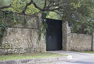
The Keith House in Austin, Texas is a historic home in the Pemberton Heights neighborhood in central Austin.
The city of San Antonio in the U.S. state of Texas is composed of a number of neighborhoods and districts, spreading out surrounding the central Downtown Area.
The Judge Robert Lynn Batts House is a historic home in central Austin, Texas, United States. It was built 1924–1925 for Judge Robert Lynn Batts and his family. Over the course of several decades, Judge Batts served in the Texas House of Representatives, as assistant attorney general of Texas, and as a law professor at the University of Texas at Austin.
North Shoal Creek is a neighborhood in north central Austin, Texas established in the 1960s.
Allandale, Austin, Texas is a neighborhood in North Central Austin, in the U.S. State of Texas known for its large lots, mature trees, and central location.

Bailey Park is located in central Austin, Texas within the vicinity of the Seton Medical Center and St. Andrews Episcopal School. Located at 30°18′09″N97°44′48″W, the small city park was created from several residential lots clustered together to make a common public green space. In 1935 F.G Rossener paid $320 in cash for lot #14 in the George W. Spears league of land. Bailey Park eventually expanded to cover 2.3 acres (9,300 m2) or about one small city lot by the late 1930s.
Bryker Woods is an older Austin, Texas, central city neighborhood developed in the 1930s, the center of which is approximately located at 30°18′17″N97°45′06″W. It is predominantly a mix of young and old families and zoned as a single-family neighborhood composed of mostly small homes in good condition, most of which are over 50 years old. The Bryker Woods neighborhood is also part of the Old West Austin Historic District. Bryker Woods has its own elementary school, Bryker Woods Elementary, and is convenient to retail and recreational facilities.

The West Line Historic District is a residential community in central Austin, Texas, United States. The district encompasses an approximately 90-block tract of land located west of downtown. Bounded by Baylor Street to the east, Fifth Street to the south, Thirteenth Street to the north and Texas State Highway Loop 1 to the west. It is located south of the Old West Austin Historic District and southeast of the Clarksville Historic District.
Splitrock is a house in Austin, Texas, built in 1893 by a Scottish immigrant named Robert F Burns. Located at 2815 Wooldridge Dr. on bluffs overlooking Shoal Creek, the house was one of the first in the central Austin area which is now occupied by the Pemberton Heights and Bryker Woods neighborhoods. The name Splitrock is derived from a topographic feature and swimming hole located approximately 300 feet (91 m) south east of the house. In 2006 Splitrock was designated as a City of Austin Historic Landmark. The house also referred to as the “Burns-Klein” house is a contributing property to the Old West Austin National Register Historic District.

Shoal Creek is a stream and an urban watershed in Austin, Texas, United States.

The West Fifth Street Bridge is a historic cantilever concrete girder bridge in downtown Austin, Texas. Built in 1931, the bridge carries Fifth Street across Shoal Creek to link central Austin with neighborhoods that were then the city's western suburbs. It is one of only a handful of curved cantilever girder bridges in Texas, built as part of the city's 1928 master plan for urban development and beautification. The bridge was added to the National Register of Historic Places in 2019.

The 1928 Austin city plan was commissioned in 1927 by the City Council of Austin, Texas. It was developed by consulting firm Koch & Fowler, which presented the final proposal early the next year. The major recommendations of this city plan related to Austin's street plan, its zoning code, and the development of major industries and civic features, but it is most remembered for institutionalizing housing segregation by designating East Austin as the city's negro district.
The Third Street Railroad Trestle is a historic wooden railroad trestle bridge crossing Shoal Creek in downtown Austin, Texas. Built around 1922 by the International–Great Northern Railroad, it replaced an earlier bridge in the same place. The bridge was used by the I–GN Railroad, the Missouri Pacific Railroad, and the Missouri–Kansas–Texas Railroad until 1964, when commercial rail traffic stopped; after 1991 the bridge was abandoned. It was added to the National Register of Historic Places in 2021.
Samuel Edward Gideon was a 20th-century architect and architectural historian most active in Austin, Texas, and as a professor at The University of Texas, Austin School of Architecture.

