
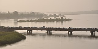
The Nile is a major north-flowing river in northeastern Africa. It flows into the Mediterranean Sea. The Nile is the longest river in Africa and has historically been considered the longest river in the world, though this has been contested by research suggesting that the Amazon River is slightly longer. Of the world's major rivers, the Nile is one of the smallest, as measured by annual flow in cubic metres of water. About 6,650 km (4,130 mi) long, its drainage basin covers eleven countries: the Democratic Republic of the Congo, Tanzania, Burundi, Rwanda, Uganda, Kenya, Ethiopia, Eritrea, South Sudan, Republic of the Sudan, and Egypt. In particular, the Nile is the primary water source of Egypt, Sudan and South Sudan. Additionally, the Nile is an important economic river, supporting agriculture and fishing.
The Niger River is the main river of West Africa, extending about 4,180 km (2,600 mi). Its drainage basin is 2,117,700 km2 (817,600 sq mi) in area. Its source is in the Guinea Highlands in south-eastern Guinea near the Sierra Leone border. It runs in a crescent shape through Mali, Niger, on the border with Benin and then through Nigeria, discharging through a massive delta, known as the Niger Delta, into the Gulf of Guinea in the Atlantic Ocean. The Niger is the third-longest river in Africa, exceeded by the Nile and the Congo River. Its main tributary is the Benue River.

The White Nile is a river in Africa, one of the two main tributaries of the Nile, the other being the Blue Nile. The name comes from the clay sediment carried in the water that changes the water to a pale color.

The Jhelum River is a river in the northern Indian subcontinent. It originates at Verinag and flows through the Indian-administered territory of Jammu and Kashmir, into Pakistani-administered Azad Kashmir, then the Pakistani province of Punjab. It is the westernmost of the five rivers of the Punjab region, and flows through the Kashmir Valley. It is a tributary of the Chenab River and has a total length of about 725 kilometres (450 mi).

The Chenab River is a major river that flows in India and Pakistan, and is one of the 5 major rivers of the Punjab region. It is formed by the union of two headwaters, Chandra and Bhaga, which rise in the upper Himalayas in the Lahaul region of Himachal Pradesh, India. The Chenab flows through the Jammu region of Jammu and Kashmir, India into the plains of Punjab, Pakistan, before ultimately flowing into the Indus River.

The Ofanto, known in ancient times as Aufidus or Canna, is a 134 or 170 km river in southern Italy that flows through the regions of Campania, Basilicata, and Apulia, into the Gulf of Manfredonia near Barletta.

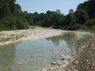
The Agri is a river in the Basilicata region of southern Italy. In ancient times it was known as Aciris. The source of the river is in the Lucan Apennines north of Monte Volturino and west of Calvello in the province of Potenza. It is near the source of the Basento. The river flows south near Paterno before curving southeast. It flows near Tramutola, Viggiano, and Grumento Nova before entering a lake. After exiting the lake, the river flows eastward near Armento, Missanello, Aliano, and Sant'Arcangelo. A right tributary, the Racanello, enters the river in this area. The river forms the border between the province of Potenza and the province of Matera for part of this area of the river. It flows into a small lake before entering the province of Matera. The river flows for a short distance before entering Lago di Gannano. After exiting the lake, the river flows southeast near Tursi, Montalbano Jonico, and Scanzano Jonico before flowing into the Gulf of Taranto near Policoro.
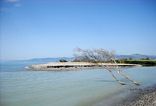
The Sinni is a 94 km long river in the Basilicata region of southern Italy. In antiquity, the city of Siris lay at its mouth. Near the town of Senise, a dam on the river was built in 1970-1982, the largest in Europe built with earth. In correspondence of it, it forms the Lago di Monte Cotugno, one of the largest artificial basins in Italy.

The Swat River is a perennial river in the northern region of the Khyber-Pakhtunkhwa Province of Pakistan. The river's source is in the high glacial valleys of the Hindu Kush mountains, where it then flows into the Kalam Valley before forming the spine of the wider Swat Valley.

The Tordino is a river flowing in the province of Teramo, in the Abruzzo region of central Italy. In Roman times it may have been known as "Batinus".

The Montone is a river in the historical region of Romagna, which is in the present-day region of Emilia-Romagna in northern Italy. It is the northernmost river on the east-facing slopes of the Apennines to flow directly into the Adriatic Sea rather than entering the Po. Its Latin name was Utis or Vitis.

The Santerno is a river in Romagna in northern Italy. It is a major tributary of the river Reno. In Roman times, it was known as the Vatrenus, although, in the Tabula Peutingeriana, it was already identified as the Santernus.

The Tronto is a 115-kilometre (71 mi) long Italian river that arises at Monti della Laga and ends in the Adriatic Sea at Porto d'Ascoli, San Benedetto del Tronto. It traverses the Lazio, Marche, and Abruzzo regions of Italy.

The Foglia is the northernmost river of the Marche region of Italy. In ancient times it was known as Pisaurus, as it debouched into the Adriatic Sea at Pisaurum. It was also known as the Isaurus. The source of the river is west of Sestino in the province of Arezzo in the Umbrian-Marchean Apennines mountains. It flows east through an extension of the province of Pesaro e Urbino and then back into Arezzo before forming the border between Arezzo and Pesaro e Urbino. The river then flows into the province of Pesaro e Urbino past Piandimeleto and curves northeast and flows past Sassocorvaro before curving east again. The river meanders south of Montecalvo in Foglia before curving northeast and flowing near Colbordolo, Saludecio, Sant'Angelo in Lizzola, Montecchio, Montelabbate and Tavullia before entering the Adriatic Sea near Pesaro.

The Vomano is a 76 km river, which is in the Abruzzo region of Italy. Its source is near Monte San Franco in Gran Sasso d'Italia and Lago di Campotosto in the province of L'Aquila. The river crosses the border into the province of Teramo and flows northeast near Montorio al Vomano and Basciano. The Fucino flows into the Vomano south of Crognaleto and the Mavone flows into the Vomano near Basciano. It enters the Adriatic Sea near Roseto degli Abruzzi.
The Fino is a river in eastern central Italy. Its source is near Monte Camicia in the province of Teramo in the Abruzzo region of Italy. The river flows northeast and then curves east before flowing past Bisenti. It continues flowing eastward and crosses into the province of Pescara near Elice. The river flows southeast until it joins the Tavo river and the two rivers become the Saline river.

The Mavone is a river in Italy. It is located in the province of Teramo in the Abruzzo region of southern Italy. The river is the main tributary of the Vomano. Its source is in the Gran Sasso e Monti della Laga National Park near Corno Grande. The river flows northeast near Isola del Gran Sasso d'Italia and Colledara before joining the Vomano near Basciano.
The Fucino is a river in Italy. It is located in the province of Teramo in the Abruzzo region of southern Italy. The river is a tributary of the Vomano. Its source is Lake Campotosto near the border with the province of L'Aquila. The river flows northeast before joining the Vomano south of Crognaleto.
The Salinello is a river in Italy. It is located in the province of Teramo in the Abruzzo region of southern Italy. The source of the river is in the Monti della Laga range southwest of Montagna dei Fiori. The river flows eastward and curves northeast near Civitella del Tronto. The river then curves southeast near Sant'Egidio alla Vibrata and the border with the province of Ascoli Piceno. Finally, the river flows east near Sant'Omero and enters the Adriatic Sea near Giulianova and Tortoreto Lido.

The Castellano is a river in Italy. Its source is in the Monti della Laga mountains near the border between the province of Teramo and the province of Rieti north of Monte Gorzano. It flows northeast through the mountains in the province of Teramo and eventually forms the border between the province of Teramo and the province of Ascoli Piceno. The river flows west of Monte dei Fiori before entering the province of Ascoli Piceno. The river joins the Tronto at Ascoli Piceno.
