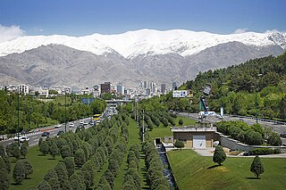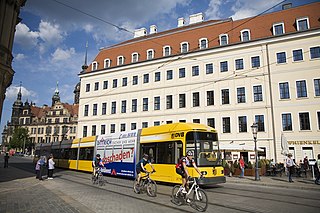
Smart growth is an urban planning and transportation theory that concentrates growth in compact walkable urban centers to avoid sprawl. It also advocates compact, transit-oriented, walkable, bicycle-friendly land use, including neighborhood schools, complete streets, and mixed-use development with a range of housing choices. The term "smart growth" is particularly used in North America. In Europe and particularly the UK, the terms "compact city", "urban densification" or "urban intensification" have often been used to describe similar concepts, which have influenced government planning policies in the UK, the Netherlands and several other European countries.
An urban growth boundary, or UGB, is a regional boundary, set in an attempt to control urban sprawl by, in its simplest form, mandating that the area inside the boundary be used for urban development and the area outside be preserved in its natural state or used for agriculture. Legislating for an "urban growth boundary" is one way, among many others, of managing the major challenges posed by unplanned urban growth and the encroachment of cities upon agricultural and rural land.

A green belt is a policy, and land-use zone designation used in land-use planning to retain areas of largely undeveloped, wild, or agricultural land surrounding or neighboring urban areas. Similar concepts are greenways or green wedges, which have a linear character and may run through an urban area instead of around it. In essence, a green belt is an invisible line designating a border around a certain area, preventing development of the area and allowing wildlife to return and be established.

Urban sprawl is defined as "the spreading of urban developments on undeveloped land near a more or less densely populated city". Urban sprawl has been described as the unrestricted growth in many urban areas of housing, commercial development, and roads over large expanses of land, with little concern for very dense urban planning. Sometimes the urban areas described as the most "sprawling" are the most densely populated. In addition to describing a special form of urbanization, the term also relates to the social and environmental consequences associated with this development. In modern times some suburban areas described as "sprawl" have less detached housing and higher density than the nearby core city. Medieval suburbs suffered from the loss of protection of city walls, before the advent of industrial warfare. Modern disadvantages and costs include increased travel time, transport costs, pollution, and destruction of the countryside. The revenue for building and maintaining urban infrastructure in these areas are gained mostly through property and sales taxes. Most jobs in the US are now located in suburbs generating much of the revenue, although a lack of growth will require higher tax rates.
Metropolitan Washington Council of Governments (MWCOG) is an independent, nonprofit association designed to address regional issues confronting Washington, D.C., suburban Maryland, and Northern Virginia. It was founded in 1957.
The Association of Bay Area Governments (ABAG) is a regional planning agency incorporating various local governments in the San Francisco Bay Area in California. It encompasses nine counties surrounding the San Francisco Bay. Those counties are Alameda, Contra Costa, Marin, Napa, San Francisco, San Mateo, Santa Clara, Solano, and Sonoma. It has the ability to establish housing and transportation goals for cities to minimize urban sprawl by requiring that housing be zoned for near new workplace construction. It deals with land use, housing, environmental quality, and economic development. Non-profit organizations as well as governmental organizations can be members. All nine counties and 101 cities within the Bay Area are voluntary members of ABAG.

Metro is the regional government for the Oregon portion of the Portland metropolitan area, covering portions of Clackamas, Multnomah, and Washington Counties. It is the only directly elected regional government and metropolitan planning organization in the United States. Metro is responsible for overseeing the Portland region's solid waste system, general planning of land use and transportation, maintaining certain regional parks and natural areas, and operating the Oregon Zoo, Oregon Convention Center, Portland's Centers for the Arts, and the Portland Expo Center. It also distributes money from two voter-approved tax measures: one for homeless services and one for affordable housing.

Suburbanization (AE), or suburbanisation (BE), is a population shift from historic core cities or rural areas into suburbs, resulting in the formation of (sub)urban sprawl. As a consequence of the movement of households and businesses away from city centers, low-density, peripheral urban areas grow.
Smart Growth America (SGA) is a US non-profit 501(c)(3) organization headquartered in Washington, D.C.
The Metropolitan Transportation Commission (MTC) is the government agency responsible for regional transportation planning and financing in the San Francisco Bay Area. It was created in 1970 by the State of California, with support from the Bay Area Council, to coordinate transportation services in the Bay Area's nine counties: Alameda, Contra Costa, Marin, Napa, San Francisco, San Mateo, Santa Clara, Solano, and Sonoma. The MTC is fourth most populous metropolitan planning organization in the United States.
Urban planning in Singapore is the direction of infrastructure development in Singapore. It is done through a three-tiered planning framework, consisting of a long-term plan to plot out Singapore's development over at least 50 years, a Master Plan for the medium term, and short-term plans, the first two of which are prepared by the Urban Redevelopment Authority (URA) and the last by multiple agencies.
Green development is a real estate development concept that considers social and environmental impacts of development. It is defined by three sub-categories: environmental responsiveness, resource efficiency, and community and cultural sensitivity. Environmental responsiveness respects the intrinsic value of nature, and minimizes damage to an ecosystem. Resource efficiency refers to the use of fewer resources to conserve energy and the environment. Community and cultural sensitivity recognizes the unique cultural values that each community hosts and considers them in real estate development, unlike more discernable signs of sustainability, like solar energy,. Green development manifests itself in various forms, however it is generally based on solution multipliers: features of a project that provide additional benefits, which ultimately reduce the projects' environmental impacts.

In urban planning, infill, or in-fill, is the rededication of land in an urban environment, usually open-space, to new construction. Infill also applies, within an urban polity, to construction on any undeveloped land that is not on the urban margin. The slightly broader term "land recycling" is sometimes used instead. Infill has been promoted as an economical use of existing infrastructure and a remedy for urban sprawl. Detractors view increased urban density as overloading urban services, including increased traffic congestion and pollution, and decreasing urban green-space. Many also dislike it for social and historical reasons, partly due to its unproven effects and its similarity with gentrification.
The term "sustainable communities" has various definitions, but in essence refers to communities planned, built, or modified to promote sustainable living. Sustainable communities tend to focus on environmental and economic sustainability, urban infrastructure, social equity, and municipal government. The term is sometimes used synonymously with "green cities," "eco-communities," "livable cities" and "sustainable cities."

A sustainable city, eco-city, or green city is a city designed with consideration for social, economic, environmental impact, and resilient habitat for existing populations, without compromising the ability of future generations to experience the same. The UN Sustainable Development Goal 11 defines sustainable cities as those that are dedicated to achieving green sustainability, social sustainability and economic sustainability. They are committed to doing so by enabling opportunities for all through a design focused on inclusivity as well as maintaining a sustainable economic growth. The focus will also includes minimizing required inputs of energy, water, and food, and drastically reducing waste, output of heat, air pollution – CO2, methane, and water pollution. Richard Register, a visual artist, first coined the term ecocity in his 1987 book Ecocity Berkeley: Building Cities for a Healthy Future, where he offers innovative city planning solutions that would work anywhere. Other leading figures who envisioned sustainable cities are architect Paul F Downton, who later founded the company Ecopolis Pty Ltd, as well as authors Timothy Beatley and Steffen Lehmann, who have written extensively on the subject. The field of industrial ecology is sometimes used in planning these cities.
The Chicago Metropolitan Agency for Planning (CMAP) is a metropolitan planning organization (MPO) responsible for comprehensive regional transportation planning in Cook, DuPage, Kane, Kendall, Lake, McHenry and Will counties in northeastern Illinois. The agency developed and now guides implementation of ON TO 2050, a new long-range plan to help the seven counties and 284 communities of northeastern Illinois implement strategies that address transportation, housing, economic development, open space, the environment, and other quality-of-life issues.

Steve Heminger served as the former executive director of the San Francisco Bay Area's Metropolitan Transportation Commission (MTC) from 2001 until his retirement in 2019. Since then, he has been serving as a director for the San Francisco Municipal Transportation Agency (SFMTA).
The Sustainable Communities and Climate Protection Act of 2008, also known as Senate Bill 375 or SB 375, is a State of California law targeting greenhouse gas emissions from passenger vehicles. The Global Warming Solutions Act of 2006 sets goals for the reduction of statewide greenhouse gas emissions. Passenger vehicles are the single largest source of greenhouse gas emissions statewide, accounting for 30% of total emissions. SB 375 therefore provides key support to achieve the goals of AB 32.
The Growth Plan for the Greater Golden Horseshoe, 2006 is a regional growth management policy for the Greater Golden Horseshoe (GGH) area of southern Ontario, Canada. Introduced under the Places to Grow Act in 2005, the Plan was approved by the Lieutenant Governor in Council and enacted on June 16, 2006. Administered by the Ontario Ministry of Infrastructure (MOI), the plan identifies density and intensification targets, urban growth centres, strategic employment areas, and settlement area restrictions designed to mitigate negative environmental, economic, and human health impacts associated with sprawling, uncoordinated growth in the region.
Complete communities is an urban and rural planning concept that aims to meet the basic needs of all residents in a community, regardless of income, culture, or political ideologies through integrated land use planning, transportation planning, and community design. While the concept is used by many communities as part of their community plan, each plan interprets what complete community means in their own way. The idea of the complete community has roots in early planning theory, beginning with The Garden City Movement, and is a component of contemporary planning methods including Smart Growth.


