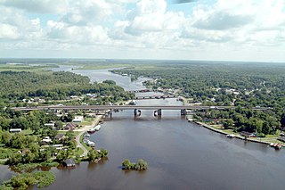
Livingston Parish is a parish located in the U.S. state of Louisiana. Livingston Parish is known as one of the eight Florida Parishes, a region of Louisiana that was bought from Spanish Florida, and created the modern day state borders.

Iberville Parish is a parish located south of Baton Rouge in the U.S. state of Louisiana, formed in 1807. The parish seat is Plaquemine. At the 2010 U.S. census, the population was 33,387, and 30,241 at the 2020 census.

Ascension Parish is a parish located in the U.S. state of Louisiana. As of the 2010 census, the population was 107,215. Its parish seat is Donaldsonville. The parish was created in 1807.

Galliano is an unincorporated community and census-designated place (CDP) on the Bayou Lafourche in Lafourche Parish, Louisiana, United States. As of the 2010 census, the CDP population was 7,676. It is part of the Houma–Bayou Cane–Thibodaux Metropolitan Statistical Area.

Springfield is a town in Livingston Parish, Louisiana, United States. The population was 487 at the 2010 census. It is part of the Baton Rouge Metropolitan Statistical Area.

Des Allemands is an unincorporated community and census-designated place (CDP) in Lafourche and St. Charles parishes in the southeastern part of the U.S. state of Louisiana. The population was 2,505 at the 2010 census. The town, known as the "Catfish Capital of the Universe", is along the Bayou des Allemands, which is the boundary of Lafourche and St. Charles parishes. Lac des Allemands is located northwest of the town. The ZIP code for Des Allemands is 70030.

Bayou Goula is an unincorporated community and census-designated place (CDP) in Iberville Parish, Louisiana, United States. Its population was 612 as of the 2010 census.

Bayou Barbary is an unincorporated community in Livingston Parish, Louisiana, United States. The community is located on Louisiana Highway 444 5 mi (8.0 km) west of Killian, 3.5 mi (5.6 km) east of Verdun and 1 mi (1.6 km) north of the Amite River.

Corbin is an unincorporated community in Livingston Parish, Louisiana, United States. The community is located 6 miles east of Denham Springs and 6 miles west of Livingston.

Denson also known as Bear Island is an unincorporated community in Livingston Parish, Louisiana, United States. The community is located 2 miles southeast of Maurepas and 6 miles southwest of Killian north of the Blind River.

Doyle is an unincorporated community in Livingston Parish, Louisiana, United States. The community is located less than 2 miles east of Livingston and 4 miles west of Holden less than a mile east from the Doyle High School.

Georgeville is an unincorporated community in Livingston Parish, Louisiana, United States. The community is located 8 miles southwest of Livingston and 2 miles southeast of Montpelier on Louisiana Highway 43.

Horse Bluff Landing is an unincorporated community in Livingston Parish, Louisiana, United States. The community is located less than 3 miles west of Killian and 5 miles northeast of Maurepas on the bank of Tickfaw River. The Tickfaw State Park is located 1 mile to the northwest across the Tickfaw River.

Oldfield is an unincorporated community in Livingston Parish, Louisiana, United States. The community is located 9 miles north of Walker and 4 miles southeast of Baywood.

Starns also known as Starns Mill is an unincorporated community in Livingston Parish, Louisiana, United States. The community is located 6 miles northwest of Albany and 4 miles north of Holden.

Magnolia, also known as Otts Mill, is an unincorporated community in Livingston Parish, Louisiana, United States. The community is located 5 miles northwest of Livingston and 2 miles west of Starns on Louisiana Highway 442 at the intersection with Louisiana Highway 1036.


