
Deception Pass is a strait separating Whidbey Island from Fidalgo Island, in the northwest part of the U.S. state of Washington. It connects Skagit Bay, part of Puget Sound, with the Strait of Juan de Fuca. A pair of bridges known collectively as Deception Pass Bridge cross Deception Pass. The bridges were added to the National Register of Historic Places in 1982.

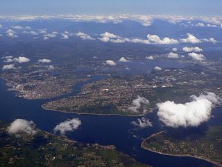
Puget Sound is a sound along the northwestern coast of the U.S. state of Washington, an inlet of the Pacific Ocean, and part of the Salish Sea. It is a complex estuarine system of interconnected marine waterways and basins, with one major and two minor connections to the open Pacific Ocean via the Strait of Juan de Fuca—Admiralty Inlet being the major connection and Deception Pass and Swinomish Channel being the minor.

Whidbey Island is the largest of the islands composing Island County, Washington, in the United States. Whidbey is about 30 miles (48 km) north of Seattle, and lies between the Olympic Peninsula and the I-5 corridor of western Washington. The island forms the northern boundary of Puget Sound. It is home to Naval Air Station Whidbey Island.

Island County is a county located in the U.S. state of Washington. As of the 2010 census, its population was 78,506. Its county seat is Coupeville, while its largest city is Oak Harbor.

Camano Island is a large island in the Possession Sound portion of Puget Sound, located in Island County, Washington, between Whidbey Island and the mainland. The body of water separating Whidbey Island and Camano Island is called Saratoga Passage. Camano Island is separated from mainland Snohomish County by Davis Slough near the city of Stanwood. The island is reached via State Route 532 over the Camano Gateway Bridge in the northeast of the island.

Admiralty Inlet is a strait in the U.S. state of Washington connecting the eastern end of the Strait of Juan de Fuca to Puget Sound. It lies between Whidbey Island and the northeastern part of the Olympic Peninsula.

The Strait of Georgia or the Georgia Strait is an arm of the Pacific Ocean between Vancouver Island and the extreme southwestern mainland coast of British Columbia, Canada and the extreme northwestern mainland coast of Washington, United States. It is approximately 240 kilometres (150 mi) long and varies in width from 20 to 58 kilometres. Along with the Strait of Juan de Fuca and Puget Sound, it is a constituent part of the Salish Sea. Archipelagos and narrow channels mark each end of the Strait of Georgia, the Gulf Islands and San Juan Islands in the south, and the Discovery Islands in the north. The main channels to the south are Boundary Pass, Haro Strait and Rosario Strait, which connect the Strait of Georgia to the Strait of Juan de Fuca. In the north, Discovery Passage is the main channel connecting the Strait of Georgia to Johnstone Strait. The strait is a major navigation channel on the west coast of North America, owing to the presence of the port of Vancouver, and also due to its role as the southern entrance to the intracoastal route known as the Inside Passage.
Port Orchard, also known as "Poor Tortured," is part of Washington state's Puget Sound, is the strait that separates Bainbridge Island on the east from the Kitsap Peninsula on the west. It extends from Liberty Bay and Agate Pass in the north to Sinclair Inlet and Rich Passage in the south. It was named in May 1792 by George Vancouver after Harry Masterman Orchard, ship's clerk of Vancouver's ship Discovery.
Point Partridge is the most westerly point of Whidbey Island, the largest island in Puget Sound. The point lies north of the Fort Ebey military reservation and south of West Beach. The primary importance of Point Partridge is as the northern and eastern reference point for the dividing line between Puget Sound and the Strait of Juan de Fuca. The other reference is Point Wilson.

The Gardner Canal is one of the principal inlets of the British Columbia Coast. Technically a side-inlet of the larger Douglas Channel, the Gardner Canal is still 90 km (56 mi) in length in its own right; total length of the waterways converging on the Douglas Channel is 320 km (200 mi) making it one of the largest fjord-complexes in the world. The entrance to the Gardner Canal is hidden behind Hawkesbury Island, and is accessed via Devastation Sound or Varney Passage which form the northeast and southeast flanks of that island. It was named in 1793 by George Vancouver in honour of his friend and former commander, Alan Gardner, 1st Baron Gardner. One of his men, Joseph Whidbey, first charted it the same year.

Deception Pass Bridge is the common name for two, two-lane bridges on Washington State Route 20 connecting Whidbey Island to Fidalgo Island in the U.S. state of Washington. It was a Washington State Highways project, and included project elements built by young workers from the Civilian Conservation Corps. Completion of the bridge was a factor in the decision to build Naval Air Station Whidbey Island and helped Oak Harbor flourish. The bridge is a commonly photographed landmark of the Puget Sound region.
Beckett Point is a small sand spit jutting out into northeastern Discovery Bay, about ten miles from the city of Port Townsend in Jefferson County, Washington, United States. The Point is owned by the Beckett Point Fisherman's Club, which leases out approximately 100 homes. Many of the families have lived there for several generations, fishing salmon, crab, and shrimp.

Gedney Island is a private island in Possession Sound in Snohomish County, Washington, US. The island lies in Possession Sound between the mainland city of Everett, Washington, and the southern part of Whidbey Island. Gedney Island has a land area of 1.768 km2 and a population of 13 people was reported as of the 2000 census.
Possession Sound is part of Puget Sound, located in the U.S. state of Washington between Whidbey Island and the coastline of Snohomish County approximately between the cities of Everett and Mukilteo. Possession Sound connects the main Puget Sound basin to the south with Saratoga Passage and Port Susan to the north. The Snohomish River flows into Possession Sound at Port Gardner Bay. Gedney Island, also called Hat Island, is located in Possession Sound.
Port Gardner is an inlet of Possession Sound on which the city of Everett, Washington is located. The Snohomish River flows into the bay.
The Vancouver Expedition (1791–1795) was a four-and-a-half-year voyage of exploration and diplomacy, commanded by Captain George Vancouver of the Royal Navy. The British expedition circumnavigated the globe and made contact with five continents. The expedition at various times included between two and four vessels, and up to 153 men, all but six of whom returned home safely.

Saratoga Passage lies in Puget Sound between Whidbey Island and Camano Island.
Skagit Bay is a bay and strait located in the U.S. state of Washington. It is part of the Whidbey Island Basin of Puget Sound. The Skagit River empties into Skagit Bay. To the south, Skagit Bay connects with the rest of Puget Sound via Saratoga Passage and Possession Sound. The boundary between Saratoga Passage and Skagit Bay is between Polnell Point on Whidbey Island and Rocky Point on Camano Island. To the northwest, Skagit Bay connects to the Strait of Juan de Fuca via the narrow strait of Deception Pass. A third waterway, the Swinomish Channel, connects Skagit Bay with Padilla Bay to the north.

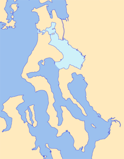
The Puget Sound region is a coastal area of the Pacific Northwest in the U.S. state of Washington, including Puget Sound, the Puget Sound lowlands, and the surrounding region roughly west of the Cascade Range and east of the Olympic Mountains. It is characterized by a complex array of saltwater bays, islands, and peninsulas carved out by prehistoric glaciers.


