
Horn is a small town in the Waldviertel in Lower Austria, Austria and the capital of the district of the same name.

Rust is a city in the Austrian state of Burgenland, located on the western shore of Lake Neusiedl near the border with Hungary. With only about 1,900 inhabitants, it is the country's smallest statutory city, as it was endowed with the rights of a royal free city by the Hungarian crown in 1681. As a Statutarstadt, it also forms an administrative district (Bezirk) in its own right. The city is famous for its wines, especially for Beerenauslese, ice wine and - especially - Ruster Ausbruch.
Bad Vöslau is a spa town in the Lower Austria federal state of Austria. It is also known as the cradle of the Austrian red wine cultivation. Population (2008): 11,190.
Oslip is a town in Burgenland, Austria, known for its viticulture. It lies in the Eisenstadt-Umgebung district in the state of Burgenland.

Donnerskirchen is a market town in the district Eisenstadt-Umgebung in the Austrian state of Burgenland.

Aggsbach is a small wine-growing town in the Krems-Land district of Lower Austria, Austria. As of 2001, it has a population of 714 and an area of 13.72 km.² Aggsbach was first mentioned in an 1148 document calling it "Accusabah".

Satteins is a town in the Austrian state of Vorarlberg.
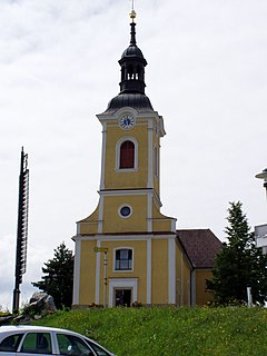
Breitenbrunn am Neusiedler See is a small wine village in the district of Eisenstadt-Umgebung in the Austrian state of Burgenland.

Illmitz is a market town in the district of Neusiedl am See in Burgenland in Austria. It is located in a region to the east of the Lake Neusiedl which is named the Seewinkel.

For people with the surname, see Jois (surname).

Weingraben is a town in the district of Oberpullendorf in the Austrian state of Burgenland.

Nenzing is a market town in the district of Bludenz in the Austrian state of Vorarlberg.

Dürnkrut is a market town in the district of Gänserndorf in the Austrian state of Lower Austria. Castle Dürnkrut (pictured) is the most famous landmark of the town. The town is agricultural with some noteworthy businesses. Crops grown in the flatter areas are canola, corn, sunflowers and sugar beets. The rolling hils are planted with wine grapes by local vintners.
Mailberg is a town in the district of Hollabrunn in Lower Austria, Austria. First mentioned in records in 1055 Castle Mailberg is owned and run by the Austrian Grand Priory of the Sovereign Military Order of Malta since 1146. It is known for its wine production and now serves as a castle hotel and as Vinothek for the local Winemakers Community "Mailberg Valley".
Langenlois is a town in the district of Krems-Land in the Austrian state of Lower Austria. Famous for its wine production, it is also home to the Loisium, a centre celebrating and advertising the local wine and built by the American deconstructionist architect Steven Holl.
Grieskirchen is a town in Austria. It is capital of the Grieskirchen district of Upper Austria, in the Trattnachtal valley. The musicologist Franz Födermayr was born in the town in 1933.
Kitzeck is the central settlement in the Sausal mountain range in Southern Styria, Austria. It is the highest-altitude wine-growing community in Central Europe. Kitzeck is home to the first wine museum that was established in Styria (1979). Besides wine culture, tourism has become a pillar of the local economy and obviously both are pursued on close combination.
Großriedenthal is a municipality in the district of Tulln in Lower Austria, Austria. The community consists of 3 districts: Großriedenthal, Ottenthal, and Neudegg. The mild climate and fertile soil allow the region to produce both fruity and full-bodied wines. Grossriedenthal is in the wine district of Lower Austria about 50 km northwest of Vienna which is around one hour by car.

Schwanenstadt is a town in the district of Vöcklabruck in the Austrian state of Upper Austria.

Hitzendorf is a municipality in the district of Graz-Umgebung in the Austrian state of Styria.


