Punang Terusan

Last updated
Punang Terusan
town
Malaysia location map.svg
Red pog.svg
Punang Terusan
Location in Sarawak, Malaysia
Coordinates: 4°17′0″N115°37′0″E / 4.28333°N 115.61667°E / 4.28333; 115.61667 Coordinates: 4°17′0″N115°37′0″E / 4.28333°N 115.61667°E / 4.28333; 115.61667
Country Malaysia
State Sarawak
Elevation
1,105 m (3,628 ft)
Time zone UTC+8 (Asia/Brunei)

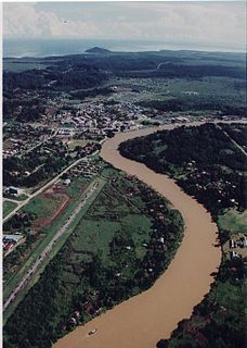
Punang Terusan is a town or settlement in Sarawak, Malaysia. It is about 3,628 feet (1,105 meters) above sea level, and the approximate population within a seven-kilometer radius was 1,110 as of 2004. [1]

Sarawak State of Malaysia

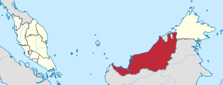
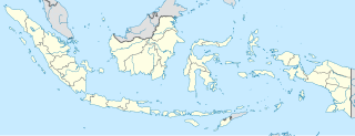
Sarawak is a state of Malaysia. The largest among the 13 states, with an area almost equal to that of Peninsular Malaysia, Sarawak is located in northwest Borneo Island, and is bordered by the Malaysian state of Sabah to the northeast, Kalimantan to the south, and Brunei in the north. The capital city, Kuching, is the largest city in Sarawak, the economic centre of the state, and the seat of the Sarawak state government. Other cities and towns in Sarawak include Miri, Sibu, and Bintulu. As of the 2015 census, the population of Sarawak was 2,636,000. Sarawak has an equatorial climate with tropical rainforests and abundant animal and plant species. It has several prominent cave systems at Gunung Mulu National Park. Rajang River is the longest river in Malaysia; Bakun Dam, one of the largest dams in Southeast Asia, is located on one of its tributaries, the Balui River. Mount Murud is the highest point in Sarawak.

Malaysia Federal constitutional monarchy in Southeast Asia

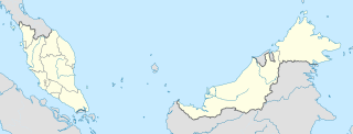
Malaysia is a country in Southeast Asia. The federal constitutional monarchy consists of 13 states and three federal territories, separated by the South China Sea into two similarly sized regions, Peninsular Malaysia and East Malaysia. Peninsular Malaysia shares a land and maritime border with Thailand and maritime borders with Singapore, Vietnam, and Indonesia. East Malaysia shares land and maritime borders with Brunei and Indonesia and a maritime border with the Philippines and Vietnam. Kuala Lumpur is the national capital and largest city while Putrajaya is the seat of federal government. With a population of over 30 million, Malaysia is the world's 44th most populous country. The southernmost point of continental Eurasia, Tanjung Piai, is in Malaysia. In the tropics, Malaysia is one of 17 megadiverse countries, with large numbers of endemic species.

Nearby towns and villages include Long Buang (9.9 nm north), Pa Brayong (11.7 nm north), Long Semado (2.8 nm south), Long Kinoman (1.0 nm south), Long Pa Sia (9.2 nm east), and Long Lapukan (5.1 nm west). [1]

Nautical mile unit of distance (1852 m)

A nautical mile is a unit of measurement used in both air and marine navigation, and for the definition of territorial waters. Historically, it was defined as one minute of a degree of latitude. Today it is defined as exactly 1852 metres. The derived unit of speed is the knot, one nautical mile per hour.

Pa Brayong Place in Sarawak, Malaysia

Pa Brayong is a settlement in the Lawas division of Sarawak, Malaysia. It lies approximately 658.5 kilometres (409 mi) east-north-east of the state capital Kuching.

Long Semado Place in Sarawak, Malaysia

Long Semado is a settlement in the Lawas division of Sarawak, Malaysia. It lies approximately 654.6 kilometres (407 mi) east-north-east of the state capital Kuching.

Related Research Articles

Lawas Place in Sarawak, Malaysia

Lawas is a small town and the capital of Lawas District, Limbang Division, Sarawak, Malaysia. This district area is 3,811.9 square kilometres, and population was 35,300. It is 1200 km from the state capital, Kuching and 200 km from the capital city of Sabah, Kota Kinabalu.

Gurun is a mukim in Kuala Muda District, Kedah, Malaysia. "Gurun" in English means desert, however the town does not resemble in the slightest the meaning of its English translation. Gurun derived its name from the word "gerun", which means terrify or "kurun" meaning elephant in the Siamese dialect. These words are associated with an incident during the reign of King Ekataat’s grandsons, Sultan Jaafar Mad Azam Syah, Sultan of Islamic Siam Kingdom of Ayutthia, who was killed in 1876 by the invading Thai armies when they crushed his body using an elephant. This incident took place behind the current Gurun Police Station.

Sungai Tujoh Place in Brunei, Brunei

Sungai Tujoh, also abbreviated as Sg. Tujoh, is the westernmost point of Brunei. It is located in the Belait district. The name of the area is derived from two Bruneian Malay words - Sungai, which means river or stream, and Tujoh or the number seven. Literally, Sungai Tujoh is translated as the Seventh River or Seventh Stream in English.

Ampelu Place in Jambi Province, Indonesia

Ampelu is a village in the Batang Hari Regency in the Jambi Province of Sumatra, Indonesia.

Jebak Place in Jambi Province, Indonesia

Jebak is a village in the Batang Hari Regency in the Jambi Province of Sumatra, Indonesia.

Muarabulian Place in Jambi Province, Indonesia

Muarabulian is the capital of Batang Hari Regency in the Jambi Province of Sumatra, Indonesia.

Terusan village in Sabah, Malaysia

Terusan is a settlement in Sabah, Malaysia. It is about three feet above sea level, and the approximate population within a seven-kilometer radius was 818 as of 2004.

Pa Umor Place in Sarawak, Malaysia

Pa Umor is a settlement in the Marudi division of Sarawak, Malaysia. It lies approximately 623.9 kilometres (388 mi) east-north-east of the state's capital, Kuching.

Long Rapung Place in Sarawak, Malaysia

Long Rapung is a former settlement in the Marudi division of Sarawak, Malaysia. It lies approximately 634.8 kilometres (394 mi) east-north-east of the state capital Kuching. Long Rapung lies in the Dapur River floodplain. It was formerly a village but was evacuated during the Confrontation. Now the shelters provide overnight accommodation hunters and for visitors walking to Ba Kelalan or climbing Gunung Murud.

Long Merarap Place in Sarawak, Malaysia

Long Merarap is a settlement in the Lawas division of Sarawak, Malaysia. It lies approximately 648.3 kilometres (403 mi) east-north-east of the state capital Kuching.

Long Lapukan Place in Sarawak, Malaysia

Long Lapukan is a settlement in the Lawas division of Sarawak, Malaysia. It lies approximately 650.5 kilometres (404 mi) east-north-east of the state capital Kuching.

Long Karabangan Place in Sarawak, Malaysia

Long Karabangan is a settlement in the Lawas division of Sarawak, Malaysia. It lies approximately 648.8 kilometres (403 mi) east-north-east of the state capital Kuching.

Long Lopeng Place in Sarawak, Malaysia

Long Lopeng is a settlement in the Lawas division of Sarawak, Malaysia. It lies approximately 646.4 kilometres (402 mi) east-north-east of the state capital Kuching.

Long Kinoman Place in Sarawak, Malaysia

Long Kinoman is a settlement in the Lawas division of Sarawak, Malaysia. It lies approximately 658.7 kilometres (409 mi) east-north-east of the state capital Kuching.

Long Tanid Place in Sarawak, Malaysia

Long Tanid is a settlement in the Lawas division of Sarawak, Malaysia. It is about 3 hours drive from Lawas just before entering Ba'kelalan.

Kampung Gaya Place in Sarawak, Malaysia

Kampung Gaya is a settlement in the Lawas division of Sarawak, Malaysia. It lies approximately 669.1 kilometres (416 mi) east-north-east of the state capital Kuching.

Kampung Sitakong Place in Sarawak, Malaysia

Kampung Sitakong is a settlement in the Lawas division of Sarawak, Malaysia. It lies approximately 671.7 kilometres (417 mi) east-north-east of the state capital Kuching.

Tanjong Karang is a federal constituency in Selangor, Malaysia, that has been represented in the Dewan Rakyat since 1974.

References

  1. 1 2 “Punang Terusan, Malaysia Page.” Falling Rain Genomics. 2004 <http://www.fallingrain.com/world/MY/11/Punang_Terusan.html>.