The Lincolnshire Limestone Formation is a geological formation in England, part of the Inferior Oolite Group of the (Bajocian) Middle Jurassic strata of eastern England. It was formed around 165 million years ago, in a shallow, warm sea on the margin of the London Platform and has estuarine beds above and below it. The maximum known thickness is 40.2 metres, at around TF9730, while four kilometres further west it is 18.3 metres thick at its outcrop in the upper Witham valley. It fades out in the south, around Kettering in Northamptonshire.
The Blisworth Limestone Formation is a geological formation primarily consisting of limestone deposited during the Bathonian stage of the Middle Jurassic, found in the Jurassic ridge which extends north and south through England. It was laid down in the shallows of the Jurassic sea and is part of the more widely defined Great Oolite Group. It was previously known as the Great Oolite Limestone, White Limestone and the Snitterby Limestone Formation. It is the lateral equivalent of the White Limestone Formation From the Jurassic ridge it extends eastwards below the later deposits and in the North Sea terminology, it is part of the West Sole Group.
The Lias Group or Lias is a lithostratigraphic unit found in a large area of western Europe, including the British Isles, the North Sea, the Low Countries and the north of Germany. It consists of marine limestones, shales, marls and clays.
The Taynton Limestone is a geological formation in Oxfordshire in the United Kingdom. It dates to the Middle Jurassic, mid-Bathonian stage. It predominantly consists of ooidal grainstone. The term "Stonesfield Slate" refers to slaty limestone horizons within the formation that during the 18th and 19th centuries were extensively quarried for use in roof tiling within the vicinity of Stonesfield, Oxfordshire. Previously these were thought to belong to the Sharp's Hill Formation, but boreholes and shaft sections suggest that at least three horizons within the Taynton Limestone were quarried for the slate. These horizons are well known for producing a diverse set of fossils including those of plants, insects as well as vertebrates, including some of the earliest known mammals, pterosaurs as well as those of first dinosaur ever described, Megalosaurus.

The Inferior Oolite is a sequence of Jurassic age sedimentary rocks in Europe. It was deposited during the Middle Jurassic. The Inferior Oolite Group as more recently defined is a Jurassic lithostratigraphic group in southern and eastern England. It has been variously known in the past as the Under Oolite, the Inferior Oolite, the Inferior Oolite Series and the Redbourne Group.
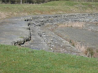
The Cornbrash Formation is a Middle Jurassic geological formation in England. It ranges in age from Bathonian to Callovian, the uppermost part of the Middle Jurassic. Dinosaur remains are among the fossils that have been recovered from the formation, although none have yet been referred to a specific genus. The name Cornbrash is an old English agricultural name applied in Wiltshire to a variety of loose rubble or brash which, in that part of the country, forms a good soil for growing corn. The name was adopted by William Smith for a thin band of shelly limestone which, in the south of England, breaks up in the manner indicated. Although only a thin group of rocks, it is remarkably persistent; it may be traced from Weymouth to the Yorkshire coast, but in north Lincolnshire it is very thin, and probably dies out in the neighborhood of the Humber. It appears again, however, as a thin bed in Gristhorpe Bay, Cayton Bay, Wheatcroft, Newton Dale and Langdale. In the inland exposures in Yorkshire it is difficult to follow on account of its thinness, and the fact that it passes up into dark shales in many places the so-called clays of the Cornbrash, with Avicula echinata. The Cornbrash is of little value for building or road-making, although it is used locally; in the south of England it is not oolitic, but in Yorkshire it is a rubbly, marly, frequently ironshot oolitic limestone. In Bedfordshire it has been termed the Bedford limestone.

The Northampton Sand Formation, sometimes called the Northamptonshire Sand, is a Middle Jurassic geological formation which is placed within the Inferior Oolite Group. It was formerly worked extensively in Northamptonshire for its ironstone.
The Great Oolite Group is a Middle Jurassic stratigraphic unit that outcrops in southern England. It consists of a complex set of marine deposits primarily mudstone and bioclastic ooidal and fine grained limestone, deposited in nearshore to shelf settings. It is exposed at the surface as a variably thick belt extending roughly NE-SW from the coast of Dorset up to the Humber. It is also present at depth in the Weald and Wessex Basins, as well as offshore. Several of the constituent formations, notably the Taynton Limestone Formation and the Forest Marble Formation are notable for their fossil content, including those of dinosaurs and pterosaurs and some of the earliest mammals.

The Great Estuarine Group is a sequence of rocks which outcrop around the coast of the West Highlands of Scotland. Laid down in the Hebrides Basin during the middle Jurassic, they are the rough time equivalent of the Inferior and Great Oolite Groups found in southern England.
The geology of Rutland in eastern England largely consists of sedimentary rocks of Jurassic age which dip gently eastwards.
The geology of Lincolnshire in eastern England largely consists of an easterly dipping succession of Mesozoic age sedimentary rocks, obscured across large parts of the county by unconsolidated deposits dating from the last few hundred thousand years of the present Quaternary Period.

The Corallian Group or Corallian Limestone is a geologic group in England. It is predominantly a coralliferous sedimentary rock, laid down in the Oxfordian stage of the Jurassic. It is a hard variety of "coral rag". Building stones from this geological structure tend to be irregular in shape. It is often found close to seams of Portland Limestone. It is a younger limestone than its near-neighbour, the Oolitic, as found in the Cotswolds, in Gloucestershire. It is laterally equivalent to and interfingers with units of the Ancholme Group.

Hunts Bay Oolite is an oolitic carboniferous limestone geological formation found in the south Wales region. It is named after Hunts Bay on the Gower peninsula, south-south west of Bishopston, where a significant amount of the limestone forms the cliffs there.

Finedon Top Lodge Quarry, also known as Finedon Gullet is a 0.9 hectare geological Site of Special Scientific Interest east of Wellingborough in Northamptonshire. It is a Geological Conservation Review site revealing a sequence of middle Jurassic limestones, sandstones and ironstones, and is the type section for a sequence of sedimentary rocks known as the 'Wellingborough Member'. It was created by quarrying for the underlying ironstone for use at Wellingborough and Corby Steelworks; the ore was transported by the 1,000 mm gauge Wellingborough Tramway.
The Horsehay Sand Formation is a geological formation in England. Part of the Great Oolite Group, it was deposited in the Bajocian to Bathonian stages of the Middle Jurassic, the lithology consists of weakly cemented sand and sandstone, with thin interbeds of mudstone and siltstone. Rootlets and lignitic debris are common. It is the lateral equivalent of the Chipping Norton Limestone and the lower part of the Rutland Formation
The Corsham Limestone Formation is a geological formation in England. It is part of the Great Oolite Group and was deposited in the Bathonian stage of the Middle Jurassic. It is found in the central to southern regions of the Cotswolds
The Blisworth Clay Formation is a geological formation in England. It is part of the Great Oolite Group and was deposited in the Bathonian stage of the Middle Jurassic. The predominant lithology is mudstone with thin beds of limestone and sandstone with ironstone nodules. Towards the South-West it laterally transitions into the Forest Marble Formation.

The Scalby Formation is a geological formation in England. Part of the Ravenscar Group, it was deposited in the Bathonian stage of the Middle Jurassic. The lower Moor Grit Member has a lithology consisting of medium to coarse grained cross bedded sandstone, with thin beds of mudstone and siltstone, while the upper Long Nab Member has a lithology consisting of predominantly laminated mudstone and siltstone, with fine to medium grained planar and cross stratified sandstones.
The Coralline Oolite Formation is a limestone formation of Oxfordian age, found in the Cleveland Basin of North Yorkshire, England.
The geology of the Peak District National Park in England is dominated by a thick succession of faulted and folded sedimentary rocks of Carboniferous age. The Peak District is often divided into a southerly White Peak where Carboniferous Limestone outcrops and a northerly Dark Peak where the overlying succession of sandstones and mudstones dominate the landscape. The scarp and dip slope landscape which characterises the Dark Peak also extends along the eastern and western margins of the park. Although older rocks are present at depth, the oldest rocks which are to be found at the surface in the national park are dolomitic limestones of the Woo Dale Limestone Formation seen where Woo Dale enters Wye Dale east of Buxton.
