Ridgewood Reservoir

Last updated

Ridgewood Reservoir
New York State Register of Historic Places
Aerial photo of the Ridgewood Reservoir, February 2020.jpg
Aerial photo showing the three basins of the reservoir with the Manhattan skyline in the background, February 2020
USA New York City location map.svg
Red pog.svg
USA New York location map.svg
Red pog.svg
Usa edcp location map.svg
Red pog.svg
LocationJackie Robinson Parkway, Vermont Place, Cypress Hills Street, & Highland Boulevard
Coordinates 40°41′N73°53′W / 40.69°N 73.89°W / 40.69; -73.89
Area50 acres (20 ha)
Built1856-1858
Engineer James P. Kirkwood of H.S. Welles & Co.
Architectural style Romanesque Revival
NRHP reference No. 100002074
Added to NRHPFebruary 2, 2018
Ring-necked ducks in the middle basin, November 2016 Ducks at the Ridgewood Reservoir.jpg
Ring-necked ducks in the middle basin, November 2016

Ridgewood Reservoir is a decommissioned 19th century reservoir and freshwater wetland on the border between the New York City boroughs of Brooklyn and Queens, within what is now Highland Park. Although the reservoir was originally built to secure a reliable water supply for the City of Brooklyn, it is positioned on the Queens side of the border in the neighborhood of Glendale. The reservoir and park are bounded on the north by the Jackie Robinson Parkway, on the south by Highland Boulevard, on the west by Vermont Place and on the east by Cypress Hills National Cemetery.

Contents

The reservoir was named after the Ridgewood Ponds in Nassau County, which provided the reservoir's eastern water source. Consequently, the neighborhood north of the Reservoir became known as Ridgewood. [1]

Following decommissioning and abandonment, the reservoir naturally became a lush freshwater wetland. This ecosystem attracted a wide variety of fauna and flora, including some threatened and endangered species such as the Short-eared Owl and Pied-billed Grebe. [2] The bicycling trail around the reservoir perimeter became part of the 40-mile (64 km) Brooklyn-Queens Greenway.

Between 2004 and 2017, the Ridgewood Reservoir's future was in question, as the New York City Parks Department and New York State DEC each proposed plans that would have breached the reservoir's basins and disrupted the wetland ecosystem. These plans were dropped after opposition from local community groups who sought to preserve the reservoir's natural setting. In 2018, the reservoir was listed on the National Register of Historic Places and was officially designated by the New York State DEC as a Class I freshwater wetland, ensuring its preservation as a natural space. [3] [4] [5]

Construction

Ridgewood Reservoir was built by the City of Brooklyn, New York, which was rapidly outgrowing its local water supplies. In 1851 the City thought it was failing to attract business firms that would have moved to Brooklyn if it had as reliable a water source as New York City's Croton Aqueduct. [6] Various sources were proposed. The Croton River was already being used as the City of New York's water supply, and it did not have the capacity to serve the City of Brooklyn as well. The Bronx River was both inadequate and difficult to access. Wells in and near Brooklyn were inadequate both in quantity and quality. Natural lakes on Long Island were few and could not provide enough water. The only solution was to tap the many small streams on Long Island and conduct their water to Brooklyn to be lifted into an elevated reservoir.

The original design of the Ridgewood Reservoir as well as the final specifications for the Brooklyn Water Works system were designed by Brooklyn civil engineer Samuel McElroy. This original design called for three basins, but engineer James P. Kirkwood later altered the designs and instead built a double basin. [7] The new double reservoir was built in Snediker's Cornfield on a hilltop near Evergreen Cemetery in what was once part of Ridgewood, Queens (this section of Queens is now part of Glendale) and was sealed by puddling with clay. The walls were faced with fieldstone and mortar. Ground was broken for the reservoir's construction on July 11, 1856 and the reservoir's water was initially raised on November 18, 1858. [8]

Ridgewood Reservoir, Brooklyn, ca. 1872-1887. (5832944747) Ridgewood Reservoir, Brooklyn, ca. 1872-1887. (5832944747).jpg
Ridgewood Reservoir, Brooklyn, ca. 1872-1887. (5832944747)

In 1862, the water supply for the reservoir consisted of six dammed streams in what is now Queens and Nassau Counties: Jamaica Stream (Baisley Pond), Simonson's Stream, Clear Stream, Valley Stream, Pine's Stream, and Hempstead Stream (Hempstead Lake). [9] This water was carried in a 12-mile-long masonry conduit, called the Ridgewood Aqueduct, [10] to a pumping station at Atlantic Avenue and Chestnut Street. There, steam-powered pumps, each with a capacity of 14 million gallons (53,000 m3) per day, forced the water up through a reinforced tube into the high reservoir whence it was distributed. By 1868 the Ridgewood Reservoir held an average of 154.4 million gallons (584,000 m3) daily, enough to supply the City of Brooklyn for ten days at that time. [11]

The Ridgewood Reservoir’s innovative use of driven wells was notable for the time; an 1886 Scientific American article states that the reservoir’s system of driven wells “has attracted widespread attention because of the originality and boldness of the plans and the perfect success attained.” [12] In the late nineteenth century, Brooklyn was the largest American city whose water supply system relied on driven wells. [13] Other large American cities chose to adopt this technology after the success of the Ridgewood Reservoir’s driven well system. By 1900, Lowell, Massachusetts and Newark, New Jersey—two of the nation’s most important industrial centers at the time—had both followed Brooklyn’s example by installing their own municipal water systems that used driven wells. At this time, Brooklyn obtained over 45 million gallons of water per day from driven wells at the Ridgewood Reservoir and other sites. [14]

In subsequent decades the Brooklyn Water Works system was repeatedly expanded by adding wells and collection reservoirs, extending the conduit farther east, and adding pumps. The Ridgewood Reservoir's third basin was completed in 1891. [15] Farmers in southern Queens County complained that Brooklyn's thirst was lowering the water table. Late in the century, the conduit was extended to a large pumping station in Massapequa, some 30 miles (48 km) away. Efforts to extend it farther were thwarted by legislation protecting the water of Suffolk County. [16] Force Tube Avenue, Conduit Boulevard, and Sunrise Highway were built, in part, atop the water conduit or within its right of way, early in the 20th century.

Highland Park was created on land immediately surrounding Ridgewood Reservoir that was purchased by the City of Brooklyn in 1891 under the jurisdiction of the Highland Park Society. The park was constructed between 1901 and 1906 and included additional parcels purchased to the south and west. [17]

Decommissioning

In 1898, Brooklyn merged with the City of Greater New York, thus gaining access to the superior New York City water supply system. Ridgewood Reservoir was expensive to operate because of the need for pumping and was slowly made obsolete by expansion of New York City's Catskill and Delaware water systems. Ridgewood Reservoir became a backup reservoir in 1959 with the third basin being filled with water from the Catskill system. The reservoir was last used in a drought in the 1960s. During the 1970s the reservoir was the site of illegal swimming and a number of drownings. The reservoir was finally decommissioned and drained in 1989. [18]

Some of the Nassau County pumping stations including the one at Milburn (now Baldwin) survived into the 21st century as ruins. Valley Stream State Park, Hempstead Lake State Park, and other South Shore lakes and parks were originally Brooklyn Water Works reservoirs.

In 2004, the reservoir was officially turned over to the Department of Parks for more extensive integration into Highland Park. [11]

Ecological significance

Visitors explore the newly restored East Causeway as part of OHNY weekend, October 2019 OHNY visitors at Ridgewood in October 2019.jpg
Visitors explore the newly restored East Causeway as part of OHNY weekend, October 2019

Since the Ridgewood Reservoir was decommissioned, it has naturally become reforested and has developed into a thriving wetland ecosystem. It currently contains a wide range of natural environments, including woodlands, swamp, standing water wetlands, coastal swamp forest, bog, and open grassy area. [19] The reservoir is home to a wide range of flora and fauna, including 156 species of birds, 175 plant species, and numerous species of insects. [20] The evolving fresh-water site has become an important nearby oasis on the Atlantic Flyway and is a common destination for birdwatchers. [21] The reservoir’s distinct ecological setting has also made it a frequent destination for field trips and walking tours. [22] Currently, the pond in the middle basin of the reservoir is being overgrown by invasive weeds that belong to the genus Phragmites . Left unchecked, the Phragmites would outcompete the reservoir’s natural plant species and fill in the pond. Community efforts to control the reservoir’s Phragmites population, via underwater weed-cutting and root removal, are ongoing. [23]

In January 2019, the NYC Parks Department designated the Ridgewood Reservoir as a Critical Environmental Area, citing the reservoir's status as a "naturalized area that is unique within New York City and serves as an important ecological, historic, and public recreation resource." [24]

Redevelopment plans

In October 2007, New York City Parks Commissioner Adrian Benepe unveiled a plan to breach one of the reservoir basins and clear 20 acres (81,000 m2) for new ball fields. [25] This resulted in a backlash from local residents, environmentalists, and community organizations, who formed the Highland Park-Ridgewood Reservoir Alliance to oppose the plan. [26]

On June 26, 2008, Comptroller of New York City Bill Thompson, Jr. rejected the contract for the new development, citing concerns about the environmental impact, increased truck traffic, and the vendor selection process. [27]

In 2010, the Highland Park-Ridgewood Reservoir Alliance submitted an application to the New York State DEC requesting that the Ridgewood Reservoir be classified as a wetland. [28]

In 2014, community members learned that the NYC Parks Department was planning to construct culverts to breach the three basins. This would have destroyed the reservoir's natural ecosystem. [29] The plans illustrated the design and construction of culverts large enough to accommodate trucks and were part of a project that the City Parks Department claimed was necessary to eliminate the risk of flooding. [30] The City argued that unless the culverts were built, the State of New York would issue fines since the reservoir would allegedly be a flooding hazard, according to its classification as a Class C "High Hazard" dam. However, local activists argued that because the reservoir no longer impounds water, it does not pose a risk of flooding and should instead be classified as a Class D "Negligible or No Hazard" dam, rendering the construction of culverts unnecessary. Environmentalists also argued that building the culverts would violate New York State Environmental Conservation Law by adversely impacting a freshwater wetland habitat. [31] This work was scheduled to begin in August 2014 but was put on hold after pressure from activists. [32]

In March 2017, the NYS DEC reclassified the Ridgewood Reservoir as a Class A "Low Hazard" dam, such that the reservoir's basins would no longer be required to be breached to address flooding risk. [33]

In February 2018, the Ridgewood Reservoir was officially designated as a Class I freshwater wetland by the New York State DEC. The wetland designation ensures that the Ridgewood Reservoir will be permanently preserved in a natural state, as it is now protected under the 1975 New York Freshwater Wetlands Act. [34]

See also

Related Research Articles

<span class="mw-page-title-main">Glendale, Queens</span> Neighborhoods of Queens in New York City

Glendale is a neighborhood in the west-central portion of the New York City borough of Queens. It is bounded by Forest Hills to the east, Ridgewood to the west, Woodhaven to the south, and Middle Village to the north.

<span class="mw-page-title-main">Hempstead Lake State Park</span> State park in Nassau County, New York

Hempstead Lake State Park is a 737-acre (2.98 km2) state park located in Nassau County, New York in the United States. The park is located in West Hempstead and is one of three state parks within the Town of Hempstead. There is a quick-access entrance at exit 18 from the Southern State Parkway. The park contains the largest freshwater lake in Nassau County.

<span class="mw-page-title-main">Ridgewood, Queens</span> Neighborhood of Queens in New York City

Ridgewood is a neighborhood in the New York City borough of Queens. It borders the Queens neighborhoods of Maspeth to the north, Middle Village to the east, and Glendale to the southeast, as well as the Brooklyn neighborhoods of Bushwick to the southwest and East Williamsburg to the west. Historically, the neighborhood straddled the Queens-Brooklyn boundary.

<span class="mw-page-title-main">Jackie Robinson Parkway</span> Highway in New York

The Jackie Robinson Parkway is a 4.95-mile (7.97 km) parkway in the New York City boroughs of Brooklyn and Queens. The western terminus of the parkway is at Jamaica Avenue in the Brooklyn neighborhood of East New York. It runs through Highland Park, along the north side of Ridgewood Reservoir, and through Forest Park. The eastern terminus is at the Kew Gardens Interchange in Kew Gardens, Queens, where the Jackie Robinson Parkway meets the Grand Central Parkway and Interstate 678. It is designated New York State Route 908B (NY 908B), an unsigned reference route. The parkway was officially named the Interboro Parkway until 1997, when it was renamed for trailblazing Major League Baseball player Jackie Robinson.

<span class="mw-page-title-main">Rensselaer Lake</span>

Rensselaer Lake is an artificial lake in Albany, New York, United States named for Major-General Stephen Van Rensselaer, last patroon of Rensselaerswyck. The lake was Albany's first municipally-owned source of water. It is part of a 57-acre (23 ha) park and the state's Albany Pine Bush Preserve. The lake and park have been under the purview of the Albany Water Authority since 2003.

<span class="mw-page-title-main">Alley Pond Park</span> Public park in Queens, New York

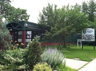
Alley Pond Park is the second-largest public park in Queens, New York City, occupying 655.3 acres (265.2 ha). The park is bordered to the east by Douglaston, to the west by Bayside, to the north by Little Neck Bay, and to the south by Union Turnpike. The Cross Island Parkway travels north-south through the park, while the Long Island Expressway and Grand Central Parkway travel east-west through the park. The park primarily consists of woodlands south of the Long Island Expressway and meadowlands north of the expressway. It is run and operated by the New York City Department of Parks and Recreation.

<span class="mw-page-title-main">Flushing River</span> Creek in Queens, New York

The Flushing River, also known as Flushing Creek, is a waterway that flows northward through the borough of Queens in New York City, mostly within Flushing Meadows–Corona Park, emptying into the Flushing Bay and the East River. The river runs through a valley that may have been a larger riverbed before the last Ice Age, and it divides Queens into western and eastern halves. Until the 20th century, the Flushing Creek was fed by three tributaries: Mill Creek and Kissena Creek on the eastern bank, and Horse Brook on the western bank.

<span class="mw-page-title-main">Highland Park (Brooklyn)</span> Public park in Brooklyn, New York

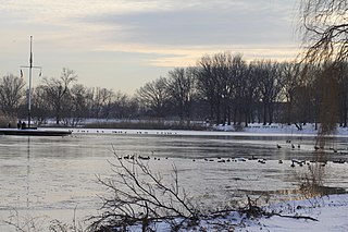
Highland Park is a park located in Brooklyn, New York City, on the border with Queens. Established in 1901, Highland Park borders Cypress Hills, Brooklyn—part of the East New York neighborhood—to its south, and it abuts Glendale and Ridgewood, Queens, to its north.

The Brooklyn–Queens Greenway is a bicycling and pedestrian path connecting parks and roads in the New York City boroughs of Brooklyn and Queens, connecting Coney Island in the south to Fort Totten in the north, on Long Island Sound. The route connects major sites in the two boroughs, such as the New York Aquarium, Brooklyn Museum, the Brooklyn Botanic Garden, the New York Hall of Science and Citi Field.

<span class="mw-page-title-main">Paerdegat Basin</span>

Paerdegat Basin is a channel that connects to Jamaica Bay between the neighborhoods of Bergen Beach and Canarsie in southeast Brooklyn, New York, United States. It connects to Jamaica Bay to the south, and the north end of the basin is adjacent to the intersection of Ralph Avenue and Flatlands Avenue. "Paerdegat" derives from the old Dutch paardengat, meaning "horse gate".

The Central Utah Project is a US federal water project that was authorized for construction under the Colorado River Storage Project Act of April 11, 1956, as a participating project. In general, the Central Utah Project develops a portion of Utah's share of the yield of the Colorado River, as set out in the Colorado River Compact of 1922.

<span class="mw-page-title-main">Brooklyn Waterworks</span> Industrial in Freeport, Long Island

The Brooklyn Waterworks, also known as the Milburn Pumping Station, was a historic building in Freeport, Long Island. Designed by noted Brooklyn architect Frank Freeman and completed in 1890, it was described as "Long Island's most ambitious Romanesque Revival design."

<span class="mw-page-title-main">Elizabeth Crowley</span> American politician

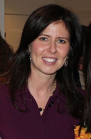
Elizabeth S. Crowley is an American politician. She was previously the New York City Council member for the 30th district from 2009 to 2017, representing the neighborhoods of Glendale, Maspeth, Middle Village, Ridgewood, and parts of Woodside and Woodhaven, in the borough of Queens. Crowley is both the first woman and first Democrat to hold the seat. Crowley was a 2021 candidate for Queens Borough President. She is a cousin of former U.S. Congressman Joseph Crowley.

<span class="mw-page-title-main">Boeing Creek</span> Stream in Shoreline, United States

Boeing Creek is a stream in the U.S. state of Washington, located in the city of Shoreline, just north of Seattle. It is about 1.6 miles (2.6 km) long and empties into Puget Sound. The creek is heavily modified along its course, and in many places has been diverted into culverts. The watershed of Boeing Creek is about 11.2 square miles (29 km2) in size, with two main tributaries aside from the mainstem. The creek takes its name from William Boeing, who built a mansion along the creek in 1913. Despite the river modifications and stormwater pollution, the creek supports a variety of riparian habitats, native animals and fishes.

<span class="mw-page-title-main">Conduit Avenue</span> Avenue in Brooklyn and Queens, New York

Conduit Avenue is an arterial road in New York City, the vast majority of which is in Queens. The divided highway runs from Atlantic Avenue in Cypress Hills, Brooklyn to Hook Creek Boulevard in Rosedale, Queens at the Nassau County border. The thoroughfare is named after an aqueduct in its right-of-way.

<span class="mw-page-title-main">Baisley Pond Park</span> Public park in Queens, New York

Baisley Pond Park is a public park located in the southeastern part of Queens, New York City, bordering the neighborhoods of South Jamaica, Rochdale, and St. Albans. It covers 109.61 acres (44.36 ha), including the 30-acre (12 ha) Baisley Pond in the center of the park. It is maintained by the New York City Department of Parks and Recreation.

<span class="mw-page-title-main">Kissena Creek</span> Buried stream in Queens, New York

Kissena Creek is a buried stream located in the neighborhoods of Flushing, Fresh Meadows, Hillcrest, and Kew Gardens Hills in the New York City borough of Queens. Kissena Creek originates in a now-filled swamp within Kew Gardens Hills and Pomonok in central Queens, flowing east to Hillcrest. The creek then travels mostly north and west, largely flowing beneath Kissena Park Golf Course, Kissena Park, Kissena Corridor Park, and Queens Botanical Garden, before merging with the Flushing River in Flushing Meadows–Corona Park.

<span class="mw-page-title-main">Spring Creek Park</span> Public park in New York City

Spring Creek Park is a public park along the Jamaica Bay shoreline between the neighborhoods of Howard Beach, Queens, and Spring Creek, Brooklyn, in New York City. Created on landfilled former marshland, the park is mostly an undeveloped nature preserve, with only small portions accessible to the public for recreation.

<span class="mw-page-title-main">Croton River watershed</span> Drainage basin in New York State, USA

This page is about the Croton River watershed, a hydrological feature. For the component of the New York City water supply system with a similar name, see Croton Watershed

<span class="mw-page-title-main">Captain Tilly Park</span> Public park in Queens, New York

Captain Tilly Park is a 9.16-acre (3.71 ha) park in Jamaica Hills, Queens, New York, north of downtown Jamaica. It is bordered by 165th Street to the west, 85th Avenue to the north, Chapin Parkway and Gothic Drive to the northeast, and Highland Avenue to the south. The park consists of a kettle pond named Goose Pond, the only remaining kettle pond in Jamaica Hills.

References

  1. Armbruster, Eugene L. (1942). Brooklyn's Eastern District. pp. 324–325.
  2. "NYC Parks' Ridgewood Reservoir Designated as a Class I Freshwater Wetland" (Press release).
  3. "National Register Database and Research". U.S. National Park Service . Retrieved February 2, 2021.
  4. Parry, Bill (February 15, 2018). "Ridgewood Reservoir added to the National Register of Historic Places" . Retrieved February 2, 2021.
  5. Ridgewood Reservoir Historic Register Report (PDF) (Report). United States National Park Service. 2019.
  6. McAlpine, WJ (1851). Report of the Standing Committee on Water for the City of Brooklyn. Orange Street, Brooklyn, NY: City of Brooklyn. p. 5.
  7. Documents and plans submitted by the Water committee to the Common ... - Google Books Result
  8. Minn, Michael. "Ridgewood Reservoir / Highland Park" . Retrieved February 5, 2021.
  9. Cirillo, Thomas; Genevro, Rosalie; Rieselbach, Anne. "Waterworks: Architecture and Landscape". The Architectural League of New York. Retrieved April 14, 2015.
  10. Bagli, Charles V. (June 13, 2001). "Soccer Team Is Negotiating For Stadium At Aqueduct". The New York Times . Retrieved December 4, 2015.
  11. 1 2 "Mayor Michael R. Bloomberg Announces Ridgewood Reservoir to Become Parkland" (Press release). New York City Mayor's Office. July 7, 2004. Retrieved February 3, 2021.
  12. "The Driven Well System of the Brooklyn Waterworks" (PDF). Scientific American. New York, NY: Scientific American. April 10, 1886. Retrieved January 31, 2021.
  13. John Shaw Billings (1890). Report on the Social Statistics of Cities in the United States (Report). U.S. Government Printing Office. p. 17. Retrieved February 2, 2021.
  14. "Driven Well Water Supplies". City Government. City Government Publishing Company. February 1900. Retrieved February 2, 2021.
  15. "Mr. Dalton's Report Sent To The Mayor". Brooklyn Daily Eagle. February 18, 1899. p. 3. Retrieved April 14, 2015.
  16. Kroessler, Jeffrey A. (2011). "Brooklyn's Thirst, Long Island's Water: Consolidation, Local Control, And The Aquifer". Long Island History Journal. 22 (1). Retrieved February 11, 2021.
  17. "Highland Park". New York City Department of Parks & Recreation. Retrieved July 10, 2010.
  18. Frishberg, Hannah (January 12, 2018). "In photos: Ridgewood Reservoir in its industrial heyday". Curbed NY. Retrieved February 11, 2021.
  19. "Ridgewood Reservoir Wetlands Delineation Report" (PDF).
  20. "NYC Parks' Ridgewood Reservoir Designated as a Class I Freshwater Wetland" (Press release).
  21. Hallum, Mark (January 12, 2019). "Ridgewood Reservoir gets protected status after years of activism". QNS. Retrieved February 2, 2021.
  22. Malina, Matthew (April 8, 2020). "Saving Water". Urban Omnibus. Architectural League of New York. Retrieved February 2, 2021.
  23. Imbler, Sabrina (December 10, 2019). "Checking In on the Algae of a Brooklyn Reservoir With a Microbiologist". Atlas Obscura. Architectural League of New York. Retrieved February 2, 2021.
  24. Konon, Alyssa (January 4, 2019). "Re: CEQR Number: 17DPR008Q, Ridgewood Reservoir Critical Environmental Area Designation, Highland Park, Queens Block 3470, Lot 75; Brooklyn Block 3889, Lot 1" (PDF). Letter to Hilary Semel. NYC Parks Department.
  25. Lauinger, John (October 21, 2007). "Forest fans howl over plans to raze 20 acres in Ridgewood Reservoir". Daily News. New York. Archived from the original on October 9, 2010. Retrieved January 2, 2010.
  26. Goldberg, Ryan (June 27, 2017). "Saving Queens' Secret Wetlands". Village Voice. Retrieved February 3, 2021.
  27. "Comptroller Rejects Contract to Turn Ridgewood Reservoir into Sports Fields" (Press release). New York City Comptroller's Office. June 26, 2008. Archived from the original on October 9, 2008. Retrieved July 2, 2008.
  28. Spivack, Caroline (January 22, 2019). "At a Queens park, an urban wetland is reclaimed". Curbed New York. Retrieved February 3, 2021.
  29. Spivack, Caroline (January 22, 2019). "At a Queens park, an urban wetland is reclaimed". Curbed New York. Retrieved February 3, 2021.
  30. Colangelo, Lisa L. (June 4, 2014). "Plan to cut culverts in historic Ridgewood Reservoir has local activists fearful it will lead to development of the natural oasis". Daily News. New York. Retrieved June 4, 2014.
  31. "The Fate of the Ridgewood Reservoir". Save Ridgewood Reservoir. June 27, 2014.
  32. Kern-Jedrychowska, Ewa (September 8, 2014). "Revamped City Plan Would Preserve Ridgewood Reservoir". DNAinfo. Archived from the original on November 11, 2020. Retrieved February 11, 2021.
  33. Fuchs, Alan (March 21, 2017). "Re: Hazard Classification Change, Ridgewood Reservoir Dam, DEC Dam ID #: 216-0074, Queens/Brooklyn, Queens/Kings County" (PDF). Letter to Therese Braddick. New York State DEC.
  34. "NYC Parks' Ridgewood Reservoir Designated as a Class I Freshwater Wetland" (Press release).

40°41′20″N73°53′13″W / 40.68889°N 73.88694°W / 40.68889; -73.88694