Riverbank, California

Last updated

Riverbank, California
DowntownRiverbank.JPG
Downtown Riverbank (Third Street)
Flag of Riverbank, California.gif
Riverbank.gif
Motto: 
City of Action
Stanislaus County California Incorporated and Unincorporated areas Riverbank Highlighted.svg
Location in Stanislaus County and the state of California
Usa edcp relief location map.png
Red pog.svg
Riverbank, California
Location in the United States
Coordinates: 37°43′53″N120°56′37″W / 37.73139°N 120.94361°W / 37.73139; -120.94361
Country Flag of the United States (23px).png  United States
State Flag of California.svg  California
County Stanislaus
Incorporated August 23, 1922 [1]
Government
  Type City
   Mayor Richard O'Brien
Area
[2]
  Total4.10 sq mi (10.61 km2)
  Land4.07 sq mi (10.54 km2)
  Water0.03 sq mi (0.07 km2)  0.59%
Elevation
86 ft (43 m)
Population
 (2020) [3]
  Total24,865
  Density6,100/sq mi (2,300/km2)
Time zone UTC-8 (Pacific (PST))
  Summer (DST) UTC-7 (PDT)
ZIP code
95367
Area code 209
FIPS code 06-61068
GNIS feature ID 1659518
Website www.riverbank.org

Riverbank is a city in Stanislaus County, California, United States. The population was 24,623 at the 2020 census, up from 15,826 at the 2000 census. Incorporated on August 23, 1922, Riverbank's official slogan is "City of Action." [4] It is part of the Modesto Metropolitan Statistical Area.

Contents

Riverbank was founded as a ferry crossing, and was established as a town with the coming of the San Francisco and San Joaquin Valley Railroad, which was soon acquired by the Santa Fe Railroad. It is named for its location on the Stanislaus River. [5]

History

In the 1850s, the Riverbank area was known as Burneyville. Major James Burney, sheriff of Mariposa, established the Burneyville Ferry over the Stanislaus River at the site of the modern bridge in Riverbank. [6]

Geography

According to the United States Census Bureau, the city has a total area of 4.1 square miles (11 km2), of which, 4.1 square miles (11 km2) of it is land and 0.02 square miles (0.052 km2) of it (0.59%) is water.

Demographics

Historical population
CensusPop.Note
1930 803
1940 1,13040.7%
1950 2,662135.6%
1960 2,7864.7%
1970 3,94941.7%
1980 5,69544.2%
1990 8,54750.1%
2000 15,82685.2%
2010 22,67843.3%
2020 24,8659.6%
U.S. Decennial Census [7]

2020

At the 2020 census Riverbank had a population of 24,623. The racial makeup of Riverbank was 16,620 (67.5%) White, 443 (1.8%) African American, 196 (0.8%) Native American, 1,378 (5.6%) Asian, 49 (0.2%) Pacific Islander, 7,805 (31.7%) from other races, and 3,176 (12.9%) from two or more races. Hispanic or Latino of any race were 14,355 persons (58.3%). [8]

There were 6,579 households, 3,380 (51.4%) had children under the age of 18 living in them, 4,053 (61.6%) were opposite-sex married couples living together, 880 (13.4%) had a female householder with no husband present, 434 (6.6%) had a male householder with no wife present. There were 413 (6.3%) unmarried opposite-sex partnerships, and 42 (0.6%) same-sex married couples or partnerships. 923 households (14.0%) were one person and 358 (5.4%) had someone living alone who was 65 or older. The average household size was 3.42. There were 5,367 families (81.6% of households); the average family size was 3.76. (This Information was gathered from the 2010 Census due to lack of information on the official 2020 report)

The age distribution was 1,822 people (7.4%) under the age of 5, 6,943 people (28.2%) under the age of 18, and 2,659 people (10.8%) who were 65 or older. The Female persons percent came up to be 51.6%, or 12,705 people.

The Owner-occupied housing unit rate from 2016-2020 was 66%. The median value of owner-occupied housing units throughout those years $318,800. The median selected monthly owner costs -with a mortgage, 2016-2020 was around $1,711. The median selected monthly owner costs -without a mortgage, 2016-2020 was around $530. Lastly the median gross rent during those 4 years came up to be around $1,244.

2000

Store and gas station in Riverbank, 1940. Photo by Dorothea Lange. Riverbank, San Joaquin Valley, California. Newly-built store and trading center typical of new shack . . . - NARA - 521694.jpg
Store and gas station in Riverbank, 1940. Photo by Dorothea Lange.

At the 2000 census there were 15,826 people in 4,544 households, including 3,821 families, in the city. The population density was 5,091.7 inhabitants per square mile (1,965.9/km2). There were 4,698 housing units at an average density of 1,511.5 per square mile (583.6/km2). The racial makeup of the city was 66.85% White, 1.53% African American, 1.43% Native American, 1.31% Asian, 0.13% Pacific Islander, 24.03% from other races, and 4.72% from two or more races. Hispanic or Latino of any race were 45.91%. [9]

Of the 4,544 households 49.6% had children under the age of 18 living with them, 65.0% were married couples living together, 13.2% had a female householder with no husband present, and 15.9% were non-families. 11.9% of households were one person and 4.2% were one person aged 65 or older. The average household size was 3.45 and the average family size was 3.73.

The age distribution was 33.9% under the age of 18, 9.9% from 18 to 24, 30.8% from 25 to 44, 18.2% from 45 to 64, and 7.2% 65 or older. The median age was 30 years. For every 100 females, there were 97.4 males. For every 100 females age 18 and over, there were 95.1 males.

The median income for a household in the city was $44,668, and the median family income was $47,411. Males had a median income of $36,370 versus $29,012 for females. The per capita income for the city was $14,972. About 9.3% of families and 12.3% of the population were below the poverty line, including 14.8% of those under age 18 and 4.9% of those age 65 or over.

The California State Department of Finance estimates the population of Riverbank as of January 1, 2006, to be 21,215 people, an estimated 34.1% increase since 2000.

Arts and culture

The Riverbank Branch Library is listed on the National Register of Historic Places.

The Riverbank Cheese and Wine Festival is an annual event each October, featuring wine and cheese tasting, arts and crafts, and vendors. [10]

Riverbank's downtown was remodeled in 2009. [11] New attractions include a downtown plaza with a mural and statue of a cable ferry operator.

Government

In the California State Legislature, Riverbank is in the 5th Senate District , represented by Democrat Susan Eggman, and the 12th Assembly District , represented by Democrat Damon Connolly. [12]

In the United States House of Representatives, Riverbank is in California's 10th congressional district , represented by Democrat Mark DeSaulnier. [13]

Education

Elementary schools

Middle schools

High schools

Other schools

Infrastructure

Transportation

Atchison, Topeka and Santa Fe Railway locomotive in Riverbank 42C Riverbank - Flickr - drewj1946.jpg
Atchison, Topeka and Santa Fe Railway locomotive in Riverbank

The BNSF Railway has a mainline running through Riverbank and serves as the BNSF's principal line linking Northern California with the Los Angeles-Chicago mainline. The line used to be owned by the Santa Fe Railway (ATSF).

Amtrak had a station in Riverbank which also served nearby Modesto, California; it was replaced by Modesto station on November 1, 1999, [14] and was destroyed by fire in 2005.

The Stanislaus Regional Transit Authority operates one bus route in Riverside.

Public safety

The Stanislaus County Sheriff's Department provides police services to the city.

Notable people

Sister cities

CityState/ProvinceCountryPopulation
Fuyang [17] [18] Zhejiang Flag of the People's Republic of China.svg  China 659,000
Tamazula de Gordiano [17] Jalisco Flag of Mexico.svg  Mexico 41,121
Fürstenfeld [19] Styria Flag of Austria.svg  Austria 5,986

Related Research Articles

<span class="mw-page-title-main">Stanislaus County, California</span> County in California, United States

Stanislaus County is a county located in the San Joaquin Valley of the U.S. state of California. As of 2023, its estimated population is 564,404. The county seat is Modesto.

Bret Harte is a census-designated place (CDP) in Stanislaus County, California, United States. The population was 5,152 at the 2010 census, down from 5,161 at the 2000 census. It is part of the Modesto Metropolitan Statistical Area. It is named for the American poet and short story writer, Bret Harte, best known for his writings about the California Gold Rush.

<span class="mw-page-title-main">Bystrom, California</span> Census-designated place in California, United States

Bystrom is a census-designated place (CDP) in Stanislaus County, California, United States. The population was 4,008 at the 2010 census, down from 4,518 at the 2000 census. It is part of the Modesto Metropolitan Statistical Area.

<span class="mw-page-title-main">Ceres, California</span> City in the United States

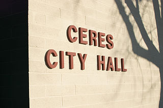
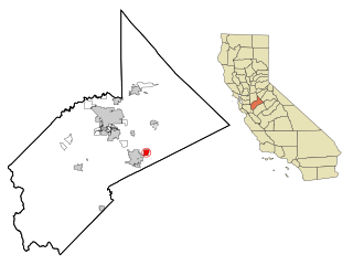
Ceres is a city in Stanislaus County, California. Its population was 49,302 at the 2020 U.S. Census, up from 45,417 at the 2010 U.S. Census. It is part of the Modesto metropolitan statistical area.

<span class="mw-page-title-main">Del Rio, California</span> Census-designated place in California, United States

Del Rio is a census-designated place (CDP) in Stanislaus County, California, United States that is located around the Del Rio Country Club. The population was 1,270 at the 2010 census, up from 1,168 at the 2000 census. It is part of the Modesto Metropolitan Statistical Area.

<span class="mw-page-title-main">Denair, California</span> Census-designated place in California, United States

Denair is a census-designated place (CDP) in Stanislaus County, California, United States. The population was 4,404 at the 2010 census, up from 3,446 at the 2000 census. It is part of the Modesto Metropolitan Statistical Area.

<span class="mw-page-title-main">East Oakdale, California</span> Census-designated place in California, United States

East Oakdale is an unincorporated census-designated place (CDP) on the Stanislaus River, located east of the city of Oakdale in Stanislaus County, California.

<span class="mw-page-title-main">Empire, California</span> Census-designated place in California, United States

Empire is a census-designated place (CDP) in Stanislaus County, California, United States. The population was 4,189 at the 2010 census, up from 3,903 at the 2000 census. It is part of the Modesto Metropolitan Statistical Area. Influenced by the Mexican culture, Empire is agriculturally active, and is home to the new Empire Community Park.

<span class="mw-page-title-main">Grayson, California</span> Place in California, United States

Grayson is an unincorporated community in Stanislaus County, California, United States. The population was 952 at the 2010 census, down from 1,077 at the 2000 census. For statistical purposes, the United States Census Bureau has defined Grayson as a census-designated place (CDP). It is part of the Modesto Metropolitan Statistical Area.

<span class="mw-page-title-main">Hughson, California</span> City in California, United States

Hughson is a city in Stanislaus County, California, United States. It is part of the Modesto Metropolitan Statistical Area. The population was 7,481 at the 2020 census, up from 6,640 at the 2010 census.

<span class="mw-page-title-main">Oakdale, California</span> City in California, United States

Oakdale is a city in the San Joaquin Valley and Stanislaus County, California. It is part of the Modesto Metropolitan Statistical Area.

<span class="mw-page-title-main">Patterson, California</span> City in California, United States

Patterson is a city in Stanislaus County, California, United States, located off Interstate 5. It is 27 miles (43 km) southeast of Tracy and is part of the Modesto Metropolitan Statistical Area. Patterson is known as the "Apricot Capital of the World"; the town holds an annual Apricot Fiesta to celebrate with many drinks, food, desserts and games. The population was 20,413 at the 2010 Census.

<span class="mw-page-title-main">Salida, California</span> Census-designated place in California, United States

Salida is a census-designated place (CDP) in Stanislaus County, California, in the United States. As of the 2010 census, the CDP population was 13,722. It is part of the Modesto Metropolitan Statistical Area. Cultivation of almonds has historically been a significant activity in the vicinity, including a major Blue Diamond processing facility nearby. The plant is involved exclusively in processing whole brown almond kernels with a "dry" process involving no water, heat or chemicals. Salida is within the East Stanislaus Resource Conservation District which comprises 984 square miles (2,550 km2) of land area and attends to a variety of environmental conservation and best management agricultural practices.

<span class="mw-page-title-main">Shackelford, California</span> Neighbourhood in Stanislaus, California, United States

Shackelford is a southern neighbourhood of the city of Modesto in Stanislaus County, California, United States, which was officially annexed on June 1, 2012. The population was 3,371 at the 2010 census, down from 5,170 at the 2000 census. It is part of the Modesto Metropolitan Statistical Area. Prior to its annexation, the neighbourhood was a census-designated place (CDP).

<span class="mw-page-title-main">Waterford, California</span> City in California, United States

Waterford is the eighth largest city in Stanislaus County, California, United States. The population was 9,120 at the 2020 census, up from 8,456 as of the 2010 census. Waterford is part of the Modesto Metropolitan Statistical Area.

<span class="mw-page-title-main">West Modesto, California</span> Census-designated place in California, United States

West Modesto is a census-designated place (CDP) in Stanislaus County, California, United States. The population was 5,682 at the 2010 census, down from 6,096 at the 2000 census. It is part of the Modesto Metropolitan Statistical Area.

<span class="mw-page-title-main">Hazelwood, Missouri</span> City in Missouri, United States

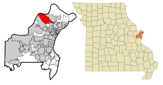
Hazelwood is a city in St. Louis County, Missouri, within Greater St. Louis. It is a second-ring northern suburb of St. Louis. Based on the 2020 United States census, the city had a total population of 25,485. It is located north of St. Louis-Lambert International Airport and is situated on Interstates 270 and 170, as well as the much-traveled Lindbergh Boulevard and Highway 370.

<span class="mw-page-title-main">Amalga, Utah</span> Town in the state of Utah, United States

Amalga is a town in Cache County, Utah, United States. The population was 488 at the 2010 census. It is included in the Logan, Utah-Idaho (partial) Metropolitan Statistical Area.

<span class="mw-page-title-main">Crows Landing, California</span> Census-designated place in California, United States

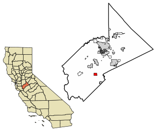
Crows Landing is a census-designated place (CDP) in Stanislaus County, California. Crows Landing is about 20 miles (32 km) southwest of Modesto. Crows Landing sits at an elevation of 128 feet (39 m). The 2020 United States census reported Crows Landing's population was 322.

<span class="mw-page-title-main">Airport, California</span> Census-designated place in California, United States

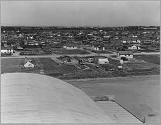
Airport is a census-designated place (CDP) in Stanislaus County, California. Airport sits at an elevation of 92 feet (28 m). and is located near Modesto City–County Airport. The 2010 United States census reported Airport's population was 1,964.

References

  1. "California Cities by Incorporation Date". California Association of Local Agency Formation Commissions. Archived from the original (Word) on February 21, 2013. Retrieved August 25, 2014.
  2. "2019 U.S. Gazetteer Files". United States Census Bureau. Retrieved July 1, 2020.
  3. "Explore Census Data". data.census.gov. Retrieved June 13, 2023.
  4. "Riverbank, California - The city of action". Business View Magazine. February 21, 2019. Retrieved August 19, 2020.
  5. Capace, Nancy (1999). Encyclopedia of California. North American Book Dist LLC. Page 391. ISBN   9780403093182.
  6. Santos, Robert LeRoy (2002). "Chronology of Stanislaus County History Through 1912 With Bibliography". Archived from the original on June 23, 2006. Retrieved June 13, 2006.
  7. "Census of Population and Housing". Census.gov. Retrieved June 4, 2015.
  8. "2010 Census Interactive Population Search: CA - Riverbank city". U.S. Census Bureau. Archived from the original on July 15, 2014. Retrieved July 12, 2014.
  9. "U.S. Census website". United States Census Bureau . Retrieved January 31, 2008.
  10. Clark, Pat (September 28, 2022). "Ready to celebrate wine and cheese? When, where, and other fests coming to Modesto region". The Modesto Bee.
  11. "Downtown Full of Action". Riverbank News. September 30, 2009.
  12. "Statewide Database". Regents of the University of California. Archived from the original on February 1, 2015. Retrieved March 27, 2015.
  13. "California's 10th Congressional District - Representatives & District Map". Civic Impulse, LLC. Retrieved September 28, 2014.
  14. Riverbank Amtrak Station (USA RailGuide -- TrainWeb)
  15. Edited by Ilan Stavans (1996). Oscar "Zeta" Acosta: The Uncollected Works. Arte Publico. ISBN   9781611922431.{{cite book}}: |last= has generic name (help)
  16. "Standout Bruin Alum Fernandez Honored At County Track Meet". www.theriverbanknews.com. Retrieved December 17, 2023.
  17. 1 2 "Sister City US Listings - California". Archived from the original on March 14, 2011. Retrieved September 12, 2011.
  18. "Memorandum of Friendly Exchanges Between Fuyang City of the People's Republic of China And City of Riverbank, California, United States of America" (PDF). Sister Cities International. Retrieved May 12, 2019.
  19. The name of "Furstenfeld, Austria" is on the mural in downtown Riverbank, CA.