Rustaq District, Afghanistan

Last updated

Rustaq District
Rustaq District Map.svg
Location of the district in Takhar Province
Coordinates: 37°08′30″N69°48′16″E / 37.14167°N 69.80444°E / 37.14167; 69.80444
CountryFlag of the Taliban.svg  Afghanistan
Province Takhār Province
Area
[1]
  Total1,915 km2 (739 sq mi)
Population
 (2015) [2]
  Total199,160
  Density104/km2 (270/sq mi)
Ethnicity
[1]
   Uzbek 45%
   Tajik 40%
   Baloch 15%
Time zone UTC+4:30 (Afghanistan Standard Time)
Post code
3754 [3]

Rustaq District is a district of Takhar Province, northern Afghanistan. The district centre is the town of Rostaq. [4]

Contents

Geography

Rustaq has an area of 1915 square kilometers, comparatively equivalent to Maui. [5] The district has the Rustaq River, or the Ab-i Rustaq, running through the district, emptying into the Panj River. [6] Some streams run to the Kokcha River. [4] [7]

Location

This district borders 12 other districts. Going clockwise from the north, they are Chah Ab District, Shahri Buzurg District, Argo District, Tishkan District, Kishim District, Kalafgan District, Taluqan District, Hazar Sumuch District, Khwaja Ghar District, Dashti Qala District, Khwaja Bahauddin District, and finally Yangi Qala District. Shahri Buzurg, Argo, Tishkan, and Kishim districts are all located in Badakhshan Province, with all other districts Rustaq borders in Takhar province. Taluqan District holds the provincial capital, Taloqan. [8] [2]

Demographics

Rustaq has 102 males for every 100 females or 2% more males than females. The median age is 16.1 years old, and the average household size is 6.5 persons, meaning there is about 30 thousand households in the district. [2]

Most of the population lives next to the Rustaq River. [9]

Economy

The majority of district residents are engaged in agricultural activity, with wheat, corn, sugarcane, and chickpeas being the main crops. Both men and women work in this area. However, there is low agricultural output, because of a lack of tools, skill, and cold storehouses. In addition, armed groups cut and utilize resources illegally.

Weaving, tailoring, jungles, and mines are also important economic activities in Rustaq. However, lack of training, lack of management in the exploitation of resources, and lack of international selling for handicrafts are all major problems in these sectors. [1]

Rustaq has about a 55% unemployment rate, with males being 8 times more likely to be working as females. Approximately 8% of the district's population are migrants. [2]

Education and Healthcare

Rustaq has 47 schools with access to primary, secondary, literacy courses, and high schools for boys and girls. However, there are shortages of buildings, materials, and money. About a third of residents ages 15–24 can read. 89% of the district has had no schooling, with more males being schooled than females. [2]

The district also has 6 clinics with doctors, nurses, and midwives. However, there is a lack of trained doctors and medical drugs. [1]

Footnotes

  1. 1 2 3 4 "SUMMARY OF THE DISTRICT DEVELOPMENT PLAN ROSTAQ DISTRICT TAKHAR PROVINCE" (PDF). mrrd-nabdp.org. Ministry of Rural Rehabilitation and Development. July 2006. Archived from the original (PDF) on 7 April 2014. Retrieved 15 July 2020.
  2. 1 2 3 4 5 "Takhar Socio-Demographic and Economic Survey 2015" (PDF). UNFPA . Retrieved 15 July 2020.
  3. "Rustaq, Afghanistan Postal Codes". worldpostalcode.com. Retrieved 15 July 2020.
  4. 1 2 "Map of Rustaq" (PDF). aims.org.af. Archived from the original (PDF) on 15 December 2011. Retrieved 15 July 2020.
  5. "Island Directory Tables: Islands by Land Area". United Nations Environment Program. 18 February 1998. Retrieved 15 July 2020.
  6. "Summary of the North Takhar Placer Gold Area of Interest" (PDF). usgs.gov. Retrieved 10 August 2020.
  7. "Rostaq". google.com/maps. Retrieved 15 July 2020.
  8. "AFGHANISTAN ADMINISTRATIVE DIVISIONS" (PDF). Archived from the original (PDF) on 23 September 2010. Retrieved 15 July 2020.
  9. Chornak, Michael; Mack, Thomas. "Geohydrologic Summary of the North Takhar Gold Placer Area of Interest" (PDF). usgs.gov. Retrieved 10 August 2020.

Related Research Articles

<span class="mw-page-title-main">Takhar Province</span> Province of Afghanistan

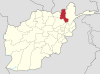
Takhar is one of the thirty-four provinces of Afghanistan, located in the northeast of the country next to Tajikistan. It is surrounded by Badakhshan in the east, Panjshir in the south, and Baghlan and Kunduz in the west. The city of Taloqan serves as its capital. The province contains 17 districts, over 1,000 villages, and approximately 1,113,173 people, which is multi-ethnic and mostly a rural society.

<span class="mw-page-title-main">Districts of Afghanistan</span> Second-level administrative subdivision of Afghanistan

The districts of Afghanistan, known as wuleswali, are secondary-level administrative units, one level below provinces. The Afghan government issued its first district map in 1973. It recognized 325 districts, counting wuleswalis (districts), alaqadaries (sub-districts), and markaz-e-wulaiyat. In the ensuing years, additional districts have been added through splits, and some eliminated through merges. In June 2005, the Afghan government issued a map of 398 districts. It was widely adopted by many information management systems, though usually with the addition of Sharak-e-Hayratan for 399 districts in total. It remains the de facto standard as of late 2018, despite a string of government announcements of the creation of new districts.

<span class="mw-page-title-main">Tishkan District</span> Place in Badakhshan, eastern Afghanistan

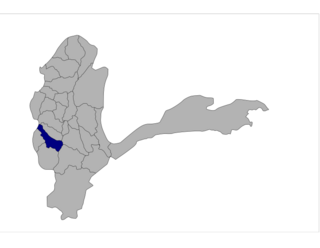
Tishkan is one of the 29 districts of Badakhshan province in eastern Afghanistan. It was created in 2005 from part of Kishim District and is home to approximately 33,165 residents.

<span class="mw-page-title-main">Bangi District</span> District in Takhār Province, Afghanistan

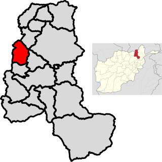
Bangi District is a district of Takhar Province, Afghanistan.

<span class="mw-page-title-main">Chah Ab District</span> District in Takhār Province, Afghanistan

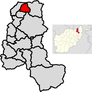
Chah Ab District is a district of Takhar Province, Afghanistan. Its district center is Chah Ab. The district's economy is primarily based on agriculture and livestock.

<span class="mw-page-title-main">Chal District</span> District in Takhār, Afghanistan

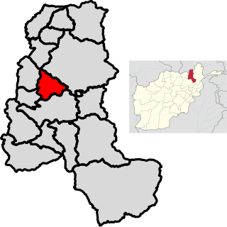
Chal District is a district of Takhar Province, Afghanistan. It was considered to be largely under control of the Afghan government in 2018.

<span class="mw-page-title-main">Darqad District</span> District in Takhār Province, Afghanistan

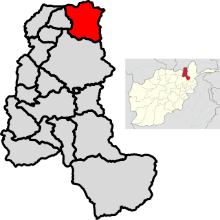
Darqad District is a district of Takhar Province, Afghanistan. The district has 34 villages. Darqad did not change between the 325 and 398 district sets. Near the end of 2018, the district was considered to be Taliban-influenced, as opposed to the Afghan government. The district was Taliban-controlled by August 2021.

<span class="mw-page-title-main">Farkhar District</span> District in Takhar, Afghanistan

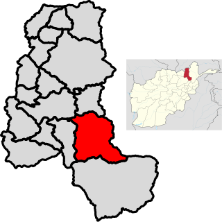
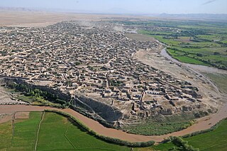
Farkhar District is a district in Takhar Province of Afghanistan. It is located southeast of Taloqan. The Khanabad River flows inside this valley. Around 99% of the people in Farkhar speak Dari. Farkhar has about 50,000 people and 75 villages.

<span class="mw-page-title-main">Kalafgan District</span> District in Takhār Province, Afghanistan

Kalafgan District is a district of Takhar Province, Afghanistan. The district is well governed, with self-governance in parts of Kalafgan because of how remote they are. 42 villages are located in the district. In 2017, Kalafgan was considered to be under full control by the Afghan Government. However, the Taliban had taken full control by August 2021.

<span class="mw-page-title-main">Khwaja Ghar District</span> District in Takhār Province, Afghanistan

Khwaja Ghar District is a district of Takhar Province, Afghanistan. The district was badly destroyed during the 1996-2001 Afghan Civil War in fighting between the Taliban and the Northern Alliance.

<span class="mw-page-title-main">Yangi Qala District</span> District in Takhār Province, Afghanistan

Yangi Qala District is a district in Takhar Province, Afghanistan. Economically the population of this district is primarily involved in agriculture. The main crops are rice and wheat, and the surplus rice is exporting to neighboring districts and provinces. There are 64 villages in the district. As of August 2021, the Taliban has full control over this district.

<span class="mw-page-title-main">Kokcha River</span> River in Afghanistan

The Kokcha River is located in northeastern Afghanistan. A tributary of the Panj river, it flows through Badakhshan Province in the Hindu Kush. It is named after the Koksha Valley. The city of Feyzabad lies along the Kokcha. Near the village of Artin Jelow there is a bridge over the river.

<span class="mw-page-title-main">Afghan Border Force</span> Border Guard of Afghanistan

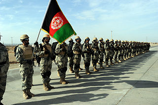
The Afghan Border Force (ABF) was responsible for security of Afghanistan's border area with neighboring countries extending up to 30 miles (48 km) into the interior and formed part of the Afghan National Army. In December 2017, most of the Afghan Border Police (ABP) personnel of the Afghan National Police were transferred to the Afghan National Army to form the Afghan Border Force. The ABP retained 4,000 personnel for customs operations at border crossings and international airports such as checking documents of foreigners entering the country or deporting them.

<span class="mw-page-title-main">Baharak District, Takhar</span> District in Takhār Province, Afghanistan

Baharak District is a district of Takhar Province, Afghanistan. The district was split-off from Taluqan District in 2005. Most people work in agriculture. The district has been the site of fighting between the Afghan Government and the Taliban; Baharak was considered to be contested in late 2018 and taken by the Taliban by August 2021.

<span class="mw-page-title-main">Dashti Qala District</span> District in Takhār Province, Afghanistan

Dashti Qala District is a district of Takhar Province, Afghanistan. It split from Khwaja Ghar District in June 2005. This district borders Tajikistan. Ai-Khanoum, probably founded by the Seleucid Empire, is located in this district. In 2018, this district was considered contested between the government and the Taliban.

<span class="mw-page-title-main">Namak Ab District</span> District in Takhār Province, Afghanistan

Namak Ab District is a district of Takhar Province, Afghanistan. The district was split-off from Taluqan District. In late 2018, Namak Ab was considered to be government influenced, as opposed to the Taliban.

<span class="mw-page-title-main">Hazar Sumuch District</span> District in Takhār Province, Afghanistan

Hazar Sumuch District is a district of Takhar Province, Afghanistan. The district was split-off from Taluqan District. Most people in the district work in agriculture. In late 2018, Hazar Sumuch was considered to be government influenced as opposed to the Taliban.

<span class="mw-page-title-main">Khwaja Bahauddin District</span> District in Takhār Province, Afghanistan

Khwaja Bahauddin District is a district of Takhar Province, Afghanistan. The district was created from a portion of Yangi Qala District in 2005. 25 villages are located in Khwaja Bahauddin.

Rostaq is a village in Takhar Province, Afghanistan. It is the district center of Rustaq District.

References