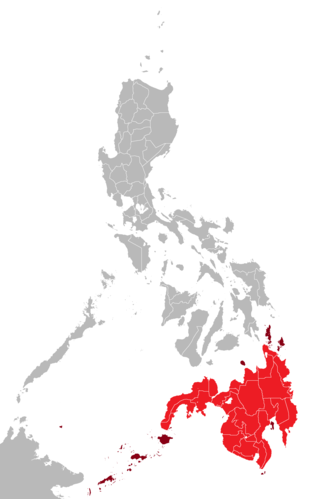
Mindanao is the second-largest island in the Philippines, after Luzon, and seventh-most populous island in the world. Located in the southern region of the archipelago, the island is part of an island group of the same name that also includes its adjacent islands, notably the Sulu Archipelago. According to the 2020 census, Mindanao has a population of 26,252,442 people, while the entire island group has an estimated population of 27,021,036 according to the 2021 census.
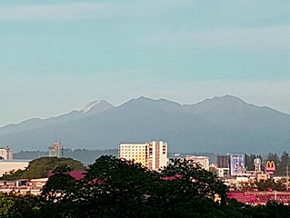
Mount Apo, also known locally as Apo Sandawa, is a large solfataric, dormant stratovolcano on the island of Mindanao, Philippines. With an elevation of 2,954 meters (9,692 ft) above sea level, it is the highest-mountain in the Philippine Archipelago, Mindanao and 24th-highest peak of an island on Earth. Located between Davao City and Davao del Sur in the Davao Region, and Cotabato in Soccsksargen, Mount Apo is the most-prominent mountain in the Philippines. The peak overlooks from Davao City 45 kilometers (28 mi) to the northeast, Digos 25 kilometers (16 mi) to the southeast, and Kidapawan 20 kilometers (12 mi) to the west. It is a protected area and a Natural Park of the Philippines.
Mount Pulag is Luzon's highest peak at 2,928 metres (9,606 ft) above sea level, third-highest mountain in the Philippines, and the 26th-highest peak of an island on Earth. It is second-most prominent mountain in the Philippines, it is a dormant volcano. Located on the triple border of the provinces of Benguet, Ifugao, and Nueva Vizcaya, the borders meet at the mountain's peak. Mount Pulag is third highest next to Mount Apo and Mount Dulang-dulang.

Marawi, officially the Islamic City of Marawi, is a 4th class component city and capital of the province of Lanao del Sur, Philippines. According to the 2020 census, it has a population of 207,010 people.
Bud Dajo, is a cinder cone and the second highest point (+600m) in the province of Sulu, Philippines. it is one of the cinder cones that make up the island of Jolo and part of the Jolo Volcanic Group in the Republic of the Philippines. The extinct volcano is located 8 kilometres (5.0 mi) southeast from the town of Jolo in Sulu province. The mountain and adjacent lands were declared as Mount Dajo National Park in 1938. It is a sacred mountain for the locals, and the Tausug people at-large, as well as nearby ethnic groups.

Mount Banahaw is an active complex volcano on Luzon in the Philippines. The three-peaked volcano is located at the boundary of Laguna and Quezon provinces. It is the highest mountain in both provinces and Calabarzon region, dominating the landscape for miles around.

Saguiaran, officially the Municipality of Saguiaran, is a 4th class municipality in the province of Lanao del Sur, Philippines. According to the 2020 census, it has a population of 26,712 people.

Tourism is an important sector for Philippine economy. The travel and tourism industry contributed 5.2%% to the country's GDP in 2021; this was lower than the 12.7% recorded in 2019 prior to the COVID-19 lockdowns. The country is known for having its rich biodiversity as its main tourist attraction. Popular destinations among tourists include Boracay, Palawan, and Siargao. Despite potential, the Philippines has lagged in tourism industry behind some of its Southeast Asian neighbors due to political and social problems.
Mount Kitanglad is an inactive volcano located in the Kitanglad Mountain Range in Bukidnon province on Mindanao island. It is the fourth highest mountain in the Philippines and has an approximate height of 2,899 metres (9,511 ft). It is located between Malaybalay City and the municipalities of Lantapan, Impasugong, Sumilao, and Libona. It is home to one of the Philippines' few remaining rainforests.

Mount Malindang is a complex volcano located in the province of Misamis Occidental in the southern island of Mindanao, Philippines. It is the highest point in the province. The least studied mountain range was formed through several volcanic activities some of which could be historical, evident by the presence of two calderas, surrounded by high rock walls, cinder cones, dome volcano plugs, two sulfurous hot springs, and a crater lake named Lake Duminagat. The amphitheater structures have extensive distribution of volcanic rocks, carbonized wood that are found in pyroclastic deposits. The mountain range is dissected by several canyons and ravines.
The Northern Luzon Heroes Hill National Park is a national park in the Republic of the Philippines, located in the municipalities of Santa and partly in Narvacan in Ilocos Sur province. The protected area was established on July 9, 1963, by Proclamation No. 132.
Aurora Memorial National Park is a protected area of the Philippines located within the Sierra Madre mountain range between the provinces of Nueva Ecija and Aurora in Central Luzon. The Aurora Memorial National park covers an area of 5,676 hectares stretching over 50 kilometers along the scenic Bongabon-Baler road. Established in 1937 by virtue of Proclamation No. 220, the park was dedicated to then First Lady Aurora Aragon Quezon. It had an initial area of 2,356 hectares. By 1941, its size more than doubled to its current area of 5,676 hectares. The maximum altitude of the park is reported to be 1,000 m, so the main forest type inside the park must be lowland dipterocarp, with only limited areas of montane forest. Land uses inside the park include both permanent and shifting agriculture (kaingin) and forestry.

Bataan National Park is a protected area of the Philippines located in the mountainous interior of Bataan province in the Central Luzon Region. The park straddles the northern half of Bataan Peninsula near its border with Subic Bay Freeport Zone. The park was first established in 1945 under Proclamation No. 24 with an initial area of 31,000 hectares and included portions of the fenced area of Subic Bay Freeport Zone. The park was reduced in 1987 to its present size of 23,688 hectares and is now wholly located in Bataan province. The park encompasses the Bataan towns and cities of Hermosa, Orani, Samal, Abucay, Balanga, Bagac and Morong.
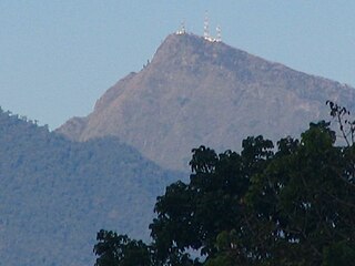
Lake Butig National Park is a protected area of the Philippines located in the municipality of Butig, Lanao del Sur in Mindanao Island. The park spans an area of 68 hectares comprising Lake Butig and its surrounding forest. It was declared a national park in 1965 by virtue of Republic Act No. 4190.

Cassamata Hill National Park is a protected area of the Philippines located in the municipality of Bangued, Abra in the Cordillera Administrative Region. The park covers an area of 57 hectares (140 acres) and was declared a protected area in 1974.
Pantuwaraya Lake National Park is a protected area of the Philippines located in barangay Pantao Raya in the municipality of Saguiaran, Lanao del Sur. The park covers an area of 20 hectares comprising Lake Pantao Raya and surrounding area. It was declared a national park in 1965 by virtue of Republic Act No. 4190.
Rungkunan National Park is a protected area of the Philippines located in the municipalities of Ditsaan-Ramain and Tagoloan II in Lanao del Sur, some 10 kilometers east-south-east of the provincial capital Marawi. The park covers the mountainous eastern section of Lanao del Sur near the Lake Lanao-Agus River Watershed Area known for its beautiful sparkling stream, virgin forest and invigorating climate. It was declared a national park in 1965 by virtue of Republic Act No. 4190.
The Bangsamoro Islamic Freedom Fighters (BIFF), also known as the Bangsamoro Islamic Freedom Movement, is an Islamist militant organization based in Mindanao, the Philippines. It is a smaller player in the overall Moro insurgency in the Philippines and is mostly active in Maguindanao and other places in central Mindanao. It is a breakaway group from the Moro Islamic Liberation Front founded by Ameril Umbra Kato. Following Kato's death, the group split into three factions, one of which has aligned with the Islamic State of Iraq and the Levant (ISIL), while the other two are less radical.

The Quezon Protected Landscape is a protected area in the Republic of the Philippines, spanning the municipalities of Pagbilao, Padre Burgos and Atimonan in Quezon province. The park is situated north of the narrowest section of Luzon in Quezon province, located about 164 km (102 mi) southeast of Metro Manila.

The siege of Marawi, also known as the Marawi crisis, and the Battle of Marawi, was a five-month-long armed conflict in Marawi, Philippines, that started on May 23, 2017, between Philippine government security forces against militants affiliated with the Islamic State (IS), including the Maute and Abu Sayyaf Salafi jihadist groups. The battle also became the longest urban battle in the modern history of the Philippines.

