Saildrone (company)

Last updated
Saildrone, Inc.
Company type Private
IndustryOcean drones
Founded2012
Founder Richard Jenkins
Headquarters
Key people
Richard Jenkins (CEO)
Barak Ben-Gal (CFO)
Mark Cuyler (COO)
Brian Hernacki (CTO)
Website saildrone.com

Saildrone, Inc. is a United States company based in Alameda, California, that designs, manufacturers, and operates a fleet of unmanned/uncrewed surface vehicles (USVs), or ocean drones, known as "saildrones". The company was founded by engineer Richard Jenkins in 2012. [1]

Contents

Saildrone customers and research partners include the various departments of the National Oceanographic and Atmospheric Administration [2] [3] [4] [5] NASA, the University of New Hampshire, [6] the University of Rhode Island, [7] the Commonwealth Scientific and Industrial Research Organisation (Australia), [8] the European Center for Medium-range Weather Forecasts, [9] GEOMAR Helmholtz Centre for Ocean Research Kiel (Germany), [10] the Monterey Bay Aquarium Research Institute, [11] and others.

History

Founding (2012-2018)

Saildrone was founded by Richard Jenkins in 2012. [12] [13]

In 2014, Saildrone began a partnership with the National Oceanic and Atmospheric Administration's Pacific Marine Environmental Laboratory under a Cooperative Research and Development Agreement to develop and refine vehicle capabilities and payload of sensors. Objectives included acoustic fisheries surveys for management and conservation while also collecting metocean data. [14]

In 2016, Saildrone closed a $14 million Series A funding round. The round was led by Social Capital and included Capricorn Investment Group and Lux Capital. Saildrone had previously received mission-related investment from The Schmidt Family Foundation, a private foundation created by Eric and Wendy Schmidt. [15]

Projects and funding (2017-2023)

In 2017, two saildrones deployed from San Francisco took part in the NASA-funded Salinity Processes in the Upper-ocean Regional Study 2 (SPURS-2) field campaign as part of their more than six-month Tropical Pacific Observing System (TPOS)-2020 pilot study in the eastern tropical Pacific. The mission compared saildrone measurements with those of the research vessel Revelle and the Woods Hole Oceanographic Institution (WHOI) SPURS-2 buoy. The data collected by the saildrones was found to be in good agreement with the ship and buoy, and demonstrated the saildrone to be “an effective platform for observing a wide range of oceanographic variables important to air-sea interaction studies,” according to a paper published in Oceanography . [16]

In 2018, the website DroneBelow reported the company raised a $60 million Series B funding round to scale operations with participation from Horizons Ventures as well as existing investors Social Capital, Capricorn Investment Group, and Lux Capital. [17]

In October 2020, the U.S. Coast Guard Research and Development Center in Hawaii began a 30-day test to "assess low-cost, commercially available autonomous solutions to improve maritime domain awareness in remote regions of the Pacific Ocean." Saildrone was one of two platforms tested. [18]

In 2021, TechCrunch reported the company had raised a $100 million Series C funding round led by Mary Meeker's investment fund Bond Capital with participation from new investors XN, Standard Investments, Emerson Collective, Crowley Maritime Corporation, as well as previous investors Capricorn's Technology Impact Fund, Lux Capital, Social Capital, and Tribe Capital. [19]

In 2022, the Saildrone Surveyor was recognized with the Innovation Award from the Blue Marine Foundation and BOAT International's annual Ocean Awards for revolutionizing ocean mapping. The company says that with 20 Saildrone Surveyors, it should be possible to achieve Seabed 2030's goal of mapping the world's oceans in high-resolution by the end of the decade. [20]

Vehicles

There are three Saildrone platforms: Explorer, Voyager, and Surveyor. All three Saildrone uncrewed surface vehicles (USVs) combine wind-powered propulsion technology with solar-powered meteorological and oceanographic sensors.

Saildrone Explorer

The Saildrone Explorer is a 23-foot-long (7.0 m) USV that can sail at an average speed of 3 knots (5.6 km/h; 3.5 mph) (depending on the wind) and stay at sea for up to 365 days. The Explorer is designed for fisheries missions, metocean data collection, ecosystem monitoring, and satellite calibration and validation missions. [21] [22]

Saildrone Voyager

In August 2021, Seapower Magazine reported the company is adding a new mid-size USV to the fleet: The Voyager is a 33-foot-long (10 m) USV with primary wind power and auxiliary propulsion of a 4kW electric motor for a wide variety of missions including bathymetry (ocean mapping) missions, border patrol and maritime domain awareness. [23] [24] The average speed is 5 knots.

Saildrone Surveyor

At 72 feet (22 m) long and weighing 14 tons, [25] the Surveyor is the largest vehicle in the Saildrone fleet. According to Wired , the Surveyor was first launched in January 2021 and is designed to carry multibeam echo sounders for IHO-compliant bathymetry surveys. The Surveyor's multibeam echo sounders can map the ocean seafloor to depths of 23,000 feet (7,000 m). It also carries an acoustic Doppler current profiler to measure the speed and direction of ocean currents. [26]

In July 2021, the Surveyor completed its first trans-Pacific mapping mission sailing from San Francisco to Honolulu, Hawaii, and mapping 6,400 square nautical miles (22,000 km2; 8,500 sq mi) of seafloor along the way. Hawaii News Now reported that 20 Surveyors could map the entire ocean in less than 10 years. [27]

In September 2022, it was announced that Austal USA signed an agreement with Saildrone, to build Saildrone Surveyor drones by year end for the US Navy, and other customers. [28] In April 2024, Saildrone and Thales Australia announced a partnership to integrate the Thales BlueSentry thin-line towed array with the Surveyor for conducting autonomous long-endurance anti-submarine warfare (ASW) missions. [29]

Missions

2019 Antarctic circumnavigation

In January 2019, a consortium of organizations led by the Li Ka Shing Foundation launched an autonomous circumnavigation of Antarctica using a group of saildrones. Researchers from agencies around the world participated including from NOAA, NASA, CSIRO, Palmer Long-Term Ecological Research, the Scripps Institution of Oceanography, the Southern Ocean Observing System, the Japan Agency for Marine-Earth Science and Technology, the Korea Polar Research Institute, the Norwegian Polar Institute, the University of Exeter, the University of Gothenburg, the University of Otago, and the New Zealand National Institute of Water and Atmospheric Research. Bloomberg Businessweek reported that, on August 3, 2019, SD 1020 became the first autonomous vehicle to circumnavigate Antarctica, having spent 196 days in the Southern Ocean sailing 13,670 miles. During the mission, SD 1020 had to survive freezing temperatures, 50-foot (15 m) waves, 80 mph (130 km/h) winds, and collisions with giant icebergs. In order to survive the extreme conditions of the Southern Ocean, the saildrone was equipped with a special "square" wing. [30] [31]

According to a paper published in Geophysical Research Letters by oceanographers Adrienne Sutton, Nancy Williams, and Bronte Tilbrook, one aspect of the mission focused on using Saildrone in situ data collection to better understand the role of the Southern Ocean in regulating the global carbon budget. Assumptions that the Southern Ocean is a significant carbon sink had previously been made using ship-based measurements, which are limited due to challenging ocean conditions in the Southern Ocean. The data collected by the saildrone was used to reduce uncertainty about Southern Ocean CO2 uptake: "By directly measuring air and surface seawater carbon dioxide (CO2) and wind speed on the USV, we were able to observe CO2 exchange between the ocean and atmosphere every hour during the mission. Using this data set, we estimated potential errors in these measurements as well as other approaches to estimating CO2 exchange." [32] [33]

2021 Atlantic hurricane mission

In partnership with NOAA, Saildrone deployed five vehicles equipped with "hurricane" wings to the tropical Atlantic Ocean to study air-sea heat exchange to better understand hurricane rapid intensification during the 2021 Atlantic hurricane season. On September 30, 2021, SD 1045 became the first Saildrone Explorer to sail into a category 4 hurricane. It collected ocean data and video from inside Hurricane Sam where the sea state included 50-foot (15 m) waves and wind speeds reached over 120 mph (190 km/h). [34] [35] NOAA has stated that it will deploy five more Saildrone USVs during the 2022 hurricane season. [36]

Related Research Articles

<span class="mw-page-title-main">Unmanned aerial vehicle</span> Aircraft without any human pilot on board

An unmanned aerial vehicle (UAV), commonly known as a drone, is an aircraft without any human pilot, crew, or passengers on board. UAVs were originally developed through the twentieth century for military missions too "dull, dirty or dangerous" for humans, and by the twenty-first, they had become essential assets to most militaries. As control technologies improved and costs fell, their use expanded to many non-military applications. These include aerial photography, area coverage, precision agriculture, forest fire monitoring, river monitoring, environmental monitoring, policing and surveillance, infrastructure inspections, smuggling, product deliveries, entertainment, and drone racing.

<span class="mw-page-title-main">Survey vessel</span> Type of research vessel

A survey vessel is any type of ship or boat that is used for underwater surveys, usually to collect data for mapping or planning underwater construction or mineral extraction. It is a type of research vessel, and may be designed for the purpose, modified for the purpose or temporarily put into the service as a vessel of opportunity, and may be crewed, remotely operated, or autonomous. The size and equipment vary to suit the task and availability.

<span class="mw-page-title-main">Autonomous underwater vehicle</span> Unmanned underwater vehicle with autonomous guidance system

An autonomous underwater vehicle (AUV) is a robot that travels underwater without requiring continuous input from an operator. AUVs constitute part of a larger group of undersea systems known as unmanned underwater vehicles, a classification that includes non-autonomous remotely operated underwater vehicles (ROVs) – controlled and powered from the surface by an operator/pilot via an umbilical or using remote control. In military applications an AUV is more often referred to as an unmanned undersea vehicle (UUV). Underwater gliders are a subclass of AUVs.

<span class="mw-page-title-main">Atlantic Oceanographic and Meteorological Laboratory</span> U.S. Government research laboratory

The Atlantic Oceanographic and Meteorological Laboratory (AOML), a federal research laboratory, is part of the National Oceanic and Atmospheric Administration's (NOAA) Office of Oceanic and Atmospheric Research (OAR), located in Miami in the United States. AOML's research spans tropical cyclone and hurricanes, coastal ecosystems, oceans and human health, climate studies, global carbon systems, and ocean observations. It is one of seven NOAA Research Laboratories (RLs).

<span class="mw-page-title-main">Underwater glider</span> Type of autonomous underwater vehicle

An underwater glider is a type of autonomous underwater vehicle (AUV) that employs variable-buoyancy propulsion instead of traditional propellers or thrusters. It employs variable buoyancy in a similar way to a profiling float, but unlike a float, which can move only up and down, an underwater glider is fitted with hydrofoils that allow it to glide forward while descending through the water. At a certain depth, the glider switches to positive buoyancy to climb back up and forward, and the cycle is then repeated.

<span class="mw-page-title-main">Unmanned underwater vehicle</span> Submersible vehicles that can operate underwater without a human occupant

Unmanned underwater vehicles (UUV), also known as uncrewed underwater vehicles and underwater drones, are submersible vehicles that can operate underwater without a human occupant. These vehicles may be divided into two categories: remotely operated underwater vehicles (ROUVs) and autonomous underwater vehicles (AUVs). ROUVs are remotely controlled by a human operator. AUVs are automated and operate independently of direct human input.

<span class="mw-page-title-main">Unmanned surface vehicle</span> Vehicle that operates on the surface of the water without a crew

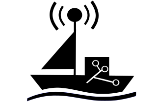
An unmanned surface vehicle, unmanned surface vessel or uncrewed surface vessel (USV), colloquially called a drone boat, drone ship or sea drone, is a boat or ship that operates on the surface of the water without a crew. USVs operate with various levels of autonomy, from remote control to fully autonomous surface vehicles (ASV).

Richard Jenkins is a 47 year old engineer from Lymington, UK. He is known for engineering and sailing wind-driven vessels on land, ice, and water. In 1999, he founded the Windjet Project while studying mechanical engineering at Imperial College. Since then he has designed, built, and tested four separate speed record craft. Jenkins is currently the founder and CEO of Saildrone, a company that designs, manufacturers, and manages unmanned surface vehicles that sail the world's oceans collecting science data. In 2019, SD 1020 became the first unmanned vehicle to complete a circumnavigation of Antarctica, crossing every longitude line in the Southern Ocean.

<span class="mw-page-title-main">Uncrewed vehicle</span> Type of vehicle

An uncrewed vehicle or unmanned vehicle is a vehicle without a person on board. Uncrewed vehicles can either be under telerobotic control—remote controlled or remote guided vehicles—or they can be autonomously controlled—autonomous vehicles—which are capable of sensing their environment and navigating on their own.

Liquid Robotics is an American marine robotics corporation that designs, manufactures and sells the Wave Glider, a wave and solar powered unmanned surface vehicle (USV). The Wave Glider harvests energy from ocean waves for propulsion. With this energy source, Wave Gliders can spend many months at a time at sea, collecting and transmitting ocean data.

Robbie Hood is an atmospheric scientist who studies hurricanes. She was lead scientist for the Convection and Moisture Experiment at NASA and Director of the Unmanned Aircraft Systems (UAS) division of the National Oceanic and Atmospheric Administration.

<i>Sea Hunter</i> Autonomous unmanned surface vehicle launched in 2016

Sea Hunter is an autonomous unmanned surface vehicle (USV) launched in 2016 as part of the DARPA Anti-Submarine Warfare Continuous Trail Unmanned Vessel (ACTUV) program. The ship was christened 7 April 2016 in Portland, Oregon. It was built by Vigor Industrial. The vessel continues the line of experimental "Sea" ships, including Sea Shadow, Sea Fighter, Sea Jet, and Sea Slice. Sea Hunter is classified as a Class III USV and designated the Medium Displacement Unmanned Surface Vehicle (MDUSV).

<span class="mw-page-title-main">Raytheon Coyote</span> Type of aircraft

The Raytheon Coyote is a small, expendable, unmanned aircraft system built by the Raytheon Company, with the capability of operating in autonomous swarms. It is launched from a sonobuoy canister with the wings deploying in early flight phase.

USV Maxlimer is a semi-autonomous, remotely controlled unmanned surface vehicle (USV) owned and operated by the British company SEA-KIT International. She was the winning entry in the Shell Ocean Discovery X Prize competition, and subsequently has been used as a proof-of-concept vessel for uncrewed, over-the-horizon offshore operations.

The JARI USV is an uncrewed surface vehicle developed by the China Shipbuilding Industry Corporation (CSIC), specifically between its No. 716 Research Institute, the Jiangsu Automation Research Institute (JARI), and No. 702 Research Institute, China Ship Scientific Research Centre (CSRRC). The uncrewed warship is designed for potential use for the People's Liberation Army Navy and export customers.

<span class="mw-page-title-main">Exercise REP(MUS)</span> Annual military exercise

REP(MUS) (Robotic Experimentation and Prototyping using Maritime Uncrewed Systems) is an annual military exercise organized and hosted by the Portuguese Navy and NATO with the participation of forces from foreign military forces, universities and tech companies. The exercise has the objective of testing different types of unmanned aerial vehicles, unmanned surface vehicles, unmanned undersea vehicles, and unmanned ground vehicles. Today it is the largest UAV testing exercise, with the participation of several NATO countries.

Jinghai USVs are a series unmanned surface vehicles developed by Shanghai University, and as end of 2021, a total of eight models have been identified:

CSSC unmanned vehicles (UUV)s are uncrewed vehicles developed in the People's Republic of China (PRC) by China State Shipbuilding Corporation (CSSC), most of which are in service with various Chinese governmental agencies/departments, and government-owned enterprises.

PWT unmanned underwater vehicles (UUV)s are uncrewed vehicles developed in the People's Republic of China (PRC) by PWT in Wuhan, most of which are in service with various Chinese governmental agencies/departments, and government-owned enterprises.

A weather drone, or weather-sensing uncrewed aerial vehicle (UAV), – is a remotely piloted aircraft weighing less than 25 kg and carrying sensors that collect thermodynamic and kinematic data from the mid and lower atmosphere.

References

  1. Vance, Ashlee (May 15, 2018). "This Armada of Saildrones Could Conquer the Ocean". Bloomberg Businessweek. Retrieved 14 October 2021.
  2. "Autonomous vessel operations in the Arctic: Lessons learned from the Summer 2020 Mapping Mission". NOAA Office of Coast Survey. October 8, 2020. Retrieved 16 October 2021.
  3. "Ocean Drone Sails into Category 4 Hurricane Sam". Atlantic Oceanographic and Meteorological Laboratory (AOML). October 4, 2021. Retrieved 16 October 2021.
  4. "Ocean-Going Robots Poised to Enter Bering Sea to Start Unconventional Fisheries Survey". NOAA Fisheries. July 1, 2020. Retrieved 16 October 2021.
  5. "Saildrone". Physical Oceanography Distributed Active Archive Center (PO.DAAC). NASA Jet Propulsion Laboratory. 18 March 2020. Retrieved 16 October 2021.
  6. "UNH Sails into the Next Generation of Ocean Mapping With NOAA Grant". University of New Hampshire. December 10, 2019. Retrieved 16 October 2021.
  7. "URI oceanographer part of pioneering study to improve weather prediction and global carbon budget understanding". University of Rhode Island. April 13, 2021. Retrieved 16 October 2021.
  8. Knight, Renee (January 30, 2018). "CSIRO Forms Partnership with Saildrone". Inside Unmanned Systems. Retrieved 16 October 2021.
  9. Dahoui, Mohamed; Pidduck, Emma; Ingleby, Bruce; Isaksen, Lars; de Halleux, Sebastien (October 2019). "Use of saildrone observations at ECMWF". No. 161. European Centre for Medium-Range Weather Forecasts. Retrieved 16 October 2021.
  10. Nicolai, Maike (October 1, 2021). "Maiden voyage tracking carbon dioxide in the ocean". GEOMAR. Retrieved 16 October 2021.
  11. Peterson, Ken (April 20, 2018). "Voyage to the White Shark Café". Monterey Bay Aquarium. Retrieved 16 October 2021.
  12. Ryan, Kevin J. "This Engineer Built a Crazy Unmanned Vehicle to Break World Records, and It Accidentally Became a Venture-Backed Startup". No. March/April 2019. Inc. Magazine. Retrieved 15 October 2021.
  13. Markoff, John (September 4, 2016). "No Sailors Needed: Robot Sailboats Scour the Oceans for Data". The New York Times. Retrieved 18 October 2021.
  14. "Saildrone". Ocean Climate Stations. National Oceanic and Atmospheric Administration, Pacific Marine Environmental Laboratory. Retrieved 15 October 2021.
  15. "Saildrone Raises $14M In Series A Funding". FinSMEs. September 5, 2016. Retrieved 15 October 2021.
  16. Zhang, Dongxiao; Cronin, Meghan F.; Meinig, Christian; Farrar, J. Thomas; Jenkins, Richard; Peacock, David; Keene, Jennifer; Sutton, Adrienne; Yang, Qiong (June 14, 2019). "Comparing Air-Sea Flux Measurements from a New Unmanned Surface Vehicle and Proven Platforms During the SPURS-2 Field Campaign". Oceanography. 32 (2): 122–133. doi:10.5670/oceanog.2019.220. hdl: 1912/24466 . S2CID   197584889 . Retrieved 16 October 2021.
  17. Whitaker, Stephanie (May 16, 2018). "Saildrone Scales Up With $60M Funding to Help Save The Oceans". DroneBelow.com. Retrieved 15 October 2021.
  18. Eckstein, Megan (October 15, 2020). "Coast Guard Begins At-Sea Testing of Unmanned Surface Vehicles to Tackle Illegal Fishing, Crime". USNI News. Retrieved 15 October 2021.
  19. Coldewey, Devin (October 18, 2021). "Saildrone catches a $100M C breeze to build more robo-boats". TechCrunch. Retrieved 18 October 2021.
  20. "The 2022 Ocean Award Winners announced". www.boatinternational.com. Retrieved 2022-06-08.
  21. Condliffe, Jamie (September 19, 2016). "Fleets of Robotic Boats Are Getting Ready to Set Sail". MIT Technology Review. Retrieved 15 October 2021.
  22. "Detecting Fish from Ocean-Going Robots to Complement Ship-Based Surveys". NOAA Fisheries Alaska Fisheries Science Center. August 22, 2019. Retrieved 15 October 2021.
  23. Davis, Brett (August 1, 2021). "Saildrone Voyager: A Unique Solution for 24/7/365 Maritime Domain Awareness". Seapower Magazine. Retrieved 15 October 2021.
  24. Tegler, Eric (August 16, 2021). "With A Sight, Sound And Radar Picture, Saildrone Could Build An AI Database Of Everything In The Ocean". Forbes. Retrieved 15 October 2021.
  25. "Autonomous Research Vehicle Completes Ocean Crossing from San Francisco to Hawaii". Hydro International. July 13, 2021. Retrieved 15 October 2021.
  26. Niiler, Eric (January 18, 2021). "The Autonomous Saildrone Surveyor Preps for Its Sea Voyage". Wired. Retrieved 15 October 2021.
  27. Mendoza, Jim (July 12, 2021). "They call it the 'Surveyor,' but it does much more than map the ocean floor". Hawaii News Now. Retrieved 15 October 2021.
  28. "Austal USA Inks Deal with Saildrone to Build Wind-powered Drones as USV Work Expands". September 1, 2022.
  29. SAS News: U.S., Australian Companies Partner on Uncrewed Anti-Submarine Boat. National Defense Magazine. 8 April 2024.
  30. Vance, Ashlee (August 5, 2019). "Saildrone's Journey Around Antarctica Uncovers New Climate Clues". Bloomberg Businessweek. Retrieved 15 October 2021.
  31. Hanley, Steve (August 10, 2019). "Saildrone Completes 22,000 Kilometer Circumnavigation Of Antarctica". CleanTechnica. Retrieved 18 October 2021.
  32. Sutton, A.J.; Williams, N.L.; Tilbrook, B. (January 19, 2021). "Constraining Southern Ocean CO2 Flux Uncertainty Using Uncrewed Surface Vehicle Observations". Geophysical Research Letters. 48 (3). Bibcode:2021GeoRL..4891748S. doi:10.1029/2020GL091748. S2CID   233970251 . Retrieved 16 October 2021.
  33. Sprintall, J. (February 22, 2021). "Robot Measures Air-Sea Carbon Dioxide Exchange in Southern Ocean". Eos. Retrieved 16 October 2021.
  34. "A world first: Ocean drone captures video from inside a hurricane". NOAA.gov. September 30, 2021. Retrieved 15 October 2021.
  35. Cappucci, Matthew (September 30, 2020). "Scientists drove a robotic surfboard into Hurricane Sam, and the waves were incredible". The Washington Post. Retrieved 15 October 2021.
  36. "New hurricane research supports advances to NOAA's 2022 forecasts – NOAA's Atlantic Oceanographic and Meteorological Laboratory". 24 May 2022. Retrieved 2022-06-10.