Jammu and Kashmir, abbreviated as AJK and commonly known as Azad Kashmir, is a nominally self-governing jurisdiction administered by India. The territory lies west of the Indian-administered state of Jammu and Kashmir, and was part of the former princely state of Jammu and Kashmir.

The Geography of Pakistan is a profound blend of landscapes varying from plains to deserts, forests, hills, and plateaus ranging from the coastal areas of the Arabian Sea in the south to the mountains of the Karakoram range in the north. Pakistan geologically overlaps both with the Indian and the Eurasian tectonic plates where its Sindh and Punjab provinces lie on the north-western corner of the Indian plate while Balochistan and most of the Khyber Pakhtunkhwa lie within the Eurasian plate which mainly comprises the Iranian Plateau. Gilgit-Baltistan and Azad Kashmir lie along the edge of the Indian plate and hence are prone to violent earthquakes where the two tectonic plates collide.

A valley is a low area between hills or mountains typically with a river running through it. In geology, a valley or dale is a depression that is longer than it is wide. The terms U-shaped and V-shaped are descriptive terms of geography to characterize the form of valleys. Most valleys belong to one of these two main types or a mixture of them, at least with respect to the cross section of the slopes or hillsides.

Afghan Girl is a 1984 photographic portrait of Sharbat Gula, also known as Sharbat Bibi, by journalist Steve McCurry. It appeared on the June 1985 cover of National Geographic. The image is of an adolescent girl with green eyes in a red headscarf looking intensely at the camera. The identity of the photo's subject was not initially known, but in early 2002, she was identified as Sharbat Gula. She was an Afghan child who was living in the Nasir Bagh refugee camp in Pakistan during the time of the Soviet occupation of Afghanistan when she was photographed.

The Pakistan Men's National Cricket Team, popularly referred to as the Shaheens, Green Shirts and Men in Green, is administered by the Pakistan Cricket Board (PCB). The team is a Full Member of the International Cricket Council, and participates in Test, ODI and Twenty20 International cricket matches.

Bhera is a city and tehsil of Sargodha District, Punjab province of Pakistan.

The Lahore Resolution, was prepared by Muslim League Working Committee and was presented by A. K. Fazlul Huq, the Prime Minister of Bengal was a formal political statement adopted by the All-India Muslim League on the occasion of its three-day general session in Lahore on 22–24 March 1940. The resolution called for independent states as seen by the statement:
That geographically contiguous units are demarcated regions which should be constituted, with such territorial readjustments as may be necessary that the areas in which the Muslims are numerically in a majority as in the North Western and Eastern Zones of (British) India should be grouped to constitute ‘independent states’ in which the constituent units should be autonomous and sovereign.
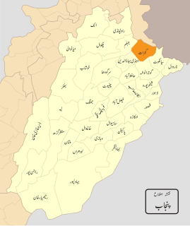
Gujrat, is a district of Punjab Province in Pakistan.

The following outline is provided as an overview of and topical guide to Pakistan:

Gilgit-Baltistan, formerly known as the Northern Areas, is the northernmost territory administered by Pakistan. It borders Azad Kashmir to the south, the province of Khyber Pakhtunkhwa to the west, the Wakhan Corridor of Afghanistan to the north, the Xinjiang region of China, to the east and northeast, and the Indian-administered state of Jammu and Kashmir to the southeast.

The Indian subcontinent is a southern region and peninsula of Asia, mostly situated on the Indian Plate and projecting southwards into the Indian Ocean from the Himalayas. Geologically, the Indian subcontinent is related to the land mass that rifted from Gondwana and merged with the Eurasian plate nearly 55 million years ago. Geographically, it is the peninsular region in south-central Asia delineated by the Himalayas in the north, the Hindu Kush in the west, and the Arakanese in the east. Politically, the Indian subcontinent includes Bangladesh, Bhutan, India, Maldives, Nepal, Pakistan and Sri Lanka.

South Asia or Southern Asia, is a term used to represent the southern region of the Asian continent, which comprises the sub-Himalayan SAARC countries and, for some authorities, adjoining countries to the west and east. Topographically, it is dominated by the Indian Plate, which rises above sea level as Nepal and northern parts of India situated south of the Himalayas and the Hindu Kush. South Asia is bounded on the south by the Indian Ocean and on land by West Asia, Central Asia, East Asia, and Southeast Asia.
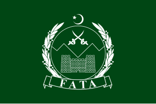
The Federally Administered Tribal Areas was a semi-autonomous tribal region in northwestern Pakistan that existed from 1947 until being merged with neighboring province Khyber Pakhtunkhwa, in 2018. It consisted of seven tribal agencies (districts) and six frontier regions, and were directly governed by Pakistan's federal government through a special set of laws called the Frontier Crimes Regulations. It bordered Pakistan's provinces of Khyber Pakhtunkhwa and Balochistan to the east and south, and Afghanistan's provinces of Kunar, Nangarhar, Paktia, Khost and Paktika to the west and north. The territory is almost exclusively inhabited by the Pashtun, who also live in the neighbouring provinces of Khyber Pakhtunkhwa and Northern Balochistan, and straddle across the border into Afghanistan. They are mostly Muslim.

As of present, there are around 157 protected areas in Pakistan that are recognized by IUCN.

Kalmat Naval Base is a proposed naval base of the Pakistan Navy at Khor Kalmat, Balochistan, Pakistan.
Landhi railway station is one of three major railway stations in Karachi, Pakistan. It is situated in the east end of the city near Quaidabad in Landhi and serves as a major stop along the Karachi–Peshawar Railway Line.
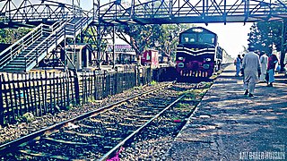
Drigh Road railway station is the fourth important railway station of Karachi, Pakistan. It is situated near Drigh Road Flyover on Sharah-e-Faisal. This railway station is a stop for a few "up" and all "down" Express trains. In the past it was the junction of the KCR loop line. It has facilities like a booking office, a shed, a tuck shop, a mosque, an advance reservation office and a parking lot. The station is also closest to the Jinnah International Airport.


