Sanford, Texas

Last updated

Sanford, Texas
TXMap-doton-Sanford.PNG
Location of Sanford, Texas
Hutchinson County Sanford.svg
Coordinates: 35°42′9″N101°31′54″W / 35.70250°N 101.53167°W / 35.70250; -101.53167
Country United States
State Texas
County Hutchinson
Area
[1]
  Total0.13 sq mi (0.35 km2)
  Land0.13 sq mi (0.35 km2)
  Water0.00 sq mi (0.00 km2)
Elevation
[2]
3,028 ft (923 m)
Population
 (2010)
  Total164
  Estimate 
(2019) [3]
156
  Density1,164/sq mi (451/km2)
Time zone UTC-6 (Central (CST))
  Summer (DST) UTC-5 (CDT)
ZIP code
79078
Area code 806
FIPS code 48-65384 [4]
GNIS feature ID2413257 [2]

Sanford is a town in Hutchinson County, Texas, United States. The population was 164 at the 2010 census, [5] down from 203 at the 2000 census.

Contents

History

Sanford was established in 1927 following discovery of natural gas in what became known as the Panhandle Gas Field. The town was named for pioneer rancher James McEuin Sanford (1864–1933). [6]

Geography

Sanford is located in southwestern Hutchinson County at the intersection of Ranch Roads 687 and 1319. It is 1 mile (1.6 km) southeast of the Sanford Dam on the Canadian River, forming Lake Meredith, and it is 11 miles (18 km) northwest of Borger, the county seat.

According to the United States Census Bureau, the town of Sanford has a total area of 0.14 square miles (0.35 km2), all land. [5]

Demographics

Historical population
CensusPop.Note
1970 181
1980 24937.6%
1990 218−12.4%
2000 203−6.9%
2010 164−19.2%
2019 (est.)156 [3] −4.9%
U.S. Decennial Census [7]

As of the census [4] of 2000, there were 203 people, 82 households, and 59 families residing in the town. The population density was 1,517 inhabitants per square mile (586/km2). There were 113 housing units at an average density of 844 per square mile (326/km2). The racial makeup of the town was 95.57% White, 1.48% Native American, 0.49% from other races, and 2.46% from two or more races. Hispanic or Latino of any race were 5.42% of the population.

There were 82 households, out of which 28.0% had children under the age of 18 living with them, 57.3% were married couples living together, 11.0% had a female householder with no husband present, and 28.0% were non-families. 26.8% of all households were made up of individuals, and 9.8% had someone living alone who was 65 years of age or older. The average household size was 2.48 and the average family size was 3.02.

In the town, the population was spread out, with 25.6% under the age of 18, 8.9% from 18 to 24, 25.6% from 25 to 44, 23.2% from 45 to 64, and 16.7% who were 65 years of age or older. The median age was 40 years. For every 100 females, there were 109.3 males. For every 100 females age 18 and over, there were 112.7 males.

The median income for a household in the town was $28,672, and the median income for a family was $29,375. Males had a median income of $27,750 versus $16,250 for females. The per capita income for the town was $12,208. About 24.2% of families and 27.6% of the population were below the poverty line, including 45.9% of those under the age of eighteen and 7.4% of those 65 or over.

Education

The town is served by the Sanford-Fritch Independent School District.

Related Research Articles

<span class="mw-page-title-main">Sanford, Alabama</span> Town in Alabama, United States

Sanford is a town in Covington County, Alabama, United States. At the 2020 census, the population was 257. Sanford was originally incorporated in 1902 and was on the 1910 U.S. Census. It did not appear again on the census until 1960.

<span class="mw-page-title-main">Astatula, Florida</span> Town in the state of Florida, United States

Astatula is a town in Lake County, Florida, United States. The population was 1,889 at the 2020 census. It is part of the Orlando–Kissimmee–Sanford Metropolitan Statistical Area.

<span class="mw-page-title-main">Howey-in-the-Hills, Florida</span> Town in the state of Florida, United States

Howey-In-The-Hills is a town in Lake County, Florida, United States. The population was 1,643 at the 2020 census. It is part of the Orlando–Kissimmee–Sanford Metropolitan Statistical Area.

<span class="mw-page-title-main">Montverde, Florida</span> Town in Florida, United States

Montverde is a town in Lake County, Florida, United States. The population was 1,655 at the 2020 census. It is part of the Orlando–Kissimmee–Sanford Metropolitan Statistical Area.

South Sanford is a former census-designated place (CDP) in the city of Sanford in York County, Maine, United States. The population was 4,536 at the 2010 census. It is part of the Portland–South Portland–Biddeford, Maine Metropolitan Statistical Area. The CDP was abolished when the town of Sanford re-incorporated as a city.

<span class="mw-page-title-main">Sanford, New York</span> Town in New York, United States

Sanford is a town in Broome County, New York, United States. The population was 2,407 at the 2010 census.

<span class="mw-page-title-main">China Grove, Texas</span> Town in Texas, United States

China Grove is a town in Bexar County, Texas, United States, located on the far east side of San Antonio. The population was 1,141 at the 2020 census. It is part of the San Antonio Metropolitan Statistical Area.

<span class="mw-page-title-main">Holiday Lakes, Texas</span> Town in Texas, United States

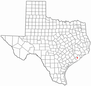
Holiday Lakes is a town in Brazoria County, Texas, United States. The population was 991 at the 2020 census.

<span class="mw-page-title-main">Bayview, Texas</span> Town in Texas, United States

Bayview is a town in Cameron County, Texas, United States. The population was 383 at the 2010 census. It is part of the Brownsville–Harlingen–Raymondville and the Matamoros–Brownsville metropolitan areas.

<span class="mw-page-title-main">Alma, Texas</span> Town in Texas, United States

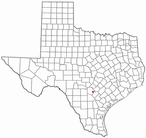
Alma is a town in Ellis County, Texas, United States. The population was 373 at the 2020 census.

<span class="mw-page-title-main">Tioga, Texas</span> Town in Texas, United States

Tioga is a town in Grayson County, Texas, United States. The population was 1,142 at the 2020 census. It is part of the Sherman–Denison Metropolitan Statistical Area.

<span class="mw-page-title-main">Coffee City, Texas</span> Town in Texas, United States

Coffee City is a small town in southeastern Henderson County, Texas, United States. The population was 278 at the 2010 census, up from 193 at the 2000 census.

<span class="mw-page-title-main">Poynor, Texas</span> Town in United States

Poynor is a town in Henderson County, Texas, United States. The population was 305 at the 2010 census.

<span class="mw-page-title-main">Blum, Texas</span> Town in Texas, United States

Blum is a town in Hill County, Texas, United States. The population was 383 at the 2020 census.

<span class="mw-page-title-main">Stinnett, Texas</span> City in Texas, United States

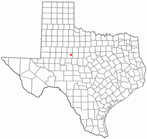
Stinnett is a city in and the county seat of Hutchinson County, Texas, United States. The population was 1,881 at the 2010 census, a decrease from 1,936 at the 2000 census.

<span class="mw-page-title-main">Loraine, Texas</span> Town in Mitchell County, Texas, United States

Loraine is a town in Mitchell County, Texas, United States. The population was 504 at the 2020 United States Census

<span class="mw-page-title-main">Stratford, Texas</span> Town in Texas, United States

Stratford is a town and county seat of Sherman County, Texas, United States. The population was 2,017 at the 2010 census, up from 1,991 in 2000.

<span class="mw-page-title-main">Auburn, West Virginia</span> Town in West Virginia, United States

Auburn is a town in Ritchie County, West Virginia, United States. The population was 80 at the 2020 census.

<span class="mw-page-title-main">Fritch, Texas</span> City in Texas, United States

Fritch is a city in Hutchinson and Moore Counties in the U.S. state of Texas. The population was 2,117 at the 2010 census.

<span class="mw-page-title-main">Moore County, Texas</span> County in Texas, United States

Moore County is a county located in the U.S. state of Texas. As of the 2020 census, its population was 21,358. The county seat is Dumas. The county was created in 1876 and organized in 1892. It is named for Edwin Ward Moore, the commander of the Texas Navy. The Dumas micropolitan statistical area includes all of Moore County.

References

  1. "2019 U.S. Gazetteer Files". United States Census Bureau. Retrieved August 7, 2020.
  2. 1 2 U.S. Geological Survey Geographic Names Information System: Sanford, Texas
  3. 1 2 "Population and Housing Unit Estimates". United States Census Bureau. May 24, 2020. Retrieved May 27, 2020.
  4. 1 2 "U.S. Census website". United States Census Bureau . Retrieved January 31, 2008.
  5. 1 2 "Geographic Identifiers: 2010 Census Summary File 1 (G001): Sanford town, Texas". American Factfinder. U.S. Census Bureau. Archived from the original on February 13, 2020. Retrieved March 20, 2018.
  6. Anderson, H. Allen. "Sanford, TX". tshaonline.org. Texas State Historical Association . Retrieved November 9, 2020.
  7. "Census of Population and Housing". Census.gov. Retrieved June 4, 2015.