Seething Wells

Last updated

Seething Wells
Old waterworks building in Seething Wells.jpg
Old waterworks building in Seething Wells, viewed from the A307
Greater London UK location map 2.svg
Red pog.svg
Seething Wells
Location within Greater London
OS grid reference TQ173674
Ceremonial county
Region
Country England
Sovereign state United Kingdom
Post town SURBITON
Postcode district KT6
Police Metropolitan
Fire London
Ambulance London
UK Parliament
List of places
UK
England
London
51°23′36″N0°18′47″W / 51.39344°N 0.31310°W / 51.39344; -0.31310

Seething Wells is a neighbourhood in southwest London on the border between Surbiton in the Royal Borough of Kingston upon Thames in Greater London, and Elmbridge in Surrey. The area was historically a waterworks that supplied London with water from the River Thames. Nowadays it is mainly a residential area, with the notable exception of decommissioned filter beds — the Seething Wells Filter Beds — in the northwest part of the area that borders the Thames.

Contents

Etymology

The name is a gradual corruption of the original Siden Wells which appears on maps from the 18th century, recorded as the medicinal spring at Soothing Wells in a time-of-construction guide to the South Western railway and its neighbouring countryside. [1] It denoted springs — reportedly warm springs of potable water.

Geography

Seething Wells Filter Beds Seething Wells Filter Beds on a cloudy day.jpg
Seething Wells Filter Beds

Seething Wells is considered to roughly consist of any land previously used as a waterworks on the southeast bank of the Thames facing Hampton Court Park. [2] This land lies primarily in Surbiton in Greater London, although a small part of this land extends into Elmbridge in Surrey. [3] [4] [2]

The Seething Wells area is now primarily residential, bordering Long Ditton Recreation Ground on the west side, and the Victoria Recreation Ground to the south. [5] As well as many houses, the residential area contains a hall of residence for Kingston University, and an old waterworks building that has been converted inside into a gym. [6] [7] On the east side is a clock tower in a small area called Electric Parade. [8] A small plot of land inside the residential area is still used for pumping water, operated by Thames Water.

Marina in the west of Seething Wells Marina in Seething Wells.jpg
Marina in the west of Seething Wells

Towards the west end of the Seething Wells riverbank there is a marina. [9] Midway along the riverbank there are 7, approximately 8 metre deep, decommissioned filter beds known as the Seething Wells Filter Beds (or less commonly, the Surbiton Filter Beds). [10] [5] At the southwest end of the filter bed site is a former coal wharf, with a former pump house building on top; near the site's centre there are a few pumps and pipes which are still in use. [11] At the northeast section of the riverbank there is another marina, with Ravens Ait around 20 metres further northeast in the river. [12]

The decommissioned filter beds are within the 0.23 km2 Riverside South Conservation Area which was identified in 2003. [13]

History

There is no evidence of any substantial early settlement of the area, although a few Neolithic, Bronze Age, and Roman artifacts were discovered during the waterworks' construction. [14] From medieval times to the early 1800s the area is thought to have been home to several springs and wells (giving rise to the name "Seething Wells") that were purported to have healing properties. [14] In 1808 the area was enclosed for the first time, by the Baron King, and by this point had become occupied by around 200 people. [14]

The Metropolis Water Act 1852 prohibited the extraction of water for household purposes from the tidal Thames. The Lambeth Waterworks Company anticipated this by choosing to build their works at Seething Wells in 1847, which were purchased around 1849, and completed and opened in 1852. [15] [14] Another company - the Chelsea Waterworks Company - joined the Lambeth Waterworks Company here, they started construction in 1854 and opened in 1856. [15] [14] The Lambeth Waterworks played a part in John Snow's investigations into cholera; he showed that homes supplied from further downriver by the Southwark and Vauxhall Waterworks Company had a cholera mortality rate 14 times that of homes supplied by Seething Wells, which was upriver and hence had cleaner water. [16] [17]

Remaining, functioning, surface level water pipes in the residential area Water pipes in Seething Wells.jpg
Remaining, functioning, surface level water pipes in the residential area

Despite carrying less disease, the inlets at Seething Wells sucked up too much mud with the water because of turbulence caused by the twin-mouthed River Mole, The Rythe, and the sharp bend in the Thames. The Lambeth Waterworks Company thus built a replacement intake at Molesey, and the Chelsea Waterworks Company followed them there three years later, after attempting to build works opposite Hampton Court. [18] This left the two companies with just water treatment works at Seething Wells, which existed side by side until they were incorporated into the Metropolitan Water Board in 1903, which was in turn incorporated into the Thames Water Authority in 1973. [18] [19] The water treatment works was privatized as part of Thames Water in 1989, and it was mostly decommissioned by Thames Water in 1992 a pumping station on Simpson Way now supplies the area with water from the Thames Water Ring Main. [20] [11]

In the early 21st century, most of the old waterworks were turned into a residential area, with the notable exception of 7 decommissioned filter beds — the Seething Wells Filter Beds. [11] Several of the old waterworks buildings were converted inside, instead of being knocked down.

The Electric Parade area and the 130 year old Victoria Recreation Park at the edge of Seething Wells were not located inside the actual waterworks. [21] Electric Parade originated as a row of shops along the pavement (Parade) of a road that used to be called Electric Parade; they were built around 1904-05 when electricity (Electric) first arrived in Surbiton, and were among the first in the area to use this new technology. [8] The original shops all closed and were replaced with new ones within 15–20 years. [8] Later on, the road was renamed to Brighton Road A243, and Electric Parade now refers to the narrow road and area facing the backs of these shops. [8] The clock tower at the northwest end of the road used to have a globe on top, but it was damaged by a V-1 in WWII and replaced with a bell. [8]

Transport

Seething Wells is served on behalf of Transport for London, via the Electric Parade and Victoria Recreation Ground stops on the K3 bus route, run by London United Busways. There are also the Seething Wells Kingston University Campus, St Leonard's Road, and Cleaveland Road bus stops, run by several other private companies. [22] [23] [24] [25] [26]

The area is also around half a mile from Surbiton railway station.

Additionally, there are passenger ferries just north of the river facing side of Seething Wells.

See also

Related Research Articles

<span class="mw-page-title-main">Surbiton</span> Neighbourhood in Kingston upon Thames, London

Surbiton is a suburban neighbourhood in South West London, within the Royal Borough of Kingston upon Thames (RBK). It is next to the River Thames, 11 miles (18 km) southwest of Charing Cross. Surbiton was in the historic county of Surrey and since 1965 it has been in Greater London. Surbiton comprises four of the RBK's wards: Alexandra, Berrylands, St. Mark's, and Surbiton Hill.

<span class="mw-page-title-main">Tolworth</span> Human settlement in England

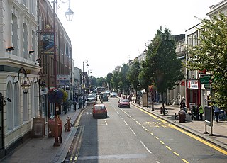
Tolworth is a suburban area in the Surbiton district, Royal Borough of Kingston upon Thames, Greater London. It is 11 miles (17.7 km) southwest of Charing Cross. Neighbouring places include Long Ditton, New Malden, Kingston, Surbiton, Berrylands, Hinchley Wood, Chessington, Ewell and Worcester Park. Surbiton is the nearest, about a mile to the northwest. Tolworth is divided in two by the A3 Kingston Bypass and is situated slightly north of the Greater London-Surrey border.

<span class="mw-page-title-main">Borough of Elmbridge</span> Local government district in Surrey, England

Elmbridge is a local government district with borough status in Surrey, England. Its principal towns and villages are Esher, Cobham, Walton-on-Thames, Weybridge and Molesey. It directly borders the London Borough of Richmond upon Thames and the London Royal Borough of Kingston upon Thames. Some areas of the borough form a continuation of the Greater London Built-up Area, formerly falling into the Metropolitan Police District.

<span class="mw-page-title-main">Long Ditton</span> Human settlement in England

Long Ditton is a residential suburb in the Borough of Elmbridge, Surrey, England on the boundary with the Royal Borough of Kingston upon Thames, London. In medieval times it was a village, occupying a narrow strip of land. Neighbouring settlements include Hinchley Wood, Thames Ditton and Surbiton.

<span class="mw-page-title-main">Thames Ditton</span> Human settlement in England

Thames Ditton is a suburban village on the River Thames, in the Elmbridge borough of Surrey, England. Apart from a large inhabited island in the river, it lies on the southern bank, centred 12.2 miles (19.6 km) southwest of Charing Cross in central London. Thames Ditton is just outside Greater London but within the Greater London Urban Area as defined by the Office for National Statistics. Its clustered village centre and shopping area on a winding High Street is surrounded by housing, schools and sports areas. Its riverside faces the Thames Path and Hampton Court Palace Gardens and golf course in the London Borough of Richmond upon Thames. Its most commercial area is spread throughout its conservation area and contains restaurants, cafés, shops and businesses.

<span class="mw-page-title-main">Hogsmill River</span> River in Surrey and Greater London, England

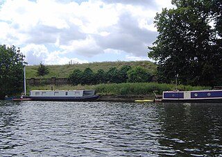
The Hogsmill River in Surrey and Greater London, England is a small chalk stream tributary of the River Thames. It rises in Ewell and flows into the Thames at Kingston upon Thames on the lowest non-tidal reach, that above Teddington Lock.

<span class="mw-page-title-main">Berrylands</span> Residential neighbourhood in Surbiton, London

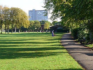
Berrylands is a residential neighbourhood in Surbiton, London, originally forming part of the Municipal Borough of Surbiton, and since 1965 part of the Royal Borough of Kingston upon Thames. It is a suburban development situated 10.1 miles (16.3 km) south west of Charing Cross. Nearby places include Surbiton, New Malden, Old Malden, Tolworth and Chessington. Berrylands railway station is 24 minutes from London Waterloo by train.

<span class="mw-page-title-main">Claygate</span> Human settlement in England

Claygate is an affluent suburban village in Surrey, England, 14 miles southwest of central London. It is the only civil parish in the borough of Elmbridge. Surrounded by green belt, it lies inside the Greater London Built-up Area.

<span class="mw-page-title-main">Molesey</span> District in Surrey, England

Molesey is a district of two twin towns, East Molesey and West Molesey, in the Borough of Elmbridge, Surrey, England, and is situated on the south bank of the River Thames.

<span class="mw-page-title-main">Hook, London</span> Area in Kingston upon Thames, London

Hook is a suburban area in south west London, England. It forms part of the Royal Borough of Kingston upon Thames and is located 12 miles (19.3 km) south west of Charing Cross. Neighbouring settlements include Hinchley Wood, Long Ditton, Surbiton, Tolworth and Chessington.

<span class="mw-page-title-main">Molesey Lock</span> Lock on the River Thames in Surrey, England

Molesey Lock is a lock on the River Thames in England at East Molesey, Surrey on the right bank.

<span class="mw-page-title-main">A243 road</span> Road in England

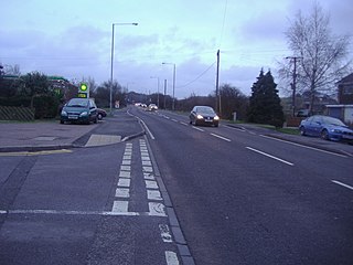
The A243 road in England is a partially primary status A-road that runs from Leatherhead in Surrey to Surbiton in the Royal Borough of Kingston Upon Thames, Greater London. It is primary for most of its length, from Leatherhead to Hook Junction with the A3 before running as a non-primary A-road through Surbiton to its terminus at the A307. Although comparatively short it is a busy road connecting a number of other A roads with the M25 motorway.

<span class="mw-page-title-main">Molesey Reservoirs</span>

The Molesey Reservoirs were a group of reservoirs in England near Molesey, Surrey, in the western suburbs of London. There was an adjacent water treatment works.

<span class="mw-page-title-main">Knight Reservoir</span> Reservoir in Surrey

The Knight Reservoir is a large pumped storage reservoir located in the Borough of Elmbridge in Surrey. It was inaugurated in 1907 and stores up to 2,180 million litres of raw water abstracted from the River Thames prior to its treatment and supply to London and north Surrey. It is located south of the River Thames, west of West Molesey, and between Hurst Road (A3050) and Walton Road (B369). It is adjacent to, and west of, its twin Bessborough Reservoir.

<span class="mw-page-title-main">London water supply infrastructure</span>

London's water supply infrastructure has developed over the centuries in line with the expansion of London.

<span class="mw-page-title-main">Chelsea Waterworks Company</span> Water company supplying London, 1723–1902

The Chelsea Waterworks Company was a London waterworks company founded in 1723 which supplied water to many central London locations throughout the 18th and 19th centuries until its functions were taken over by the Metropolitan Water Board in 1904.

<span class="mw-page-title-main">Hundred of Elmbridge</span>

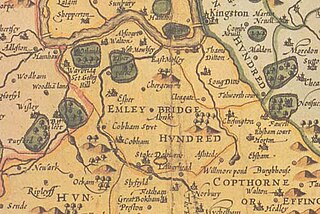
The Hundred of Elmbridge or Elmbridge/Emley Hundred was a geographic subdivision in the north of the county of Surrey, England. The majority of its area forms the modern Borough of Elmbridge, with the remainder forming part of the Royal Borough of Kingston upon Thames in Greater London.

The Lambeth Waterworks Company was a utility company supplying water to parts of south London in England. The company was established in 1785 with works in north Lambeth and became part of the publicly owned Metropolitan Water Board in 1904.

<span class="mw-page-title-main">Metropolis Water Act 1852</span> United Kingdom legislation

The Metropolis Water Act 1852 was an Act of the Parliament of the United Kingdom which introduced regulation of water supply companies in London, including minimum standards of water quality for the first time.

<span class="mw-page-title-main">Lower Green, Esher</span> Human settlement in England

Lower Green is a residential and commercial area within Esher, in Surrey, England, on the banks of the River Ember and River Mole. The area has many businesses, most of them in the commercial complex comprising Sandown Industrial Complex and Royal Mills.

References

  1. Wyld's South Western London and Southampton Railway Guide Portsmouth, Isle of Wight and the Channel Islands...containing a topological...account of the country and of the towns and villages within 10 miles of the railway Publ. W. Clowes and Sons, London, 1839 Retrieved 2015-03-02
  2. 1 2 "Landscape Character Reach, 3. Portsmouth Road" (PDF). Thames Landscape Strategy.
  3. ""Chelsea Waterworks"". www.ph.ucla.edu.
  4. "Location of Lambeth Waterworks at Seething Wells". www.ph.ucla.edu.
  5. 1 2 Google (25 April 2020). "Seething Wells" (Map). Google Maps . Google. Retrieved 25 April 2020.
  6. "Seething Wells - Halls of residence - Accommodation - Kingston University London". www.kingston.ac.uk. Retrieved 19 May 2020.
  7. Google (25 April 2020). "Nuffield Health Surbiton Fitness & Wellbeing Gym" (Map). Google Maps . Google. Retrieved 25 April 2020.
  8. 1 2 3 4 5 Everson, Tim (15 January 2017). Surbiton Through Time. Amberley Publishing. ISBN   978-1445668383.
  9. Google (25 April 2020). "Thames Ditton Marina" (Map). Google Maps . Google. Retrieved 25 April 2020.
  10. "Seething Wells Filter Beds". historicengland.org.uk. Retrieved 19 May 2020.
  11. 1 2 3 "AppealRef:APP/Z5630/A/13/2197943, Seething Wells Filter Beds, Portsmouth Road, Surbiton, Kingston Upon Thames, Surrey". Historic England. Retrieved 6 June 2020.
  12. Google (25 April 2020). "Stewart Marine" (Map). Google Maps . Google. Retrieved 25 April 2020.
  13. List of conservation areas - Riverside South Royal Borough of Kingston upon Thames. Retrieved 2015-03-02
  14. 1 2 3 4 5 "Seething Wells and the local area" (PDF). Seething Wells Water. Retrieved 6 June 2020.
  15. 1 2 McCarthy, Julian (15 March 2017). Kingston Upon Thames in 50 Buildings. Amberley Publishing. ISBN   9781445656489.
  16. "Location of water companies". www.ph.ucla.edu.
  17. "Proof from Seething Wells". seethingwellswater.org.
  18. 1 2 "A Guide To The Industrial Archaeology Of The Borough Of Elmbridge". www.moleseyhistory.co.uk.
  19. "The Thames Water Authority Constitution Order 1973". www.legislation.gov.uk. Retrieved 6 June 2020.
  20. "Privatising Thames Water". OpenLearn. Retrieved 6 June 2020.
  21. "Planners refuse phone mast in Surbiton's Victoria Rec | The Good Life". 4 May 2020.
  22. "Electric Parade". Transport for London. Retrieved 17 May 2020.
  23. "Victoria Recreation Ground". Transport for London. Retrieved 19 May 2020.
  24. Google (13 June 2020). "Seething Wells Kingston University Campus" (Map). Google Maps . Google. Retrieved 13 June 2020.
  25. Google (13 June 2020). "St Leonard's Road" (Map). Google Maps . Google. Retrieved 13 June 2020.
  26. Google (13 June 2020). "Cleaveland Road" (Map). Google Maps . Google. Retrieved 13 June 2020.