
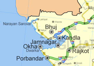
Cartography is the study and practice of making and using maps. Combining science, aesthetics and technique, cartography builds on the premise that reality can be modeled in ways that communicate spatial information effectively.

Dom Henrique of Portugal, Duke of Viseu, better known as Prince Henry the Navigator, was a central figure in the early days of the Portuguese Empire and in the 15th-century European maritime discoveries and maritime expansion. Through his administrative direction, he is regarded as the main initiator of what would be known as the Age of Discovery. Henry was the fourth child of King Dom John I of Portugal, who founded the House of Aviz.

A map is a symbolic depiction emphasizing relationships between elements of some space, such as objects, regions, or themes.
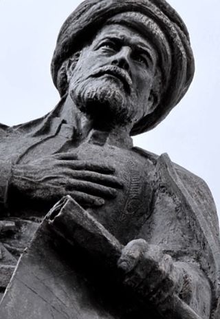
Ahmed Muhiddin Piri, better known as Piri Reis, was an Ottoman navigator, geographer and cartographer. He is primarily known today for his maps and charts collected in his Kitab-ı Bahriye, a book that contains detailed information on early navigational techniques as well as relatively accurate charts for their time, describing the important ports and cities of the Mediterranean Sea.
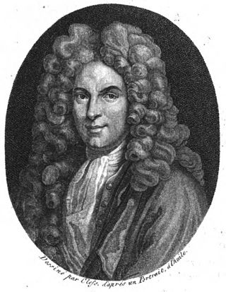
Guillaume Delisle, also spelled Guillaume de l'Isle, was a French cartographer known for his popular and accurate maps of Europe and the newly explored Americas.
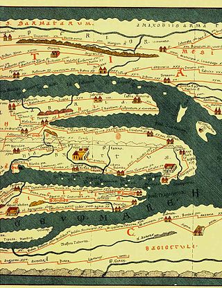
Tabula Peutingeriana, also referred to as Peutinger's Tabula or Peutinger Table, is an illustrated itinerarium showing the layout of the cursus publicus, the road network of the Roman Empire.
The earliest known world maps date to classical antiquity, the oldest examples of the 6th to 5th centuries BCE still based on the flat Earth paradigm. World maps assuming a spherical Earth first appear in the Hellenistic period. The developments of Greek geography during this time, notably by Eratosthenes and Posidonius culminated in the Roman era, with Ptolemy's world map, which would remain authoritative throughout the Middle Ages. Since Ptolemy, knowledge of the approximate size of the Earth allowed cartographers to estimate the extent of their geographical knowledge, and to indicate parts of the planet known to exist but not yet explored as terra incognita.

The earliest known term used for maps in Japan is believed to be kata, which was probably in use until roughly the 8th century. During the Nara period, the term zu (図) came into use, but the term most widely used and associated with maps in pre-modern Japan is ezu. As the term implies, ezu were not necessarily geographically accurate depictions of physical landscape, as is generally associated with maps in modern times, but pictorial images, often including spiritual landscape in addition to physical geography. Ezu often focused on the conveyance of relative information as opposed to adherence to visible contour. For example, an ezu of a temple may include surrounding scenery and clouds to give an impression of nature, human figures to give a sense of how the depicted space is used, and a scale in which more important buildings may appear bigger than less important ones, regardless of actual physical size.
The history of cartography refers to the development and consequences of cartography, or mapmaking technology, throughout human history. Maps have been one of the most important human inventions for millennia, allowing humans to explain and navigate their way through the world.

Pictorial maps depict a given territory with a more artistic rather than technical style. It is a type of map in contrast to road map, atlas, or topographic map. The cartography can be a sophisticated 3-D perspective landscape or a simple map graphic enlivened with illustrations of buildings, people and animals. They can feature all sorts of varied topics like historical events, legendary figures or local agricultural products and cover anything from an entire continent to a college campus. Drawn by specialized artists and illustrators, pictorial maps are a rich, centuries-old tradition and a diverse art form that ranges from cartoon maps on restaurant placemats to treasured art prints in museums.
Medieval Islamic geography and cartography refer to the study of geography and cartography in the Muslim world during the Islamic Golden Age. Muslim scholars made advances to the map-making traditions of earlier cultures, particularly the Hellenistic geographers Ptolemy and Marinus of Tyre, combined with what explorers and merchants learned in their travels across the Old World (Afro-Eurasia). Islamic geography had three major fields: exploration and navigation, physical geography, and cartography and mathematical geography. Islamic geography reached its apex with Muhammad al-Idrisi in the 12th century.
Thomas Marmaduke was an English explorer, sealer, and whaler in the early 17th century.
Chinese cartography began in the 5th century BC during the Warring States period when cartographers started to make maps of the Earth's surface. Its scope extended beyond China's borders with the expansion of the Chinese Empire under the Han dynasty. By the 11th century during the Song dynasty highly-accurate maps drawn on grids were produced. During the 15th century, the Ming dynasty admiral Zheng He went on a series of voyages to the South China Sea, Indian Ocean, and beyond and maps for areas outside of China were produced, although world maps covering territories known to the Chinese outside of China existed as early as the Tang dynasty.

Lopo Homem was a 16th-century Portuguese cartographer and cosmographer based in Lisbon and best known for his work on the Miller Atlas.
A map symbol or cartographic symbol is a graphical device used to visually represent a real-world feature on a map, working in the same fashion as other forms of symbols. Map symbols may include point markers, lines, regions, continuous fields, or text; these can be designed visually in their shape, size, color, pattern, and other graphic variables to represent a variety of information about each phenomenon being represented.

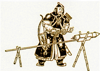
Mao Kun map, usually referred to in modern Chinese sources as Zheng He's Navigation Map, is a set of navigation charts published in the Ming dynasty military treatise Wubei Zhi. The book was compiled by Mao Yuanyi in 1621 and published in 1628; the name of the map refers to his grandfather Mao Kun from whose library the map is likely to have originated. The map is often regarded as a surviving document from the expeditions of Zheng He in addition to accounts written by Zheng's officers, such as Yingya Shenglan by Ma Huan and Xingcha Shenglan by Fei Xin. It is the earliest known Chinese map to give an adequate representation of Southern Asia, Persia, Arabia and East Africa.
João da Gama was a Portuguese explorer and colonial administrator in the Far East in the last quarter of the 16th century. He was the grandson of Vasco da Gama. João da Gama sailed from Macau to northeast and rounded Japan by north. He crossed the Pacific Ocean at the northernmost latitudes taken until then by Europeans. Forced by the circumstances of his voyage, he became also a circumnavigator. The lands northeast of Japan which João da Gama discovered were the target of legend and speculation in the centuries that followed, inspiring its search by European powers.

Cartographic design or map design is the process of crafting the appearance of a map, applying the principles of design and knowledge of how maps are used to create a map that has both aesthetic appeal and practical function. It shares this dual goal with almost all forms of design; it also shares with other design, especially graphic design, the three skill sets of artistic talent, scientific reasoning, and technology. As a discipline, it integrates design, geography, and geographic information science.
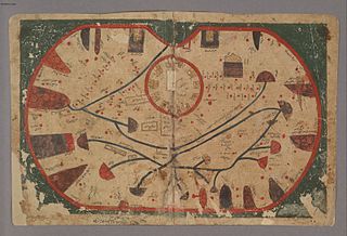
The Book of Curiosities is an anonymous 11th-century Arabic cosmography from Fatimid Egypt containing a series of early illustrated maps of the world and celestial diagrams of the universe and sky. TheBook of Curiosities contains 17 maps in total, 14 of which are extremely rare not only in Islamic cartography but also in greater medieval map history. The cosmography includes the earliest recorded map of Sicily as well as a rectangular world map, considered the earliest surviving map with a graphic scale. The autograph manuscript has not survived, but the Bodleian Library of Oxford University acquired one of the only known copies of the manuscript in 2002, making its contents widely accessible today due to its digitization. Based on the production processes and physical materials of the copy, such as paper and pigment, scholars date the production of this copy to the early 13th century.

A graticule, on a map, is a graphical depiction of a coordinate system as a grid of lines, each line representing a constant coordinate value. It is thus a form of isoline, and is commonly found on maps of many kinds at scales from the local to global.
