Birmingham City Council is the local government body responsible for the governance of the City of Birmingham in England, which has been a metropolitan district since 1974. It is the most populated local council area in the United Kingdom with 101 elected councillors representing over one million people, in 69 wards. The council headquarters are at the Council House in the city centre. The council is responsible for running nearly all local services, with the exception of those run by joint boards. The provision of certain services has in recent years been devolved to several council constituencies, which each have a constituency committee made up of councillors from that district. It is part of the West Midlands Combined Authority. On September 6 2023, the council declared effective bankruptcy, and central government commissioners were later appointed to run the council under emergency measures.

Edgbaston is an affluent suburban area of southern Birmingham, England, historically in Warwickshire, and curved around the southwest of the city centre.

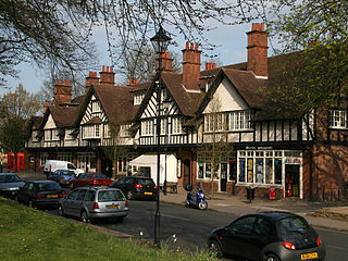
Harborne is an area of south-west Birmingham, England. It is one of the most affluent areas of the Midlands, three miles southwest from Birmingham city centre. It is a Birmingham City Council ward in the formal district and in the parliamentary constituency of Birmingham Edgbaston.
Bournville is a model village on the southwest side of Birmingham, England, founded by the Quaker Cadbury family for employees at its Cadbury's factory, and designed to be a "garden" village where the sale of alcohol was forbidden. Cadbury's is well known for chocolate products – including a dark chocolate bar branded Bournville. Historically in northern Worcestershire, it is also a ward within the council constituency of Selly Oak and home to the Bournville Centre for Visual Arts. Bournville is known as one of the most desirable areas to live in the UK; research by the Joseph Rowntree Foundation in 2003 found that it was "one of the nicest places to live in Britain".

Northfield is a residential area in outer south Birmingham, England, and near the boundary with Worcestershire, which it was historically within. It is also a council constituency, managed by its own district committee. The constituency includes the wards of Kings Norton, Longbridge, Weoley Castle and the smaller ward of Northfield that includes West Heath and Turves Green.

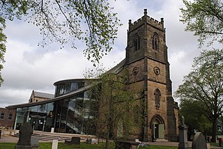
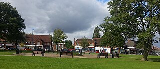
Kings Norton, alternatively King's Norton, is an area of Birmingham, England. Historically in Worcestershire, it was also a Birmingham City Council ward within the Government of Birmingham, England. The district lies 6.5 miles south-southwest of Birmingham city centre and is within 1.5 miles of the north Worcestershire border. Kings Norton has been split into two wards, Kings Norton North and Kings Norton South.
Erdington is a suburb and ward of Birmingham in the West Midlands County, England. Historically part of Warwickshire and located 5 miles (8 km) northeast of central Birmingham, bordering Sutton Coldfield. It was also a council constituency, managed by its own district committee. The former council district consisted of the ward of Erdington, and Tyburn,, Stockland Green and Kingstanding, although all of Kingstanding and most of both Tyburn and Stockland Green wards lie outside the historical boundaries of Erdington. Stockland Green was formerly part of Aston, Kingstanding part of Perry Barr and Tyburn partially split between Aston and Hodge Hill. Erdington (ward) was part of the Sutton Coldfield constituency before 1974.

Selly Oak is an industrial and residential area in south-west Birmingham, England. The area gives its name to Selly Oak ward and includes the neighbourhoods of: Bournbrook, Selly Park, and Ten Acres. The adjoining wards of Edgbaston and Harborne are to the north of the Bourn Brook, which was the former county boundary, and to the south are Weoley, and Bournville. A district committee serves the four wards of Selly Oak, Billesley, Bournville and Brandwood. The same wards form the Birmingham Selly Oak constituency, represented since 2010 by Steve McCabe (Labour). Selly Oak is connected to Birmingham by the Pershore Road (A441) and the Bristol Road (A38). The Worcester and Birmingham Canal and the Birmingham Cross-City Railway Line run across the Local District Centre.

Stirchley is a suburb in south-west Birmingham, England.

West Heath is a residential area of Birmingham, England on the boundary with Worcestershire. Forming the larger part of the ward of Longbridge And West Heath it is situated between Kings Norton, Northfield, Longbridge and Cofton Hackett and lies on traditional heathland formed in the 13th century as part of the Kings Norton manorial lands, and was historically in Worcestershire.
Weoley Castle is a residential suburban district in south-west Birmingham, England. The area is part of the Weoley local authority electoral ward, and also comes under the Northfield local council constituency. The suburb of Weoley Castle is bordered by Selly Oak to the east, Harborne to the north, Bartley Green to the west, and Weoley Hill and Shenley Fields to the south.
Cotteridge is an area of Birmingham, England, and part of the Bournville ward. It is about 4 miles (6.4 km) miles south of Birmingham city centre. It has a shopping centre with a mixture of local shops, eateries and national brands.

Bournbrook is an industrial and residential district in southwest Birmingham, England, in the ward of Bournbrook and Selly Park and the parliamentary constituency of Birmingham Selly Oak. Before 2018 it was in Selly Oak Council Ward. Prior to what is commonly termed the Greater Birmingham Act, which came into effect on 9 November 1911, the Bourn Brook watercourse was the North Eastern boundary of Worcestershire, and the area was locally governed by the King's Norton and Northfield Urban District Council.

Selly Oak railway station is a railway station in Selly Oak in Birmingham, England, on the Cross-City Line between Redditch, Birmingham and Lichfield.

Bearwood is the southern part of Smethwick, Sandwell, West Midlands, England, and north of the A456 Hagley Road. Bearwood Hill was the original name of the High Street from Smethwick Council House to Windmill Lane. The border at the Shireland Brook where Portland Road (Edgbaston) becomes Shireland Road (Sandwell) is signed "Bearwood".

King's Norton and Northfield Urban District was a local government administrative district in north Worcestershire, England, from 1898 until 1911. Much of its area was afterwards absorbed into the neighbouring Borough of Birmingham, under the Greater Birmingham Scheme, and now constitutes most of the city's southern and southwestern suburban environs.
The Selly Oak local council ward was one of the 40 electoral wards for the City of Birmingham, England prior to 2018. It was also one of the four wards that make up the local council constituency of Selly Oak, the other three being the wards of Billesley, Bournville and Brandwood.

Selly Oak Park is a public park in Selly Oak, Birmingham, England. It is close to the University of Birmingham. The stump from the "Selly Oak", a large oak tree on Oak Tree Lane was situated in the park after it was felled in 1909.

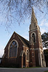
Encounter Church formerly known as Selly Oak Elim Church and formerly St Wulstan's is a parish church of the Church of England in the Bournbrook district of Birmingham, but which is now an Elim Pentecostal Church.