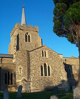
Anstey is a village and civil parish in the East Hertfordshire district of Hertfordshire, England, about 15 miles (24 km) miles northeast of Stevenage. According to the 2001 Census the population of the parish was 338, reducing to 299 at the 2011 Census.

The Max Reinhardt Seminar is the School of Drama at the University of Music and Performing Arts in Vienna, Austria. It is located in the Palais Cumberland, Penzingerstraße 9, in Vienna's 14th district
Knieja is a village in the administrative district of Gmina Cekcyn, within Tuchola County, Kuyavian-Pomeranian Voivodeship, in north-central Poland.
Lisy is a village in the administrative district of Gmina Biała Podlaska, within Biała Podlaska County, Lublin Voivodeship, in eastern Poland.

Xəndək is a village in the Siazan Rayon of Azerbaijan.

Jacków is a village in the administrative district of Gmina Żytno, within Radomsko County, Łódź Voivodeship, in central Poland. It lies approximately 7 kilometres (4 mi) north-east of Żytno, 20 km (12 mi) south-east of Radomsko, and 91 km (57 mi) south of the regional capital Łódź.
Świdrówka is a village in the administrative district of Gmina Szczucin, within Dąbrowa County, Lesser Poland Voivodeship, in southern Poland.

The Saleina Hut is a mountain hut in the Swiss Alps at 2,691 meters above sea level. It can be reached from the Val Ferret. The hut lies above the Saleina Glacier near the Aiguille d'Argentière in the Mont Blanc Massif, and has places for 48 people and is wardened between mid-June to mid-September.

Kei Lun is an at-grade MTR Light Rail stop located at Tsing Lun Road in Tuen Mun District, near Kei Lun Wai. It opened on 18 September 1988 and belongs to Zone 3. It is very different from other Light Rail stops that Line 505 only routes to Siu Hong direction via this stop, but not Sam Shing direction.

Główczewice is a village in the administrative district of Gmina Brusy, within Chojnice County, Pomeranian Voivodeship, in northern Poland. It lies approximately 11 kilometres (7 mi) north of Brusy, 33 km (21 mi) north of Chojnice, and 74 km (46 mi) south-west of the regional capital Gdańsk.

Bychówko is a settlement in the administrative district of Gmina Gniewino, within Wejherowo County, Pomeranian Voivodeship, in northern Poland. It lies approximately 5 kilometres (3 mi) north-west of Gniewino, 25 km (16 mi) north-west of Wejherowo, and 61 km (38 mi) north-west of the regional capital Gdańsk.
Bara is a village in the administrative district of Gmina Chojna, within Gryfino County, West Pomeranian Voivodeship, in north-western Poland, close to the German border.

Grabowo is a village in the administrative district of Gmina Kamień Pomorski, within Kamień County, West Pomeranian Voivodeship, in north-western Poland. It lies approximately 2 kilometres (1 mi) north-east of Kamień Pomorski and 64 km (40 mi) north of the regional capital Szczecin.
Jatynia is a village in the administrative district of Gmina Bobolice, within Koszalin County, West Pomeranian Voivodeship, in north-western Poland.
Viruvere is a village in Jõgeva Parish, Jõgeva County in eastern Estonia.

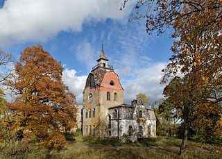
Neeruti is a village in Kadrina Parish, Lääne-Viru County, in northeastern Estonia. It lies on the left bank of the Loobu River. Neeruti is known for its manor now in ruins, built in Jugendstil for Count von Rehbinder.
Väljamõisa is a village in Saaremaa Parish, Saare County in western Estonia.

Vámosmikola is a village and commune in Pest County in Hungary.
Djebala is a town and commune in Tlemcen Province in northwestern Algeria.


