Related Research Articles

Dildo is a local service district and designated place in the Canadian province of Newfoundland and Labrador on the island of Newfoundland. It is located on the southeastern Dildo Arm of Trinity Bay about 100 kilometres (62 mi) west of St. John's. South Dildo is a neighbouring community of 200 residents. The town's unusual name has brought it a certain amount of notoriety.

Avalon is a federal electoral district on Newfoundland Island in Newfoundland and Labrador, Canada. It has been represented in the House of Commons of Canada since 2004.
Random—Burin—St. George's was a federal electoral district in Newfoundland and Labrador, Canada, that was represented in the House of Commons of Canada from 2004 to 2015.
Castle Junction is a locality where the northern extent of the Banff–Windermere Highway intersects with the Trans-Canada Highway, the Bow River, and Bow Valley Parkway in Banff National Park, Alberta. It is named after the nearby Castle Mountain, clearly visible from the junction. The area is also referred to as Castle Mountain; however, the official location is approximately 1.6 km (1.0 mi) southwest of Castle Junction along the Canadian Pacific Railway.
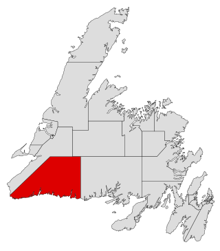
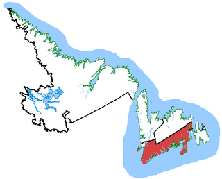
Burgeo-La Poile is a provincial electoral district for the House of Assembly of Newfoundland and Labrador, Canada. As of 2011, there are 7,527 eligible voters living within the district. The district was first created when Newfoundland joined confederation in 1949 as Burgeo and La Poile, and existed until 1975. It was recreated in 1995 following a reduction in the number of seats in the House of Assembly from 52 to 48, forming from the amalgamation of the former districts of La Poile and Burgeo-Bay D'Espoir.
Ramea is a small village in Newfoundland and Labrador located on Northwest Island, one of a group of five major islands located off the south coast of Newfoundland, Canada. The island is approximately 3.14 km long by 0.93 km wide. The other major islands in the archipelago are Great Island, Middle Island, Harbour Island, and South West Island.
Calvert is a local service district and designated place in the Canadian province of Newfoundland and Labrador in the Southern Shore region of the province. It is 72 kilometres south of the provincial capital St. John's, 7 kilometres south of Cape Broyle, and 3 kilometres north of Ferryland. The population in 2001 was 355, a decline of 17% since 1996.
Fortune Bay is a fairly large natural bay located in the Gulf of St. Lawrence on the south coast of Newfoundland, Canada. The Bay is bounded by Point Crewe on the Burin Peninsula and Pass Island at the entrance to Hermitage Bay to the northwest for a distance of 56 kilometers. The bay extends in a northeast direction for 105 kilometers ending at Terrenceville.
Aquaforte is a town on the south shore of Newfoundland's Avalon Peninsula in the province of Newfoundland and Labrador, Canada.
Glover Island is a large (178 km2) lake island in the interior of the Island of Newfoundland in the province of Newfoundland and Labrador, Canada. It is the 18th largest lake island in the world by area. The island is located in Grand Lake, a natural lake whose waters were raised for the Deer Lake Power Development. Historic maps show that Glover Island pre-dates this.
Swift Current is a local service district and designated place in the Canadian province of Newfoundland and Labrador. Swift Current is located approximately 20 km south of Goobies.
Bonalds Island is an island off the south coast of Newfoundland, Canada. Fox Island Harbour separates it from the mainland. The Shag Islands lie to the east and the larger Bear Island to the northwest. Its highest point is about 90 metres above sea level.
White Bear Bay is natural bay on the island of Newfoundland in the province of Newfoundland and Labrador, Canada. The Ramea islands are south of the bay. The bay is filled with fjords, valleys and massive waterfalls which makes it a well known tourist spot. Many people own cabins in the bay to temporarily live there.
Connoire Bay is natural bay or cove on the island of Newfoundland in the province of Newfoundland and Labrador, Canada. Miffel Island is nearby.
Isthmus Bay is a natural bay on the island of Newfoundland in the province of Newfoundland and Labrador, Canada. It is a sub-bay of St. George's Bay and flanked by the town of Port-au-Port. It is separated from Port au Port Bay by two narrow gravel isthmi.
Wild Bay is a natural bay on the coast of Labrador in the province of Newfoundland and Labrador, Canada. It lies within the southern reaches of Bonavista Bay, adjoining Monk Bay to the south.
Coppett was a small town located on the south coast of Newfoundland and Labrador, and north-east of Ramea. The first record of the community was in the 1857 census. Coppett grew steadily until the 1930s and at its peak had a school and two lobster factories. Several factors including the collapse of the inshore cod fishery, lack of government services and isolation caused the community to be abandoned between 1945 and 1951 without government assistance. The majority of the inhabitants resettled to Ramea or Burgeo. Several properties on the island were maintained until the 1980s for use as summer homes.
Long Range Mountains is a federal electoral district in the Canadian province of Newfoundland and Labrador. It covers the entirety the west coast of the island of Newfoundland.

Division No. 1, Subdivision G is an unorganized subdivision on the Avalon Peninsula in Newfoundland and Labrador, Canada. It is in Division 1 and contains the unincorporated communities of Baccalieu Island, Besom Cove, Bradley's Cove, Burnt Point, Caplin Cove, Daniel's Cove, Grates Cove, Gull Island, Job's Cove, Kingston, Long Beach, Lower Island Cove, Low Point, Northern Bay, Ochre Pit Cove, Red Head Cove, Riverhead, Smooth Cove and Western Bay.
Wild Cove is a local service district and designated place in the Canadian province of Newfoundland and Labrador. It is on the Baie Verte Peninsula of the island of Newfoundland.
References
- ↑ Canadian Hydrographic Service (1974). Newfoundland pilot. Marine Sciences Directorate, Dept. of the Environment. Retrieved 20 November 2011.
- ↑ "Shag Islands" (Map). Google Maps . Retrieved November 20, 2011.
- ↑ National Geospatial-intelligence Agency (January 2005). Prostar Sailing Directions 2005 Newfoundland, Labrador, and Hudson Bay Enroute. ProStar Publications. p. 37. ISBN 978-1-57785-661-0 . Retrieved 20 November 2011.