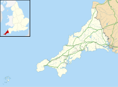
Bodmin is a civil parish and historic town in Cornwall, England, United Kingdom. It is situated south-west of Bodmin Moor.

Bodmin Moor is a granite moorland in northeastern Cornwall, England. It is 208 square kilometres (80 sq mi) in size, and dates from the Carboniferous period of geological history. It includes Brown Willy, the highest point in Cornwall, and Rough Tor, a slightly lower peak. Many of Cornwall's rivers have their sources here. It has been inhabited since at least the Neolithic era, when primitive farmers started clearing trees and farming the land. They left their megalithic monuments, hut circles and cairns, and the Bronze Age culture that followed left further cairns, and more stone circles and stone rows. By medieval and modern times, nearly all the forest was gone and livestock rearing predominated.
In the United Kingdom and Ireland, a county town is the most important town or city in a county. It is usually the location of administrative or judicial functions within a county and the place where the county's members of Parliament are elected. Following the establishment of the English county councils in 1889, the headquarters of the new councils were usually located in the county town of each county. However, the concept of a county town pre-dates the establishment of these councils.
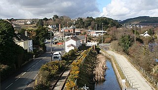
Camelford is a town and civil parish in north Cornwall, England, United Kingdom, situated in the River Camel valley northwest of Bodmin Moor. The town is approximately ten miles (16 km) north of Bodmin and is governed by Camelford Town Council. Lanteglos-by-Camelford is the ecclesiastical parish in which the town is situated. The ward population at the 2011 Census was 4,001. The town population at the same census was 865.

The Jamaica Inn is a traditional inn on Bodmin Moor in Cornwall in the UK, which was built as a coaching inn in 1750, and has a historical association with smuggling. Located just off the A30, near the middle of the moor close to the hamlet of Bolventor, it was originally used as a staging post for changing horses. The 1,122 feet (342 m) high "Tuber" or "Two Barrows" hill, is close by.

Launceston Castle is located in the town of Launceston, Cornwall, England. It was probably built by Robert the Count of Mortain after 1068, and initially comprised an earthwork and timber castle with a large motte in one corner. Launceston Castle formed the administrative centre of the new earldom of Cornwall, with a large community packed within the walls of its bailey. It was rebuilt in stone in the 12th century and then substantially redeveloped by Richard of Cornwall after 1227, including a high tower to enable visitors to view his surrounding lands. When Richard's son, Edmund, inherited the castle, he moved the earldom's administration to Lostwithiel, triggering the castle's decline. By 1337, the castle was increasingly ruinous and used primarily as a gaol and to host judicial assizes.
East Cornwall was a county constituency in the House of Commons of the Parliament of the United Kingdom. It elected two Members of Parliament (MPs) by the bloc vote system of election.

Wadebridge railway station was on the Bodmin and Wadebridge Railway, in Cornwall, England, UK. It opened in 1834 to transport goods between the market town of Wadebridge, the limit of navigation on the River Camel, and inland farming and mining areas. The railway was built to take stone from local quarries such as the De Lank Quarries on Bodmin Moor towards the coast, as well as sand dredged from the River Camel and landed at the quays in Wadebridge inland to be used to improve the heavy local soil. The station is situated just upstream of Wadebridge bridge and almost next to the tidal River Camel; a fact that prompted the former Poet Laureate John Betjeman to write in his autobiography "On Wadebridge station what a breath of sea scented the Camel Valley! Cornish air, soft Cornish rains, and silence after steam".
The Jacobite uprising in Cornwall of 1715 was the last uprising against the British Crown to take place in the county of Cornwall.

Cornwall played a significant role in the English Civil War, being a Royalist enclave in the generally Parliamentarian south-west.
The evolution of transport in Cornwall has been shaped by the county's strong maritime, mining and industrial traditions and much of the transport infrastructure reflects this heritage.

Rough Tor, or Roughtor, is a tor on Bodmin Moor, Cornwall, United Kingdom. The site is composed of the tor summit and logan stone, a neolithic tor enclosure, a large number of Bronze Age hut circles, and some contemporary monuments.

A civil parish is a country subdivision, forming the lowest unit of local government in England. There are 218 civil parishes in the ceremonial county of Cornwall, which includes the Isles of Scilly. The county is effectively parished in its entirety; only the unpopulated Wolf Rock is unparished. At the 2001 census, there were 501,267 people living in the current parishes, accounting for the whole of the county's population. The final unparished areas of mainland Cornwall, around St Austell, were parished on 1 April 2009 to coincide with the structural changes to local government in England.

Launceston is a town, ancient borough, and civil parish in Cornwall, England, United Kingdom. It is 1 mile (1.6 km) west of the middle stage of the River Tamar, which constitutes almost the entire border between Cornwall and Devon. The landscape of the town is generally steep particularly at a sharp south-western knoll topped by Launceston Castle. These gradients fall down to the River Kensey and smaller tributaries.

Brown Willy is a hill in Cornwall, England, United Kingdom. The summit, at 1,378 feet above sea level, is the highest point of Bodmin Moor and of Cornwall as a whole. It is about 2+1⁄2 miles northwest of Bolventor and 4 miles southeast of Camelford. The hill has a variable appearance that depends on the vantage point from which it is seen. It bears the conical appearance of a sugarloaf from the north but widens into a long multi-peaked crest from closer range.
Presented below is an alphabetical index of articles related to Cornwall:

Truro Crown Court is a judicial complex in Truro, Cornwall, England. It is a Grade II* listed building.

Reading Crown Court is a judicial facility in Reading, Berkshire. It is a Grade II listed building.

Old County Hall is a municipal facility at Station Road in Truro, Cornwall. The old County Hall, which was the headquarters of Cornwall County Council from 1890 to 1966, is a Grade II listed building.

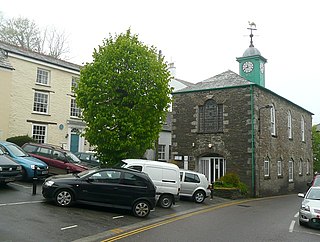
Launceston Guildhall and Town Hall is a municipal building in Western Road in Launceston, Cornwall, England. The building, which was the meeting place of Launceston Town Council, is a Grade II listed building.