Signal Mountain, Tennessee

Last updated

Signal Mountain, Tennessee
Signal Mountain, Tennessee.jpg
Signal Mountain Middle/High School
Hamilton County Tennessee Incorporated and Unincorporated areas Signal Mountain Highlighted 4768540.svg
Location of Signal Mountain in Hamilton County, Tennessee
Coordinates: 35°8′N85°21′W / 35.133°N 85.350°W / 35.133; -85.350
Country United States
State Tennessee
County Hamilton
Incorporated1919 [1]
Area
[2]
  Total8.37 sq mi (21.69 km2)
  Land8.37 sq mi (21.68 km2)
  Water0.00 sq mi (0.01 km2)
Elevation
[3]
1,703 ft (519 m)
Population
 (2020) [4]
  Total8,852
  Density1,057.59/sq mi (408.36/km2)
Time zone UTC–5 (Eastern (EST))
  Summer (DST) UTC–4 (EDT)
ZIP Code
37377
Area code 423
FIPS code 47-68540 [5]
GNIS feature ID1270254 [3]
Website signalmountaintn.gov

Signal Mountain is a town in Hamilton County, Tennessee, United States. The town is a suburb of Chattanooga and is located on Walden Ridge. "Signal Mountain" is used as a colloquial name for the part of Walden Ridge close to the town. The town population was 8,852 as of the 2020 census [6] and estimated to be 8,567 in 2018. [7]

Contents

Geography

Signal Mountain is located in southwestern Hamilton County at 35°8′N 85°21′W (35.1291, -85.3424), atop the south end of Walden Ridge. The southern edge of the town overlooks the Tennessee River 1,000 feet (300 m) below. The town is bordered to the south by the city of Chattanooga, to the northeast by the town of Walden, and to the north by the unincorporated community of Fairmount.

U.S. Route 127 (Ridgeway Avenue) is the main road through the town, leading south off the mountain 8 miles (13 km) to downtown Chattanooga and north over Walden Ridge 21 miles (34 km) to Dunlap.

According to the United States Census Bureau, the town has a total area of 7.7 square miles (19.9 km2), all land. [6]

History

Signal Mountain's history dates back years before settlement of the mountain itself. Centuries prior to the Civil War, Native Americans used a location on the mountain known as Signal Point to send fire and smoke signals across the Tennessee Valley. Later, the Union Army used Signal Point as a communications station during the Civil War. At the outbreak of the war, only a few families lived on the mountain. However, when various health epidemics struck Chattanooga in 1873 and 1878, several wealthy families relocated to the mountain where they could find clear air and pure water. In the early 20th century, Charles E. James purchased 4,400 acres (18 km2) of land in the Signal Point area and developed the mountain. In 1913, construction was completed of twelve miles (19 km) of streetcar track, which linked Chattanooga to Signal Mountain. While the streetcars are no longer used, the tracks remain in the streets of Signal Mountain's historic district named after Velma. On April 4, 1919, the Tennessee Legislature passed the bill that chartered the Town of Signal Mountain. During the 1970s, the town experienced significant growth. In 2013 Signal Mountain made Bloomberg Businessweeks' list of the best places to raise a family. [8]

Notable people

Demographics

Historical population
CensusPop.Note
1920 441
1930 966119.0%
1940 1,30835.4%
1950 1,78636.5%
1960 3,41391.1%
1970 4,83941.8%
1980 5,81820.2%
1990 7,03420.9%
2000 7,4295.6%
2010 7,5541.7%
2020 8,85217.2%
Sources: [9] [10] [4]

2020 census

Signal Mountain racial composition [11]
RaceNumberPercentage
White (non-Hispanic)8,14692.02%
Black or African American (non-Hispanic)500.56%
Native American 10.01%
Asian 1181.33%
Pacific Islander 60.07%
Other/Mixed 2923.3%
Hispanic or Latino 2392.7%

As of the 2020 United States census, there were 8,852 people, 3,096 households, and 2,419 families residing in the town.

2010 census

As of the census of 2010, there were 7,554 people, 2,950 households, and 2,175 families residing in the town. The population density was 1,112.6 inhabitants per square mile (429.6/km2). There were 3,168 housing units at an average density of 457.4 per square mile (176.6/km2). The racial makeup of the town was 98.2% White, 0.03% African American, 0.1% Native American, 0.5% Asian, and 0.2% from other races.

There were 2,960 households, of which 33.4% had children under the age of 18 living with them, 65.3% were married couples living together, 6.2% had a female householder with no husband present, and 26.5% were non-families. 25.1% of all households were made up of individuals, and 17.2% had someone living alone who was 65 years of age or older. The average household size was 2.51 and the average family size was 3.01.

The population of Signal Mountain was spread out, with 25.6% under the age of 18, 4.4% from 18 to 24, 22.2% from 25 to 44, 27.1% from 45 to 64 and 20.6% who were 65 years of age or older. The median age was 45.3 years. For every 100 females, there were 87.6 males. For every 100 females age 18 and over, there were 83.3 males.

The median income for a household was $78,900, and the median income for a family was $130,997. Males had a median income of $102,241 versus $54,878 for females. The per capita income for the town was $71,134. About 2.3% of families and 3.4% of the population were below the poverty line, including 3.3% of those under age 18 and 3.0% of those age 65 or over.

Attractions

Signal Mountain is home to a number of outdoors attractions, including the Cumberland Trail, Mabbitt Springs, and Signal Point, which is part of Chickamauga and Chattanooga National Military Park. Visitors and citizens have many different locations where they can hike and backpack, such as Rainbow Lake and Edward's Point. [12]

The Signal Mountain Playhouse presents two plays per year including an outdoor musical every summer in the natural amphitheatre behind the Town Hall. The MACC (Mountain Arts Community Center), located in the historic Signal Mountain Elementary School building, offers classes in music, dance, and visual arts. The neighboring town of Walden hosts an outdoor public playground and pavilion called the Pumpkin Patch that is open for all to enjoy. Also, Bachman Community Center has many annual events as well as a small library and community garden plots. The New Mountain Opry hosts a weekly bluegrass music show every Friday evening.

Schools

Related Research Articles

<span class="mw-page-title-main">Sequatchie County, Tennessee</span> County in Tennessee, United States

Sequatchie County is a county located in the U.S. state of Tennessee. As of the 2020 census, the population was 15,826. Its county seat is Dunlap. Sequatchie County is part of the Chattanooga, TN–GA Metropolitan Statistical Area.

<span class="mw-page-title-main">Roane County, Tennessee</span> County in Tennessee, United States

Roane County is a county of the U.S. state of Tennessee. As of the 2020 census, the population was 53,404. Its county seat is Kingston. Roane County is included in the Knoxville, TN Metropolitan Statistical Area.

<span class="mw-page-title-main">McMinn County, Tennessee</span> County in Tennessee, United States

McMinn County is a county in the U.S. state of Tennessee. It is located in East Tennessee. As of the 2020 census, the population was 53,794. The county has a total area of 432 square miles (1,120 km2). Most of the county is within the Ridge and Valley area of the Appalachian Mountains. Its county seat is Athens. McMinn County, along with Meigs County comprises the Athens, TN Micropolitan Statistical Area.

<span class="mw-page-title-main">Whitfield County, Georgia</span> County in Georgia, United States

Whitfield County is a county located in the northwestern part of the U.S. state of Georgia. As of the 2020 census shows a population of 102,864. The county seat is Dalton. The county was created on December 30, 1851, and named after George Whitefield, Methodist evangelist. The "e" was omitted to reflect the pronunciation of his name.

<span class="mw-page-title-main">Catoosa County, Georgia</span> County in Georgia, United States

Catoosa County is a county located in the northwestern part of the U.S. state of Georgia. As of the 2020 census, the population was 67,872. The county seat is Ringgold. The county was created on December 5, 1853. The meaning of the Cherokee language name "Catoosa" is obscure: "Catoosa" may come from the Cherokee words gatusi or gatu'gitse.

<span class="mw-page-title-main">Ringgold, Georgia</span> City in Georgia, United States

Ringgold is a city in and the county seat of Catoosa County, Georgia, United States. Its population was 3,414 at the 2020 census. It is part of the Chattanooga, Tennessee–GA Metropolitan Statistical Area.

<span class="mw-page-title-main">Summerville, Georgia</span> City in Georgia, United States

Summerville is a city and the county seat of Chattooga County, Georgia, United States. The population was 4,534 at the 2010 census.

<span class="mw-page-title-main">East Ridge, Tennessee</span> City in Tennessee, United States

East Ridge is a city in Hamilton County, Tennessee, United States. As of the 2020 census, the city population was 22,167. East Ridge is bordered by Chattanooga to the west, north, and east, and the Georgia state line to the south. It is part of the Chattanooga, TN–GA Metropolitan Statistical Area. The name of the city comes from its location due east of Missionary Ridge. The Bachman Tubes beneath Missionary Ridge link East Ridge with downtown Chattanooga.

Fairmount is a census-designated place (CDP) in Hamilton County, Tennessee, United States. The population was 2,193 at the 2020 census, down from 2,825 at the 2010 census. It is part of the Chattanooga, TN–GA Metropolitan Statistical Area.

Harrison is a census-designated place (CDP) in Hamilton County, Tennessee, United States. The population was 7,902 at the 2020 census. It is part of the Chattanooga metropolitan area. Harrison Bay State Park, the Hamilton County Landfill, Bear Trace Golf Course, a course designed by Jack Nicklaus, and Skull Island, a recreational area owned by TVA, are all located in Harrison.

<span class="mw-page-title-main">Lookout Mountain, Tennessee</span> Town in Tennessee, United States

Lookout Mountain is a town in Hamilton County, Tennessee, United States. The population was 2,058 at the 2020 census. Bordering its sister city of Lookout Mountain, Georgia to the south, Lookout Mountain is part of the Chattanooga, TN–GA Metropolitan Statistical Area.

<span class="mw-page-title-main">Ooltewah, Tennessee</span> Census-designated place in Tennessee, United States

Ooltewah is a census-designated place (CDP) in Hamilton County, Tennessee, United States. It is a community near Chattanooga. The population was 684 at the 2020 census. Ooltewah is an enclave in the city of Collegedale.

<span class="mw-page-title-main">Soddy-Daisy, Tennessee</span> City in Tennessee, United States

Soddy-Daisy is a city in Hamilton County, Tennessee, United States. The population was 13,070 at the 2020 census and estimated to be 13,619 in 2022. The city was formed in 1969 when the communities of Soddy and Daisy, along with nearby developed areas along U.S. Highway 27, merged to form Soddy-Daisy. It is becoming a bedroom community of nearby Chattanooga and is part of the Chattanooga Metropolitan Statistical Area. Sequoyah Nuclear Generating Station is located in Soddy-Daisy.

<span class="mw-page-title-main">Walden, Tennessee</span> Town in Tennessee, United States

Walden is a town located in Hamilton County, Tennessee, United States. The population was 1,981 at the 2020 census and up from 1,898 at the 2010 census. It is part of the Chattanooga, Tennessee–Georgia Metropolitan Statistical Area.

<span class="mw-page-title-main">Whitwell, Tennessee</span> City in Tennessee, United States

Whitwell is a city in Marion County, Tennessee, United States, approximately 24 miles northwest of Chattanooga. The population was 1,641 at the 2020 census. It is part of the Chattanooga, TN–GA Metropolitan Statistical Area.

<span class="mw-page-title-main">Athens, Tennessee</span> City in Tennessee, United States

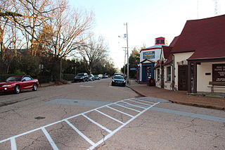
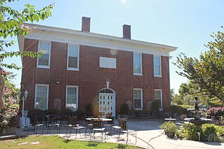
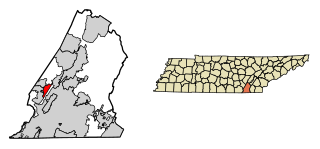
Athens is the county seat of McMinn County, Tennessee, United States and the principal city of the Athens Micropolitan Statistical Area has a population of 53,569. The city is located almost equidistantly between the major cities of Knoxville and Chattanooga. The population was 14,084 at the 2020 census. The population of the zipcode area is at 23,726

<span class="mw-page-title-main">Graysville, Tennessee</span> Town in Tennessee, United States

Graysville is a town in Rhea County, Tennessee, United States. The population was 1,471 at the 2020 census and 1,502 at the 2010 census.

<span class="mw-page-title-main">Dunlap, Tennessee</span> City in Tennessee, United States

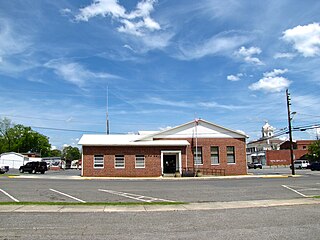
Dunlap is a city in and the county seat of Sequatchie County, Tennessee, United States. The population was 5,357 at the 2020 census and 4,815 at the 2010 census.

<span class="mw-page-title-main">Oliver Springs, Tennessee</span> Town in Tennessee, United States

Oliver Springs is a town in Anderson, Morgan, and Roane counties in the U.S. state of Tennessee. Its population was 3,231 at the 2010 census. It is included in the Harriman, Tennessee Micropolitan Statistical Area, which consists of Roane County.

<span class="mw-page-title-main">Tennessee Ridge, Tennessee</span> Town in Tennessee, United States

Tennessee Ridge is a town in Houston county in the U.S. state of Tennessee. The population was 1,332 at the 2020 census and 1,368 at the 2010 census.

References

  1. Tennessee Blue Book , 2005–2006, pp. 618–625.
  2. "ArcGIS REST Services Directory". United States Census Bureau. Retrieved October 15, 2022.
  3. 1 2 U.S. Geological Survey Geographic Names Information System: Signal Mountain, Tennessee
  4. 1 2 "Census Population API". United States Census Bureau. Retrieved October 15, 2022.
  5. "U.S. Census website". United States Census Bureau . Retrieved January 31, 2008.
  6. 1 2 "Geographic Identifiers: 2010 Census Summary File 1 (G001): Signal Mountain town, Tennessee". American Factfinder. U.S. Census Bureau. Archived from the original on February 13, 2020. Retrieved January 29, 2018.
  7. "Population and Housing Unit Estimates" . Retrieved August 3, 2019.
  8. "sigmtn.com". www.sigmtn.com. Retrieved August 26, 2021.
  9. "Census of Population and Housing: Decennial Censuses". United States Census Bureau . Retrieved March 4, 2012.
  10. "Incorporated Places and Minor Civil Divisions Datasets: Subcounty Resident Population Estimates: April 1, 2010 to July 1, 2012". Population Estimates. U.S. Census Bureau. Archived from the original on June 11, 2013. Retrieved December 11, 2013.
  11. "Explore Census Data". data.census.gov. Retrieved December 25, 2021.
  12. "sigmtn.com". www.sigmtn.com.
  13. "Obituaries - Nolan, Paul V." The Chattanoogan. June 27, 2009. Retrieved January 7, 2017.