
The Pulaski Skyway is a four-lane bridge-causeway in the northeastern part of the U.S. state of New Jersey, carrying an expressway designated U.S. Route 1/9 (US 1/9) for most of its length. The structure has a total length of 3.502 miles (5.636 km). Its longest bridge spans 550 feet (168 m). Traveling between Newark and Jersey City, the roadway crosses the Passaic and Hackensack rivers, Kearny Point, the peninsula between them, and the New Jersey Meadowlands.

A bascule bridge is a moveable bridge with a counterweight that continuously balances a span, or leaf, throughout its upward swing to provide clearance for boat traffic. It may be single- or double-leafed.
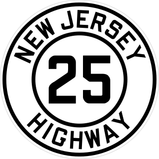
Route 25 was a major state highway in New Jersey, United States prior to the 1953 renumbering, running from the Benjamin Franklin Bridge in Camden to the Holland Tunnel in Jersey City. The number was retired in the renumbering, as the whole road was followed by various U.S. Routes: US 30 coming off the bridge in Camden, US 130 from the Camden area north to near New Brunswick, US 1 to Tonnele Circle in Jersey City, and US 1 Business to the Holland Tunnel.

The HX Draw is a bascule bridge carrying the New Jersey Transit Bergen County Line and Pascack Valley Line across the Hackensack River between Secaucus, New Jersey and East Rutherford. The bridge is also known as The Jack-Knife because of its unusual method of opening.

The Cortland Street Drawbridge over the Chicago River is the original Chicago-style fixed-trunnion bascule bridge, designed by John Ericson and Edward Wilmann. When it opened in 1902, on Chicago's north side, it was the first such bridge built in the United States. The bridge was a major advance in American movable bridge engineering, and was the prototype for over 50 additional bridges in Chicago alone. The bridge was designated as an ASCE Civil Engineering Landmark in 1981, and a Chicago Landmark in 1991.

The Chicago and North Western Railway's Kinzie Street railroad bridge is a single leaf bascule bridge across the north branch of the Chicago River in downtown Chicago, Illinois. At the time of its opening in 1908 it was the world's longest and heaviest bascule bridge. The previous bridges on the same site included a pedestrian span that was the first bridge across the Chicago River; a second bridge that served as Chicago's first railroad bridge; and a third bridge that was one of the first all-steel spans in the United States.
The Elizabeth River runs through Essex and Union counties, New Jersey in the United States for 11.9 miles (19.2 km) before draining into the Arthur Kill.
The West Jefferson Avenue–Rouge River Bridge is a bridge located where Jefferson Avenue crosses the Rouge River at the border of Detroit and River Rouge, Michigan. It is the only surviving pony truss bascule bridge in the state of Michigan. It was listed on the National Register of Historic Places in 2000.

Bridge Street Bridge is a swing bridge over the Passaic River connecting Newark and Harrison, New Jersey. It is the 10th bridge from the river's mouth at Newark Bay and is 5.7 miles (9.2 km) upstream from it. Carrying vehicular traffic, the roadway is designated County Route 508.

14th Street is a county highway in Hudson County, New Jersey, designated County Route 670. It begins at an intersection with Manhattan Avenue in Union City, also known as the South Wing Viaduct, and proceeds east over the 14th Street Viaduct to terminate at Sinatra Drive on the banks of the Hudson River in Hoboken. It is located at the northern end of Hoboken's street grid, and one of the only east–west streets in the city that allows for two-way traffic. It is located two blocks south of Weehawken Cove.

The Winant Avenue Bridge is a vehicular movable bridge spanning the Hackensack River in Bergen County, New Jersey 14 miles (23 km) from its mouth at Newark Bay. Built in 1934, it is also known as the Route 46 Hackensack River Bridge and S46 Bridge, it carries U.S. Route 46 (US 46) in Little Ferry and Ridgefield Park. Owned and operated by the New Jersey Department of Transportation (NJDOT), the double leaf bascule bridge is located on a navigable reach. While there have been no requests since 1978, the Code of Federal Regulations last amended in 1999 requires 24-hour notice to be opened. The bridge has been minimally altered since its construction and is eligible for individual listing on the National Register of Historic Places (NRHP).
The Lincoln Highway Hackensack River Bridge is a vehicular vertical lift bridge crossing the Hackensack River at a point 1.8 mi (2.9 km) from the river mouth at Newark Bay in Hudson County, New Jersey, United States. The bridge, along the route of the Lincoln Highway, carries U.S. Route 1/9 Truck and the East Coast Greenway between the West Side of Jersey City and Kearny Point in Kearny. The most recent of many crossings at the location, the current bridge was completed in 1954. It is owned by and operated by the New Jersey Department of Transportation (NJDOT), and is required by the Title 33 of the Code of Federal Regulations to open on signal for maritime traffic. In 2007 it was designated the Shawn Carson and Robert Nguyen Memorial Bridge.

Eighth Street Bridge is a road bridge over the Passaic River in northeastern New Jersey, United States. It connects the City of Passaic in Passaic County with the Borough of Wallington in Bergen County and is jointly owned by both counties. The bridge connects Eighth Street in Passaic with County Route 507 in Wallington.

The Straight Street Bridge is a vehicular bridge over the Passaic River in Paterson, New Jersey, that is listed on the National Register of Historic Places.

Market Street Bridge, also known as the Second Street Bridge, is a vehicular bridge over the Passaic River crossing the Passaic-Bergen county line in Passaic and Wallington in northeastern New Jersey. The double-leaf bascule bridge was built in 1930 and fixed in the closed position in 1977. It was reconstructed in 2002. It carries a two-lane street and sidewalks in a late-19th and early-20th century industrial area along the river. An earlier structure built at the crossing in 1894 was damaged during the Passaic floods of 1902 and 1903 but survived.

The Dorset Avenue Bridge is a vehicular bridge in Ventnor City, Atlantic County, New Jersey, south of in Atlantic City. The double-leaf Strauss trunnion bascule drawbridge spans the Intracoastal Waterway (ICW) Inside Thorofare and carries CR 629 in Ventnor Heights and St Leonard's Tract on Absecon Island.

