Parts of this article (those related to census data) need to be updated.(October 2015) |
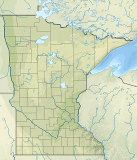
South Koochiching is an unorganized territory in Koochiching County, Minnesota, United States. The population was 267 at the 2000 census.
Parts of this article (those related to census data) need to be updated.(October 2015) |
South Koochiching is an unorganized territory in Koochiching County, Minnesota, United States. The population was 267 at the 2000 census.
According to the United States Census Bureau, the unorganized territory has a total area of 845.5 square miles (2,189.7 km2), of which 844.4 square miles (2,186.9 km2) is land and 1.1 square miles (2.8 km2) (0.13%) is water.
As of the census [1] of 2000, there were 267 people, 121 households, and 86 families residing in the unorganized territory. The population density was 0.3 people per square mile (0.1/km2). There were 408 housing units at an average density of 0.5/sq mi (0.2/km2). The racial makeup of the unorganized territory was 94.76% White, 3.75% Native American, and 1.50% from two or more races. Hispanic or Latino of any race were 0.37% of the population.
There were 121 households, out of which 22.3% had children under the age of 18 living with them, 58.7% were married couples living together, 5.0% had a female householder with no husband present, and 28.9% were non-families. 26.4% of all households were made up of individuals, and 12.4% had someone living alone who was 65 years of age or older. The average household size was 2.21 and the average family size was 2.60.
In the unorganized territory the population was spread out, with 18.0% under the age of 18, 4.9% from 18 to 24, 21.3% from 25 to 44, 33.7% from 45 to 64, and 22.1% who were 65 years of age or older. The median age was 49 years. For every 100 females, there were 118.9 males. For every 100 females age 18 and over, there were 119.0 males.
The median income for a household in the unorganized territory was $33,250, and the median income for a family was $35,417. Males had a median income of $37,188 versus $15,938 for females. The per capita income for the unorganized territory was $16,295. About 2.2% of families and 6.5% of the population were below the poverty line, including 2.4% of those under the age of 18 and 17.3% of those 65 or over.

East Hancock is an unorganized territory in Hancock County, Maine, United States. The population was 94 at the 2010 census.
Upper Red Lake is an unorganized territory in Beltrami County, Minnesota, U.S. It is a part of the Red Lake Indian Reservation. The population was 25 at the 2000 census.

North Cass is an unorganized territory in Cass County, Minnesota, United States. The population was 348 at the 2000 census. It is part of the Brainerd Micropolitan Statistical Area.

Wahnena is an unorganized territory in Cass County, Minnesota, United States. The population was 197 at the 2000 census. It is part of the Brainerd Micropolitan Statistical Area. Wahnena was named for an Ojibwe chief.
Little Sand Lake is an unorganized territory in Itasca County, Minnesota, United States. As of the 2010 census, the unorganized territory population was 349.
Northeast Itasca is an unorganized territory in Itasca County, Minnesota, United States. The population was 1,179 at the 2010 census.
East Koochiching is an unorganized territory in Koochiching County, Minnesota, United States. The population was 383 at the 2000 census.
Northwest Koochiching is an unorganized territory in Koochiching County, Minnesota, United States. The population was 541 at the 2000 census.
Rainy Lake is an unorganized territory in Koochiching County, Minnesota, United States. The population was 4,469 at the 2000 census.
Lake No. 2 is an unorganized territory in Lake County, Minnesota, United States. The population was 1,955 at the 2000 census.
Camp A Lake is an unorganized territory in Saint Louis County, Minnesota, United States. The population was 16 at the 2000 census.
Jeanette Lake is an unorganized territory in Saint Louis County, Minnesota, United States. The population was 249 at the 2000 census.
McCormack is an unorganized territory in Saint Louis County, Minnesota, United States, located near Hibbing and Balkan Township. The population was 237 at the 2000 census.
Northwest St. Louis is an unorganized territory in Saint Louis County, Minnesota, United States. The population was 306 at the 2000 census.
Slim Lake is an unorganized territory in Saint Louis County, Minnesota, United States, located north of Ely and Morse Township. The population was 75 at the 2000 census.
Sturgeon River is an unorganized territory in Saint Louis County, Minnesota, United States. The population was 99 at the 2000 census.
Nett Lake is an unorganized territory in Koochiching County, Minnesota, United States. The population was 56 at the 2000 census.
Nett Lake is an unorganized territory in Saint Louis County, Minnesota, United States. The population was 272 at the 2000 census.
Effie is an unorganized territory in Itasca County, Minnesota, United States. The population was 203 at the 2010 census.
Northome is an unorganized territory in Koochiching County, Minnesota, United States. The term "unorganized territory" is used by the United States Census Bureau to designate a portion of a county that is not included in any legally established minor civil division for the purpose of presenting statistical data. The population was 496 at the 2000 census.
Municipalities and communities of Koochiching County, Minnesota, United States | ||
|---|---|---|
| Cities |  | |
| Unorganized territories | ||
| CDP | ||
| Unincorporated communities | ||
| Indian reservations | ||
| Ghost town | ||
| Footnotes | ‡This populated place also has portions in an adjacent county or counties | |