Spring Valley, San Diego County, California

Last updated

Spring Valley, California
San Diego County California Incorporated and Unincorporated areas Spring Valley Highlighted.svg
Location in San Diego County and the state of California
Usa edcp relief location map.png
Red pog.svg
Spring Valley, California
Location in the United States
Coordinates: 32°44′4″N116°58′53″W / 32.73444°N 116.98139°W / 32.73444; -116.98139
Country Flag of the United States.svg  United States
State Flag of California.svg  California
County San Diego
Area
[1]
  Total7.374 sq mi (19.099 km2)
  Land7.165 sq mi (18.558 km2)
  Water0.209 sq mi (0.541 km2)  2.83%
Elevation
390 ft (119 m)
Population
 (2010)
  Total28,205
  Density3,800/sq mi (1,500/km2)
Time zone UTC-8 (PST)
  Summer (DST) UTC-7 (PDT)
ZIP codes
91976-91979
Area code 619
FIPS code 06-73696
GNIS feature ID1661495

Spring Valley is a census-designated place (CDP) in the East County region of San Diego County, California. The population was 28,205 at the time of the 2010 census.

Contents

From 1970 through 1990, Spring Valley included what is now the La Presa CDP to the south; La Presa is still popularly considered to be a part of Spring Valley. Extended definitions of Spring Valley may also include the Casa de Oro neighborhood to the north, which belongs to the Casa de Oro-Mount Helix CDP. Locations in both La Presa and Casa de Oro use Spring Valley addresses.

Spring Valley is served by the 91977 and 91978 ZIP codes.

History

Spring Valley is named for the natural spring located there. It was long the home of the Kumeyaay people, who called it Neti or Meti. Spanish conquerors drove off the natives and used the area for cattle, calling it El aguaje de San Jorge (St. George's Spring).

In 1863, Judge A. S. Ensworth of San Diego filed a claim for a 160-acre (65 ha) ranch that included the spring. The ranch, and the small adobe house he built there, were sold to Rufus King Porter and later to historian Hubert Howe Bancroft. The adobe is now a National Historic Landmark.

Geography

The United States Geological Survey (USGS) places Spring Valley at 32°44′41″N116°59′56″W / 32.74472°N 116.99889°W / 32.74472; -116.99889 (32.7447740, -116.9989160). [2] This is near the intersection of Kenwood Drive and Helix Street. Most maps place Spring Valley at this location.

The United States Census Bureau places Spring Valley at 32°44′4″N116°58′53″W / 32.73444°N 116.98139°W / 32.73444; -116.98139 (32.734318, -116.981372), [2] which is approximately two miles southeast of where the USGS places it. According to the United States Census Bureau, the CDP has a total area of 7.4 square miles (19 km2). 7.2 square miles (19 km2) of it is land and 0.2 square miles (0.52 km2) of it (2.83%) is water.

Demographics

Historical population
CensusPop.Note
1970 29,742
1980 40,19135.1%
1990 55,33137.7%
2000 26,663−51.8%
2010 28,2055.8%
source: [3] [4]

2010

At the 2010 census Spring Valley had a population of 28,205. The population density was 3,824.9 inhabitants per square mile (1,476.8/km2). The racial makeup of Spring Valley was 10,915 (38.7%) White, 3,449 (11.1%) African American, 237 (0.8%) Native American, 1,766 (5.7%) Asian, 616 (2.0%) Pacific Islander, 5,172 (17.4%) from other races, and 1,828 (6.5%) from two or more races. Hispanic or Latino of any race were 11,201 persons (36.0%). [5]

The census reported that 28,040 people (99.4% of the population) lived in households, 51 (0.2%) lived in non-institutionalized group quarters, and 114 (0.4%) were institutionalized.

There were 9,305 households, 3,854 (41.4%) had children under the age of 18 living in them, 4,940 (53.1%) were opposite-sex married couples living together, 1,514 (16.3%) had a female householder with no husband present, 636 (6.8%) had a male householder with no wife present. There were 560 (6.0%) unmarried opposite-sex partnerships, and 96 (1.0%) same-sex married couples or partnerships. 1,612 households (17.3%) were one person and 560 (6.0%) had someone living alone who was 65 or older. The average household size was 3.01. There were 7,090 families (76.2% of households); the average family size was 3.39.

The age distribution was 7,481 people (26.5%) under the age of 18, 2,819 people (10.0%) aged 18 to 24, 7,496 people (26.6%) aged 25 to 44, 7,461 people (26.5%) aged 45 to 64, and 2,948 people (10.5%) who were 65 or older. The median age was 35.0 years. For every 100 females, there were 95.2 males. For every 100 females age 18 and over, there were 90.6 males.

There were 9,741 housing units at an average density of 1,321.0 per square mile, of the occupied units 5,916 (63.6%) were owner-occupied and 3,389 (36.4%) were rented. The homeowner vacancy rate was 1.9%; the rental vacancy rate was 4.9%. 17,130 people (60.7% of the population) lived in owner-occupied housing units and 10,910 people (38.7%) lived in rental housing units.

2000

The United States Census Bureau has split Spring Valley (in its greater sense) into two Census-Designated Places (CDPs). The statistics below cover only the Spring Valley CDP. For the demographics of the complete community of Spring Valley also see La Presa, California.

At the 2000 census there were 26,663 people, 9,129 households, and 6,901 families in the CDP. The population density was 3,685.4 inhabitants per square mile (1,422.9/km2). There were 9,291 housing units at an average density of 1,284.2 per square mile (495.8/km2). The racial makeup of the CDP was 45.6% White, 10.7% African American, 0.8% Native American, 4.8% Asian, 1.2% Pacific Islander, 12.4% from other races, and 6.2% from two or more races. Hispanic or Latino of any race were 30.1%. [6]

Of the 9,129 households 40.5% had children under the age of 18 living with them, 54.8% were married couples living together, 15.6% had a female householder with no husband present, and 24.4% were non-families. 17.5% of households were one person and 6.0% were one person aged 65 or older. The average household size was 2.90 and the average family size was 3.27.

The age distribution was 29.1% under the age of 18, 9.1% from 18 to 24, 31.4% from 25 to 44, 20.9% from 45 to 64, and 9.5% 65 or older. The median age was 33 years. For every 100 females, there were 94.8 males. For every 100 females age 18 and over, there were 91.6 males.

The median household income was $48,271 and the median family income was $51,217. Males had a median income of $36,338 versus $30,297 for females. The per capita income for the CDP was $19,504. About 6.5% of families and 8.6% of the population were below the poverty line, including 11.3% of those under age 18 and 3.2% of those age 65 or over.

Education

Public high school education is provided by the Grossmont Union High School District. Elementary and middle schools are operated by the La Mesa-Spring Valley School District.

Government

In the California State Legislature, Spring Valley is in the 38th Senate District , represented by Democrat Catherine Blakespear, and in the 71st Assembly District , represented by Republican Kate Sanchez. [7]

In the United States House of Representatives, Spring Valley is included in California's 53rd congressional district. [8]

Notable people

Related Research Articles

Silver Springs is a census-designated place (CDP) in Copper River Census Area, Alaska, United States. At the 2020 census the population was 111, down from 114 in 2010.

<span class="mw-page-title-main">Avra Valley, Arizona</span> CDP in Pima County, Arizona

Avra Valley is a census-designated place (CDP) in Pima County, Arizona, United States. The population was 6,050 at the 2010 census, up from 5,038 in 2000.

<span class="mw-page-title-main">Bear Valley Springs, California</span> Place in California, United States

Bear Valley Springs is a guarded-gate community in Kern County, California, United States. The unincorporated community is in the Tehachapi Mountains and is part of the greater Tehachapi area. The elevation ranges from 4,121 feet (1,256 m) to 6,934 feet (2,113 m). The population fluctuates between a low during the winter months when snow is common, to a high in the summer months when its elevation keeps it much cooler than surrounding areas and major cities. The population was 5,172 at the 2010 census, up from 4,232 at the 2000 census. For statistical purposes, the United States Census Bureau has defined Bear Valley Springs as a census-designated place (CDP). The census definition of the area may not precisely correspond to local understanding of the area with the same name.

<span class="mw-page-title-main">Tamalpais-Homestead Valley, California</span> Census-designated place in California, United States

Tamalpais-Homestead Valley is a census-designated place (CDP) in Marin County, California, United States. The population was 11,492 at the 2020 census.

<span class="mw-page-title-main">Cherry Valley, California</span> Census-designated place in California, United States

Cherry Valley is a census-designated place (CDP) in Riverside County, California, United States. The population was 6,362 at the 2010 census, up from 5,891 at the 2000 census. It is situated at the most northwestern point of the San Gorgonio Pass.

<span class="mw-page-title-main">East Hemet, California</span> Census-designated place in California, United States

East Hemet is a census-designated place (CDP) in Riverside County, California, United States, located east of Hemet. East Hemet is in an unincorporated area outside the city limits of Hemet. The population was 17,418 at the 2010 census, up from 14,823 at the 2000 census.

<span class="mw-page-title-main">Thousand Palms, California</span> Census-designated place in California, United States

Thousand Palms is a census-designated place (CDP) in the Coachella Valley of Riverside County, California, United States. The population was 7,715 at the 2010 census, up from 5,120 at the 2000 census.

<span class="mw-page-title-main">Valle Vista, California</span> Census-designated place in California, United States

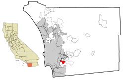
Valle Vista is a census-designated place (CDP) in Riverside County, California, United States and is located in the San Jacinto Valley. Some areas of Valle Vista are considered to be part of both unincorporated San Jacinto and Hemet but have yet to be incorporated. The population was 11,036 at the 2010 census, up from 8,356 at the 2000 census.

<span class="mw-page-title-main">Casa de Oro-Mount Helix, California</span> Census designated place in California, United States

Casa de Oro-Mount Helix is a census-designated place (CDP) in the East County region of San Diego County, California.

<span class="mw-page-title-main">Granite Hills, California</span> Census-designated place in California, United States

Granite Hills is a census-designated place in San Diego County, California. The name is also applied to a neighborhood within the city limits of El Cajon in the eastern part of that city. The population of the CDP, which does not include the people living within the city of El Cajon, was 3,035 at the 2010 census, down from 3,246 at the 2000 census.

<span class="mw-page-title-main">Jamul, California</span> Census designated place in California, United States

Jamul is a census-designated place (CDP) in San Diego County, California, United States. Jamul had a population of 6,163 at the 2010 census.

<span class="mw-page-title-main">La Presa, California</span> Census-designated place in California, United States

La Presa is a census-designated place (CDP) in the East County region of San Diego County, California, United States. The population was 34,169 at the 2010 census, up from 32,721 at the 2000 census.

<span class="mw-page-title-main">Pine Valley, California</span> Census-designated place in California, United States

Pine Valley is a community and census-designated place (CDP) in the Cuyamaca Mountains of the Mountain Empire area, in southeastern San Diego County, California. The population was 1,510 at the 2010 census, up from 1,501 at the 2000 census.

<span class="mw-page-title-main">Winter Gardens, California</span> Census-designated place in California, United States

Winter Gardens is a census-designated place (CDP) in San Diego County, California. The population was 20,631 at the 2010 census, up from 19,771 at the 2000 census.

<span class="mw-page-title-main">El Verano, California</span> Census-designated place in California, United States

El Verano is a census-designated place (CDP) in Sonoma Valley, Sonoma County, California, United States. The population was 4,123 at the 2010 census, falling to 3,867 at the 2020 census.

<span class="mw-page-title-main">Spring Creek, Nevada</span> CDP in Nevada, United States

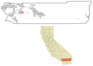
Spring Creek is a census-designated place (CDP) in central Elko County, in northeastern Nevada in the western United States. It mainly serves as a bedroom community for the businesses and industries in and around the nearby city of Elko. It is part of the Elko Micropolitan Statistical Area. The population was 12,361 at the 2010 census.

<span class="mw-page-title-main">Salem, New Mexico</span> CDP in New Mexico, United States

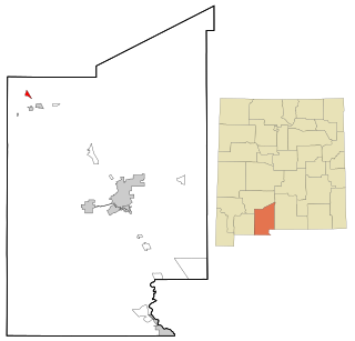
Salem is a census-designated place (CDP) in Doña Ana County, New Mexico, United States. The population was 942 at the 2010 census. It is part of the Las Cruces Metropolitan Statistical Area.

<span class="mw-page-title-main">Spring Mills, Pennsylvania</span> Census designated place in Pennsylvania, United States

Spring Mills is an unincorporated community and census-designated place (CDP) in Centre County, Pennsylvania, United States. It is part of the State College, Pennsylvania Metropolitan Statistical Area. The population was 268 at the 2010 census.

<span class="mw-page-title-main">Green Valley, South Dakota</span> CDP in South Dakota, United States

Green Valley is a census-designated place (CDP) and unincorporated community in Pennington County, South Dakota, United States. The population was 1,051 at the 2020 census.

<span class="mw-page-title-main">Provincetown (CDP), Massachusetts</span> Census-designated place in Massachusetts, United States

Provincetown (CDP) is a census-designated place (CDP) in the town of Provincetown in Barnstable County, Massachusetts, United States. The population was 2,642 at the 2010 census, out of 2,942 in the entire town.

References

  1. "2010 Census U.S. Gazetteer Files – Places – California". United States Census Bureau.
  2. 1 2 "US Gazetteer files: 2010, 2000, and 1990". United States Census Bureau. February 12, 2011. Retrieved April 23, 2011.
  3. "Census of Population and Housing (1790-2000)". U.S. Census Bureau . Retrieved July 17, 2010.
  4. Part of 1990 census area was lost to La Presa
  5. "2010 Census Interactive Population Search: CA - Spring Valley CDP". U.S. Census Bureau. Archived from the original on July 15, 2014. Retrieved July 12, 2014.
  6. "U.S. Census website". United States Census Bureau . Retrieved January 31, 2008.
  7. "Statewide Database". UC Regents. Retrieved December 8, 2014.
  8. "California's 53rd Congressional District - Representatives & District Map". Civic Impulse, LLC.