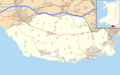
South Glamorgan is a preserved county of Wales.

Mid Glamorgan is a preserved county of Wales. From 1974 until 1996 it was also an administrative county with a county council.

Ewenny is a village and community (parish) on the River Ewenny in the Vale of Glamorgan, Wales.

Colwinston is both a village and a community in the Vale of Glamorgan, Wales, approximately 4 miles (6.4 km) southeast of the centre of Bridgend and 21 miles (34 km) west of the centre of Cardiff. The village is located within 1⁄2 mile (0.80 km) of the A48. The population in 2005 was approximately 400 but with recent building development, the population is now estimated at over 600 people.

The Borough of Ogwr was one of six districts of Mid Glamorgan in Wales, which existed from 1974 to 1996.

St Athan is a village and community in the Vale of Glamorgan in South Wales. The village and its parish church are dedicated to Saint Tathan. The church dates to the 13th–14th century, though an earlier church was dated to the Norman period. The village and the adjacent dormitory village of Eglwys Brewis are known primarily for the MOD St Athan RAF base. There is one pub in the village, as well as a football team at St Athan Football Club and the St Athan Golf Club. The community includes West Aberthaw.

Bridgend County Borough Council is the governing body for Bridgend County Borough, one of the Principal Areas of Wales.

Llandow is a village and community in the Vale of Glamorgan, Wales. The community population taken at the 2011 census was 726. The village is located 15 miles (24 km) south west of Cardiff. The community includes the villages of Sigingstone and Llysworney.
Church Village is a large village in the historic parish and community of Llantwit Fardre, located within the Taff Ely district of the County Borough of Rhondda Cynon Taf in Wales. The village is centrally located being around 4 miles (6.4 km) from the local principal towns of Llantrisant to the southwest and Pontypridd to the north and is situated around 10 miles (16 km) northwest of Cardiff city centre.

Eglwys Brewis is a village in the Vale of Glamorgan in south Wales. It is located just to the north of the village of St Athan, south of Flemingston and northeast of Llantwit Major. Greenlands and St Mary Church lie to the north by road from Eglwys Brewis. The village consists primarily of residential estates which were originally built in the mid-20th century for service families stationed at nearby RAF St Athan. The estates are regularly used by driving instructors in the Vale of Glamorgan. Nant y Stepsau flows in the vicinity.
Coity Higher is a community in Bridgend County Borough, south Wales. It contains the north western suburbs of Bridgend which includes the villages of Litchard and Coity. The southern boundary of the community adjoins the community of Brackla, while the northern border is defined by the M4 motorway. Notable buildings and landmarks within the community include Coity Castle, Parc Prison, the 14th century Church of St Mary, Pendre Hospital, Ty Mawr house and a burial chamber. At the 2001 census, the community's population was 835, being re-measured at 6,078 t the 2011 Census.
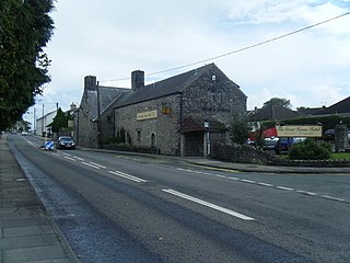
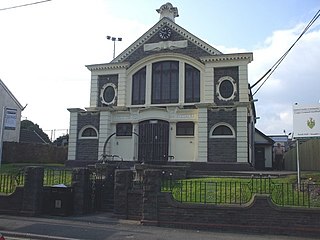
Laleston is a village and a community in Bridgend County Borough, south Wales, directly west of Bridgend town centre. The village takes its name from the Norman Lageles family who settled in the area. Buildings of note in the village include St David's Church, which still possesses features dating back to the 13th and 14th centuries, the Great House which was built in the early 16th century and Horeb Welsh Presbyterian Church (1831).
St Bride's Minor is a community in Bridgend County Borough, south Wales. Located north of Bridgend town it is made up of Sarn, a large housing estate, and the villages of Bryncethin and Abergarw. The southern border of the community is defined by the M4 motorway, though the community stretches briefly beyond the Motorway to take in the McArthurGlen Designer Outlet. The eastern, and largest area of the community consists of farmland and small scattered farm houses. At the 2001 census, the community's population was 5,575, increasing to 6,014 at the 2011 Census.
Newcastle Higher is a community in Bridgend County Borough, south Wales. Located north west of Bridgend town centre it is made up of the townships of Pen-y-fai and Aberkenfig and straddles the M4 motorway. The community is home to several notable buildings, including the Pen-y-fai Hospital, Court Coleman and All Saints Church.

St Brides Major is a community on the western edge of the Vale of Glamorgan, South Wales. Its largest settlement is the village of St Brides Major, and also includes the villages of Ogmore-by-Sea and Southerndown, and the hamlets of Ogmore Village, Castle-upon-Alun, Heol-y-Mynydd, Norton and Pont-yr-Brown It is notable for coastal geology and scenery, limestone downlands and fossilised primitive mammals, sea cliffs and beaches, two Iron Age hillforts, three medieval castle sites,, two stepping stone river crossings and a clapper bridge. Three long distance paths cross the community. It is the western limit of the Vale of Glamorgan Heritage Coast, and has a visitor centre and tourist facilities.
The first election to the Bridgend County Borough Council was held on 4 May 1995. It was followed by the 1999 election. On the same day there were elections to the other 21 local authorities in Wales and community councils in Wales.

Llantwit Major is the name of an electoral ward in the Vale of Glamorgan, Wales. It covers its namesake town of Llantwit Major and neighbouring village of Llanmaes. The ward elects four county councillors to the Vale of Glamorgan Council.

Llandow, is the name of an electoral ward in the west of the Vale of Glamorgan, Wales. It covers its namesake community of Llandow as well as the neighbouring communities of Colwinston and Llangan. Since 1995 the ward has elected a county councillor to the Vale of Glamorgan Council.
Oldcastle is an area and electoral ward of the town of Bridgend, Wales, to the south of the town centre. The ward elects councillors to Bridgend Town Council and Bridgend County Borough Council.
The 1995 Vale of Glamorgan Council election was held on 4 May 1995 to the new Vale of Glamorgan Council unitary authority in Vale of Glamorgan, Wales. It took place on the same day as other council elections in Wales and England. These were the first elections since the re-organization of local government in Wales.