Standon, Staffordshire

Last updated

Standon
Standon (Staffs) All Saints Church - geograph.org.uk - 69760.jpg
Staffordshire UK location map.svg
Red pog.svg
Standon
Location within Staffordshire
Population879 (2011)
OS grid reference SJ8140334997
Civil parish
  • Standon
District
Shire county
Region
Country England
Sovereign state United Kingdom
Post town Stafford
Postcode district ST21
Dialling code 01782
Police Staffordshire
Fire Staffordshire
Ambulance West Midlands
UK Parliament
List of places
UK
England
Staffordshire
52°54′43″N2°16′37″W / 52.912°N 2.277°W / 52.912; -2.277

Standon is a village and civil parish in the Stafford district, in the county of Staffordshire, England. Standon has a church called Church of All Saints and one school called All Saints C of E First School. [1] In 2001 the population of the civil parish of Standon was 823, and in the 2011 census it had a population of 879. [2] [3]

Contents

History

Standon in Old English has a particular meaning which, when broken down means 'Stone Hill'. The elements in Old English are 'stān' which means a stone rock and 'dūn' which means a hill. [4]

Dated to 1086, the Church of All Saints has been listed as a Grade One building. It was rebuilt in 1847, except the middle aisle and the tower. [5] It has since been restored three times, with extensive work happening to the roof. [6] The Church is a part of a benefice of churches, which is formed of four church parishes of Staffordshire villages. These four parishes are Cotes Heath, Swynnerton with Yarnfield, Standon and Tittensor, and these create the united family of 'The CoSST Churches'. The parishes are small Church of England parishes located 10 miles from the city of Stoke-on-Trent, in the Lichfield Diocese. [7]

According to the Domesday Book from 1086, Standon had nine households which is considered quite small, with 11 villagers, three smallholders, three slaves and one priest. The Lord of Standon in 1086 was Brian of Rauceby and the recorded Tenant-in-Chief was Robert of Stafford. In 1086 there were six ploughlands, of which one was owned by the Lord of Standon and five were for men's plough teams. Prior to the Domesday Book, the Lord of Standon was recorded to be Siward in 1066. [8]

John Marius Wilson described Standon in the Imperial Gazetteer of England and Wales as

" STANDON, a parish, with a village, in Stone district, Stafford; on the Northwestern railway, 4 miles NNW of Eccleshall. It has a r[ailway]. station, called Standon-Bridge, and a post-office under Eccleshall." [9]

In 1885, The Standon Home was established as the only second boy's home in the Waifs and Strays' Society. Miss Maria Anderdon laid the foundation stone after she donated £2,000 to the new home. It initially housed 50 boys but after building work in 1892, numbers increased to 90, having built a new kitchen, a scullery and a large dormitory. The home was a purpose built farm and was well equipped to train boys in agricultural skills, with much of their produce sold at local markets along with a regular stall kept at Stoke-on-Trent. They cultivated over 50 acres of land which was leased from Thomas Salt MP. The Home closed in 1947. [10]

Standon Hall, which was built circa 1910, to the design of Liverpool architect J. Francis Doyle, is a manor house located in Standon. The Hall was formerly owned and built for Sir Thomas Anderton Salt, a director of the North Staffordshire Railway company, but its use as a family home was short-lived, it being sold to Staffordshire County Council in 1925 for hospital use. In the 1930s pavilions for tuberculosis patients were built in the grounds whilst the principal activity at the site was orthopaedic treatment. Upon the opening of Stafford General Hospital in 1983, the NHS sold the property into the private sector and the manor house itself converted into a residential care home for up to 22 elderly ladies and gentlemen, with the outbuildings, by now known as "The Beeches", specialising in dementia care for an additional 21 elderly residents. [11]

Standon was affected by boundary changes in the expansion of the neighbouring town of Eccleshall. On 1 April 1932, Standon's area was reduced by 439 acres which became part of Eccleshall. [12]

The 1931 Census of England and Wales, County Report Part II described the boundary change as

" Areas altered between 26th April, 1931 and 30th June, 1934, showing constitution as at the latter date, in terms of constitution as at the former date, together with particulars of acreage and population". [13]

Demographics

Total Population of Standon Civil Parish, Staffordshire, as reported by the Census of Population from 1801 to 2011. 1801-2011, Standon population time series.jpg
Total Population of Standon Civil Parish, Staffordshire, as reported by the Census of Population from 1801 to 2011.

The population of Standon saw little fluctuation between 1801 and 1931, with the lowest being 332 in 1801 and the highest being 464 in 1921. [14] However, after 1931, there was a dramatic increase in population size even with the boundary change in 1932, meaning that the area of Standon decreased by 439 acres. The population in Standon in 1931 was 428 but increased exponentially to 879 in 2011. [15]

Occupations for Standon Civil Parish, as reported by the 1881 Census. Occupations for Standon from the 1881 Census..jpg
Occupations for Standon Civil Parish, as reported by the 1881 Census.

Since the 1881 census report, Standon has seen a shift in occupational employment in the 2011 census report. The 2011 census report shows that the most common profession is Human Health and Social Work with 78 persons employed in this field. In comparison, the 1881 census states the most common profession was agriculture with 31 persons employed in this field. [16] In comparison, modern day Standon only has 35 persons employed in agriculture.

Occupations for Standon Civil Parish, as reported by the 2011 Census. Occupations for Standon from the 2011 Census.jpg
Occupations for Standon Civil Parish, as reported by the 2011 Census.

It is clearly shown that of the 451 residents in Standon between the ages of 16 and 74 who are in employment it can be seen that occupations in 2011 are more diverse than in 1881. In 1881 occupations were more labour-intensive in agriculture, dress-making and conveyance of goods. In 2011, occupations such as Human Health And Social Work and Wholesale and Retail Trade are on the rise, however agriculture and construction are still some of the main occupations in Standon. [17]

Present Day

All Saints C of E First School is the only school located in Standon. It provides education to boys and girls from the ages of five to nine. The school's capacity is 60 children and its religious character is Church of England. [18] For secondary schools, the nearest to Standon are in Stoke-on-Trent and Stone.

The nearest operating railway station to Standon is Stone, followed by Stafford. There is limited road access, with the nearest major road being the A519 which runs through the neighbouring village of Cotes Heath.

From the last census in 2011, it was recorded that there were 332 dwellings in Standon of which the most common are the detached properties, with 180 in the parish. [19] The censuses from 1831 to 1961 show an overall increase in dwellings. However between the years of 1851 and 1921 there was a decrease in the number of dwellings, but then the number increased to 115 in 1961. [20]

See also

Related Research Articles

<span class="mw-page-title-main">Beeston, Cheshire</span> Village and civil parish in England

Beeston is a village and civil parish in the unitary authority of Cheshire West and Chester, which itself is in the ceremonial county of Cheshire in the north of England. It is located approximately 10 km south-east of Chester, and approximately 3.5 km south-west of Tarporley, close to the Shropshire Union Canal. According to the 2011 census, Beeston had a population of 188.

<span class="mw-page-title-main">Rickinghall Inferior</span> Human settlement in England

Rickinghall Inferior is a civil parish in the Mid Suffolk district of Suffolk, England. According to the 2011 census there were 233 males and 216 females in this civil parish, for a total population of 449. It includes the western part of the village of Rickinghall and is adjacent to the village and parish of Wattisfield. The old road from the market town of Bury. St Edmunds to the City of Norwich and the town of Great Yarmouth passes through the centre of the village but the new road, the A143, uses a by-pass to the East.

<span class="mw-page-title-main">Slawston</span> Human settlement in England

Slawston is a village and civil parish in the Harborough district of Leicestershire, England, north-east of Market Harborough. According to the 2001 census the parish had a population of 143, including Welham and increasing to 191 at the 2011 census. The parish includes the deserted village of Othorpe at grid reference SP770956. Slawston is located roughly 1 km away from Medbourne.

<span class="mw-page-title-main">Stanton under Bardon</span> Human settlement in England

Stanton-under-Bardon is a village and civil parish about 4 miles (6.4 km) southeast of Coalville, Leicestershire, England. The 2011 Census recorded the parish's population as 634.

<span class="mw-page-title-main">Swynnerton</span> Human settlement in England

Swynnerton is a village and civil parish in Staffordshire, England. It lies in the Borough of Stafford, and at the 2001 census had a population of 4,233, increasing to 4,453 at the 2011 Census.

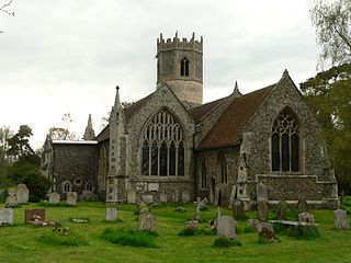
Carburton or Carberton is a small village on the west side of Clumber within the Bassetlaw district of Nottinghamshire, England. It is primarily rural and residential. The church of Saint Giles is an unusual shape and dates back to the early 12th century, parish records date back to the 1530s

<span class="mw-page-title-main">Gayton, Staffordshire</span> Human settlement in England

Gayton is a small rural village and civil parish in Staffordshire, located approximately 1 mile from the A51 between Stone and Stafford. In 2001 it had 167 residents, with 1 letter box, one bus stop, and new village hall. The post box is owned now by the village as is the telephone booth. The post code for Gayton properties normally start with ST18.

<span class="mw-page-title-main">Kexby, Lincolnshire</span> Village in Lincolnshire, England

Kexby is a small village and civil parish in the West Lindsey district of Lincolnshire, England. The population of the civil parish at the 2011 census was 340. It lies at the side of the B1241 road, and is situated 4 miles (6 km) south-east of Gainsborough and 11 miles (18 km) north-west of the city and county town of Lincoln.

<span class="mw-page-title-main">Thurlaston, Leicestershire</span> Human settlement in England

Thurlaston is a village and civil parish in Leicestershire, England. It is in the Blaby local government district, just over 6 miles (9.7 km) west of the City of Leicester. The 2001 census stated that the parish had a population of 745, The 2011 census gave the population as 807.

<span class="mw-page-title-main">Whitgreave</span> Human settlement in England

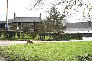
Whitgreave is a very small village a few miles to the NNW of Stafford situated midway between the M6 motorway to the west and the A34 trunk road to the east.

<span class="mw-page-title-main">Norton le Moors</span> Human settlement in England

Norton le Moors is in the north-east of the city of Stoke-On-Trent, Staffordshire, England, mostly within the city boundary, with the rest in the Staffordshire Moorlands district.

<span class="mw-page-title-main">Fakenham Magna</span> Human settlement in England

Fakenham Magna is a village and civil parish in the West Suffolk district of Suffolk in eastern England. The meaning of the word 'Fakenham' can be split into two: 'Faken' and 'ham', both of which derive from Old English. The former refers to somebody by the name of 'Facca', with the latter meaning 'a village / a homestead', making the direct translation 'Facca's homestead'. 'Magna' translates from Latin as 'great', hence the alternative name of the village of 'Great Fakenham'. During World War Two, however, the village was referred to as 'Little Fakenham', which was used to avoid confusion with the larger civil parish of Fakenham in Norfolk.

<span class="mw-page-title-main">Westley, Suffolk</span> Human settlement in England

Westley is a village and civil parish in the West Suffolk district of Suffolk in eastern England. It is located south of Junction 42 of the A14 providing primary access to adjacent market towns Bury St Edmunds (East) and Newmarket (West). The village consists of two central roads: Fornham Lane and Hill Road running north and south through the parish, with adjoining roads accommodating Westley's total population of 183.

<span class="mw-page-title-main">Stansfield</span> Human settlement in England

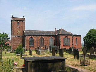
Stansfield is a village and civil parish in the West Suffolk district of Suffolk in eastern England. Located seven miles south-west of Bury St Edmunds, in 2011 its population was 221. The village has an Anglican church dedicated to All Saints. In 1870, John Marius Wilson's Imperial Gazetteer of England and Wales described Stansfield as

<span class="mw-page-title-main">Ousden</span> Human settlement in England

Ousden is a village and civil parish in the West Suffolk district of Suffolk in eastern England. It is located around six miles west of Bury St Edmunds and 72 miles north of London, and as of 2011, its population is 266. The village has an Anglican church of St Peter's and a chapel in the cemetery dedicated to St Barnabas.

<span class="mw-page-title-main">Newborough, Staffordshire</span> Human settlement in England

Newborough is a village and civil parish in the county of Staffordshire, England. It is located 3 miles (5 km) south west of Hanbury and 8 miles (13 km) west of Burton-upon-Trent. Newborough has a pub, a school and a church. At the 2011 UK census, the population stood at 476, comprising 240 males and 236 females. Newborough is part of the Yoxall ward of East Staffordshire.

<span class="mw-page-title-main">Millington, Cheshire</span> Human settlement in England

Millington is a former civil parish, now in the parishes of Millington and Rostherne and Little Bollington with Agden, in the Cheshire East district, in the ceremonial county of Cheshire, England. The parish was 8 miles (13 km) from Warrington and 3 miles (5 km) from Altrincham. Its name is a "relic of Saxon clanship – the ton or town of the Millings". The parish is primarily agricultural, with a number of farms including Moss House Farm, Newhall Farm, Mereside Farm, Boothbank Farm and Stonedelph Farm. Millington has been recently described on Britain Streets as a "hamlet or isolated settlement in the inhabited countryside". Millington is situated within the market town Macclesfield. The M56 motorway was close to the parish, which allows travel into areas of Warrington and Manchester, 13 miles (21 km) and 14 miles (23 km) away respectively. In 2011 the parish had a population of 234.

<span class="mw-page-title-main">Culmington</span> Human settlement in England

Culmington is a village and civil parish in south Shropshire, England, about 3+12 miles (5.6 km) east of Craven Arms and 4+12 miles (7 km) north of Ludlow. The village is about 330 feet (100 m) above sea level, beside the River Corve, just east of the B4365 road. The 2011 Census recorded the parish population as 423.

<span class="mw-page-title-main">Swilland</span> Human settlement in England

Swilland is a village and civil parish, in the East Suffolk district, in the English county of Suffolk. It is north of the large town of Ipswich. Swilland has a church called St Mary's Church and a pub called The Moon & Mushroom Inn which has been awarded Suffolk Pub of The Year on two occasions by the Evening Star. Swilland shares a parish council with Witnesham called "Swilland and Witnesham Grouped Parish Council".

<span class="mw-page-title-main">Poughill, Devon</span> Village in Devon, England

Poughill is a village and civil parish in Devon, England. It lies 5 miles (8 km) north of Crediton. In 2011, the parish had a population of 216.

References

  1. "All Saints, Mill Lane". English Heritage. Retrieved 26 April 2014.
  2. "Standon (Parish): Key Figures for 2011 Census: Key Statistics". Neighbourhood Statistics. Office for National Statistics. 5 February 2014.
  3. "Standon (Parish): Parish Headcounts, 2001". Neighbourhood Statistics. Office for National Statistics. Retrieved 26 April 2014.
  4. "Standon: Place Name Meaning". Key to English Place-names. The University of Nottingham. Retrieved 25 February 2014.
  5. White, William (1851). History, The Gazetteer and Directory of Staffordshire. Sheffield.{{cite book}}: CS1 maint: location missing publisher (link)
  6. "Standon All Saints, Standon". The Church of England. Retrieved 25 February 2014.
  7. "Standon: The CoSST Churches". The CoSST Churches. Retrieved 25 February 2014.
  8. "The Domesday Book". Open Domesday. Anna Powell-Smith, Professor J.J.N. Palmer. Retrieved 17 March 2014.
  9. Wilson, John Marius (1870–1872). Gazetteer of England and Wales (1st ed.). Edinburgh: A. Fullarton & Co. Retrieved 5 February 2014.
  10. "Standon Farm Home for Boys". Hidden Lives Revealed, A Virtual Archive- Children in Care 1881-1981. Retrieved 27 March 2014.
  11. "Standon Hall Care Home". Caring Homes. Retrieved 4 March 2014.
  12. "Standon CP/AP, Census tables with data for the Parish-level Unit". A Vision of Britain through Time. GB Historical GIS. Retrieved 26 March 2014.
  13. "1932 Boundary Changes". 1931 Census of England and Wales, County Report Part II. The Staffordshire (North Western Areas). Retrieved 26 March 2014.
  14. "Standon CP/AP, Population Statistics: Total Population". A Vision of Britain through Time. GB Historical GIS. Retrieved 27 March 2014.
  15. "Key Figures for 2011 Census: Key Statistics". Neighbourhood Statistics. Office for National Statistics. Retrieved 27 March 2014.
  16. "Standon CP/AP: 1881 Census of England and Wales, Tables: Ages, Condition as to Marriage, Occupations and Birthplaces of people, Table 10: " Occupations of Males and Females in the Division and its Registration Counties". A Vision of Britain through Time. 1881 Census of England and Wales. Retrieved 27 March 2014.
  17. "Standon (Parish): Industry 2011". Neighbourhood Statistics. Office for National Statistics. Retrieved 17 March 2014.
  18. "Inspection Reports: All Saints C of E First School". Ofsted. Retrieved 24 March 2014.
  19. "Standon (Parish): 2011 Key Statistics, Dwellings, Household Spaces and Accommodation Type". Neighbourhood Statistics. Office for National Statistics. Retrieved 27 March 2014.
  20. "GB Historical GIS / University of Portsmouth, Standon CP/AP through time | Housing Statistics | Total Houses, A Vision of Britain through Time". A Vision of Britain Through Time. Retrieved 27 March 2014.