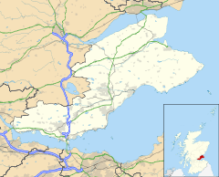
Fife is a council area, historic county, registration county and lieutenancy area of Scotland. It is situated between the Firth of Tay and the Firth of Forth, with inland boundaries with Perth and Kinross and Clackmannanshire. By custom it is widely held to have been one of the major Pictish kingdoms, known as Fib, and is still commonly known as the Kingdom of Fife within Scotland. A person from Fife is known as a Fifer. In older documents the county was very occasionally known by the anglicisation Fifeshire.

Dunfermline is a city, parish and former Royal Burgh, in Fife, Scotland, on high ground 3 miles (5 km) from the northern shore of the Firth of Forth. The city currently has an estimated population of 58,508. According to the National Records of Scotland, the Greater Dunfermline area has a population of 76,210.
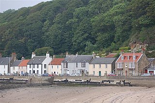
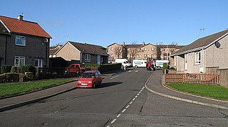
Limekilns is a village in Fife, Scotland. It lies on the shore of the Firth of Forth, around 3 miles (5 km) south of Dunfermline.

Dunfermline and West Fife is a county constituency represented in the House of Commons of the Parliament of the United Kingdom. It was created for the 2005 general election from all of the old Dunfermline West and parts of the old Dunfermline East constituencies. The current MP is Douglas Chapman of the Scottish National Party (SNP).
Crossford is a splendid village in West Fife, Scotland. It is 1 mile west of Dunfermline, east of Cairneyhill, astride the A994, at 56°03′51″N03°29′47″W.
Winchburgh is a village in the council area of West Lothian, Scotland. It is located approximately 10 miles (16 km) west of the city-centre of Edinburgh, 6 miles (9.7 km) east of Linlithgow and 3 miles (4.8 km) northeast of Broxburn.

Valleyfield consists of High Valleyfield and Low Valleyfield which are neighbouring villages in Fife, Scotland, midway between Dunfermline and Kincardine-on-Forth. Low Valleyfield is on the shore of the Firth of Forth, High Valleyfield on the ridge immediately to the north.
Saline is a village and parish in Fife, Scotland, situated 5 miles (8.0 km) to the north-west of Dunfermline. It lies in an elevated position on the western slopes of the Cleish Hills.

Townhill is a small village that lies just north of Dunfermline, Fife, Scotland. The origin of the community is thought to be from the coal-mining industry. There is a Church of Scotland parish church, which shares a minister with nearby Kingseat.
Steelend Victoria Football Club were a Scottish football club. Members of the Scottish Junior Football Association, the club were historically based at Woodside Park in the village of Steelend by Saline, Fife before being dissolved in 2013.
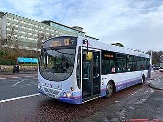
First South East & Central Scotland, formerly known as First Scotland East, was an operator of both local and regional bus services in Clackmannanshire, East Dunbartonshire, Falkirk, Fife, Midlothian, North Lanarkshire, Stirling and West Lothian, as well as the cities of Edinburgh and Glasgow, Scotland. It was a subsidiary of FirstGroup, which operates bus, rail and tram services across the United Kingdom and Ireland.

Thornton is a village in Fife, Scotland. It is between Kirkcaldy and Glenrothes, and stands between the River Ore and Lochty Burn, which are at opposite ends of the main street. The Church of Scotland parish church was built in 1835 and is located on the Main Street.

Oakley is a village in Fife, Scotland located at the mutual border of Carnock and Culross parishes, Fife, 5+1⁄2 miles west of Dunfermline on the A907.

Ballingry ; Scots: Ballingry, Bingry, Scottish Gaelic: Baile Iongrach) is a small town in Fife, Scotland. It is near the boundary with Perth and Kinross, north of Lochgelly. It has an estimated population (2016) of 5,940. The once separate villages of Ballingry, Lochore, Crosshill, and Glencraig are now somewhat joined together as the part of the Benarty area. Ballingry, along with its neighbour Lochgelly, is one of Fife's 'regeneration areas' and is classed as in need of regeneration economically and socially.

Victoria Hospital is a large hospital situated to the north of the town centre in Kirkcaldy, in Fife, Scotland. As one of two main hospitals in Fife, this serves both the town and surrounding Mid-Fife area. It is managed by NHS Fife.

Blairhall is a village in West Fife, Scotland. It is situated 1.1 miles (1.77 km) west of Comrie, and 6.7 miles (10.783 km) west of Dunfermline. The village was originally a small hamlet but was expanded in 1911 to house the miners from a nearby colliery. Today Blairhall has a primary school and a community leisure centre. The village has a population of around 1000 people.
Wellwood is a small village to the north of Dunfermline, Fife, Scotland. It was named after the Wellwoods who used to own coalmines in the area. It has a leisure centre and a golf course (Canmore). It is nearby the Town Loch and also is partially bordered by Queen Anne High School. It was formerly known as Hawkiesfauld.
Carnock is a village and parish of Fife, Scotland, 4+1⁄4 miles west of Dunfermline. It is 1+1⁄4 miles east of Oakley, Fife. The name of the village derives from Scottish Gaelic, from ceàrn ("corner"), with a suffix denoting a toponym, thus giving "[the] corner place". Carnock is known to have had military significance in antiquity. The civil parish had a population of 5,927 as of 2011.

Abbeyview is a housing estate in the town of Dunfermline in Fife, Scotland. It is situated in the east of the town, approximately 2 miles from the town centre. Most of the streets in the area are named after Scottish rivers and islands.
Several mineral railways were constructed around Dunfermline in western Fife, Scotland, in the eighteenth century and later. Their purpose was to convey minerals to market from the outcropping coal deposits that had encouraged industrial activity in the area from an early date.