Stickney, Lincolnshire

Last updated

Stickney
St.Luke's church, Stickney, Lincs. - geograph.org.uk - 163868.jpg
St Luke's Church, Stickney
Lincolnshire UK location map.svg
Red pog.svg
Stickney
Location within Lincolnshire
Population1,127 (2011)
OS grid reference TF343566
  London 110 mi (180 km)  S
District
Shire county
Region
Country England
Sovereign state United Kingdom
Post town BOSTON
Postcode district PE22
Dialling code 01205
Police Lincolnshire
Fire Lincolnshire
Ambulance East Midlands
UK Parliament
List of places
UK
England
Lincolnshire
53°5′24.64″N0°0′18.21″E / 53.0901778°N 0.0050583°E / 53.0901778; 0.0050583

Stickney is a linear village and civil parish in the East Lindsey district of Lincolnshire, England. It was an ancient parish in Lincoln County. Its population has increased since late 20th-century immigration and is 1127 as of 2011. [1]

Contents

Governance

An electoral ward in the same name exists. This ward stretches east to Eastville with a total population taken at the 2011 census of 2,357. [2]

Location and transport

Stickney is situated at the centre of the Lincolnshire Fens, 8 miles (13 km) north of Boston and 10 miles (16 km) south-east of Horncastle. The A16 road runs through it. The village postal address is Boston, although Stickney is not situated within Boston Borough.

The village is on a main bus route between Spilsby and Boston, which runs along the A16. It used to be served by an east–west railway line, but this closed in 1970. A transmitting station is located near Stickney Camp Site to the north.

History

The place-name 'Stickney' is first attested in the Domesday Book of 1086, where it appears as Stichenai. The name means 'stick island', and is thought to refer to the linear shape of the village between two streams. The nearby Stickford similarly means 'stick ford'. [3]

Stickney has been chiefly an agricultural community. The ancient 13th-century Anglican parish church is dedicated to Saint Luke and is a Grade II listed building. [4] The parish dates to 1564 . [4] A new chancel was built in 1853 and the rest of the church was restored in 1855. The tower was partly taken down in 1887 because of deterioration, but rebuilt in 1900. [4]

Donations to the poor house and for care of the poor have been recorded since 1552 when William Hardy left a yearly rent charge of £1 6s. 8d. for the poor of the parish. [5]

Stickney Church of England Primary School serves local children. Some progress to regional grammar schools, and others to the William Lovell Church of England Academy, the former William Lovell Secondary School, on Main Road. Lovell had established a free school in the parish in 1678. After the school was enlarged in 1879, pupils began paying an annual fee of £1 in 1881. [5]

Local amenities have included a public house, the Rose and Crown House on the main road, which operated for about 100 years. As of 2012 it had closed and was for sale. [5] The village had a miniature railway which has now moved locations and a fish and chips shop. A local shop, which does not serve as a post office.

Stickney publishes a monthly Stickney Parish Magazine. The Stickney War Memorial is dedicated to men from the village killed during World War I; their names are listed on the memorial. A photo of the memorial is shown at Genweb. [5]

Notable people

Stickney was the home of Priscilla Biggadike, who in 1868 was charged and convicted of murdering her husband Richard by arsenic poisoning. They lived in a small two-room house with their five children and two lodgers. She testified that she had seen one of their lodgers, Thomas Proctor, putting a white powder into her husband's tea, and later into his medicine when Richard was being treated for a sudden attack of severe illness.

At first, the two were both suspects, as they were rumoured to be having an affair. The judge in the case ruled that only Priscilla Biggadike should be prosecuted, and the jury quickly convicted her. She was executed in December 1868. Years later on his deathbed, Proctor confessed to sole responsibility for the murder of Richard Biggadike.

The French poet Paul Verlaine taught French and drawing for several months in 1875 at William Lovell's School before moving to Boston. [6]

British missionary Mary Jane Lovell was born in Stickney in 1848. [7]

Related Research Articles

<span class="mw-page-title-main">North Thoresby</span> Village and civil parish in the East Lindsey district of Lincolnshire, England

North Thoresby is a village and civil parish in the East Lindsey district of Lincolnshire, England. It is situated between Louth and Grimsby, approximately 7.5 miles (12 km) from each. and has a village population of 1,068 (2011) Some 50.5% of the population is older than 60 years.

<span class="mw-page-title-main">Spalding, Lincolnshire</span> Market town in Lincolnshire, England

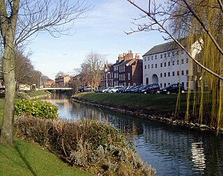
Spalding is a market town on the River Welland in the South Holland district of Lincolnshire, England. The town had a population of 34,113 at the 2017 census. The town is the administrative centre of the South Holland District. The town is located between the cities of Peterborough and Lincoln, as well as the towns of Bourne, Market Deeping, March, Boston, Wisbech, Holbeach and Sleaford.

<span class="mw-page-title-main">Alford, Lincolnshire</span> Town in East Lindsey district of Lincolnshire, England

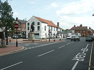
Alford is a town in the East Lindsey district of Lincolnshire, England, at the foot of the Lincolnshire Wolds, which form an Area of Outstanding Natural Beauty. The population was recorded as 3,459 in the 2011 Census and estimated at 3,830 in 2021. It lies between the towns of Mablethorpe, Louth, Spilsby, and Skegness and acts as a local retail centre.

<span class="mw-page-title-main">Spilsby</span> Market town and civil parish in Lincolnshire, England

Spilsby is a market town and civil parish in the East Lindsey district of Lincolnshire, England. The town is adjacent to the main A16, 33 miles (53 km) east of Lincoln, 17 miles (27 km) north-east of Boston and 13 miles (21 km) north-west of Skegness. It lies at the southern edge of the Lincolnshire Wolds and north of the Fenlands.

<span class="mw-page-title-main">Frampton, Lincolnshire</span> Village and civil parish in the Borough of Boston, Lincolnshire, England

Frampton is a village and civil parish in the Borough of Boston, Lincolnshire, England. The village is situated approximately 3 miles (5 km) south from the town of Boston and to the east of the A16, which runs along the townlands. The village lies on the edge of one of the great marine creek levees formed during the Bronze Age, 2 to 2.5 miles from the modern salt marsh. The population of the civil parish at the 2011 census was 1,299.

<span class="mw-page-title-main">Algarkirk</span> Village and civil parish in the Borough of Boston in Lincolnshire, England

Algarkirk is a village and civil parish in the Borough of Boston in Lincolnshire, England. It is situated 6 miles (9.7 km) south-south-west from Boston and near the A16 road. It has a population of 406, falling to 386 at the 2011 census. An alternative village spelling is 'Algakirk'.

<span class="mw-page-title-main">Wyberton</span> Village in Lincolnshire, England

Wyberton is a village in Lincolnshire, England. It lies just south-west of Boston, and on the B1397 – the former A16 London Road – between Boston and Kirton. The A16 bisects the village. The population of the civil parish at the 2011 census was 3,747.

<span class="mw-page-title-main">Sutterton</span> Village and civil parish in Lincolnshire, England

Sutterton is a village and civil parish in the Borough of Boston in Lincolnshire, England. The population of the parish at the 2011 census was 1,585.

<span class="mw-page-title-main">Kirton, Lincolnshire</span> English village in the Borough of Boston, Lincolnshire, England

Kirton or Kirton in Holland is an English village and civil parish in the Borough of Boston, Lincolnshire. The population of the civil parish at the 2011 census was 5,371.

<span class="mw-page-title-main">Fosdyke</span> Village and civil parish in the Borough of Boston, Lincolnshire, England

Fosdyke is a village and civil parish in the Borough of Boston, Lincolnshire, England. The population of the civil parish at the 2011 census was 480. It is situated approximately 7 miles (11 km) south from Boston, just off the A17, and 2 miles (3.2 km) east from the junction of the A17 with the A16.

<span class="mw-page-title-main">New Waltham</span> Village and civil parish in North East Lincolnshire, England

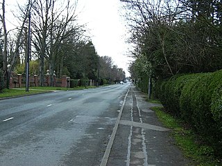
New Waltham is a village and civil parish in North East Lincolnshire, England. It is situated just south of Grimsby and Cleethorpes, close to the A16, and between the villages of Waltham and Humberston.

<span class="mw-page-title-main">Donington, Lincolnshire</span> Large village and civil parish in the South Holland district of Lincolnshire, England

Donington is a large village and civil parish in the South Holland district of Lincolnshire, England. It is 8 miles (13 km) north from the market town of Spalding on the A152, is bypassed by the A52, and sits between the A16 and A17. The parish includes the hamlet of Northorpe, and falls within the drainage area of the Black Sluice Internal Drainage Board. Donington is the birthplace of the explorer Matthew Flinders.

<span class="mw-page-title-main">Gosberton</span> Village and civil parish in Lincolnshire, England

Gosberton is a village and civil parish in the South Holland district of Lincolnshire, England. It is situated 9 miles (14.5 km) south-west of Boston, 6 miles (10 km) north of Spalding and 9 miles (14 km) north-west of Holbeach. The parish includes the villages of Gosberton Clough and Risegate, and the hamlets of Westhorpe and Gosberton Cheal. The population of Gosberton, which was approximately 2,500, increased to 2,958 at the 2011 Census.

<span class="mw-page-title-main">Sibsey</span> Village, civil parish and electoral ward in the East Lindsey district of Lincolnshire, England

Sibsey is a village, civil parish and electoral ward in the East Lindsey district of Lincolnshire, England. It is situated at the junction of the A16 and B1184 roads, 4 miles (6.4 km) north from Boston. Sibsey Northlands is to the north of the village. The Prime Meridian passes just to the west of Sibsey, crossing the Stone Bridge Drain canal. At the 2001 census, Sibsey had a population of 1,996, reducing to 1,979 at the 2011 Census.

<span class="mw-page-title-main">Keal Cotes</span> Small linear village in East Lindsey district of Lincolnshire, England

Keal Cotes, forming part of West Keal parish, is a small linear village in East Lindsey district of Lincolnshire, England. It is situated on the A16 road, 1 mile (1.6 km) south from West Keal and 1 mile north from Stickford. The nearest market town is Spilsby, about 6 miles (10 km) to the north. Keal Cotes market day is on Mondays.

<span class="mw-page-title-main">Withern</span> Village in Lincolnshire, England

Withern is a village in the civil parish of Withern with Stain, in the East Lindsey district of Lincolnshire, England. It is situated on the A157 road, and 7 miles (11 km) south-east from Louth. Stain was once an independent parish but was combined with Withern when the old church of St John the Baptist was destroyed some centuries ago.

<span class="mw-page-title-main">Stickford</span> Village and civil parish in the East Lindsey district of Lincolnshire, England

Stickford is a village and civil parish in the East Lindsey district of Lincolnshire, England. The village is situated near the A16 road and approximately 6 miles (10 km) south-west from the town of Spilsby.

<span class="mw-page-title-main">New Leake</span> Village and civil parish in the East Lindsey district of Lincolnshire, England

New Leake is a village and civil parish in the East Lindsey district of Lincolnshire, England. The population of the civil parish at the 2011 census was 323. It is situated 9 miles (14 km) north from Boston, and 10 miles (16 km) east from Coningsby.

<span class="mw-page-title-main">Fotherby</span> Village and civil parish in the East Lindsey district of Lincolnshire, England

Fotherby is a village and civil parish in the East Lindsey district of Lincolnshire, England. It is situated just east from the A16 road, 13 miles (21 km) east from Market Rasen, and 10 miles (16 km) south from Cleethorpes.

William Lovell Church of England Academy is a coeducational Church of England secondary school with academy status, located in Stickney in the English county of Lincolnshire.

References

  1. "Parish population 2011" . Retrieved 22 August 2015.
  2. "Ward population 2011" . Retrieved 22 August 2015.
  3. Eilert Ekwall, The Concise Oxford Dictionary of English Place-names, p.442.
  4. 1 2 3 "St. Luke's Church, Stickney", Explore Lincolnshire, accessed 6 August 2014
  5. 1 2 3 4 "Stickney", Lincolnshire GenWeb, Rootsweb, accessed 6 August 2014
  6. J.J. Lévêque, Paul Verlaine, le poète orageux: 1844-1896 (Paris, 1996), p.190; D. Stouck, Ethel Wilson: A Critical Biography (Toronto,2003), p.94; G.Vannier, Paul Verlaine ou l'enfance de l'art (Paris, 1993), p.153
  7. Dafesh., Adele (January 1933). "Mary Jane Lovell Mother of the Blind in Bible Lands" . The Muslim World. 23 (1): 56–64. doi:10.1111/j.1478-1913.1933.tb00236.x. ISSN   0027-4909.