Lochaber is a name applied to a part of the Scottish Highlands. Historically, it was a provincial lordship consisting of the parishes of Kilmallie and Kilmonivaig, as they were before being reduced in extent by the creation of Quoad Sacra parishes in the 19th century. Lochaber once extended from the Northern shore of Loch Leven, a district called Nether Lochaber, to beyond Spean Bridge and Roybridge, which area is known as Brae Lochaber or Braigh Loch Abar in Gaelic. Lochaber is now also used to refer to a much wider area, one of the 16 ward management areas of the Highland Council of Scotland and one of eight former local government districts of the two-tier Highland region. The main town of Lochaber is Fort William.

Glen Affric is a glen south-west of the village of Cannich in the Highland region of Scotland, some 15 miles west of Loch Ness. The River Affric runs along its length, passing through Loch Affric and Loch Beinn a' Mheadhoin. A minor public road reaches as far as the end of Loch Beinn a' Mheadhoin, but beyond that point only rough tracks and footpaths continue along the glen.

Clan Chisholm is a Highland Scottish clan.

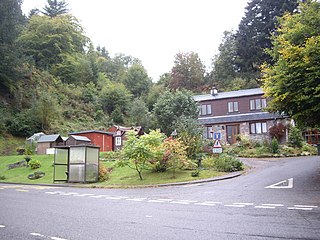
Cannich is a village at the southern end of Strathglass, in the Highlands of Scotland, about 26 miles (42 km) west of the city of Inverness. It is at the furthest point of the A831 that loops around the Aird from Beauly to Drumnadrochit.

Kintail is an area of mountains in the Northwest Highlands of Scotland, located in the Highland Council area. It consists of the mountains to the north of Glen Shiel and the A87 road between the heads of Loch Duich and Loch Cluanie; its boundaries, other than Glen Shiel, are generally taken to be the valleys of Strath Croe and Gleann Gaorsaic to the north and An Caorann Mòr to the east. Although close to the west coast the mountains lie on the main east–west watershed of Scotland, as the northern side of Kintail drains via Glen Affric to the east coast.
Glen Strathfarrar is a glen in the Highland region of Scotland, near Loch Ness.

Glenmoriston or Glen Moriston is a river glen in the Scottish Highlands, that runs from Loch Ness, at the village of Invermoriston, westwards to Loch Cluanie, where it meets with Glen Shiel. The A887 and A87 roads pass through Glenmoriston.
The Affric / Beauly hydro-electric power scheme for the generation of hydro-electric power is located in the western Highlands of Scotland. It is based around Glen Strathfarrar, Glen Cannich and Glen Affric, and Strathglass further downstream.
Crask of Aigas is a small hamlet in the Highland council area of Scotland. It is 4.3 miles (7 km) southwest of Beauly. The scattered hamlet of Aigas lies a short distance to the southwest.
Struy is a small village at the end of Glen Strathfarrar, about 15 km south-west of Beauly in the Highland council area of Scotland.

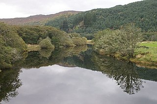
Glen Cannich is a long glen in the Northwest Highlands of Scotland and through which runs the River Cannich. Emerging from the reservoir of Loch Mullardoch, the river flows east to merge with the River Affric at the village of Cannich, their combined waters forming the River Glass.
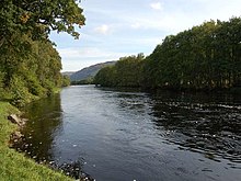
The River Glass is a river in the Scottish Highlands which flows northeastwards down Strathglass. It begins at the confluence of the River Affric and the Abhainn Deabhag, near the village of Tomich. It is joined by the River Cannich near the village of Cannich, then flows as far as a confluence with the River Farrar near Struy, from which point the merged waters are known as the River Beauly.
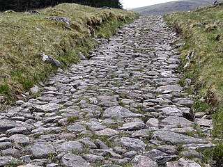
A network of military roads, sometimes called General Wade's Military Roads, was constructed in the Scottish Highlands during the middle part of the 18th century as part of an attempt by the British Government to bring order to a part of the country which had risen up in the Jacobite rebellion of 1715.

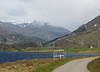
Loch Mullardoch is a major reservoir in Glen Cannich in the Northwest Highlands of Scotland. It was created by the damming in 1951 of the River Cannich just upstream of Mullardoch House, as part of the Affric-Beauly hydro-electric power scheme. A car park at the southern end of the dam is the terminus of the public road up Glen Cannich. The reservoir extends for about 14 km westwards up the glen to the point where the Abhainn a Choilich and Abhainn Sithidh burns drop down from the West Benula deer forest.

Loch Affric is a freshwater loch within Glen Affric, in the Highland council area of Scotland. It lies about 25 miles (40 km) southwest of Beauly. The loch sits in a national nature reserve known for being home to a number of rare species and the loch itself is popular for trout fishing. An annual duathlon is held on the banks of the loch in May and the loch has been widely used as the backdrop in films.

Mullach Fraoch-choire is a 1,102-metre (3,615 ft) mountain – a Munro – in the Northwest Highlands of Scotland on a ridge extending north for 8 kilometres (5.0 mi) between Loch Cluanie in Glenmoriston and upper Glen Affric. It is within the Glen Affric National Scenic Area and Glen Affric National Nature Reserve.

Lurg Mhòr is a remote 986-metre (3,235 ft) mountain, a Munro, in the Northwest Highlands of Scotland at the high point of an east–west range of hills comprising Meall Mor, Lurg Mhòr and Bidein a' Choire Sheasgaich.
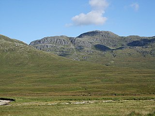
Bidein a' Choire Sheasgaich is a remote mountain in the Northwest Highlands of Scotland. It is a Munro with a height of 945 metres (3,100 ft) and is at the western end of an east–west ridge comprising a Munro Top Meall Mor, and the Munro Lurg Mhòr.
Alexander Cameron S.J. was a Scottish nobleman, servant to Prince Charles Edward Stuart, and Roman Catholic priest in the Society of Jesus. After travelling in Catholic Europe and the Caribbean, Cameron converted from the Non-Juring Anglican Communion to Roman Catholicism and was ordained as a priest. Fr. Cameron ran a highly successful vicariate for the still illegal and underground Catholic Church in Scotland in Lochaber and Strathglass before serving as a military chaplain to the regiment of the Jacobite Army commanded by his brother, Donald Cameron of Lochiel, during the Uprising of 1745.