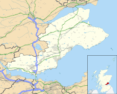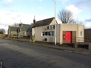
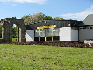
Kinglassie is a small village and parish in central Fife, Scotland. It is located two miles southwest of Glenrothes. It has a population of around 1,900 (mid-2020 est.) The civil parish has a population of 22,543.
Cupar is a town, former royal burgh and parish in Fife, Scotland. It lies between Dundee and Glenrothes. According to a 2011 population estimate, Cupar had a population around 9,000, making it the ninth-largest settlement in Fife, and the civil parish a population of 11,183. It is the historic county town of Fife, although the council now sits at Glenrothes.

Culross (/ˈkurəs/) is a village and former royal burgh, and parish, in Fife, Scotland.

Inverkeithing is a port town and parish, in Fife, Scotland, on the Firth of Forth. A town of ancient origin, Inverkeithing was given royal burgh status during the reign of Malcolm IV in the 12th century. It was an important center of trade during the Middle Ages, and its industrial heritage built on quarrying and ship breaking goes back to the 19th century. In 2016, the town had an estimated population of 4,890, while the civil parish was reported to have a population of 8,090 in 2011.

Selkirkshire or the County of Selkirk is a historic county and registration county of Scotland. It borders Peeblesshire to the west, Midlothian to the north, Roxburghshire to the east, and Dumfriesshire to the south. It derives its name from its county town, the Royal burgh of Selkirk.
Leuchars is a small town and parish near the north-east coast of Fife in Scotland.
Newburgh is a royal burgh and parish in Fife, Scotland, at the south shore of the Firth of Tay. The town has a population of 2,171, which constitutes a 10% increase since 1901 when the population was counted at 1,904 persons.

Coldingham is a village and parish in Berwickshire, Scottish Borders, on Scotland's southeast coastline, north of Eyemouth.

Falkland, previously in the Lands of Kilgour, is a village, parish and former royal burgh in Fife, Scotland, at the foot of the Lomond Hills. According to the 2008 population estimate, it has a population of 1,180.

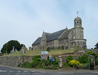
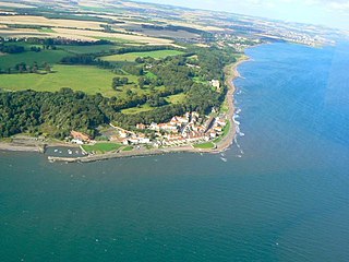
Elie and Earlsferry is a coastal town and former royal burgh in Fife, and parish, Scotland, situated within the East Neuk beside Chapel Ness on the north coast of the Firth of Forth, eight miles east of Leven. The burgh comprised the linked villages of Elie to the east and to the west Earlsferry, which were formally merged in 1930 by the Local Government (Scotland) Act 1929. To the north is the village of Kilconquhar and Kilconquhar Loch.
Danderhall is a village in Midlothian, Scotland, just outside Edinburgh but inside the Edinburgh City Bypass.
Saline is a village and parish in Fife, Scotland, situated 5 miles (8.0 km) to the north-west of Dunfermline. It lies in an elevated position on the western slopes of the Cleish Hills.
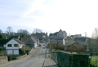
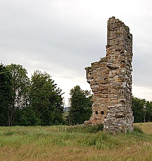
Dairsie, or Osnaburgh, is a village and parish in north-east Fife, Scotland. It is 3 miles (4.8 km) south-southwest of Leuchars Junction, and 3 miles (4.8 km) east-northeast of Cupar on the A91 Stirling to St Andrews road. The village grew out of two smaller settlements, and developed principally around the industry of weaving. Since the late twentieth century it has become a dormitory settlement for nearby towns.
Torryburn is a village and parish in Fife, Scotland, lying on the north shore of the Firth of Forth. It is one of a number of old port communities on this coast and at one point served as port for Dunfermline. It lies in the Bay of Torry in south western Fife.

Dunino is a village and parish in the East Neuk of Fife. It is 10 km from the nearest town, St Andrews, and 8 km from the fishing village of Anstruther. It is a small village with no local shops or services. It had one primary school which was closed down in 2014.

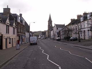
Leslie is a large village and parish on the northern tip of the River Leven Valley, to the west of Glenrothes in Fife. According to the population estimates (2006), the village has a population of 3,092. The village was granted burgh of barony status by James II in 1458 for George Leslie who became the first Earl of Rothes. Later, this was upgraded to a police burgh in 1865.

Carnock is a village and parish of Fife, Scotland, 4+1⁄4 miles west of Dunfermline. It is 1+1⁄4 miles east of Oakley, Fife. The name of the village derives from Scottish Gaelic, from ceàrn ("corner"), with a suffix denoting a toponym, thus giving "[the] corner place". Carnock is known to have had military significance in antiquity. The civil parish had a population of 5,927 as of 2011.
Scoonie is a settlement and parish in Fife, Scotland, the parish contains the town of Leven. It is bordered on the north by the parishes of Kettle and Ceres, on the east by the parish of Largo, on the south by the parishes of Markinch and Wemyss, and on the west by the parishes of Markinch and Kennoway. It extends about 4+1⁄2 miles north to south. Its width varies between 5⁄8 and 2+3⁄4 mi . The parish is on the coast of the Firth of Forth, with a coastline of about 1+1⁄2 mi (2.4 km) The area of the parish is 4,107 acres.

Cameron is a parish in east Fife, Scotland, 3½ miles south-west of St Andrews.
Wemyss is a civil parish on the south coast of Fife, Scotland, lying on the Firth of Forth. It is bounded on the north-east by the parish of Scoonie and the south-west by the parish of Kirkcaldy and Dysart and its length from south-west to north-east is about 6 miles. Inland it is bounded by Markinch and its greatest breadth is 2+1⁄4 miles.