The Battle of Mactan was fought on a beach in Mactan Island between Spanish forces led by the Portuguese explorer Ferdinand Magellan along with local allies, and Lapulapu, the chieftain of the island, on the early morning hours of April 27, 1521. Magellan, a Portuguese-born commander serving the Spanish Empire who led an expedition that ultimately circumnavigated the world for the first time, commanded a small Spanish contingent in an effort to subdue Mactan led by Lapulapu under the Spanish crown. The sheer number of Lapulapu's forces, compounded with issues on the location and armor, ultimately resulted in a disastrous defeat to the Europeans and the death of Magellan. Surviving members of Magellan's crew continued the expedition under the command of Juan Sebastian de Elcano, who completed the journey in September 1522.

Leyte Gulf, also known simply as the Leyte, is a gulf in the Eastern Visayan region in the Philippines. The bay is part of the Philippine Sea of the Pacific Ocean, and is bounded by two islands; Samar in the north and Leyte in the west. On the south of the bay is Mindanao Island, separated from Leyte by the Surigao Strait. Dinagat Island partly encloses the gulf to the southeast, and the small Homonhon Island and Suluan Island, sit astride the eastern entrance to the Gulf. It is approximately 130 km (81 mi) north-south, and 60 km (37 mi) east-west.

Eastern Samar, officially the Province of Eastern Samar, is a province in the Philippines located in the Eastern Visayas region. Its capital is the city of Borongan. Eastern Samar occupies the eastern portion of the island of Samar. Bordering the province to the north is the province of Northern Samar and to the west is Samar province. To the east lies the Philippine Sea, part of the vast Pacific Ocean, while to the south lies Leyte Gulf.

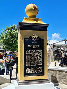
Homonhon Island is an island in the province of Eastern Samar, Philippines, on the east side of Leyte Gulf. The 20-kilometre (12 mi) long island is part of the municipality of Guiuan, encompassing eight barangays: Bitaugan, Cagusu-an, Canawayon, Casuguran, Culasi, Habag, Inapulangan, and Pagbabangnan.

Samar is the third-largest and seventh-most populous island in the Philippines, with a total population of 1,909,537 as of the 2020 census. It is located in the eastern Visayas, which are in the central Philippines. The island is divided into three provinces: Samar, Northern Samar, and Eastern Samar. These three provinces, along with the provinces on the nearby islands of Leyte and Biliran, are part of the Eastern Visayas region.
Guiuan, officially the Municipality of Guiuan, is a 2nd class municipality in the province of Eastern Samar, Philippines. It constitutes the southeastern extremity of Samar Island and some adjacent islands, surrounded by Leyte Gulf and the Philippine Sea, two major bodies of water that makes the town the surfing capital of the Visayas. According to the 2020 census, it has a population of 53,361 people, making it the most populous municipality in Eastern Samar and the second most populous administrative division in the entire province after the capital city Borongan.

Limasawa, officially the Municipality of Limasawa, is an island municipality in the province of Southern Leyte, Philippines. According to the 2020 census, it has a population of 6,191 people, making it the least populated town in the province.

Gibusong, variously Hibusong and Hibuson, is a Waray-speaking island in Mindanao, Philippines, in the province of Dinagat Islands. It lies northwest of Dinagat Island, at the north end of Surigao Strait connecting with Leyte Gulf and is under the jurisdiction of the municipality of Loreto. The island, together with the smaller Little Gibusong Island, is administratively divided into three barangays: Liberty, Helene, and Magsaysay. A ferry route connects Liberty with the main port of Loreto.

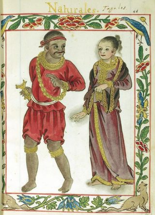
The Waray people are a subgroup of the larger ethnolinguistic group Bisaya people, who constitute the 4th largest Filipino ethnolinguistic group in the Philippines. Their primary language is the Waray language, an Austronesian language native to the islands of Samar, Leyte and Biliran, which together comprise the Eastern Visayas Region of the Philippines. Waray people inhabit most of Samar where they are called Samareños/Samarnons, the northern part of the island of Leyte where they are called Leyteños, and the island of Biliran. In Leyte island, the Waray-speaking people are separated from the Cebuano-speaking Leyteños by the island's mountain range at the middle.
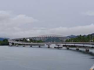
Guiuan Airport is an airport located in the municipality of Guiuan, in the province of Eastern Samar in the Philippines. It is classified as a feeder airport by the Civil Aviation Authority of the Philippines, an attached agency of the Department of Transportation that is responsible for the operations all airports in the Philippines, except the major international airports.

The Magellan expedition, sometimes called the Magellan-Elcano expedition, was an early 16th-century Spanish expedition planned and led by Portuguese explorer Ferdinand Magellan with the objective of crossing the Atlantic and Pacific oceans in order to open a trade route with the Moluccas. The expedition departed from Spain in 1519 and returned there in 1522, completed by the Spanish navigator Juan Sebastián Elcano, who crossed the Indian ocean after Magellan's death in the Philippines, thus culminating in the first circumnavigation of the world.
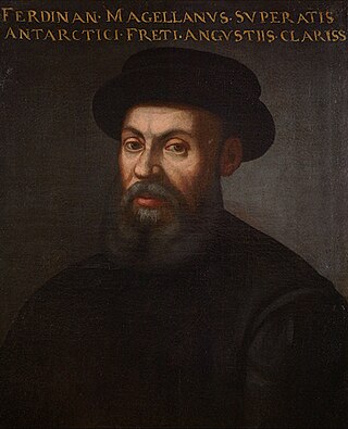
Ferdinand Magellan was a Portuguese explorer best known for having planned and led the 1519 Spanish expedition to the East Indies across the Pacific Ocean to open a maritime trade route, during which he discovered the interoceanic passage thereafter bearing his name and achieved the first European navigation to Asia via the Pacific. After his death, this expedition was the first to circumnavigate the globe in 1519–22 in the service of Spain.
The recorded history of the Philippines between 900 and 1565 begins with the creation of the Laguna Copperplate Inscription in 900 and ends with the beginning of Spanish colonization in 1565. The inscription records its date of creation in 822 Saka. The discovery of this document marks the end of the prehistory of the Philippines at 900 AD. During this historical time period, the Philippine archipelago was home to numerous kingdoms and sultanates and was a part of the Indosphere and Sinosphere.
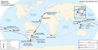
The Magellan expedition was the first voyage around the world in human history. It was a Spanish expedition that sailed from Seville in 1519 under the initial command of Ferdinand Magellan, a Portuguese sailor, and completed in 1522 by Spanish Basque navigator Juan Sebastián Elcano.

The first documented Catholic Mass in the Philippines was held on March 31, 1521, Easter Sunday. It was conducted by Father Pedro de Valderrama of Ferdinand Magellan's expedition along the shores of what was referred to in the journals of Antonio Pigafetta as "Mazaua".
Eastern Visayas is an administrative region in the Philippines, designated as Region VIII. It consists of three main islands, Samar, Leyte and Biliran. The region has six provinces, one independent city and one highly urbanized city namely, Biliran, Leyte, Northern Samar, Samar, Eastern Samar, Southern Leyte, Ormoc and Tacloban. The highly urbanized city of Tacloban is the sole regional center. These provinces and cities occupy the easternmost islands of the Visayas group of islands.
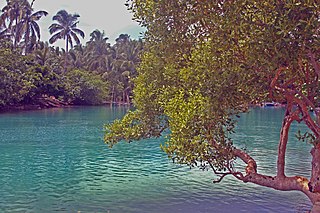
The Guiuan Protected Landscape and Seascape, also known as the Guiuan Marine Reserve, is a protected area associated with the Guiuan Island Group which is located off the coast of the municipality of Guiuan on the eastern side of Leyte Gulf in the Philippines. The protected area consists of the following islands from within the group: Calicoan, Manicani, Suluan, Tubabao, Victory, Homonhon and other smaller islands and their surrounding reefs. It also includes the coastal area of mainland Guiuan in Eastern Samar covering a total area of 60,448 hectares. The land which now comprises the conservation area was previously declared as a Marine Reserve and Tourist Zone and was placed under the administration and control of the Philippine Tourism Authority in 1978. It was re-proclaimed and re-classified as a protected landscape/seascape in 1994 under the National Integrated Protected Areas System Act of 1992.
The Philippines has its own unique drinking culture and practices that are based on influences from its Austronesian heritage to the colonial influences of Spain, the United States, and Japan.