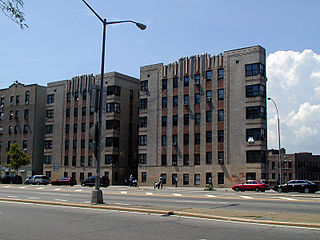
The name "Sunnyside" originates with the Bragaw family, French Huguenots who had purchased the land in 1713 and named their estate "Sunnyside Hill".[3][4] Sunnyside was a rural hamlet mostly consisting of small farms and marshland. It was incorporated into Long Island City in 1870, and developed into a bedroom community after the Queensboro Bridge was completed in 1909. A large portion of the neighborhood is six-story apartment buildings constructed during the 1920s and 1930s.
Based on data from the 2010 United States Census, the population of Sunnyside was 63,271, a change of 1,324 (2.1%) from the 61,947 counted in 2000. Covering an area of 2,340.44 acres (947.14ha), the neighborhood had a population density of 27 inhabitants per acre (17,000/sqmi; 6,700/km2).[7]
The entirety of Community Board 2, which comprises Sunnyside and Woodside, had 135,972 inhabitants as of NYC Health's 2018 Community Health Profile, with an average life expectancy of 85.4 years.[9]:2,20 This is higher than the median life expectancy of 81.2 for all New York City neighborhoods.[10]:53 (PDF p. 84)[11] Most inhabitants are middle-aged adults and youth: 17% are between the ages of 0–17, 39% between 25–44, and 24% between 45–64. The ratio of college-aged and elderly residents was lower, at 8% and 12% respectively.[9]:2
As of 2017, the median household income in Community Board 2 was $67,359.[12] In 2018, an estimated 20% of Sunnyside and Woodside residents lived in poverty, compared to 19% in all of Queens and 20% in all of New York City. One in twenty residents (5%) were unemployed, compared to 8% in Queens and 9% in New York City. Rent burden, or the percentage of residents who have difficulty paying their rent, is 51% in Sunnyside and Woodside, about equal to the boroughwide and citywide rates of 53% and 51% respectively. Based on this calculation, as of 2018[update], Sunnyside and Woodside is considered to be high-income relative to the rest of the city and not gentrifying.[9]:7
As according to the 2020 census from the New York City Department of City Planning the neighborhood were approximately equally populated by White, Hispanic, and Asian populations with each of them being between 10,000 to 19,999 residents, however there were less than 5000 Black residents.[15][16][17][18]
Police and crime
Woodside, Sunnyside, and Long Island City are patrolled by the 108th Precinct of the NYPD, located at 5-47 50th Avenue.[5] The 108th Precinct ranked 25th safest out of 69 patrol areas for per-capita crime in 2010.[19]As of 2018[update], with a non-fatal assault rate of 19 per 100,000 people, Sunnyside and Woodside's rate of violent crimes per capita is less than that of the city as a whole. The incarceration rate of 163 per 100,000 people is lower than that of the city as a whole.[9]:8
The 108th Precinct has a lower crime rate than in the 1990s, with crimes across all categories having decreased by 88.2% between 1990 and 2018. The precinct reported 2 murders, 12 rapes, 90 robberies, 108 felony assaults, 109 burglaries, 490 grand larcenies, and 114 grand larcenies auto in 2018.[20]
As of 2018[update], preterm births are more common in Sunnyside and Woodside than in other places citywide, but births to teenage mothers are less common. In Sunnyside and Woodside, there were 90 preterm births per 1,000 live births (compared to 87 per 1,000 citywide), and 14.9 births to teenage mothers per 1,000 live births (compared to 19.3 per 1,000 citywide).[9]:11 Sunnyside and Woodside has a high population of residents who are uninsured. In 2018, this population of uninsured residents was estimated to be 16%, which is higher than the citywide rate of 12%.[9]:14
The concentration of fine particulate matter, the deadliest type of air pollutant, in Sunnyside and Woodside is 0.0093 milligrams per cubic metre (9.3×10⁻⁹oz/cuft), higher than the city average.[9]:9 Fourteen percent of Sunnyside and Woodside residents are smokers, which is equal to the city average of 14% of residents being smokers.[9]:13 In Sunnyside and Woodside, 20% of residents are obese, 9% are diabetic, and 23% have high blood pressure—compared to the citywide averages of 20%, 14%, and 24% respectively.[9]:16 In addition, 19% of children are obese, compared to the citywide average of 20%.[9]:12
Ninety-two percent of residents eat some fruits and vegetables every day, which is higher than the city's average of 87%. In 2018, 79% of residents described their health as "good", "very good", or "excellent", slightly higher than the city's average of 78%.[9]:13 For every supermarket in Sunnyside and Woodside, there are 17 bodegas.[9]:10
Sunnyside is covered by three ZIP Codes. The area west of 39th Street is covered by 11101, while Sunnyside Gardens is located in 11104, and the area east of 45th Street is inside 11377.[25] The United States Post Office operates the Sunnyside Station at 45-15 44th Street.[26]
Education
PS 150
Sunnyside and Woodside generally has a slightly higher ratio of college-educated residents than the rest of the city as of 2018[update]. While 45% of residents age 25 and older have a college education or higher, 19% have less than a high school education and 35% are high school graduates or have some college education. By contrast, 39% of Queens residents and 43% of city residents have a college education or higher.[9]:6 The percentage of Sunnyside and Woodside students excelling in math rose from 40% in 2000 to 65% in 2011, and reading achievement rose from 45% to 49% during the same time period.[27]
Sunnyside and Woodside's rate of elementary school student absenteeism is less than the rest of New York City. In Sunnyside and Woodside, 11% of elementary school students missed twenty or more days per school year, lower than the citywide average of 20%.[10]:24 (PDF p. 55)[9]:6 Additionally, 86% of high school students in Sunnyside and Woodside graduate on time, more than the citywide average of 75%.[9]:6
Schools
Sunnyside contains the following public schools in both District 30 and 24. Queens Blvd serves as the border between the two districts.:[28]
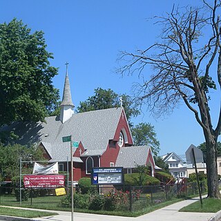
There are numerous churches and temples in Sunnyside that support its diverse religious communities.[33]
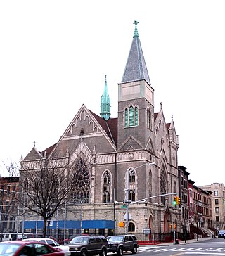
New York Presbyterian Church, located at 43-23 37th Avenue, is historically notable; the original structure was built in 1932 as the Knickerbocker Laundry Factory.[34]
Mosaic West Church and Community Center, located at 46-01 43rd Avenue. During the COVID-19 pandemic in New York City, local business owner Sofia Moncayo led a volunteer-run food pantry at the church.[35]
Islamic Institute of New York, located at 55-11 Queens Boulevard.
Queen of Angels Church, located at 44-04 Skillman Avenue.
Sunnyside Reformed Church, 48-03 Skillman Avenue, has served Queens for over 125 years.
Parks and recreation
Parks in the area include:
L/Cpl. Thomas P. Noonan Playground, located between Greenpoint Avenue, 42nd Avenue, 43rd Street, and 47th Streets. The park was acquired in 1936 and commemorates Thomas P. Noonan Jr., a local resident who was killed in an ambush during the Vietnam War and posthumously honored.[36]
Torsney Playground, located at Skillman Avenue and 43rd Street. It was built in the 1950s and honors George F. Torsney, a local politician and World War I veteran.[37]
Sabba Park, located in the median of Queens Boulevard between 48th Street and 49th Street. It honors Joe Sabba, a World War II veteran, and was founded in 1913.[38]
Additionally, several other people have been involved with Sunnyside's history. The Queens-grown punk rock group The Ramones played some of their earliest gigs in Sunnyside pubs during the 1970s.[citation needed] In the years before World War II New York Giants star Hap Moran coached a youth football team, the Mustangs, in Sunnyside Park.[43] Legendary jazz musician Bix Beiderbecke died at 43–30 46th Street in Sunnyside, and a plaque was erected in his honor by the Greater Astoria Historical Society.[44]
Long Island City (LIC) is a residential and commercial neighborhood on the extreme western tip of Queens, a borough in New York City in the United States. It is bordered by Astoria to the north; the East River to the west; New Calvary Cemetery in Sunnyside to the east; and Newtown Creek—which separates Queens from Greenpoint, Brooklyn—to the south.
Ozone Park is a neighborhood in the southwestern section of the New York City borough of Queens, New York, United States. It is next to the Aqueduct Racetrack in South Ozone Park, a popular spot for Thoroughbred racing and home to the Resorts World Casino & Hotel. Traditionally home to a large Italian-American population, Ozone Park has grown to have many residents of Caribbean, Hispanic, and Asian backgrounds.
Corona is a neighborhood in the borough of Queens in New York City. It borders Flushing and Flushing Meadows–Corona Park to the east, Jackson Heights to the west, Forest Hills and Rego Park to the south, Elmhurst to the southwest, and East Elmhurst to the north. Corona's main thoroughfares include Corona Avenue, Roosevelt Avenue, Northern Boulevard, Junction Boulevard, and 108th Street.
Flatlands is a neighborhood in the southeast part of the borough of Brooklyn in New York City. The current neighborhood borders are roughly defined by the Bay Ridge Branch to the north, Avenue U to the south, Ralph Avenue to the east, and Flatbush Avenue to the southwest.
Throggs Neck is a neighborhood and peninsula in the south-eastern portion of the borough of the Bronx in New York City. It is bounded by the East River and Long Island Sound to the south and east, Westchester Creek on the west, and Baisley Avenue and the Bruckner Expressway on the north.
Hollis is a residential middle-class neighborhood within the southeastern section of the New York City borough of Queens. While a predominantly African-American community, there are small minorities of Hispanics and South Asians residing in the area. Boundaries are considered to be 181st Street to the west, Hillside Avenue to the north, Francis Lewis Boulevard to the east, and Murdock Avenue to the south. Hollis is located between Jamaica to the west and Queens Village to the east.
Queens Village is a mostly residential middle class neighborhood in the eastern part of the New York City borough of Queens. It is bound by Hollis to the west, Cambria Heights to the south, Bellerose, Queens and Elmont, Nassau County to the east, and Oakland Gardens to the north.
Allerton is a working-class neighborhood geographically located in the East Bronx section of the Bronx, New York City. It is named in honor of Daniel Allerton, an early Bronx settler who purchased and farmed this area with his wife Hustace. It consists of two subsections called Bronxwood and Laconia. Its boundaries, starting from the north and moving clockwise, are Adee Avenue, Boston Road, and Gun Hill Road to the northeast; the IRT Dyre Avenue Line to the east; Waring Avenue to the south; and Bronx River Parkway to the west. White Plains Road and Boston Road are the primary thoroughfares through Allerton.
Fordham Manor is a neighborhood located in the western Bronx, New York City. Fordham is roughly bordered by East 196th Street to the north, the Harlem River to the west, Fordham Road to the south, and Southern Boulevard to the east. The neighborhood's primary thoroughfares are Fordham Road and Grand Concourse.
Kingsbridge is a residential neighborhood in the northwest portion of the Bronx, New York City. Kingsbridge's boundaries are Manhattan College Parkway to the north, the Major Deegan Expressway or Bailey Avenue to the east, West 230th Street to the south, and Irwin Avenue to the west.
Tremont is a residential neighborhood in the West Bronx, New York City. Its boundaries are East 181st Street to the north, Third Avenue to the east, the Cross-Bronx Expressway to the south, and the Grand Concourse to the west. East Tremont Avenue is the primary thoroughfare through Tremont.
Maspeth is a residential and commercial community in the borough of Queens in New York City. It was founded in the early 17th century by Dutch and English settlers. Neighborhoods sharing borders with Maspeth are Woodside to the north; Sunnyside to the northwest; Greenpoint, Brooklyn to the west; East Williamsburg, Brooklyn to the southwest; Fresh Pond and Ridgewood to the south; and Middle Village and Elmhurst to the east.
Woodside is a residential and commercial neighborhood in the western portion of the borough of Queens in New York City. It is bordered on the south by Maspeth, on the north by Astoria, on the west by Sunnyside, and on the east by Elmhurst, Jackson Heights, and East Elmhurst. Some areas are widely residential and very quiet, while other parts, especially the ones around Roosevelt Avenue, are busier.
Richmond Hill is a commercial and residential neighborhood located in the southeastern section of the New York City borough of Queens. The area borders Kew Gardens and Forest Park to the north, Jamaica and South Jamaica to the east, South Ozone Park to the south, and Woodhaven and Ozone Park to the west. The neighborhood is split between Queens Community Board 9 and 10.
Hamilton Heights is a neighborhood in the northern part of Manhattan in New York City. It is the northernmost part of the West Harlem area, along with Manhattanville and Morningside Heights to its south, and it contains the sub-neighborhood and historic district of Sugar Hill. Washington Heights lies to Hamilton Heights' north, and to its east is Central Harlem.
East Elmhurst is a residential neighborhood in the northwest section of the New York City borough of Queens. It is bounded to the south by Jackson Heights and Corona, to the north and east by Bowery Bay, and to the west by Woodside and Ditmars Steinway. The area also includes LaGuardia Airport, located on the shore of Flushing Bay, LaGuardia Landing Lights Fields, and Astoria Heights.
South Ozone Park is a neighborhood in the southwestern section of the New York City borough of Queens. It is just north of John F. Kennedy International Airport, between Aqueduct Racetrack to the west and the Van Wyck Expressway to the east. Adjacent neighborhoods include Ozone Park to the west; Richmond Hill to the north; Jamaica, South Jamaica, and Springfield Gardens to the east; and Howard Beach and Old Howard Beach to the southwest.
Prospect Lefferts Gardens is a residential neighborhood in the Flatbush area of the New York City borough of Brooklyn. The community is bounded by Empire Boulevard to the north, Clarkson Avenue to the south, New York Avenue to the east, and Ocean Avenue/Prospect Park to the west. Prospect Lefferts Gardens was designated a New York City Landmark area in 1979 and called the Prospect Lefferts Gardens Historic District.
Bay Terrace is a neighborhood in the northeastern section of the New York City borough of Queens. It is often considered part of the larger area of Bayside. Bay Terrace overlooks the East River and the approaches to the Throgs Neck Bridge from the Clearview Expressway and Cross Island Parkway. It is bounded on the west by the Clearview Expressway, on the south by 26th and 28th Avenues, to the east by the Little Neck Bay, and to the north by the East River.
Concourse is a neighborhood in the southwestern section of the New York City borough of the Bronx which includes the Bronx County Courthouse, the Bronx Museum of the Arts, and Yankee Stadium. Its boundaries, starting from the north and moving clockwise, are East 169th Street to the north, Webster Avenue to the east, East 149th Street to the south, and Jerome Avenue and Harlem River to the west. The neighborhood is divided into three subsections: West Concourse, East Concourse, and Concourse Village with the Grand Concourse being its main thoroughfare.
↑ Vandam, Jeff. "An Enclave at Once Snug and Inclusive"Archived September 17, 2020, at the Wayback Machine , The New York Times, February 4, 2007. Accessed February 14, 2008. "When the Long Island Rail Road's East Side Access project is completed in 2013, its trains, too, will go to Grand Central. Sunnyside's new station in the system will create a nonstop commute to Midtown."
↑ Shepard, Richard F. "Memories of My Queens"Archived May 9, 2016, at the Wayback Machine , The New York Times, September 3, 1995. Accessed October 19, 2007. "My earliest memories are of Sunnyside, about 1929 and 1930, when my family moved to Queens and bought a house in Sunnyside Gardens, on what was then called Locust Street. Our next-door neighbors were a family by the name of Tuvim, whose daughter was to become a star of Broadway and Hollywood named Judy Holliday, although as a younger-than-teen-age Queens girl she gave little evidence of such talent."
↑ "Spare Times", The New York Times, October 12, 2001. Accessed October 19, 2007. "Hometown NYC: Sunnyside, Queens. A tour of the area that was once home to Rudy Vallee, led by Saul Bennett, a poet who was raised in the neighborhood."
This page is based on this Wikipedia article Text is available under the CC BY-SA 4.0 license; additional terms may apply. Images, videos and audio are available under their respective licenses.