Swayzee, Indiana

Last updated

Swayzee, Indiana
Swayzee, Indiana.jpg
Swayzee Town Hall
Grant County Indiana Incorporated and Unincorporated areas Swayzee Highlighted 1874510.svg
Location of Swayzee in Grant County, Indiana.
Coordinates: 40°30′18″N85°49′35″W / 40.50500°N 85.82639°W / 40.50500; -85.82639
Country United States
State Indiana
County Grant
Township Sims
Area
[1]
  Total0.47 sq mi (1.21 km2)
  Land0.47 sq mi (1.21 km2)
  Water0.00 sq mi (0.00 km2)
Elevation
[2]
866 ft (264 m)
Population
 (2020)
  Total918
  Density1,957.36/sq mi (756.36/km2)
Time zone UTC-5 (Eastern (EST))
  Summer (DST) UTC-4 (EDT)
ZIP code
46986
Area code 765
FIPS code 18-74510 [3]
GNIS feature ID2397690 [2]
Website http://www.swayzee.org

Swayzee is a town in Sims Township, Grant County, Indiana, United States. The population was 981 at the 2010 census.

Contents

On its welcome sign, Swayzee claims to be "the only Swayzee in the world." This motto is based on a story about a postcard sent by a serviceman overseas during World War II, which although being addressed only to "Swayzee", with no mention of Indiana or any other information, was still said to have been successfully delivered.

Sign welcoming people to "The Only Swayzee in the World" and noting the local high school's basketball achievements Welcome to Swayzee.jpg
Sign welcoming people to "The Only Swayzee in the World" and noting the local high school's basketball achievements

History

James Swayzee was the original owner of the town site. [4]

Pipe Creek Sinkhole, uncovered in 1996 at the Pipe Creek Junior limestone quarry near Swayzee, has been the site of important paleontological discoveries dating from the Pliocene epoch. [5]

Geography

Swayzee is located approximately eight miles west of the city of Marion. State Road 13 passes north and south through town along Washington Street, and State Road 22/Route 35 runs east and west about two & half mile south of town.

According to the 2010 census, Swayzee has a total area of 0.47 square miles (1.22 km2), all land. [6]

Demographics

Historical population
CensusPop.Note
1900 1,162
1910 836−28.1%
1920 650−22.2%
1930 604−7.1%
1940 6619.4%
1950 6904.4%
1960 86325.1%
1970 1,07324.3%
1980 1,1275.0%
1990 1,059−6.0%
2000 1,011−4.5%
2010 981−3.0%
2020 918−6.4%
U.S. Decennial Census [7]

Swayzee is home to churches of three Christian denominations: United Methodist, Nazarene, and United Church of Christ.

2010 census

As of the census [8] of 2010, there were 981 people, 393 households, and 289 families residing in the town. The population density was 2,087.2 inhabitants per square mile (805.9/km2). There were 426 housing units at an average density of 906.4 per square mile (350.0/km2). The racial makeup of the town was 97.7% White, 0.3% African American, 0.3% Native American, 0.1% Asian, 0.2% from other races, and 1.4% from two or more races. Hispanic or Latino of any race were 1.3% of the population.

There were 393 households, of which 33.1% had children under the age of 18 living with them, 57.0% were married couples living together, 12.5% had a female householder with no husband present, 4.1% had a male householder with no wife present, and 26.5% were non-families. 23.9% of all households were made up of individuals, and 13% had someone living alone who was 65 years of age or older. The average household size was 2.50 and the average family size was 2.92.

The median age in the town was 40 years. 25.8% of residents were under the age of 18; 7.7% were between the ages of 18 and 24; 23.6% were from 25 to 44; 26.3% were from 45 to 64; and 16.3% were 65 years of age or older. The gender makeup of the town was 48.6% male and 51.4% female.

2000 census

As of the census [3] of 2000, there were 1,011 people, 404 households, and 309 families residing in the town. The population density was 2,141.5 inhabitants per square mile (826.8/km2). There were 414 housing units at an average density of 876.9 per square mile (338.6/km2). The racial makeup of the town was 97.73% White, 0.40% African American, 0.10% Pacific Islander, 1.19% from other races, and 0.59% from two or more races. Hispanic or Latino of any race were 1.48% of the population.

There were 404 households, out of which 34.4% had children under the age of 18 living with them, 62.6% were married couples living together, 10.1% had a female householder with no husband present, and 23.3% were non-families. 21.5% of all households were made up of individuals, and 9.4% had someone living alone who was 65 years of age or older. The average household size was 2.50 and the average family size was 2.89.

In the town, the population was spread out, with 25.4% under the age of 18, 6.9% from 18 to 24, 28.4% from 25 to 44, 23.6% from 45 to 64, and 15.6% who were 65 years of age or older. The median age was 38 years. For every 100 females, there were 92.2 males. For every 100 females age 18 and over, there were 88.0 males.

The median income for a household in the town was $41,146, and the median income for a family was $46,750. Males had a median income of $34,531 versus $22,361 for females. The per capita income for the town was $17,476. About 4.2% of families and 6.0% of the population were below the poverty line, including 5.5% of those under age 18 and 1.6% of those age 65 or over.

Education

Swayzee Elementary School, located along Washington Street, is administered by the Oak Hill United School Corporation.

Swayzee is the state record-holder for the most overtimes in a basketball game, with nine overtimes during a March 15, 1964, game at the Marion Regional against Liberty Center. Swayzee won, 65-61. [9] The record is noted on the town's welcome sign.

The town has a lending library, the Swayzee Public Library. [10]

Notable person

Related Research Articles

<span class="mw-page-title-main">Jamestown, Indiana</span> Town in Indiana, United States

Jamestown is a town in Jackson Township, Boone County and Eel River Township, Hendricks County, Indiana, United States. The population was 958 at the 2010 census.

<span class="mw-page-title-main">Elnora, Indiana</span> Town in Indiana, United States

Elnora is a town in Elmore Township, Daviess County, Indiana, United States. The population was 640 at the 2010 census.

<span class="mw-page-title-main">Chesterfield, Indiana</span> Town in Indiana, United States

Chesterfield is a town in the U.S. state of Indiana which lies in Union Township, Madison County, and Salem Township, Delaware County. The population was 2,490 at the 2020 census. It is part of the Indianapolis–Carmel–Anderson metropolitan statistical area.

<span class="mw-page-title-main">Kingman, Indiana</span> Town in Indiana, United States

Kingman is a town in Millcreek Township, Fountain County, Indiana, United States. The population was 511 at the 2010 census.

<span class="mw-page-title-main">Mount Carmel, Indiana</span> Town in Indiana, United States

Mount Carmel is a town in Springfield Township, Franklin County, Indiana, United States. The population was 86 at the 2010 census.

<span class="mw-page-title-main">Akron, Indiana</span> Town in Indiana, United States

Akron is a town in Henry Township, Fulton County, Indiana, United States. The population was 1,167 at the 2010 census.

<span class="mw-page-title-main">Converse, Indiana</span> Town in Indiana, United States

Converse is a town in Jackson Township, Miami County, and Richland Township, Grant County, in the U.S. state of Indiana. The population was 1,161 at the 2020 census.

<span class="mw-page-title-main">McCordsville, Indiana</span> Town in Indiana, United States

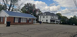
McCordsville is a town in Vernon Township, Hancock County, Indiana, United States. The town is a fast-growing suburb of Indianapolis with an estimated population of 8,592 in 2020.

<span class="mw-page-title-main">Lizton, Indiana</span> Town in Indiana, United States

Lizton is a town in Union Township, Hendricks County, Indiana, United States. The population was 488 at the 2010 Census. It is one of the three towns that make up North West Hendricks School Corporation.

<span class="mw-page-title-main">North Salem, Indiana</span> Town in Indiana, United States

North Salem is a town in Eel River Township, Hendricks County, Indiana, United States. The population was 518 at the 2010 Census.

<span class="mw-page-title-main">Medora, Indiana</span> Town in Indiana, United States

Medora is a town in Carr Township, Jackson County, Indiana, United States. The population was 693 at the 2010 census.

<span class="mw-page-title-main">Mentone, Indiana</span> Town in Indiana, United States

Mentone is a town in Harrison and Franklin townships, Kosciusko County, in the U.S. state of Indiana. Mentone is the self-proclaimed "Egg Basket of the Midwest" because of prolific commercial egg production in the area, and holds an Egg Festival annually in early June to celebrate its heritage. A large concrete egg stands near the town center and is considered locally to be the "Largest Egg in the World". The Lawrence D. Bell Aircraft Museum, is located within the town limits. The Popular Rotorcraft Association has its home at the PRA Mentone Airport C92) and is home to their annual fly-in convention.

<span class="mw-page-title-main">Milford, Kosciusko County, Indiana</span> Town in Indiana, United States

Milford is a town in Van Buren Township, Kosciusko County, in the U.S. state of Indiana. The population was 1,614 at the 2020 census.

<span class="mw-page-title-main">Wolcottville, Indiana</span> Town in Indiana, United States

Wolcottville is a town in Orange Township, Noble County and Johnson Township, LaGrange County in the U.S. state of Indiana. The population was 998 at the 2010 census.

New Richmond is a town in Coal Creek Township, Montgomery County, in the U.S. state of Indiana. The population was 309 at the 2020 census.

<span class="mw-page-title-main">Parker City, Indiana</span> Town in Indiana, United States

Parker City is a town in Monroe Township, Randolph County, in the U.S. state of Indiana. The population was 1,419 at the 2010 census.

<span class="mw-page-title-main">Ridgeville, Indiana</span> Town in Indiana, United States

Ridgeville is a town in Franklin Township, Randolph County, Indiana, United States, along the Mississinewa River. The population was 688 at the 2020 census.

<span class="mw-page-title-main">Economy, Indiana</span> Town in Indiana, United States

Economy is a town in Perry Township, Wayne County, in the U.S. state of Indiana. The population was 173 at the 2021 census.

<span class="mw-page-title-main">Fountain City, Indiana</span> Town in Indiana, United States

Fountain City, formerly Newport, is a town in New Garden Township, Wayne County, in the U.S. state of Indiana. The population was 796 at the 2010 census.

<span class="mw-page-title-main">Uniondale, Indiana</span> Town in Indiana, United States

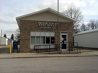
Uniondale is a town in Union and Rockcreek townships, Wells County, in the U.S. state of Indiana. The population was 310 at the 2010 census, down from 271 at the 2020 Census.

References

  1. "2020 U.S. Gazetteer Files". United States Census Bureau. Retrieved March 16, 2022.
  2. 1 2 U.S. Geological Survey Geographic Names Information System: Swayzee, Indiana
  3. 1 2 "U.S. Census website". United States Census Bureau . Retrieved January 31, 2008.
  4. Baker, Ronald L. (October 1995). From Needmore to Prosperity: Hoosier Place Names in Folklore and History . Indiana University Press. p.  318. ISBN   978-0-253-32866-3. James Swayzee owned land here.
  5. Staff, Evan-Moor Educational Publishers (February 4, 2007). A Boy, a Dog, and a Frog: Adding Words to Pictures, Book Project. Evan-Moor. p. 78. ISBN   978-1-59673-986-4.
  6. "G001 - Geographic Identifiers - 2010 Census Summary File 1". United States Census Bureau. Archived from the original on February 13, 2020. Retrieved July 25, 2015.
  7. "Census of Population and Housing". Census.gov. Retrieved June 4, 2015.
  8. "U.S. Census website". United States Census Bureau . Retrieved December 11, 2012.
  9. "Throwback game to honor 50th anniversary of 9-OT game". Indianapolis Star. February 11, 2014. Retrieved March 28, 2016.
  10. "Indiana public library directory" (PDF). Indiana State Library. Retrieved March 7, 2018.