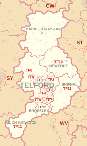
The CO postcode area, also known as the Colchester postcode area, is a group of sixteen postcode districts in England, which are subdivisions of nine post towns. These postcode districts cover northeast Essex and a small part of south Suffolk. The main sorting office is in Colchester.

The DY postcode area, also known as the Dudley postcode area, is a group of fourteen postcode districts in England, which are subdivisions of eight post towns. These districts cover the south-western portion of the West Midlands and north Worcestershire, plus very small parts of Shropshire and Staffordshire.

The LN postcode area, also known as the Lincoln postcode area, is a group of 13 postcode districts in England, which are subdivisions of post towns: Lincoln, Alford, Horncastle, Louth, Mablethorpe, Market Rasen and Woodhall Spa. These cover a broad central belt of Lincolnshire, are consecutive and are arranged by geography rather than alphabetically.

The ME postcode area, also known as the Rochester or Medway postcode area, is a group of 20 geographic postcode districts around Medway in Kent, England. The area is divided into eleven post towns and extends into the districts of Tonbridge and Malling, Swale, Gravesham and Maidstone as well as covering the unitary authority of Medway.

The NG postcode area, also known as the Nottingham postcode area, is a group of 29 postcode districts in the East Midlands, which are subdivisions of seven post towns. These cover the majority of Nottinghamshire, plus south-west Lincolnshire and parts of east Derbyshire and north Leicestershire.

The RH postcode area, also known as the Redhill postcode area, is a group of 20 geographic postcode districts in England for 27 post towns. These cover east Surrey and northeastern West Sussex, as well as small parts of northwestern East Sussex.

The CW postcode area, also known as the Crewe postcode area, is a group of twelve postcode districts in England, which are subdivisions of eight post towns. These postcode districts cover much of Cheshire, including Crewe, Northwich, Congleton, Middlewich, Nantwich, Sandbach, Tarporley and Winsford, plus very small parts of Staffordshire and Shropshire.

The LS postcode area, also known as the Leeds postcode area, is a group of 29 geographic postcode districts for post towns: Leeds, Wetherby, Tadcaster, Pudsey, Otley and Ilkley in England. Most of the area is within the Leeds Metropolitan district in West Yorkshire and parts are within City of Bradford, same county, and the Harrogate and Selby districts of North Yorkshire.

The TS postcode area, also known as the Cleveland postcode area, is a group of 29 consecutive postcode districts in north-east England for ten post towns. These cover north-east North Yorkshire and south-east County Durham.

The DH postcode area, also known as the Durham postcode area, is a group of twelve postcode districts in north-east England, which are subdivisions of five post towns. These districts cover northern County Durham and south-west Tyne and Wear.

The HU postcode area, also known as the Hull postcode area, is a group of 20 postcode districts for post towns: Beverley, Brough, Cottingham, Hessle, Hornsea, Hull, North Ferriby and Withernsea in the present and former East Riding of Yorkshire, England and taking in the autonomous council area: Kingston upon Hull which is post town of 12 of these districts.

The WF postcode area, also known as the Wakefield postcode area, is a group of 17 geographic, consecutive postcode districts in England for 11 post towns: Wakefield, Pontefract, Dewsbury, Batley, Castleford, Heckmondwike, Knottingley, Liversedge, Mirfield, Normanton and Ossett. These cover much of southern and eastern West Yorkshire and stray somewhat into South and North Yorkshire for ease of postal administration.

The CA postcode area, also known as the Carlisle postcode area, is a group of consecutive, geographical 28 postcode districts in north-west England, subdivisions of 22 post towns: Carlisle, Penrith, Workington, Whitehaven, Maryport, Cockermouth, Egremont, Alston, Appleby-in-Westmorland, Beckermet, Brampton, Cleator, Cleator Moor, Frizington, Holmrook, Keswick, Kirkby Stephen, Moor Row, Ravenglass, Seascale, St Bees and Wigton. These cover all but southern Cumbria plus a very small part of Northumberland. Two non-geographic postcode districts exist in the CA area.

The BD postcode area, also known as the Bradford postcode area, is a group of postcode districts in West and North Yorkshire, and very small parts of Lancashire in and around seven post towns: Bingley, Bradford, Cleckheaton, Keighley, Settle, Shipley and Skipton divided into 24 consecutive districts in England and as at 2019 having 3 non-geographical districts.

The SA postcode area, also known as the Swansea postcode area, is a group of 51 geographic postcode districts for post towns Aberaeron, Ammanford, Boncath, Burry Port, Cardigan, Carmarthen, Clynderwen, Crymych, Ferryside, Fishguard, Glogue, Goodwick, Haverfordwest, Kidwelly, Kilgetty, Lampeter, Llanarth, Llandeilo, Llandovery, Llandysul, Llanelli, Llanfyrnach, Llangadog, Llangrannog, Llansaint, Llanwrda, Llanybydder, Milford Haven, Narberth, Neath, New Quay, Newcastle Emlyn, Newport, Pembroke, Pembroke Dock, Pencader, Pontardawe, Port Talbot, Saundersfoot, Swansea, Tenby and Whitland forming south-west Wales. As at 2019 four non-geographic SA postcode districts exist.

The SP postcode area, also known as the Salisbury postcode area, is a group of eleven geographic, consecutive postcode districts in England for six post towns. These cover south Wiltshire and parts of north Dorset and west Hampshire.

The GL postcode area, also known as the Gloucester postcode area, is a group of 26 postcode districts covering 28 post towns: Badminton, Berkeley, Blakeney, Cheltenham, Chipping Campden, Cinderford, Cirencester, Coleford, Drybrook, Dursley, Dymock, Fairford, Gloucester, Lechlade, Longhope, Lydbrook, Lydney, Mitcheldean, Moreton-in-Marsh, Newent, Newnham, Ruardean, Stonehouse, Stroud, Tetbury, Tewkesbury, Westbury-on-Severn and Wotton-under-Edge. The main series has a hiatus after GL20, resuming at GL50 for Cheltenham and areas immediately around and to its east, ceasing with GL56.

The ST postcode area, also known as the Stoke-on-Trent postcode area, is a group of 21 geographic, consecutive postcode districts in England for six post towns. These cover the great bulk of north and central Staffordshire, including Stoke-on-Trent, Stafford, Leek, Newcastle-under-Lyme, Stone, and Uttoxeter, plus very small parts of Cheshire and Derbyshire.

The HR postcode area, also known as the Hereford postcode area, is a group of nine postcode districts in England and Wales, which are subdivisions of six post towns. These cover most of Herefordshire, including Hereford, Bromyard, Kington, Ledbury, Leominster and Ross-on-Wye, while the HR2, HR3 and HR5 districts traverse the border narrowly into Powys.

The HS postcode area, also known as the Outer Hebrides postcode area, is a group of postcode districts, HS1 to HS9, from north to south covering Stornoway, Lewis, Harris, Scalpay, North Uist, Benbecula, South Uist and Barra in Scotland. All of these are treated as post towns using their full name and in one case, Isle of Harris, covering two postcode districts.


