
The walleye, also called the yellow pike or yellow pikeperch or yellow pickerel, is a freshwater perciform fish native to most of Canada and to the Northern United States. It is a North American close relative of the European zander, also known as the pikeperch. The walleye is sometimes called the yellow walleye to distinguish it from the blue walleye, which is a color morph that was once found in the southern Ontario and Quebec regions, but is now presumed extinct. However, recent genetic analysis of a preserved (frozen) 'blue walleye' sample suggests that the blue and yellow walleye were simply phenotypes within the same species and do not merit separate taxonomic classification.

Hecate Strait is a wide but shallow strait between Haida Gwaii and the mainland of British Columbia, Canada. It merges with Queen Charlotte Sound to the south and Dixon Entrance to the north. About 140 kilometres (87 mi) wide at its southern end, Hecate Strait narrows in the north to about 48 kilometres (30 mi). It is about 260 kilometres (160 mi) in length.
Fisheries and Oceans Canada is a department of the Government of Canada that is responsible for developing and implementing policies and programs in support of Canada's economic, ecological and scientific interests in oceans and inland waters. Its mandate includes responsibility for the conservation and sustainable use of Canada's fisheries resources while continuing to provide safe, effective and environmentally sound marine services that are responsive to the needs of Canadians in a global economy.

Shuswap Lake is a lake located in the southern interior of British Columbia, Canada that drains via the Little Shuswap River into Little Shuswap Lake. Little Shuswap Lake is the source of the South Thompson River, a branch of the Thompson River, a tributary of the Fraser River. It is at the heart of a region known as the Columbia Shuswap or "the Shuswap", noted for its recreational lakeshore communities including the city of Salmon Arm. The name "Shuswap" is derived from the Shuswap or Secwepemc First Nations people, the most northern of the Interior Salish peoples, whose territory includes the Shuswap. The Shuswap call themselves /ʃǝxwépmǝx/ in their own language, which is called /ʃǝxwepmǝxtʃín/.

The blue walleye, also called the blue pike, was a unique color morph of walleye which was endemic to the Great Lakes of North America. Morphometric studies led biologists to classify the blue walleye as a separate species in 1926, although it was later downgraded to a subspecies. Listed as an endangered species by the United States in 1967, it was declared extinct in 1983.

Jervis Inlet is one of the principal inlets of the British Columbia Coast, about 95 km (59 mi) northwest of Vancouver, and the third of such inlets north of the 49th parallel, the first of which is Burrard Inlet, Vancouver's harbour.

The Salish Sea is a marginal sea of the Pacific Ocean located in the Canadian province of British Columbia and the U.S. state of Washington. It includes the Strait of Georgia, the Strait of Juan de Fuca, Puget Sound, and an intricate network of connecting channels and adjoining waterways.

USAT Brigadier General M. G. Zalinski was a U.S. Army transport ship that served in World War II. It sank in 1946 in the Grenville Channel in British Columbia's Inside Passage. The crew were rescued by a tug boat and the SS Catala passenger steamer, but the cargo of bombs and oil went down with the ship.

Division No. 10 is one of eighteen census divisions in the province of Saskatchewan, Canada, as defined by Statistics Canada. It is located in the east-central part of the province. The most populous community in this division is Wynyard.

Gull Lake is a large lake in central Alberta, Canada. It is a popular recreational lake with its southern shores boasting large sandy beaches. Gull Lake is centrally located between Edmonton and Calgary and lies in two counties, Ponoka County and Lacombe County. The lake is accessed west of Ponoka on Highway 53 to get to the north side, or west of Lacombe on Highway 12 to reach the southern shores.

Canada's fishing industry is a key contributor to the success of the Canadian economy. In 2016, Canada's fishing industry exported $6.6 billion in fish and seafood products and employed approximately 72,000 people in the industry. Aquaculture, which is the farming of fish, shellfish, and aquatic plants in fresh or salt water, is the fastest growing food production activity in the world and a growing sector in Canada. In 2015, aquaculture generated over $1 billion in GDP and close to $3 billion in total economic activity. The Department Of Fisheries and Oceans (DFO) oversees the management of Canada's aquatic resources and works with fishermen across the country to ensure the sustainability of Canada's oceans and in-land fisheries.
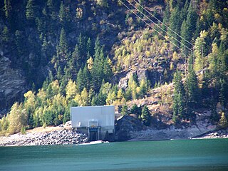
Whatshan Dam was built by the B.C. Power Commission and completed in 1952. It is a concrete hydroelectric dam on the Whatshan River in the Canadian province of British Columbia. The Whatshan powerhouse has undergone three major transformations since 1951 when it was first built by the British Columbia Power Commission to provide electricity to the Okanagan and the Upper Arrow Lakes in 1951. In 1953 the powerhouse was destroyed after a rock and mud slide roared down the mountainside. The powerhouse was rebuilt soon after only to have to be rebuilt again a few metres higher to avoid being flooded after the completion of the Hugh Keenleyside Dam in 1968. The replacement 54MW powerhouse completed in 1972 is at the end of a 3.4 kilometre long tunnel and is located on the western side of Upper Arrow Lake in the Monashee Mountains. It is owned and operated by BC Hydro.
Wellington Bay is an Arctic waterway in Kitikmeot Region, Nunavut, Canada. It is located in Dease Strait, off southern Victoria Island. It is northwest of the community of Cambridge Bay.

Canadian aquatic invasive species are all forms of life that traditionally has not been native to Canada's waterways. In Eastern Canada, non-native plant and animal species are a concern to biologists. Bringing non-native species such as invasive fishes into Canada can damage the environment and ecosystem by repressing native species due to food competition or preying. Invasive fishes enter the fresh waters of Canada in several ways including drifting, deliberate introduction, accidental release, experimental purposes and, most commonly, through the attachment on international boat hulls. Invasive species are the second biggest threat to fish and other marine life in Canada behind loss of habitat and degradation. The threat to native species is primarily caused by impacts on the food web; however, invasive species also bring dangerous pathogens and physically interfere with existing aquatic life. Invasive species include sea lampreys, zebra mussels, smallmouth bass, European green crab, vase tunicate, and sea squirts.

Somenos Lake is a small shallow water body located in the Municipality of North Cowichan on Southeast Vancouver Island. Somenos Lake has a maximum area of approximately 247 ac, 100 ha at 15.3 feet (4.7 m) above geodetic datum. The Lake is relatively shallow with a maximum depth of 22.2 feet (6.8 m). Somenos Lake is fed by three major tributary streams: Richards Creek from the North and Northeast, Averill Creek from the Northwest and Bings Creek from the West. The lake is drained near its southern extremity by Somenos Creek which flows southeast approximately 4 kilometres (2.5 mi) to the Cowichan River.

Marine Protected Areas (MPAs) (French: zones de protection marine) are zones within Canadian waters where the marine environment enjoys a high level of environmental protection. Marine Protected Areas are governed by the Oceans Act of 1996 and administered by Fisheries and Oceans Canada. The federal government has committed to protecting 25% of its oceans as Marine Protected Areas by the year 2025, and a further 5% (30% of the ocean area of the Exclusive Economic Zone) by 2030.

The Fisheries Act is legislation enacted by the Parliament of Canada, governing the powers of government to regulate fisheries and fishing vessels. The act has been undergoing major regulatory revisions in recent years, including those attached to treaty rights of Miꞌkmaq in Atlantic Canada. The Minister designated under the Act is the Ministers of Fisheries, Oceans and the Canadian Coast Guard.

The winter skate is a globally-endangered species of skate found in the surrounding waters of northeastern North America. They inhabit shallow shelf waters and are prone to bycatch during commercial fishing.
Sturgeon Bay Provincial Park is a provincial park on the western shore of Lake Winnipeg in Manitoba, Canada. The park is considered to be a Class Ib protected area under the IUCN protected area management categories. It is 144.9 km2 (55.9 sq mi) in size.

Tarium Niryutait is a marine protected area (MPA) located in the coastal areas of the Yukon and Northwest Territories in Canada. It is located within the Inuvialuit Settlement Region and was the first Arctic MPA established in Canada. The MPA was established with the goal of protecting Beluga whales and the biodiversity of other bird and fish species and their habitats.


