Tenhipalam

Last updated

Thenhipalam
Thenjipalam, Tenhipalam
Census town
Thenhipalam
CUIET.jpg
CUIET
Coordinates: 11°7′34″N75°53′25″E / 11.12611°N 75.89028°E / 11.12611; 75.89028
CountryFlag of India.svg  India
State Kerala
District Malappuram
Government
  BodyGram panchayat
Population
 (2001) [1]
  Total27,273
Languages
  Official Malayalam, English
Time zone UTC+5:30 (IST)
PIN
673 636
Lok Sabha constituency Malappuram
Vidhan Sabha constituency Vallikkunnu

Thenhipalam (also spelt Tenhipalam and Thenjipalam) is a census town and a panchayat in Tirurangadi taluk in Malappuram district of Kerala, India, with a population of 27,273 as per 2001 census, consisting of 13,293 males and 13,980 females. [1] Tenhipalam forms a portion of the Malappuram metropolitan area as of 2011 Census. [2] University of Calicut, the first university in the Malabar region, is located north-west part of the Panchayat. 'Chelari' is the main commercial place in Tenhipalam panchayat while 'Panambra' is considered the headquarters of the panchayat. The small town between Chelari and the university is called Kohinoor.

Contents

Geography

Tenhipalam panchayat is situated in the north-west region of Malappuram district, about 35 km away from district headquarters Malappuram and 11 km north of Taluk headquarters Tirurangadi. It shares its borders with Chelembra panchayat in north, Pallikkal and Peruvalloor panchayats in east, Kadalundi River separates Vallikkunnu panchayat in west. In Southern side it shares border with Mooniyoor panchayat. It is located 24 km south of Kozhikode on the MangaloreEdapally national highway 17.

Transport

Tenhipalam is well connected with all parts of Kerala by road. National Highway 17 passes through Tenhipalam. All rural localities in the panchayat are well connected to the arterial national highway by good quality roads. Minibuses operate from rural areas to nearest small towns such as Chemmad, Feroke, Kondotty and Kottakadavu. Private buses operate between Thrissur and Kozhikode call at the University of Calicut. Kerala State Road Transport Corporation buses, which operate between Kozhikode and various southern towns and cities in Kerala also have stop at the university on route to Tenhipalam. There are seven towns and one corporation in the 30 km circle around Thenhipalam.

The nearest railway stations are Vallikkunnu (station code VLI), Parappanangadi and Feroke, which are located 8.8 km (5.5 mi) west, 12 km (7.5 mi) southwest and 14 km (8.7 mi) northwest respectively from the centre of Tenhipalam. The major railway station of Kozhikode is located 24 km (15 mi) away.

Calicut International Airport at Karipur is located 12 km (7.5 mi) east of Tenhipalam.

Education

The main campus of the University of Calicut is located in Thenjipalam. [3] Government Model Higher Secondary School is functioning inside Calicut University Campus. A Government Vocational Higher Secondary School is also functioning at Chelari which imparts vocational education in addition to Higher Secondary Education. Chelari is also known for head office of the Samastha Kerala Islam matha Vidyabhysaa Board, which is sometimes called as Chelari Samastha. It has more than 10,000 madrassas throughout the world. St Paul’s English medium Higher Secondary School-Kohinoor also located in Thenhipalam.

Suburbs of Tenhipalam

Proposed Vallikunnu Municipality

The proposed Vallikunnu Municipality comprises:

Area: 77.18 km2

Population (1991 Census): 108,792

Kadakkattupara

Kadakkattu Para is a small village included in Tenhippalam panchayath. It is three kilometers west of the Upper Chelari bus stop. The main villages on this route are Shanthi Corner, Alungal, Mukkood and Pichanadathilpady. The important places of worship are Thrakkannoor Shiva Temple, Pichanadathil Masjidh and Kadakkattoor Masjidh. Other important landmarks are AEMS Public School, VEM Public School and Shamsul Hudha Madrassah

Chenakkalangadi

Chenakkalangadi is a small town near branching out from Mele Chelari. The road from Mele Chelari goes through Alungal, Chenakkalangadi, Pallippuraya, Nechinathil, Kolathode and terminates at Irumbothingal Kadavu. The important landmarks in this area are Kunnummal Bhagavathi Kavu, Thrikkannur Siva Skhethra, Cheenikkanari Bagavathi Kshethra, Muhiyadheen Masjid (kizhakke Palli), Padinjare Palli, Thomb of Nossan Thangal Uppappa, Subulul Huda Madrassa Chenakkalangadi, Irumbothingal Madrassa, Areepara Madrassa, Alungal Madrassa, GUP school, AEMS Public School, Chenakkalangadi Masjidh (Srambya), Mathapuzha Srambya, Masjidhul Mujahidheen and Alungal Shariath College for Women. The Y-junction at Chenakkalangadi forks to Kolathode on the right and Mathappuzha river on the left side. The ancient Thrikkannur Shiva temple and Muhyudheen masjid is two km from Mele Chelari on this route.

Devathiyal

Devathiyal Devathiyal Town.jpg
Devathiyal

Devathiyal is a small town near Calicut University Engineering College (IET). Devathiyal town is located 1 kilometer east of Kohinoor on NH-17, on the road from Kohinoor to Calicut International Airport (Karipur). This village was also on a cart route that used to carry goods from the east to Kozhikode in ancient times. The Noorul Islam Madrasa near Muhiyuddin Juma Masjid is located in Devathiyal town; it is also a polling station in the Thenhipalam panchayath. The east side of Devathiyal town is bordered by Pallikkal Panchayath, while the south side is known as Devathiyal Parambu, which belongs to the 7th ward of Tenhipalam Panchayath.

Panambra

Panambra is the administrative headquarters of Tenjipalam Panchayat, Panambra is located between Kohinoor and Chelari on National Highway-17. Tenjipalam Village Office, Panchayat Office, Community Hall, Krishi Bhavan, Public Health Center, Tenjipalam Service Cooperative Bank etc. are all functioning in Panambra, Sri Koyappa Mahavishnu Temple is situated about one kilometer east from here.

Neerolpalam

The eastern part of Tenjipalam Panchayat is bordered by Peruvallur Panchayat with a brook and barrage, and on its western side is the small town of Neerolpalam. It is a relatively densely populated area, and surrounded by paddy fields on three sides, this area can be said to be on top of a hill. Neerolpalam AMLP School is located 200 meters from the town of Neerolpalam, It is a polling station in the Thenjhipalam panchayath.

Notable people

See also

Related Research Articles

<span class="mw-page-title-main">Malappuram district</span> District in Kerala, India

Malappuram, is one of the 14 districts in the Indian state of Kerala, with a coastline of 70 km (43 mi). It is the most populous district of Kerala, which is home to around 13% of the total population of the state. The district was formed on 16 June 1969, spanning an area of about 3,554 km2 (1,372 sq mi). It is the third-largest district of Kerala by area, as well as the largest district in the state, bounded by Western Ghats and Arabian Sea to either side. The district is divided into seven Taluks: Eranad, Kondotty, Nilambur, Perinthalmanna, Ponnani, Tirur, and Tirurangadi.

<span class="mw-page-title-main">Feroke</span> Municipality in Kerala, India

Feroke is a Municipality and a part of Kozhikode metropolitan area under Kozhikode Development Authority (K.D.A) in the Kozhikode district of the Indian state of Kerala.

<span class="mw-page-title-main">Ramanattukara</span> Municipality/Suburb in Kozhikode, Kerala, India

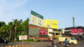
Ramanattukara is a municipality census town in Kozhikode district in the Indian state of Kerala. This town was formerly called Kadungan Chira village. Ramanattukara is located 15 km away from Kozhikode city.

<span class="mw-page-title-main">Idimuzhikkal</span> Census town in Kerala, India

Idimuzhikkal or Chelembra is a town in Malappuram district, Kerala, India. Chelembra is the Panchayath and Idimuzhikal is the capital of this Panchayath. Chelembra grama panchayat in the district.

<span class="mw-page-title-main">Parappanangadi</span> Municipality in Kerala, India

Parappanangadi is a major town and a municipality in Tirurangadi taluk of Malappuram district, Kerala, India. It is a coastal town located close to the Arabian sea.

<span class="mw-page-title-main">Vengara, Malappuram district</span> Town in Kerala, India

Vengara is a town in Malappuram district of Kerala state. It is situated in the Vengara Grama Panchayat and is located in Tirurangadi Taluk.

Kuzhimanna Gramapanchayat is a Gramapanchayat located in Areecode Block Panchayat in Kondotty Taluk, The area of Kuzhimanna Gramapanchayat is 20.05 square kilometer. There is 18 wards in this panchayat. This panchayat was formed in 1961. Kizhissery is a town near Kondotty in Malappuram district in the state of Kerala, India.

<span class="mw-page-title-main">Nediyiruppu</span> Suburb of Kondotty in Malappuram, Kerala, India

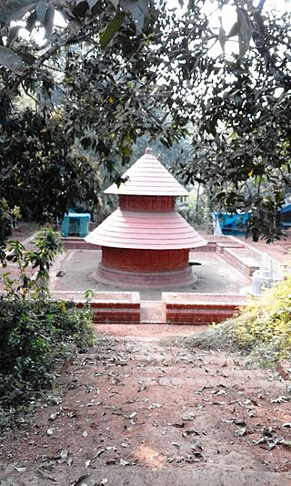
Nediyiruppu was the capital of the Zamorin's kingdom in colonial Kerala. At the time, it was known as Nediyiruppu Swaroopam. It is a region of the Kondotty municipality in Malappuram district, Kerala, India. It is situated 24 kilometres (15 mi) from Malappuram, the district headquarters.

<span class="mw-page-title-main">Pallikkal Bazar</span> Census town in Kerala, India

Pallikkal is a T-shaped town, village and gram panchayat in Kondotty Taluk, Malappuram district in the state of Kerala, India.

<span class="mw-page-title-main">Pulikkal</span> Village in Kerala, India

Pulikkal or Cherukavu is a village in Malappuram district in the state of Kerala, India.

<span class="mw-page-title-main">Purathur</span> Village in Kerala, India

Purathur is a sandy coastal village and a Grama Panchayat in Tirur Taluk, Malappuram district in the state of Kerala, India. Bharathappuzha river and Tirur River merges together in Purathur and join with the Arabian Sea at Padinjarekara Azhimukham, which is also the southernmost tip of Purathur Gram panchayat. Opposite to Padinjarekara Azhimukham is Ponnani port. The village is located at the southernmost tip of Tirur Taluk and is bordered by historically important Ponnani port in Ponnani Municipality of Ponnani taluk to south.

<span class="mw-page-title-main">Vallikkunnu</span> Village in Kerala, India

Vallikkunnu is a village in Tirurangadi Taluk of Malappuram district in the state of Kerala, India with an area of 25 km2. It is located 5 km north of Parappanangadi town and comes under the jurisdiction of Parappanangadi Police Station and Parappanangadi Judicial First Class Magistrate Court. Its latitude and longitude are 11'07" N and 7'51"E respectively. Vallikkunnu was awarded the best panchayath of Kerala in 1997. Vallikunnu is situated on Tirur-Kadalundi Road. Vallikkunnu is also a part of the Oldest Railway Line of Kerala laid in 1861 from Tirur to Chaliyam via Tanur, Parappanangadi, Vallikkunnu, and Kadalundi.

<span class="mw-page-title-main">Kadalundi</span> Village in Kerala, India

Kadalundi is a village in Kozhikode district, Kerala, India. It is a coastal village close to the Arabian Sea. Kadalundi is famous for its bird sanctuary, which is home to various migratory birds during certain seasons and has been recently declared as a bio-reserve. The Kadalundi-Vallikkunnu community reserve is the first community reserve in Kerala. The Kadalundi River and the Chaliyar river, two of the longest rivers of Kerala, merges with the Arabian Sea at Kadalundi. The first railway line in Kerala was laid in 1861 from Tirur to Chaliyam through Tanur, Parappanangadi, Vallikkunnu, and Kadalundi.

Puthuparamba or puthuparambu is a natural village in Edarikode Grama Panchayath which located near to NH 66 Pookipparamba Malappuram District of Kerala, India. Postal code is 676501

<span class="mw-page-title-main">Eranad</span> Erstwhile Province in Kerala, India

Eranad also known as Ernad refers to the erstwhile province in the midland area of Malabar, consisting of Malappuram and nearby regions such as Anakkayam, Manjeri, Kondotty, Nilambur, etc. Currently Eranad Taluk is a Taluk in Malappuram district. Eranad was ruled by a Samanthan Nair clan known as Eradis, similar to the Vellodis of neighbouring Valluvanad and Nedungadis of Nedunganad. The rulers of Eranad were known by the title Eralppad/Eradi. They also used the title Thirumulpad.

<span class="mw-page-title-main">Cherukavu</span> Census town in Kerala, India

Cherukavu is a census town in Malappuram district in the state of Kerala, India.

<span class="mw-page-title-main">Poocholamad</span> Village in Kerala, India

Poocholamad is a village in Kannamangalam in the Malappuram district, state of Kerala, India. It is part of the Gram Panchayat government. It is also included in Vengara Assembly constituency and Malappuram Lokhasabha constituency.

<span class="mw-page-title-main">Chaliyam</span> Village in Kerala, India

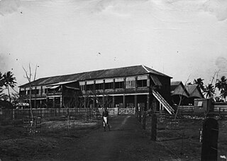
Chaliyam is a village situated at the estuary of Chaliyar in Kozhikode district of Kerala, India. Chaliyam forms an island, bounded by the Chaliyar in the north, and River Kadalundi in south, and the Conolly Canal in the east. It is located just opposite to Beypore port. Chaliyam was the former terminus of the South-West Line of the Madras Railway. Chaliyam is also famous for the Guinness World Records holder Muhammed Adil, a P.M who covered around seven km in the Chaliyar River with his hand and legs tied with ropes.

<span class="mw-page-title-main">Paruthippara</span> Village in Kerala, India

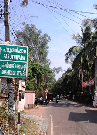
Paruthippara or Kodampuzha is a small village near Feroke in Kozhikode District. The village is considered an industrial belt as a large number of small-scale are established here for a long time.

References

  1. 1 2 Thenhippalam. OurVillageIndia.org. Retrieved on 2008-08-02.
  2. "Constituents of Malappuram metropolitan area". kerala.gov.in.
  3. About the University Archived 5 August 2008 at the Wayback Machine . University of Calicut. Retrieved on 2008-08-02.