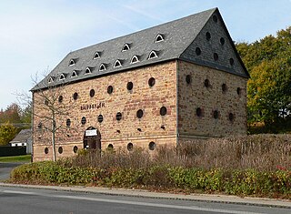
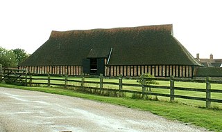
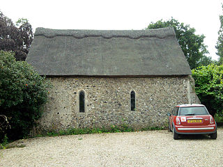
A tithe barn was a type of barn used in much of northern Europe in the Middle Ages for storing rents and tithes. Farmers were required to give one-tenth of their produce to the established church. Tithe barns were usually associated with the village church or rectory, and independent farmers took their tithes there. The village priests did not have to pay tithes—the purpose of the tithe being their support. Some operated their own farms anyway. The former church property has sometimes been converted to village greens.

Templecombe is a village in Somerset, England, situated on the A357 road five miles south of Wincanton, 12 miles (19 km) east of Yeovil, and 30 miles (48 km) west of Salisbury. It is located within the Blackmore Vale. The village has a population of 1,560. Along with the hamlet of Combe Throop, it forms the parish of Abbas and Templecombe.

Essex is a county in the East of England which originated as the ancient Kingdom of Essex and one of the seven kingdoms, or heptarchy, that went on to form the Kingdom of England.

A cruck or crook frame is a curved timber, one of a pair, which support the roof of a building, historically used in England and Wales. This type of timber framing consists of long, generally naturally curved, timber members that lean inwards and form the ridge of the roof. These posts are then generally secured by a horizontal beam which then forms an "A" shape. Several of these "crooks" are constructed on the ground and then lifted into position. They are then joined together by either solid walls or cross beams which aid in preventing 'racking'.

Shilton is a village and civil parish about 1+1⁄2 miles (2.4 km) northwest of Carterton, Oxfordshire. The 2011 Census recorded the parish's population as 626.

Cameley is a village in the civil parish of Temple Cloud with Cameley, within the Chew Valley in Somerset, and on the northern slopes of the Mendip Hills, in the Bath and North East Somerset Council area just off the A37 road. It is located 11 miles (18 km) from Bristol, Bath and Wells. The nearest town is Midsomer Norton, which is 6 miles (10 km) away. The parish has a population of 1,292 and includes the village of Temple Cloud.
Cressing Temple is a medieval site situated between Witham and Braintree in Essex, close to the villages of Cressing and White Notley. It was amongst the very earliest and largest of the possessions of the Knights Templar in England, and is currently open to the public as a visitor attraction.

Temple Church, also known as Holy Cross Church, is a ruined church in Redcliffe, Bristol, England. It is on the site of a previous, round church of the Knights Templar, which they built on land granted to them in the second quarter of the 12th century by Robert of Gloucester. In 1313 the Knights Hospitaller acquired the church, following the suppression of the Templars, only to lose it in 1540 at the time of the Dissolution of the Monasteries. By the early 14th century, the church served as the parish church for the area known as Temple Fee. From around the same time, the rebuilding of the church on a rectangular plan started. This was completed by 1460, with the construction of a leaning west tower.

The Church of St James and St Paul, south of the village of Marton, Cheshire, England, is recorded in the National Heritage List for England as a designated Grade I listed building. It is an active Anglican parish church in the diocese of Chester, the archdeaconry of Macclesfield and the deanery of Congleton. Its benefice is combined with those of Holy Trinity, Capesthorne, Christ Church, Eaton, and All Saints, Siddington. The church is an important location in the novel Strandloper by Alan Garner.

Stoke sub Hamdon Priory is a complex of buildings and ruins which initially formed a 14th-century college for the chantry chapel of St Nicholas, and later was the site of a farm in Stoke-sub-Hamdon, Somerset, England. The only building remaining from the college is a great hall and attached dwelling, dating from the late 15th century. The hall is designated by English Heritage as a Grade I listed building, while the outbuildings and gateway are Grade II listed. The whole site has been scheduled as an ancient monument. A number of the farm buildings are in poor condition, and have been added to the Heritage at Risk Register.

Stanford Rivers is a village and civil parish in the Epping Forest district of Essex, England. The parish, which is approximately 11 miles (18 km) west from the county town of Chelmsford, contains the village of Toot Hill and the hamlet of Little End, both settlements larger than Stanford Rivers village, and the hamlet of Clatterford End. The village is 2.0 miles (3 km) south-east of Chipping Ongar, 3 miles (5 km) south-west of North Weald Bassett and 3 miles north-west of Kelvedon Hatch. The parish covers an area of 1,749 hectares.

Fiddlers Hamlet is a hamlet in the civil parish of Epping, within the Epping Forest District of Essex, England, and is 1 mile (1.6 km) south-east from the market town of Epping, separated by farm and fields. The M11 motorway runs 300 yards (274 m) to the east, with Junction 7 for Harlow being 4 miles (6 km) to the north.
St James' Chapel is a 13th-century chapel located near the village of Lindsey, Suffolk, England. Built in 1250 of flint, brick and stone, the small church served as the chantry chapel for nearby Lindsey castle. The chapel was in use until 1545 when it was dissolved as a "free chapel". After dissolution, the King granted the property to Thomas Turner, who converted the building into a barn. St James' chapel is recorded in the National Heritage List for England as a designated Grade I listed building and scheduled monument.

Great Limber is a village and civil parish in the West Lindsey district of Lincolnshire, England. The population of the civil parish at the 2011 census was 271. It is on the A18, 8 miles (13 km) west from Grimsby and 8 miles east from Brigg.
The history of the Knights Templar in England began when the French nobleman Hugues de Payens, founder and Grand Master of the Order, visited the country in 1128 to raise men and money for the Crusades.

Temple Manor is a scheduled ancient monument and grade I listed building in Strood, Kent. The Manor has been owned by various religious, national and farming owners over 600 years. The building has been added to and adapted over the centuries, but the basic structure is now clearly visible.

Withham Preceptory, one of the smallest Knights Templar preceptories in England, was founded, before 1164, at Temple Hill, near South Witham, Lincolnshire, and was abandoned in the early 14th century. The site of the former preceptory at Temple Hill, South Witham. It 'has been largely under pasture' since the Knights Templar left in 1308.

Temple Hirst is a village and civil parish in the Selby District of North Yorkshire, England. It was formerly in the wapentake of Barkston Ash in the West Riding of Yorkshire. The village is located on the north bank of the River Aire. In the 2011 census the population was 117.

Grange Barn is a historic timber-framed building in Coggeshall, Essex, England. Grange Barn was built by the Cistercians in the 13th century to serve Coggeshall Abbey. It underwent significant structural alteration in the 14th century. It is Grade I listed.

Newman's End is a hamlet in the civil parish of Matching, and the Epping Forest district of Essex, England.


