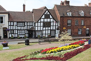
Worcestershire is a ceremonial county in the West Midlands of England. It borders Shropshire, Staffordshire, and the West Midlands county to the north, Warwickshire to the east, Gloucestershire to the south, and Herefordshire to the west. The largest settlement is the city of Worcester.

Worcester is a cathedral city in the district of the same name in Worcestershire, England, of which it is the county town. It is 30 mi (48 km) south-west of Birmingham, 27 mi (43 km) north of Gloucester and 23 mi (37 km) north-east of Hereford. The population was 87,483 in the 2021 census. Worcester is an unparished area.

Hereford and Worcester was an English non-metropolitan county created on 1 April 1974 by the Local Government Act 1972 from the areas of the former administrative county of Herefordshire, most of Worcestershire and the county borough of Worcester. An aim of the Act was to increase efficiency of local government: the two counties are among England's smaller and less populous counties, particularly after the same Act transferred some of Worcestershire's most urbanised areas to the West Midlands.

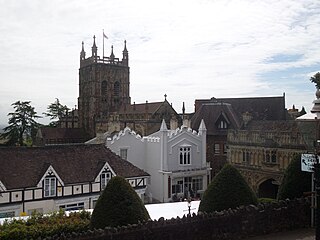
Malvern is a spa town and civil parish in Worcestershire, England. It lies at the foot of the Malvern Hills, a designated Area of Outstanding Natural Beauty. The centre of Malvern, Great Malvern, is a historic conservation area, which grew dramatically in Victorian times due to the natural mineral water springs in the vicinity, including Malvern Water.

Upton-upon-Severn is a town and civil parish in the Malvern Hills District of Worcestershire, England. Lying on the A4104, the 2021 census recorded a population of 2,903 for the town.

Malvern Hills is a local government district in Worcestershire, England. Its council is based in the town of Malvern, and its area covers most of the western half of the county, including the outlying towns of Tenbury Wells and Upton-upon-Severn. It was originally formed in 1974 and was subject to a significant boundary reform in 1998. In the 2011 census the population of the Malvern Hills district was 74,631.

BBC Hereford & Worcester is the BBC's local radio station serving the counties of Herefordshire and Worcestershire which was one county from 1974 to 1998.

Great Malvern is an area of the civil parish of Malvern, in the Malvern Hills district, in the county of Worcestershire, England. It lies at the foot of the Malvern Hills, a designated Area of Outstanding Natural Beauty, on the eastern flanks of the Worcestershire Beacon and North Hill, and is the historic centre of Malvern and includes its town centre.

Leominster was a non-metropolitan district in Hereford and Worcester, England from 1974 to 1998. The council was based in the town of Leominster.

Barnards Green is one of the main population areas of Malvern, Worcestershire, England, situated approximately 1 mile (1.6 km) east and downhill from Great Malvern, the town's traditional centre.

The Cotswold Line is an 86+1⁄2-mile (139.2 km) railway line between Oxford and Hereford in England.

North Malvern is a suburb of Malvern, Worcestershire, England. It nestles on the northern slopes of the Malvern Hills. It is a contiguous urban extension of Link Top, and other neighbouring centres of population are Great Malvern, Malvern Link, West Malvern and the former village of Cowleigh. It is part of the civil parish of Malvern, administered by the Malvern Hills District, and is included in the informal region known as The Malverns.

Worcestershire Beacon, also popularly known as Worcester Beacon, or locally simply as The Beacon, is a hill whose summit at 425 metres (1,394 ft) is the highest point in Worcestershire. It is part of the Malvern Hills which run about 13 kilometres (8.1 mi) north-south along the Herefordshire-Worcestershire border.

Worcester Foregate Street railway station, opened by the Great Western Railway in 1860 serves the city of Worcester, Worcestershire, England. It is one of the two stations serving the city, with the other station, Worcester Shrub Hill, being located to the east. A third station, Worcestershire Parkway, is located just outside the city to the south-east.

Great Malvern railway station is one of two stations serving the town of Malvern, Worcestershire, England on the Hereford to Worcester section of the Cotswold Line. It is situated downhill from the centre of Great Malvern and close to Barnards Green. The station retains most of its original Victorian station design by the architect Edmund Wallace Elmslie and is a Grade II listed building.

Malvern Link railway station serves Malvern Link in Worcestershire, England. It is one of two stations serving the town of Malvern, the other being Great Malvern station.

Hartlebury Common is an area of lowland heath in north Worcestershire, England, situated just outside the town of Stourport-on-Severn. Hartlebury Common and Hillditch Coppice are a biological and geological Site of Special Scientific Interest which covers an area of 90.2 hectares . The common supports many varieties of wild plants and insects, especially butterflies and moths. Hartlebury Common and Hillditch Pool are a Local Nature Reserve.

Poolbrook is a village and a suburb of Malvern, Worcestershire, England, situated approximately 1.5 miles (2.4 km) southeast of Great Malvern, the town's centre, and about 0.5 miles (08 km) from the Malvern suburb of Barnards Green on the Poolbrook Road (B4208). The village comprises several shops, a traditional English pub, and a number of council and private housing estates. St Andrew's C of E parish church was built in Early English style in 1882 as a memorial to a member of the Chance Brothers glass manufacturing family. The village occupies the geographical centre of the Chase ward of Malvern Town Council.

Sunshine Radio is an Independent Local Radio station which broadcasts to Herefordshire and Monmouthshire, areas of the West Midlands and South Wales respectively from its studios in Hereford. It is operated by Murfin Media Ltd, and previously by Laser Broadcasting.

The administrative boundaries of Worcestershire, England have been fluid for over 150 years since the first major changes in 1844. There were many detached parts of Worcestershire in the surrounding counties, and conversely there were islands of other counties within Worcestershire. The 1844 Counties Act began the process of eliminating these, but the process was not completed until 1966, when Dudley was absorbed into Staffordshire.


