QuickBird was a high-resolution commercial Earth observation satellite, owned by DigitalGlobe, launched in 2001 and reentered after orbit decay in 2015. QuickBird used Ball Aerospace's Global Imaging System 2000. The satellite collected panchromatic imagery at 61 centimeter resolution and multispectral imagery at 2.44- to 1.63-meter resolution, as orbit altitude is lowered during the end of mission life.

RapidEye AG was a German geospatial information provider focused on assisting in management decision-making through services based on their own Earth-observation imagery. The company operated a five-satellite constellation producing 5-meter resolution imagery that was designed and implemented by MacDonald Dettwiler of Richmond, Canada.

Fēngyún are China's meteorological satellites. Launched since 1988 into polar Sun-synchronous and geosynchronous orbit, each three-axis stabilized Fengyun satellite is built by the Shanghai Academy of Spaceflight Technology (SAST) and operated by the China Meteorological Administration (CMA). To date, China has launched twenty-one Fengyun satellites in four classes. Fengyun 1 and Fengyun 3 satellites are in polar, Sun-synchronous orbit and Low Earth orbit while Fengyun 2 and 4 are geosynchronous orbit.

Landsat 2 is the second satellite of the Landsat program. The spacecraft originally carried a designation of ERTS-B but was renamed "Landsat 2" prior to its launch on January 22, 1975. The objective of the satellite was to acquire global, seasonal data in medium resolution from a near-polar, Sun-synchronous orbit. The satellite, built by General Electric, acquired data with the Return Beam Vidicon (RBV) and the Multispectral Scanner (MSS). Despite having a design life of one year, Landsat 2 operated for over seven years, finally ceasing operations on February 25, 1982.
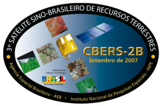
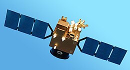
China–Brazil Earth Resources Satellite 2B (CBERS-2B), also known as Ziyuan 1-2B, was a remote sensing satellite operated as part of the China–Brazil Earth Resources Satellite program between the Chinese Center for Resources Satellite Data and Application and Brazilian National Institute for Space Research. The third CBERS satellite to fly, it was launched by China in 2007 to replace CBERS-2.

China–Brazil Earth Resources Satellite 1 (CBERS-1), also known as Ziyuan I-01 or Ziyuan 1A, is a remote sensing satellite which was operated as part of the China–Brazil Earth Resources Satellite program between the China National Space Administration and Brazil's National Institute for Space Research. The first CBERS satellite to fly, it was launched by China in 1999.

Sentinel-2 is an Earth observation mission from the Copernicus Programme that systematically acquires optical imagery at high spatial resolution over land and coastal waters. The mission is currently a constellation with two satellites, Sentinel-2A and Sentinel-2B; a third satellite, Sentinel-2C, is currently undergoing testing in preparation for launch in 2024.
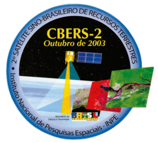
China–Brazil Earth Resources Satellite 2 (CBERS-2), also known as Ziyuan I-02 or Ziyuan 1B, was a remote sensing satellite operated as part of the China–Brazil Earth Resources Satellite program between the Chinese Center for Resources Satellite Data and Application and Brazilian National Institute for Space Research. The second CBERS satellite to fly, it was launched by China in 2003 to replace CBERS-1.

Euclid is a wide-angle space telescope with a 600-megapixel camera to record visible light, a near-infrared spectrometer, and photometer, to determine the redshift of detected galaxies. It was developed by the European Space Agency (ESA) and the Euclid Consortium, and was launched on 1 July 2023.
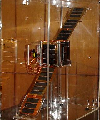
NEE-01 Pegaso is an Ecuadorian technology demonstration satellite, and Ecuador's first satellite launched to space. Built by the Ecuadorian Civilian Space Agency (EXA), it is a nanosatellite of the single-unit CubeSat class. The spacecraft's instruments include a dual visible and infrared camera which allows the spacecraft to take pictures and transmit live video from space.
Oceansat-1 or IRS-P4 was the first Indian satellite built primarily for ocean applications. It was a part of the Indian Remote Sensing Programme satellite series. The satellite carried an Ocean Colour Monitor (OCM) and a Multi-frequency Scanning Microwave Radiometer (MSMR) for oceanographic studies. Oceansat-1 thus vastly augment the IRS satellite system of Indian Space Research Organisation (ISRO) comprising four satellites, IRS-1B, IRS-1C, IRS-P3 and IRS-1D and extend remote sensing applications to several newer areas.

Planet Labs PBC is an American public Earth imaging company based in San Francisco, California. Their goal is to image the entirety of the Earth daily to monitor changes and pinpoint trends.
Gaofen 1 is a Chinese high-resolution Earth observation satellite, and the first of the Gaofen series satellites.

Gaofen is a series of Chinese high-resolution Earth imaging satellites launched as part of the China High-resolution Earth Observation System (CHEOS) program. CHEOS is a state-sponsored, civilian Earth-observation program used for agricultural, disaster, resource, and environmental monitoring. Proposed in 2006 and approved in 2010, the CHEOS program consists of the Gaofen series of space-based satellites, near-space and airborne systems such as airships and UAVs, ground systems that conduct data receipt, processing, calibration, and taskings, and a system of applications that fuse observation data with other sources to produce usable information and knowledge.
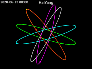
Haiyang is a series of marine remote sensing satellites developed and operated by the People's Republic of China since 2002. As of October 2022, eight satellites have been launched with ten more planned. Built by the state-owned aerospace contractor China Academy of Space Technology (CAST), Haiyang satellites carry a variety of ocean-imaging sensor payloads and are operated by the National Satellite Ocean Application Service (NSOAS), a subordinate agency of the State Oceanic Administration (SOA). Haiyang satellites are launched from Taiyuan Satellite Launch Center (TSLC) into Sun-synchronous orbit (SSO) aboard Long March-series rockets.
Cartosat-2E is an Earth observation satellite developed by the Indian Space Research Organisation (ISRO), and is the seventh in the Cartosat series. It is designed to collect high-resolution, large-scale imagery for use in urban planning, infrastructure development, utilities planning, and traffic management.
TanSat, also known as CarbonSat, is a Chinese Earth observation satellite dedicated to monitoring carbon dioxide in Earth's atmosphere. It is generally classified as a minisatellite, and is the first dedicated carbon mission of the Chinese space program. The mission was formally proposed in 2010, and work began in January 2011. It is funded by the Ministry of Science and Technology (MOST) and was built by the Shanghai Institute of Microsystem And Information Technology (SIMIT).

NOAA-20, designated JPSS-1 prior to launch, is the first of the United States National Oceanic and Atmospheric Administration's latest generation of U.S. polar-orbiting, non-geosynchronous, environmental satellites called the Joint Polar Satellite System. NOAA-20 was launched on 18 November 2017 and joined the Suomi National Polar-orbiting Partnership satellite in the same orbit. NOAA-20 operates about 50 minutes behind Suomi NPP, allowing important overlap in observational coverage. Circling the Earth from pole-to-pole, it crosses the equator about 14 times daily, providing full global coverage twice a day. This gives meteorologists information on "atmospheric temperature and moisture, clouds, sea-surface temperature, ocean color, sea ice cover, volcanic ash, and fire detection" so as to enhance weather forecasting including hurricane tracking, post-hurricane recovery by detailing storm damage and mapping of power outages.

Cartosat-2F is the eighth satellite in the Cartosat-2 Series. It is an Earth observation satellite launched on the PSLV-C40 mission by the Indian Space Research Organisation (ISRO).
TIROS 4 was a spin-stabilized meteorological satellite. It was the fourth in a series of Television Infrared Observation Satellites.