Tornado outbreak of May 18–21, 2013

Last updated
Tornado outbreak of May 18–21, 2013
Central Oklahoma supercells 2013-05-20 1940Z.jpg
Multiple supercells associated with the storm system as seen on May 20 at 2:40 p.m. CDT (1940 UTC)
TypeTornado outbreak
DurationMay 18–21, 2013
Highest winds
  • Tornadic – 210 mph (340 km/h) (Moore, OK EF5 tornado on May 20)
    Non-tornadic – 100 mph (160 km/h) (Milford Lake, KS on May 18)
Tornadoes
confirmed
78
Max. rating1 EF5 tornado
Duration of
tornado outbreak2
2 days, 17 hours, 42 minutes
Largest hail4.25 in (10.8 cm) in diameter (N of Bigheart, OK on May 20)
Fatalities26 fatalities (+3 non-tornadic; +1 indirect), 229 injuries
Damage$2–5 billion [1] [nb 1]
Part of the Tornadoes of 2013

1Most severe tornado damage; see Enhanced Fujita scale
2Time from first tornado to last tornado

A significant and destructive tornado outbreak that affected parts of the Midwestern United States and lower Great Plains in mid-May 2013. This event occurred just days after a deadly outbreak struck Texas and surrounding southern states on May 15. On May 16, a slow moving trough crossed the Rockies and traversed the western Great Plains. Initially, activity was limited to scattered severe storms; however, by May 18, the threat for organized severe thunderstorms and tornadoes greatly increased. A few tornadoes touched down that day in Kansas and Nebraska, including an EF4 tornado near Rozel, Kansas. Maintaining its slow eastward movement, the system produced another round of severe weather nearby. Activity significantly increased on May 19, with tornadoes confirmed in Oklahoma, Kansas, Iowa, Missouri, and Illinois. In Oklahoma, two strong tornadoes, one rated EF4, caused significant damage in rural areas of the eastern Oklahoma City metropolitan area; two people lost their lives near Shawnee. The most dramatic events unfolded on May 20 as a large EF5 tornado devastated parts of Moore, Oklahoma, killing 24 people. Thousands of structures were destroyed, with many being completely flattened. Several other tornadoes occurred during the day in areas further eastward, though the majority were weak and caused little damage.

Contents

The severe threat shifted towards damaging straight-line winds on May 21 as a large squall line developed across the southern states. Further north in Ontario, three tornadoes, including an EF2, touched down. Over the following five days, the system responsible for the outbreak moved very little across the Eastern United States. By May 24, it virtually stalled off the coast of New England, resulting in several days of heavy rain across the region. It later moved northeastward and was last noted by the Weather Prediction Center late on May 26 over southeastern Canada. During the storm's eleven-day trek across the United States, it produced 75 tornadoes, 4 of which were rated EF3 or higher. Over 1,000 reports of damaging winds were received by the Storm Prediction Center as well. The system's slow movement also resulted in record-breaking rainfall in North Dakota, New York and Vermont. Additionally, during the overnight of May 25–26, unusually cold air behind the cyclone resulting in record-late snowfall across northern New England.

Overall, severe weather associated with the storm was responsible for 30 fatalities (26 from tornadoes) and over 200 injuries in the United States. Additionally, damage was estimated to amount to $2–5 billion, making it one of the costliest severe weather events on record. [1] [2]

Meteorological synopsis

Casualties by State
StateTotalFatalitiesInjuries
Arkansas 11 [3] 0
Illinois 303 [4]
Kansas 202 [5]
Minnesota 42 [6] 2 [6]
New York 101 [7]
Oklahoma 40526 [8] [9] 377 [10]
Tennessee 101 [11]
West Virginia 202 [7]
Totals41929390
Totals are inclusive of all events related to the overall system.

The cause of the outbreak was a large, slow-moving trough, an associated cold front, and several shortwave troughs that triggered severe weather from the Rockies eastward to New England and from Canada southward to the Gulf Coast of the United States. The system impacted the United States and Canada from May 16–26 and produced tornadoes on five of the eleven days. During this nearly two-week-long event, the Storm Prediction Center (SPC) received 1,967 reports of severe weather: 101 for tornadoes, 1,176 for wind, and 690 for hail. Some of these reports were associated with a separate system over the Southeastern United States on May 19–20.

May 16–17

The first indications of a possible tornado outbreak came on May 13 as weather forecast models began depicting a multi-day severe weather event across the Central United States. [12] On May 16, a shortwave trough, along with a surface front emerged from the Rockies into the High Plains. Only scattered thunderstorms accompanied the system, with few reaching severe levels. [13] Only 13 reports of large hail and damaging winds in Colorado, Kansas, and Nebraska, were received by the SPC. [14] On May 17, a slow-moving mid- to upper-level trough in the same region brought a further risk of thunderstorms. Significant low-level moisture streamed northward from Texas into the Dakotas ahead of the system. This increased dew points in the area into the 50 °F (10 °C) range; orographic lift and up-slope flow was expected to trigger the development of storms. The SPC issued a small slight risk for severe thunderstorms around the Black Hills into central Nebraska, with the main threat being large hail and the possibility of an isolated tornado. A second slight risk area was issued over central Texas as the northward flow collided with a dry line in the area. [15] [16] Though there was notable atmospheric capping, convective available potential energy (CAPE) values of 2,500–3,000 J/kg led to the potential of localized supercells capable of producing very large hail and downbursts. [17] Additionally, a stationary outflow boundary over southern Minnesota and northern Iowa encountered moderate instability and produced scattered severe storms, some of which were capable of producing tornadoes. [18] Two tornadoes were confirmed in Young County, Texas: one EF1 and one EF0 (these tornadoes were only partially associated with the main system). [19] Throughout the day, the SPC received a total of 103 reports of severe weather in association with the system: 10 for tornadoes, 21 for wind, and 86 for hail. The tornadoes were not fully associated with the main system. [20]

May 18

Damage caused by an EF4 tornado near Rozel, Kansas on May 18. May 18, 2013 Rozel, Kansas tornado damage.jpg
Damage caused by an EF4 tornado near Rozel, Kansas on May 18.

On May 17, the SPC issued a moderate risk of severe weather for northwestern Kansas and southwestern Nebraska for the following day. [21] This was later extended southward into western Oklahoma. On May 18, the trough continued to slowly move from the Rockies into the Great Plains region. Extreme instability ahead of it, with CAPE values reaching 4,000–5,000 J/kg along with strong diabatic heating, was anticipated to spark widespread severe thunderstorms and some supercells. The main threat on May 18 was large hail and straight-line winds, with a lesser concern for tornadoes. [22] The first tornado watch was issued at 2:45 p.m. CDT (1945 UTC) for much of western Nebraska, Kansas, and extreme northeast Colorado as moist northerly flow ahead of the trough met up with a dry line moving into the region. Tornadic activity was expected to be relatively limited at first, though a strengthening low-level jet along with increasing relative humidity along the boundary layer would provide more favorable conditions for development. [23]

During the evening of May 18, tornadoes touched down in parts of Kansas and Nebraska. However, most remained in open country, causing little damage. [24] Around 5:30 p.m. CDT (2230 UTC), a supercell thunderstorm developed to the northeast of Dodge City. At 7:18 p.m. CDT (0018 UTC), it spawned a large EF4 tornado near Rozel, Kansas; one home was largely destroyed and five farms were damaged. Around the time it reached EF4 intensity, [25] the tornado took a sharp northward turn as it passed within 1 mile (1.6 km) of Rozel. Aaron Johnson of the National Weather Service in Dodge City stated that had it not made the turn, Rozel would have likely been destroyed. [26] A second tornado briefly touched down around 7:50 p.m. CDT (0050 UTC). [27] By 8:30 p.m. CDT (0130 UTC), a squall line began developing over south-central Nebraska and central Kansas. [28] Several corridors of intense winds, possibly associated with brief tornadoes, were observed in Clay and Washington counties in Kansas. Several homes were damaged or destroyed by the winds. Near Milford Lake, a non-tornadic gust of 100 mph (160 km/h) was measured; two people were injured near the lake after their camper tipped over. [5] Later on, strong southerly flow and isentropic lift intersected a stationary front over northern South Dakota, southern North Dakota, and western Minnesota, allowing for scattered severe storms to develop. [29] One of these storms produced gusts up to 85 mph (137 km/h) to the east of Okreek, South Dakota. Throughout the day, the SPC received a total of 231 reports of severe weather: 24 for tornadoes, 92 for wind, and 115 for hail. [24]

May 19

Visible satellite imagery of the severe thunderstorms at 6:10 p.m. CDT on May 19. GOES13 Visible 2013-05-19 231018Z.jpg
Visible satellite imagery of the severe thunderstorms at 6:10 p.m. CDT on May 19.

On May 19, the trough moved only slightly eastward, with many of the same areas impacted on May 18 being threatened again. During the day, two areas of low pressure developed along the trough: one over the north-central plains and the other over Oklahoma. A large plume of steep mid-level lapse rates accompanied by deep moisture (with dew points in some areas exceeding 70 °F (21 °C)) spread across much of the central and southern plains into the Mississippi River Valley. Thunderstorms in these areas were expected to develop early, though not be particularly widespread or damaging. The most intense storms were anticipated over the southern Missouri River Valley where strong daytime heating and "aggressive destabilization" would take place. Additionally, a diurnally strong jet and strong wind shear favored the development of long-lived supercells capable of producing large hail and tornadoes, some potentially violent. Activity was expected to become associated with a squall line by the evening as the cold front moved slowly eastward. In light of that, the SPC issued a moderate risk of severe thunderstorms for south-central Oklahoma, eastern Kansas, western Missouri, and extreme southeastern Nebraska. [30]

By the afternoon hours, rapid destabilization of the boundary layer began across eastern Kansas, prompting a tornado watch for the area. [31] Further south in Oklahoma, a rapidly mixing dry line accompanied by a deepening surface low moved eastward into an area with deep moisture. Though leftover outflow boundaries from the previous day's storms and capping limited initial convective activity, strong daytime heating would soon allow storms to break the cap. [32] A tornado watch was issued for the central third of Oklahoma at 2:15 p.m. CDT (1915 UTC), with the SPC noting the risk for potentially long-lived supercells and a few strong tornadoes. [33] Around 2:30 p.m. CDT (1930 UTC), a supercell developed over Harper County, Kansas and tracked northeastward. This cell produced three short-lived tornadoes, including an EF2 to the southwest of Wichita that prompted a tornado emergency for the city. [34] [35] Over the course of three hours, 10 other tornadoes touched down across the state, none of which exceeded EF1 intensity. [5] [34]

By 4:30 p.m. CDT (2130 UTC), the risk for significant tornadoes markedly increased over central Oklahoma, especially around the Oklahoma City metropolitan area. Maximized pressure falls ahead of the dry line allowed several storms to acquire intense updrafts and develop into rotating supercells within the state. Very strong low-level mesocyclones were expected to develop with these storms, with several tornadoes touching down. [36] Around this time, tornadoes began touching down around the city. At 4:41 p.m. CDT (2141 UTC), a large EF3 tornado developed 3 mi (4.8 km) northwest of Luther and tracked for roughly 20 mi (32 km). To the southeast, a violent EF4 tornado formed around 6:00 p.m. CDT (2300 UTC) over Cleveland County. That storm was the strongest of the day and resulted in significant damage, especially near the city of Shawnee where two people were killed. Two other tornadoes touched down during the evening in eastern Oklahoma: one EF2 and one EF1. [37] [38] In addition to the two fatalities, 39 people were injured across the state. [39]

Radar image of a supercell thunderstorm to the southwest of Wichita, Kansas at 3:32 p.m. CDT (2032 UTC) that spawned an EF2 tornado. May 19, 2013 SW Wichita supercell.jpg
Radar image of a supercell thunderstorm to the southwest of Wichita, Kansas at 3:32 p.m. CDT (2032 UTC) that spawned an EF2 tornado.

Storm coverage over eastern Kansas soon increased as well, with the main threat being damaging winds. [40] Further north over parts of Iowa and Minnesota, a mid-level vortex over the region accompanied by scattered thunderstorms presented a risk of severe storms. Increasing wind shear and an influx of moist air from the south was expected to allow convection to persist over the region for much of the evening, with the main threat being damaging winds and a few tornadoes. [41] By the evening hours, several squall lines developed across the region. Unstable air over much of Missouri allowed for these storms to maintain themselves as they moved slowly eastward. [42] Around 7:00 p.m. CDT (0000 UTC), a rapidly moving vorticity maximum over Iowa resulted in a significant increase in thunderstorms over the area, some of which were tornadic. [43] The most intense cell tracked from Dallas County to Story County, producing three brief tornadoes and straight-line winds along its path. [44] The touchdowns in Iowa marked the end of a record 358-day span with no tornadoes in the state. [45] [46]

Severe activity began decreasing by 10:00 p.m. CDT (0300 UTC) as the main squall line over Missouri entered an area of increased capping. [47] A secondary line, extending northward into Wisconsin, behind it with bowing segments, indicative of locally intense winds, produced additional damaging winds, though it gradually weakened during the overnight of May 19–20. [48] [49] Throughout the day, the SPC received a total of 558 reports of severe weather: 34 for tornadoes, 325 for wind, and 199 for hail; however, some of the wind and hail reports were associated with a separate system over the Southeastern United States. [50]

May 20

On May 20, a prominent central upper trough moved eastward with a lead upper low pivoting over the Dakotas and Upper Midwest. A Southern stream shortwave trough/moderately strong polar jet moved east-northeastward over the southern Rockies to the southern Great Plains and Ozarks area, with severe thunderstorms likely with peak heating. The Storm Prediction Center issued a moderate risk of severe thunderstorms during the early morning hours of May 20 from southeastern Missouri to north-central Texas, for the possibility of isolated strong tornadoes across central and eastern Oklahoma, in addition to the threat of large hail and damaging straight-line wind gusts. [51]

The most devastating event of the day occurred when a violent EF5 tornado struck Moore, Oklahoma, damaging or destroying more than 13,000 homes and killing 24 people including seven children who died while taking shelter inside Plaza Towers Elementary School, which was flattened by the tornado. [52]

In Michigan, gusts from the squall line reached 80 mph (130 km/h), downing numerous trees and power lines. Some trees were 1.5 feet (0.46 m) in diameter. A few trucks were blown onto their sides as well. [3] Roughly 30,000 customers of Consumers Energy lost power across the state. [53] Further south, considerable damage took place across Missouri and Arkansas due to a squall line. Gusts reached 88 mph (142 km/h) in Hannibal, Missouri. One person was killed in Springdale, Arkansas after his vehicle was struck by wind-driven debris. [3] Several tornadoes touched down within this squall line in the two states, none of which exceeded EF1 intensity. [38] [54] The squall line continued to produce damaging winds as it progressed eastward into Illinois and Indiana. [3] Three additional tornadoes touched down into the early hours of May 21, including a brief EF2 in Mount Olive, Illinois around 10:14 p.m. CDT (0314 UTC). [4] [55]

Throughout the day, the SPC received a total of 447 reports of severe weather: 37 for tornadoes, 281 for wind, and 129 for hail; however, some of the wind and hail reports were associated with a separate system over the Southeastern United States. [3]

May 21

Total precipitation across the United States from May 16-22. May 16 to 22, 2013 United States Rainfall.jpg
Total precipitation across the United States from May 16–22.

Similar to the preceding days, the slow moving trough and associated cold front moved slowly eastward on May 21. Strong instability ahead of the system prompted the SPC to issue a moderate risk of severe thunderstorms for extreme southeast Oklahoma, southwest Arkansas, northwest Louisiana, and northeast Texas; however, the main threat was damaging winds rather than tornadoes. With CAPE values of 2,500–4,000 J/kg and 50 to 65 mph (80 to 105 km/h) shear across the region, conditions were once again favorable for the development of supercells capable of producing large hail. Activity was expected to be scattered at first, with some isolated supercells capable of producing tornadoes, but a squall line was anticipated to develop quickly and become the dominant feature. In the Northeast and Great Lakes region, southwesterly flow ahead of the trough brought warm, moist air into the area. Moderate instability, with CAPE values ranging from 1,000 to 2,000 J/kg and steep lapse rates were supporting of damaging straight-line winds, especially across Michigan, New York and Massachusetts. [56] Later on, instability increased in the Northeast along a quasi-stationary front, leading to the risk of isolated supercells and a mesoscale convective system. [57]

During the morning of May 21, a strong shortwave trough over the Texas Panhandle moved eastward into Oklahoma. Moderate instability in the region led to the formation of thunderstorms across the state, with strong thunderstorms developing near the Oklahoma City metropolitan area, including the devastated city of Moore. [58]

Ahead of the main line of storms, a loosely organized squall line formed over central Tennessee by 11:15 a.m. CDT (1615 UTC). Initiating along the edge of an old outflow boundary, [59] the system moved into an area with CAPE values of 2,000–3,000 J/kg and strong daytime heating. As it moved east-northeastward, it became increasingly intense and organized. [60] Widespread wind damage occurred from central Tennessee into eastern Kentucky. The highest winds associated with this line reached 77 mph (124 km/h). Numerous trees and power lines were downed across both states. One person was injured in Wilson County, Tennessee after a construction crane was blown over onto a car by high winds. [11]

Severe storms extended into Ontario, Canada, where a squall line produced some damage. Strong winds downed many trees and power lines, leaving roughly 3,000 people without power. Heavy rains also caused some flooding, leaving cars stranded. [61] Three tornadoes touched down across the province: one EF2 near Glenarm and two EF0s. [62] [63] [64] In New York, two microbursts, both with winds up to 70 mph (110 km/h), caused minor damage in Cayuga and Seneca counties. [65] [66] Further south, a tornado warning was issued for Columbia and Dutchess Counties after a trained spotter mistakenly reported a tornado on the ground near the town Copake; it was later discovered that the spotter was looking at scud clouds rather than a funnel or a tornado. [67]

Throughout May 21, the SPC received a total of 413 reports of severe weather: none for tornadoes, 307 for wind, and 106 for hail. [11]

May 22–26

In Putnam County, West Virginia a microburst with winds up to 80 mph (130 km/h) destroyed two mobile homes and damaged five others, resulting in two injuries. [68] One person was injured by 1.75 inches (4.4 cm) diameter hail, near Roscoe, New York. [7]

Throughout May 22, the SPC received a total of 202 reports of severe weather: none for tornadoes, 145 for wind, and 57 for hail. [7]

On May 23, the slow moving system reached the Eastern United States, resulting in scattered thunderstorms across the region. [69] Located over the Ohio River Valley on May 24, prolonged heavy rains were expected across much of the Northeastern U.S. with unseasonably cold air following. [70] Later that day, a cold front extending from the trough moved offshore and over the western Atlantic Ocean. [71] Early on May 25, a closed circulation consolidated off the coast of New England and the system stalled out. Situated over the ocean, a continuous stream of Atlantic moisture was brought over the Northeast, resulting in "anomalously cold temperatures" and prolonged heavy precipitation. [72] During the overnight hours of May 25–26, record-late snow fell across portions of New York, New Hampshire, Vermont and Ontario. Meteorologists noted the system was similar to a winter nor'easter than a spring storm. [73] After affecting the country for 11 days, the system moved over southeastern Canada late on May 26. This was the final mention of the cyclone by the Weather Prediction Center. [74] [75]

Confirmed tornadoes

Confirmed tornadoes by Enhanced Fujita rating
EFUEF0EF1EF2EF3EF4EF5Total
03732512178

Lake Thunderbird–Bethel Acres–Shawnee, Oklahoma

Lake Thunderbird–Bethel Acres–Shawnee, Oklahoma
EF4 tornado
Chriscalvert-shawneetornado.jpg
The EF4 Lake Thunderbird-Shawnee tornado.
FormedMay 19, 2013, 6:00 p.m.
Duration50 minutes
DissipatedMay 19, 2013, 6:50 p.m.
Highest winds
  • 190 mph (310 km/h)
Max. rating1 EF4 tornado
Fatalities2 fatalities, 10 injuries
1Most severe tornado damage; see Enhanced Fujita scale

At 6:00 p.m. CDT (2300 UTC) on May 19, a tornado touched down along the western shore of Lake Thunderbird in eastern Cleveland County (east of Norman). [76] Initially, the tornado was weak, damaging roofs and trees (though a metal building was destroyed at EF2 intensity in this area). [77] The tornado intensified as it crossed Lake Thunderbird, destroying a mobile home and tearing the roofs off of two frame homes as it reached the eastern shore of the lake. Further northeast, the tornado intensified further to EF3 strength as it tore through several nearby subdivisions, heavily damaging or destroying numerous homes and mobile homes, and toppling several metal high-tension truss towers. The tornado widened and weakened back to EF2 strength as it crossed S Harrah Rd, completely destroying several mobile homes and outbuildings in that area. [77] The tornado maintained EF2 strength as it passed directly over the Shawnee Reservoir, destroying numerous mobile homes and tearing roofs off of frame homes along the shore. [77] The tornado regained EF3 intensity as it passed northwest of Bethel Acres, and a mobile home park sustained a direct hit from the tornado in this area, with 30–35 mobile homes completely destroyed. [78] There, one person was killed and six others were injured, two critically. [8] [79] [80] A frame home near the mobile home park was left with only interior rooms standing. [77]

Past the mobile home park, the large stovepipe tornado intensified further into a violent EF4. A permanent home in this area was swept completely away with only the slab foundation remaining and much of the debris blown to the northeast. Several trees were denuded and debarked in this area, one of which was found with a truck wrapped around it. [77] [81] The tornado continued across a nearby open field, leaving behind a pronounced swath of ground scouring. [77] The tornado then weakened back to EF2 strength as it crossed Interstate 40 at exit 181 (U.S. Highway 177) at the northwest edge of Shawnee. There, a tractor-trailer was blown off an overpass (falling 20 feet (6.1 m)) and destroyed, while two other trucks were knocked over on their sides. The driver of the first truck sustained minor injuries. Several smaller vehicles were impacted as well, resulting in a fatality and several injuries. [81] [82] The incident shut down U.S. 177 and westbound lanes of Interstate 40 in the area; U.S. 177 reopened the following morning, while traffic on the interstate was restricted to one lane. [83] A mobile home and several outbuildings were destroyed in this area, and a permanent home had its roof torn off. [77] Turning sharply to the north, a final brief area of EF3 damage was noted as a home was left with only interior walls standing, and several other nearby homes were damaged to a lesser degree. Further to the northeast, the tornado tore the roof off of a house and destroyed two outbuildings at EF2 strength. The tornado later dissipated at 6:50 p.m. CDT (2350 UTC) about 6.5 miles (10.5 km) southeast of McLoud, after causing some additional minor tree damage along Coker Rd. [77] During its 50-minute track, the tornado attained EF4 intensity and remained on the ground for approximately 20 miles (32 km). [76] Debris from the tornado was reported to have fallen in Bristow, Depew and Tulsa. [84]


Moore, Oklahoma

Notes

  1. Includes damages from the May 15 tornadoes in Texas.

Related Research Articles

<span class="mw-page-title-main">1999 Oklahoma tornado outbreak</span> Tornado outbreak in May 1999

From May 2 to 8, 1999, a large tornado outbreak took place across much of the Central and parts of the Eastern United States, as well as southern Canada. During this week-long event, 152 tornadoes touched down in these areas. The most dramatic events unfolded during the afternoon of May 3 through the early morning hours of May 4 when more than half of these storms occurred. Oklahoma experienced its largest tornado outbreak on record, with 70 confirmed. The most notable of these was the F5 Bridge Creek–Moore tornado which devastated Oklahoma City and suburban communities. The tornado killed 36 people and injured 583 others; losses amounted to $1 billion, making it the first billion-dollar tornado in history. Overall, 50 people lost their lives during the outbreak and damage amounted to $1.4 billion. For these reasons, the outbreak is known in Oklahoma as the May 3rd outbreak or the Oklahoma tornado outbreak of 1999.

<span class="mw-page-title-main">Storm Prediction Center</span> American severe weather forecasting center

The Storm Prediction Center (SPC) is a US government agency that is part of the National Centers for Environmental Prediction (NCEP), operating under the control of the National Weather Service (NWS), which in turn is part of the National Oceanic and Atmospheric Administration (NOAA) of the United States Department of Commerce (DoC).

<span class="mw-page-title-main">2000 Fort Worth tornado outbreak</span> Natural disaster in downtown Fort Worth, Texas, United States on 2000

During the evening hours of March 28, 2000, a powerful F3 tornado struck Downtown Fort Worth, Texas, causing significant damage to numerous buildings and skyscrapers as well as two deaths. The tornado was part of a larger severe weather outbreak that caused widespread storms across Texas and Oklahoma in late-March, spurred primarily by the moist and unstable atmospheric environment over the South Central United States as a result of an eastward-moving upper-level low and shortwave trough. The tornado outbreak was well forecast by both computer forecast models and the National Weather Service, though the eventual focal point for the severe weather—North Texas—only came into focus on March 28 as the conditions favorable for tornadic development quickly took hold.

<span class="mw-page-title-main">Tornado outbreak sequence of May 2003</span>

From May 3 to May 11, 2003, a prolonged and destructive series of tornado outbreaks affected much of the Great Plains and Eastern United States. Most of the severe activity was concentrated between May 4 and May 10, which saw more tornadoes than any other week-long span in recorded history; 335 tornadoes occurred during this period, concentrated in the Ozarks and central Mississippi River Valley. Additional tornadoes were produced by the same storm systems from May 3 to May 11, producing 363 tornadoes overall, of which 62 were significant. Six of the tornadoes were rated F4, and of these four occurred on May 4, the most prolific day of the tornado outbreak sequence; these were the outbreak's strongest tornadoes. Damage caused by the severe weather and associated flooding amounted to US$4.1 billion, making it the costliest U.S. tornado outbreak of the 2000s. A total of 50 deaths and 713 injuries were caused by the severe weather, with a majority caused by tornadoes; the deadliest tornado was an F4 that struck Madison and Henderson counties in Tennessee, killing 11. In 2023, tornado expert Thomas P. Grazulis created the outbreak intensity score (OIS) as a way to rank various tornado outbreaks. The tornado outbreak sequence of May 2003 received an OIS of 232, making it the fourth worst tornado outbreak in recorded history.

<span class="mw-page-title-main">Tornado outbreak of May 10–13, 2010</span> Tornado outbreak in the United States

From May 10–13, 2010, a major tornado outbreak affected large areas of Oklahoma, Kansas, Missouri, and Arkansas, with the bulk of the activity in central and eastern Oklahoma. Over 60 tornadoes, some large and multiple-vortex in nature, affected large parts of Oklahoma and adjacent parts of southern Kansas and Missouri, with the most destructive tornadoes causing severe damage in southern suburbs of the Oklahoma City metropolitan area and just east of Norman, Oklahoma, where the fatalities were reported from both tornado tracks. The outbreak was responsible for three fatalities, all of which occurred in Oklahoma. Damage was estimated to be over $595 million in central Oklahoma alone.

<span class="mw-page-title-main">Tornadoes of 2011</span>

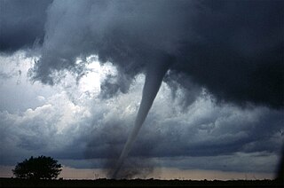
This page documents the tornadoes and tornado outbreaks of 2011. Extremely destructive tornadoes form most frequently in the United States, Bangladesh, Brazil and Eastern India, but they can occur almost anywhere under the right conditions. Tornadoes also appear regularly in neighboring southern Canada during the Northern Hemisphere's summer season, and somewhat regularly in Europe, Asia, and Australia.

<span class="mw-page-title-main">2010 New Year's Eve tornado outbreak</span> 2010 windstorm in the midwestern and southern United States

The 2010 New Year's Eve tornado outbreak was a three-day-long tornado outbreak that impacted the central and lower Mississippi Valley from December 30, 2010 to January 1, 2011. Associated with a low pressure system and a strong cold front, 37 tornadoes tracked across five states over the length of the severe event, killing nine and injuring several others. Activity was centered in the states of Missouri and later Mississippi on December 31. Seven tornadoes were rated EF3 on the Enhanced Fujita Scale; these were the strongest during the outbreak. Non-tornadic winds were recorded to have reached as high as 80 mph (130 km/h) at eight locations on December 31, while hail as large as 2.75 in (7.0 cm) was documented north-northeast of Mansfield, Missouri. Overall, damage from the outbreak totaled US$123.3 million, most of which was related to tornadoes. This is the most prolific tornado outbreak in Missouri in the month of December.

<span class="mw-page-title-main">Tornado outbreak of April 9–11, 2011</span> Tornado outbreak in the United States

One of several tornado outbreaks in the United States to take place during the record month of April 2011, 49 tornadoes were produced across the Midwest and Southeast from April 9–11. Widespread damage took place; however, no fatalities resulted from the event due to timely warnings. In Wisconsin, 16 tornadoes touched down, ranking this outbreak as the state's largest April event on record as well as one of the largest single-day events during the course of any year. The strongest tornado of the outbreak was an EF4 tornado that touched down west of Pocahontas, Iowa on April 9, a short-lived satellite to a long-track EF3 tornado. Between 0256 and 0258 UTC that day, five tornadoes were on the ground simultaneously in Pocahontas County, Iowa, all of which were from one supercell thunderstorm. Other tornadoes impacted parts of eastern Kentucky and Tennessee on April 9, hours before the event in Iowa.

<span class="mw-page-title-main">2011 Super Outbreak</span> Largest, costliest tornado outbreak in United States history

The 2011 Super Outbreak was the largest, costliest, and one of the deadliest tornado outbreaks ever recorded, taking place in the Southern, Midwestern, and Northeastern United States from April 25 to 28, 2011, leaving catastrophic destruction in its wake. Over 175 tornadoes struck Alabama, Mississippi, and Tennessee, which were the most severely damaged states. Other destructive tornadoes occurred in Arkansas, Georgia, Kentucky, Louisiana, New York, and Virginia, with storms also affecting other states in the Southern and Eastern United States. In total, 360 tornadoes were confirmed by NOAA's National Weather Service (NWS) and Government of Canada's Environment Canada in 21 states from Texas to New York to southern Canada. Widespread and destructive tornadoes occurred on each day of the outbreak. April 27 was the most active day, with a record 216 tornadoes touching down that day from midnight to midnight CDT. Four of the tornadoes were rated EF5, which is the highest ranking on the Enhanced Fujita scale; typically these tornadoes are recorded no more than once a year.

<span class="mw-page-title-main">2011 Tuscaloosa–Birmingham tornado</span> 2011 tornado in Alabama, U.S.A.

During the late afternoon and early evening of April 27, 2011, a violent, high-end EF4 multiple-vortex tornado destroyed portions of Tuscaloosa and Birmingham, Alabama, as well as smaller communities and rural areas between the two cities. It is one of the costliest tornadoes on record, and was one of the 360 tornadoes in the 2011 Super Outbreak, the largest tornado outbreak in United States history. The tornado reached a maximum path width of 1.5 miles (2.4 km) during its track through Tuscaloosa, and again when it crossed I-65 north of Birmingham, attaining estimated wind speeds of 190 mph (310 km/h) shortly after passing through the city. It then went on to impact parts of Birmingham at high-end EF4 intensity before dissipating. This was the third tornado to strike the city of Tuscaloosa in the past decade, and the second in two weeks.

<span class="mw-page-title-main">Tornado outbreak of April 13–16, 2012</span> Tornado outbreak in the United States

From April 13 to 16, 2012, a major tornado outbreak occurred across a large portion of the Great Plains. The storms resulted in six tornado-related fatalities, all of which occurred as a result of a nighttime EF3 tornado that caused major damage in and around Woodward, Oklahoma. Numerous other tornadoes occurred, including a violent EF4 tornado that passed near Marquette, Kansas, and an EF3 that caused major damage in Wichita.

<span class="mw-page-title-main">Tornadoes of 2013</span>

This page documents the tornadoes and tornado outbreaks of 2013. Strong and destructive tornadoes form most frequently in the United States, Bangladesh, Brazil and Eastern India, but they can occur almost anywhere under the right conditions. Tornadoes also appear regularly in neighboring southern Canada during the Northern Hemisphere's summer season, and somewhat regularly in Europe, Asia, and Australia.

<span class="mw-page-title-main">Tornado outbreak of May 26–31, 2013</span> Tornado outbreak in the United States

A prolonged and widespread tornado outbreak sequence affected a large portion of the United States in late-May 2013 and early-June 2013. The outbreak was the result of a slow-moving but powerful storm system that produced several strong tornadoes across the Great Plains states, especially in Kansas and Oklahoma. Other strong tornadoes caused severe damage in Nebraska, Missouri, Illinois, and Michigan. The outbreak extended as far east as Upstate New York. 27 fatalities were reported in total, with nine resulting from tornadoes.

<span class="mw-page-title-main">Tornado outbreak of November 17, 2013</span> Natural disaster

On November 17, 2013, the deadliest and costliest November tornado outbreak in Illinois history took shape, becoming the fourth-largest for the state overall. With more than 30 tornadoes in Indiana, it was that state's largest tornado outbreak for the month of November, and the second largest outbreak recorded in Indiana. Associated with a strong trough in the upper levels of the atmosphere, the event resulted in 77 tornadoes tracking across regions of the Midwest United States and Ohio River Valley, impacting seven states. Severe weather during the tornado outbreak caused over 100 injuries and eleven fatalities, of which eight were tornado related. Two tornadoes—both in Illinois and rated EF4 on the Enhanced Fujita scale—were the strongest documented during the outbreak and combined for five deaths. In addition to tornadoes, the system associated with the outbreak produced sizeable hail peaking at 4.00 in (10.2 cm) in diameter in Bloomington, Illinois, as well as damaging winds estimated as strong as 100 mph (160 km/h) in three locations.

<span class="mw-page-title-main">Tornadoes of 2014</span>

This page documents the tornadoes and tornado outbreaks of 2014. Strong and destructive tornadoes form most frequently in the United States, Bangladesh, Brazil, and Eastern India, but they can occur almost anywhere under the right conditions. Tornadoes also appear regularly in neighboring southern Canada during the Northern Hemisphere's summer season, and somewhat regularly in Europe, Asia, and Australia.

The following is a glossary of tornado terms. It includes scientific as well as selected informal terminology.

<span class="mw-page-title-main">North Carolina tornado outbreak of April 2014</span>

On April 25, 2014, a localized tornado outbreak struck North Carolina, resulting in the first tornado-related fatality during that year in the United States. The event marked the latest formation of the first EF3 or stronger tornado during a calendar year and latest date for the first tornadic death.

<span class="mw-page-title-main">Tornado outbreak of June 16–18, 2014</span> Summer tornado outbreak in the U.S. Great Plains and Midwest

The tornado outbreak of June 16–18, 2014, was a tornado outbreak concentrated in the Great Plains and the Midwestern United States. Two tornadoes also occurred in Ontario. The severe weather event most significantly affected the state of Nebraska, where twin EF4 tornadoes killed two and critically injured twenty others in and around the town of Pilger on the evening of June 16. The two Pilger tornadoes were part of a violent tornado family that produced four EF4 tornadoes and was broadcast live on television. The outbreak went on to produce multiple other strong tornadoes across the northern Great Plains states throughout the next two days.

<span class="mw-page-title-main">Tornado outbreak sequence of May 2019</span> Severe weather event

The tornado outbreak sequence of May 2019 was a prolonged series of destructive tornadoes and tornado outbreaks affecting the United States over the course of nearly two weeks, producing a total of 400 tornadoes, including 53 significant events (EF2+). Eighteen of these were EF3 tornadoes, spanning over multiple states, including Nebraska, Kansas, Texas, Missouri, Oklahoma, Indiana, Iowa, and Ohio, with additional tornadoes confirmed across a region extending from California to New Jersey. Two EF4 tornadoes occurred, one in Dayton, Ohio, and the other in Linwood, Kansas. Four tornadoes during this outbreak were fatal, causing a total of eight fatalities. The deadliest of these occurred on May 22 near Golden City, Missouri, where an EF3 tornado took three lives, including an elderly couple in their eighties. The damaging series of tornadoes that occurred in Indiana and Ohio on the evening of May 27 during this event is sometimes locally referred to as the Memorial Day tornado outbreak of 2019, which became the fourth costliest weather event in Ohio history. The near continuous stream of systems also produced to widespread flash and river flooding, along with damaging winds and large hail.

<span class="mw-page-title-main">Tornado outbreak sequence of May 19–27, 2024</span> Tornado outbreak sequence in the United States

A multi-day period of significant tornado activity occurred across the Midwestern United States and the Mississippi Valley as well as an additional tornado in the Canadian province of Quebec from May 19–27, 2024. Tornadoes were reported across large portions of the Central United States, with multiple Particularly Dangerous Situation (PDS) watches were issued across the sequence. Five fatalities were confirmed with a large, violent EF4 tornado that went through Greenfield, Iowa on May 21. Tornadic activity continued over the next several days, including a nocturnal outbreak that occurred during the overnight hours of May 25 into May 26. Seven fatalities were confirmed from a destructive tornado that struck Valley View, Texas while two more fatalities were confirmed from an EF3+ tornado that struck Claremore and Pryor, Oklahoma. Another fatality was confirmed from a tornado in Olvey, Arkansas and an additional tornadic death also occurred in Arkansas. Many other tornadoes occurred on the afternoon and evening of May 26, including a very destructive, intense EF3 tornado, which prompted the issuance of 4 tornado emergencies across western Kentucky.

References

  1. 1 2 Victor Epstein (May 24, 2013). "Tornado damage estimates skyrocket to $5 billion". DesMoines Register. Archived from the original on June 29, 2013. Retrieved May 26, 2013.
  2. "Billion-Dollar Weather/Climate Disasters". National Climatic Data Center. National Oceanic and Atmospheric Administration. 2013. Retrieved May 27, 2013.
  3. 1 2 3 4 5 "20130520's Storm Reports (1200 UTC − 1159 UTC)". Storm Prediction Center. National Oceanic and Atmospheric Administration. May 23, 2013. Retrieved May 23, 2013.
  4. 1 2 "Short-lived Tornado Confirmed in Mount Olive Illinois". National Weather Service Office in St. Louis, Missouri. National Oceanic and Atmospheric Administration. May 21, 2013. Retrieved May 26, 2013.
  5. 1 2 3 "May 18 & 19 – Two Days of Severe Weather with Damaging winds and Brief Tornadoes". National Weather Service Office in Topeka, Kansas. National Oceanic and Atmospheric Administration. May 22, 2013. Archived from the original on May 22, 2024. Retrieved May 23, 2013.
  6. 1 2 3 Matthew DeLuca (May 23, 2013). "Two children killed in Minnesota field trip landslide". NBC News. Archived from the original on June 8, 2013. Retrieved May 24, 2013.
  7. 1 2 3 4 "20130522's Storm Reports (1200 UTC − 1159 UTC)". Storm Prediction Center. National Oceanic and Atmospheric Administration. May 27, 2013. Retrieved May 27, 2013.
  8. 1 2 "2 killed in Oklahoma Sunday tornadoes ID'd". KOCO-TV. May 20, 2013. Archived from the original on June 15, 2013. Retrieved May 20, 2013.
  9. 1 2 3 Carey Gillam & Ian Simpson (May 22, 2013). "Oklahoma tornado victims astounded at how they survived". Reuters. Moore, Oklahoma. Archived from the original on May 24, 2013. Retrieved May 24, 2013.
  10. Josh Levs & Steve Almasy (May 24, 2013). "Students, teachers from tornado-leveled school say goodbye". CNN. Retrieved May 27, 2013.
  11. 1 2 3 "20130521's Storm Reports (1200 UTC − 1159 UTC)". Storm Prediction Center. National Oceanic and Atmospheric Administration. May 27, 2013. Retrieved May 27, 2013.
  12. Stephen Goss (May 13, 2013). "Day 4–8 Severe Weather Outlook Issued on May 13, 2013". Storm Prediction Center. National Oceanic and Atmospheric Administration. Retrieved May 21, 2013.
  13. Steven J. Weiss & Ariel E. Cohen (May 16, 2013). "May 16, 2013 1630 UTC Day 1 Convective Outlook". Storm Prediction Center. National Oceanic and Atmospheric Administration. Retrieved May 22, 2013.
  14. "20130516's Storm Reports (1200 UTC − 1159 UTC)". Storm Prediction Center. National Oceanic and Atmospheric Administration. May 22, 2013. Retrieved May 22, 2013.
  15. Bryan T. Smith & Patrick Marsh (May 17, 2013). "May 17, 2013 0600 UTC Day 1 Convective Outlook". Storm Prediction Center. National Oceanic and Atmospheric Administration. Retrieved May 22, 2013.
  16. Steven J. Weiss (May 17, 2013). "May 17, 2013 1630 UTC Day 1 Convective Outlook". Storm Prediction Center. National Oceanic and Atmospheric Administration. Retrieved May 22, 2013.
  17. Gregory Carbin & Steven J. Weiss (May 17, 2013). "Mesoscale Discussion 668". Storm Prediction Center. National Oceanic and Atmospheric Administration. Archived from the original on June 1, 2004. Retrieved May 22, 2013.
  18. Andrew Dean & Steven J. Weiss (May 17, 2013). "Mesoscale Discussion 671". Storm Prediction Center. National Oceanic and Atmospheric Administration. Archived from the original on January 24, 2001. Retrieved May 22, 2013.
  19. "NWS Damage Survey for 5/17/2013 Young County Tornado Event". National Weather Service Office in Fort Worth, Texas. Iowa Environmental Mesonet. May 18, 2013. Retrieved May 23, 2013.
  20. "20130517's Storm Reports (1200 UTC − 1159 UTC)". Storm Prediction Center. National Oceanic and Atmospheric Administration. May 22, 2013. Retrieved May 22, 2013.
  21. Mark Darrow (May 17, 2013). "May 17, 2013 1730 UTC Day 2 Convective Outlook". Storm Prediction Center. National Oceanic and Atmospheric Administration. Retrieved May 21, 2013.
  22. Bryan T. Smith & Patrick Marsh (May 18, 2013). "May 18, 2013 0600 UTC Day 1 Convective Outlook". Storm Prediction Center. National Oceanic and Atmospheric Administration. Retrieved May 21, 2013.
  23. Brynn Kerr (May 18, 2013). "Tornado Watch 170". Storm Prediction Center. National Oceanic and Atmospheric Administration. Archived from the original on May 11, 2000. Retrieved May 22, 2013.
  24. 1 2 "20130518's Storm Reports (1200 UTC − 1159 UTC)". Storm Prediction Center. National Oceanic and Atmospheric Administration. May 20, 2013. Retrieved May 20, 2013.
  25. "EF4 Tornado Impacts Locations Near Rozel Kansas". National Weather Service Office in Dodge City, Kansas. National Oceanic and Atmospheric Administration. May 23, 2013. Archived from the original on September 9, 2013. Retrieved May 25, 2013.
  26. Keith Miles (May 28, 2013). "Tiny Kansas town has close call with monster tornado". Kansas First News. Archived from the original on March 30, 2014. Retrieved May 28, 2013.
  27. "Pawnee County Tornado Survey Completed Sunday". National Weather Service Office in Dodge City, Kansas. National Oceanic and Atmospheric Administration. May 21, 2013. Archived from the original on April 9, 2017. Retrieved May 25, 2013.
  28. Bryan T. Smith & Stephen Corfidi (May 18, 2013). "Mesoscale Discussion 684". Storm Prediction Center. National Oceanic and Atmospheric Administration. Archived from the original on April 26, 2005. Retrieved May 22, 2013.
  29. Bryan T. Smith & Stephen Corfidi (May 18, 2013). "Mesoscale Discussion 689". Storm Prediction Center. National Oceanic and Atmospheric Administration. Archived from the original on June 1, 2004. Retrieved May 22, 2013.
  30. Jared L. Guyer & Patrick Marsh (May 19, 2013). "May 19, 2013 0600 UTC Day 1 Convective Outlook". Storm Prediction Center. National Oceanic and Atmospheric Administration. Retrieved May 22, 2013.
  31. Brynn Kerr (May 19, 2013). "Tornado Watch 181". Storm Prediction Center. National Oceanic and Atmospheric Administration. Archived from the original on April 3, 2003. Retrieved May 23, 2013.
  32. Jaret W. Rogers & Brynn Kerr (May 19, 2013). "Mesoscale Discussion 698". Storm Prediction Center. National Oceanic and Atmospheric Administration. Archived from the original on April 2, 2003. Retrieved May 23, 2013.
  33. Brynn Kerr (May 19, 2013). "Tornado Watch 182". Storm Prediction Center. National Oceanic and Atmospheric Administration. Archived from the original on May 3, 2002. Retrieved May 23, 2013.
  34. 1 2 "May 19th south central Kansas tornadoes". National Weather Service Office in Wichita, Kansas. National Oceanic and Atmospheric Administration. May 23, 2013. Archived from the original on April 15, 2015. Retrieved May 23, 2013.
  35. "Severe Weather Statement: Tornado Warning". National Weather Service Office in Wichita, Kansas. Iowa Environmental Mesonet. May 19, 2013. Retrieved May 20, 2013.
  36. Bryan T. Smith (May 19, 2013). "Mesoscale Discussion 703". Storm Prediction Center. National Oceanic and Atmospheric Administration. Archived from the original on August 19, 2004. Retrieved May 23, 2013.
  37. "The Tornado Outbreak of May 19, 2013". National Weather Service Office in Norman, Oklahoma. National Oceanic and Atmospheric Administration. May 23, 2013. Retrieved May 26, 2013.
  38. 1 2 "NWS Damage Survey for 05/19/2013 Tornado Event". National Weather Service Office in Tulsa, Oklahoma. National Oceanic and Atmospheric Administration. May 24, 2013. Retrieved May 25, 2013.
  39. Julianna Goldman (May 27, 2013). "Obama Pledges Assistance While Touring Oklahoma Tornado Damage". Bloomberg Businessweek News. Archived from the original on May 22, 2024. Retrieved May 27, 2013.
  40. Bryan T. Smith (May 19, 2013). "Mesoscale Discussion 704". Storm Prediction Center. National Oceanic and Atmospheric Administration. Archived from the original on April 22, 2003. Retrieved May 23, 2013.
  41. Corey M. Mead (May 19, 2013). "Mesoscale Discussion 705". Storm Prediction Center. National Oceanic and Atmospheric Administration. Archived from the original on April 26, 2008. Retrieved May 23, 2013.
  42. Bryan T. Smith & Stephen Corfidi (May 19, 2013). "Mesoscale Discussion 707". Storm Prediction Center. National Oceanic and Atmospheric Administration. Archived from the original on June 1, 2004. Retrieved May 23, 2013.
  43. Corey M. Mead (May 19, 2013). "Mesoscale Discussion 710". Storm Prediction Center. National Oceanic and Atmospheric Administration. Archived from the original on April 23, 2003. Retrieved May 23, 2013.
  44. "Storm Survey Results from Dallas, Polk, and Story Counties" (PDF). National Weather Service Office in Des Moines, Iowa. National Oceanic and Atmospheric Administration. May 2013. Retrieved May 23, 2013.
  45. "No one Injured in Central Iowa Tornadoes". KCRG9. May 20, 2013. Archived from the original on June 19, 2013. Retrieved May 20, 2013.
  46. Stephanie Moore (May 19, 2013). "Record Ends: Tornadoes Hit Iowa". WHOTV-13. Retrieved May 20, 2013.
  47. Bryan T. Smith (May 19, 2013). "Mesoscale Discussion 719". Storm Prediction Center. National Oceanic and Atmospheric Administration. Archived from the original on October 18, 2003. Retrieved May 23, 2013.
  48. Bryan T. Smith (May 19, 2013). "Mesoscale Discussion 720". Storm Prediction Center. National Oceanic and Atmospheric Administration. Archived from the original on May 10, 2002. Retrieved May 23, 2013.
  49. Jeffrey L. Peters & John A. Hart (May 20, 2013). "Mesoscale Discussion 722". Storm Prediction Center. National Oceanic and Atmospheric Administration. Archived from the original on April 4, 2003. Retrieved May 23, 2013.
  50. "20130519's Storm Reports (1200 UTC − 1159 UTC)". Storm Prediction Center. National Oceanic and Atmospheric Administration. May 23, 2013. Retrieved May 23, 2013.
  51. "May 20, 2013 0600 UTC Day 1 Convective Outlook". Storm Prediction Center. 2013-05-20. Retrieved 2013-05-20.
  52. The Tornado Outbreak of May 20, 2013
  53. Brad Devereaux (May 21, 2013). "Wind leaves thousands without power in northern Michigan; Consumers Energy says service should be restored by 11 p.m." Michigan Live. Retrieved May 28, 2013.
  54. "Severe Weather Event May 19–20 2013: Tornado Surveys". National Weather Service Office in Springfield, Missouri. National Oceanic and Atmospheric Administration. May 23, 2013. Retrieved May 25, 2013.
  55. "Storm Survey Reveals Tornado Damage". National Weather Service Office in Indianapolis, Indiana. National Oceanic and Atmospheric Administration. May 22, 2013. Archived from the original on March 4, 2016. Retrieved May 25, 2013.
  56. John Chris Broyles & Corey M. Mead (May 21, 2013). "May 21, 2013 0600 UTC Day 1 Convective Outlook". Storm Prediction Center. National Oceanic and Atmospheric Administration. Retrieved May 28, 2013.
  57. Jeremy S. Grams & Jaret W. Rogers (May 21, 2013). "May 21, 2013 1630 UTC Day 1 Convective Outlook". Storm Prediction Center. National Oceanic and Atmospheric Administration. Retrieved May 28, 2013.
  58. Ryan E. Jewell & Brynn Kerr (May 21, 2013). "Mesoscale Discussion 748". Storm Prediction Center. National Oceanic and Atmospheric Administration. Retrieved May 21, 2013.
  59. Jaret W. Rogers & Brynn Kerr (May 21, 2013). "Mesoscale Discussion 750". Storm Prediction Center. National Oceanic and Atmospheric Administration. Archived from the original on April 2, 2003. Retrieved May 28, 2013.
  60. Jaret W. Rogers & Brynn Kerr (May 21, 2013). "Mesoscale Discussion 754". Storm Prediction Center. National Oceanic and Atmospheric Administration. Archived from the original on September 1, 2003. Retrieved May 28, 2013.
  61. Canadian Press (May 22, 2013). "3,000 plus left without electricity in central Ontario after thunderstorms". National Post. Toronto, Canada. Retrieved May 23, 2013.
  62. Nicole Mortillaro (May 24, 2013). "Environment Canada confirms two more tornadoes in Ontario". Global News. Archived from the original on June 17, 2013. Retrieved May 25, 2013.
  63. "Environment Canada confirms Ontario's second tornado of 2013". The Weather Network. May 23, 2013. Retrieved May 23, 2013.
  64. "Tornado touches down in Ontario town". Canadian Broadcasting Corporation. May 22, 2013. Retrieved May 23, 2013.
  65. "Microburst /Straight Line Wind Damage/ Confirmed Near Scipio Center in Cayuga County New York". National Weather Service in Binghamton, New York. National Oceanic and Atmospheric Administration. May 22, 2013. Archived from the original on December 17, 2008. Retrieved May 23, 2013.
  66. "Microburst /Straight Line Wind Damage/ Confirmed Near MacDougall in Seneca County New York". National Weather Service in Binghamton, New York. National Oceanic and Atmospheric Administration. May 22, 2013. Archived from the original on August 12, 2011. Retrieved May 23, 2013.
  67. Ryan Hanrahan (May 22, 2013). "False Weather Report Leads to Tornado Warning". MSNBC. Retrieved May 23, 2013.[ dead link ]
  68. "Microburst Confirmed in Teays Valley in Putnam County West Virginia". National Weather Service in Charleston, West Virginia. National Oceanic and Atmospheric Administration. May 23, 2013. Archived from the original on October 20, 2011. Retrieved May 23, 2013.
  69. Michael J. Vojtesak (May 23, 2013). "Short Range Forecast Discussion Valid 12Z Thu May 23, 2013 – 12Z Sat May 25, 2013". Weather Prediction Center. National Oceanic and Atmospheric Administration. Archived from the original on November 18, 2011. Retrieved May 27, 2013.
  70. Frank James Pereira III (May 24, 2013). "Short Range Forecast Discussion Valid 12Z Fri May 24, 2013 – 12Z Sun May 26, 2013". Weather Prediction Center. National Oceanic and Atmospheric Administration. Archived from the original on November 18, 2011. Retrieved May 27, 2013.
  71. David F. Hamrick (May 24, 2013). "Short Range Forecast Discussion Valid 00Z Sat May 25, 2013 – 00Z Mon May 27, 2013". Weather Prediction Center. National Oceanic and Atmospheric Administration. Archived from the original on November 18, 2011. Retrieved May 27, 2013.
  72. Frank James Pereira III (May 25, 2013). "Short Range Forecast Discussion Valid 12Z Sat May 25, 2013 – 12Z Mon May 27, 2013". Weather Prediction Center. National Oceanic and Atmospheric Administration. Archived from the original on November 18, 2011. Retrieved May 27, 2013.
  73. 1 2 3 Bill Smith (May 26, 2013). "Late snowfall ties New Hampshire record set in 1967". New Hampshire Union Leader. Manchester, New Hampshire. Archived from the original on September 15, 2016. Retrieved May 26, 2013.
  74. Marybeth Gerhardt (May 26, 2013). "Short Range Forecast Discussion Valid 00Z Mon May 27, 2013 – 00Z Wed May 29, 2013". Weather Prediction Center. National Oceanic and Atmospheric Administration. Archived from the original on November 10, 2012. Retrieved May 27, 2013.
  75. Paul Allen Ziegenfelder (May 27, 2013). "Short Range Forecast Discussion Valid 12Z Mon May 27, 2013 – 12Z Wed May 29, 2013". Weather Prediction Center. National Oceanic and Atmospheric Administration. Archived from the original on July 14, 2011. Retrieved May 27, 2013.
  76. 1 2 "Latest on Tornado Information for May 19 and May 20". National Weather Service Office in Norman, Oklahoma. National Oceanic and Atmospheric Administration. May 22, 2013. Retrieved June 15, 2013.
  77. 1 2 3 4 5 6 7 8 "ArcGIS Web Application".
  78. "EF4 tornado in Shawnee Sunday destroys 75 percent of Bethel Acres; survivor remained in mobile home". KJRH-TV. 2013-05-25. Retrieved 2013-05-24.
  79. Sean Murphy (May 20, 2013). "Oklahoma tornadoes leave 1 dead, 20 hurt". The Columbus Dispatch. Shawnee, Oklahoma. Associated Press. Retrieved May 20, 2013.
  80. 1 2 Anthony Castellano (May 20, 2013). "Tornadoes in Midwest Kill 1 With More Severe Weather Due Today". ABC News. Retrieved May 20, 2013.
  81. 1 2 "Storm Events Database - Event Details | National Centers for Environmental Information".
  82. Jaclyn Cosgrove (May 20, 2013). "Oklahoma tornadoes: Tractor-trailers thrown about on Interstate 40". The Oklahoman. Retrieved May 20, 2013.
  83. "Lanes reopening near Shawnee but delays expected". Shawnee, Oklahoma: NewsOn9. Associated Press. May 20, 2013. Retrieved May 20, 2013.[ dead link ]
  84. "Carney Debris Falls In Hallett; Tornado Touches Down Near Prague". Carney, Oklahoma: NewsOn6. May 20, 2013. Retrieved May 20, 2013.
  85. "Bulletin: Tornado Warning". National Weather Service Office in Norman Oklahoma. Iowa Environmental Mesonet. May 20, 2013. Retrieved May 21, 2013.
  86. 1 2 "NWS Damage Survey for 5/20/2013 Newcastle/Moore Tornado Event – Update 3". National Weather Service Office in Norman Oklahoma. Iowa Environmental Mesonet. May 21, 2013. Retrieved May 23, 2013.
  87. "The Tornado Outbreak of May 20, 2013". National Weather Service Office in Norman, Oklahoma. National Oceanic and Atmospheric Administration. May 24, 2013. Retrieved May 24, 2013.
  88. "May 20, 2013 EF-5 Tornado Path and LandScan Population" (.jpg). National Weather Service Office in Norman, Oklahoma (Image). National Oceanic and Atmospheric Administration. May 23, 2013. Archived from the original on October 16, 2011. Retrieved May 24, 2013.
  89. "Assessing the Damage Along the Tornado's Path in Oklahoma". The New York Times. May 21, 2013. Retrieved May 22, 2013.
  90. "Top Ten Deadliest Oklahoma Tornadoes (1882–Present)". National Weather Service Office in Norman, Oklahoma. National Oceanic and Atmospheric Administration. January 12, 2013. Retrieved May 21, 2013.
  91. Eleazar David Melendez (May 21, 2013). "Moore Tornado Costs Could Total $3 Billion". Huffington Post. Retrieved May 24, 2013.
  92. Noah Buhayar (May 29, 2013). "Oklahoma Tornado Cost Insurers as Much as $3.5 Billion: RMS". Bloomberg Business News. Insurance Journal. Retrieved May 30, 2013.
  93. 1 2 Michael Clark (May 22, 2013). "Southaven declares state of emergency after flooding". Southaven Horn-Lake. Archived from the original on June 30, 2013. Retrieved May 23, 2013.
  94. 1 2 "Public Information Statement: All 3 Day Storm Totals". National Weather Service Office in Grand Forks, North Dakota. National Oceanic and Atmospheric Administration. May 21, 2013. Archived from the original on April 6, 2012. Retrieved May 24, 2013.
  95. "Record Event Report: Record Daily Maximum Rainfall Set At Bismarck ND". National Weather Service Office in Bismarck, North Dakota. National Oceanic and Atmospheric Administration. May 19, 2013. Archived from the original on October 19, 2020. Retrieved May 24, 2013.
  96. 1 2 Blake Nicholson & Dave Kolpack (May 22, 2013). "Flooding forces evacuation of 1,300 in ND town". Bismarck, North Dakota: News 9. Associated Press. Retrieved May 23, 2013.[ dead link ]
  97. "Record Rain Leading to Flooding in North Dakota". Insurance Journal. Associated Press. May 22, 2013. Archived from the original on June 21, 2013. Retrieved May 24, 2013.
  98. "Dam failure risk near NE North Dakota city may be easing; city mulls return of 1,300 evacuees". The Washington Post. Bismarck, North Dakota. Associated Press. May 23, 2013. Retrieved May 23, 2013.
  99. Ken Schachter (May 23, 2013). "Flash flood warning remains in Westchester; Taconic, Saw Mill River partly closed". Newsday. Archived from the original on May 22, 2024. Retrieved May 24, 2013.
  100. "Flash Flood Warnings as Storms Move Through Tri-State". WNBC4 New York. May 24, 2013. Archived from the original on August 10, 2013. Retrieved May 24, 2013.
  101. "Cars stuck in water covered roadways". WMC-TV 5. May 21, 2013. Retrieved May 23, 2013.
  102. Yolanda Jones; Michael Lollar; Ron Maxey (May 21, 2013). "Flooding prompts Southaven mayor to declare emergency; some Memphis streets also under water". Commercial Appeal. Retrieved May 23, 2013.
  103. Jack Thurston (May 23, 2013). "Vt. city cleans up from damaging flash floods". Burlington, Vermont: New England Cable News. Archived from the original on May 22, 2024. Retrieved May 26, 2013.
  104. "Public Information Statement: Storm Total Rainfall". National Weather Service in Burlington, Vermont. National Oceanic and Atmospheric Administration. May 24, 2013. Archived from the original on February 10, 2012. Retrieved May 26, 2013.
  105. 1 2 Wilson Ring (May 24, 2013). "Vt. seeks US damage assessment after flash floods". San Francisco Chronicle. Underhill, Vermont. Associated Press. Archived from the original on May 22, 2024. Retrieved May 26, 2013.
  106. Matt Ryan (May 29, 2013). "Storm damage in Underhill could exceed $2 million". Underhill, Vermont: Burlington Free-Press. Retrieved June 15, 2013.
  107. "Public Information Statement: Storm Total Snowfall". National Weather Service Office in Grey, Maine. National Oceanic and Atmospheric Administration. May 26, 2013. Archived from the original on June 15, 2022. Retrieved May 26, 2013.
  108. "Snow falls on Quebec's Eastern Townships". Québecor Média. Montreal, Canada: Sun News. May 26, 2013. Archived from the original on May 29, 2013. Retrieved May 26, 2013.
  109. "Snow, rain pound Vermont". Burlington, Vermont: New England Cable News. Associated Press. May 26, 2013. Archived from the original on May 22, 2024. Retrieved May 26, 2013.
  110. "Public Information Statement: Storm Total Snowfall". National Weather Service Office in Burlington, Vermont. National Oceanic and Atmospheric Administration. May 27, 2013. Archived from the original on June 10, 2022. Retrieved May 27, 2013.
  111. "Memorial Day weekend storm dumps up to 3 feet of snow on New York, Vermont ski mountains". Fox News. Associated Press. May 26, 2013. Retrieved May 27, 2013.
  112. Molly Cochran (May 27, 2013). "Photos: Snow for Memorial Day Weekend in Parts of New England". Accuweather. Retrieved May 27, 2013.
  113. "Snowfall of 34 inches reported on Whiteface". Daily Gazette . May 26, 2013. Retrieved May 27, 2013.
  114. Kim Morava (May 20, 2013). "Red Cross sets up shelter at Shawnee High School". News-Star. Retrieved May 20, 2013.
  115. "Obama Signs Oklahoma Disaster Declaration". The Huffington Post. Washington D.C. Associated Press. May 21, 2013. Retrieved May 21, 2013.
  116. "Donations for Oklahoma top $20 million". CNN. New York, United States: KETK-TV. May 27, 2013. Retrieved May 27, 2013.
  117. "Disaster Assistance Expands to Include More Storms and Canadian County". Federal Emergency Management Agency. Oklahoma City, Oklahoma: Government of the United States. June 12, 2013. Retrieved June 15, 2013.
  118. "Disaster Assistance Tops $7.6 Million for May 18 – June 2 Storms in Oklahoma". Federal Emergency Management Agency. Oklahoma City, Oklahoma: Government of the United States. June 15, 2013. Retrieved June 15, 2013.
  119. 1 2 Craig Day & Brandi Ball (May 22, 2013). "Shawnee Tornado Victims Begin To Pick Up Pieces". NewsOn6. Retrieved May 23, 2013.
  120. "President Declares Disaster for Vermont". Federal Emergency Management Agency. Washington D.C., United States: Government of the United States. June 13, 2013. Retrieved June 15, 2013.
Moore, Oklahoma