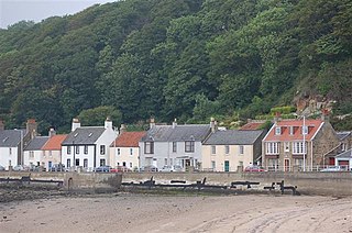
Aberdour is a scenic and historic village on the south coast of Fife, Scotland. It is on the north shore of the Firth of Forth, looking south to the island of Inchcolm and its Abbey, and to Leith and Edinburgh beyond. According to the 2011 census, the village has a population of 1,633.

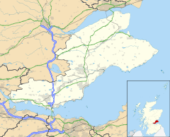
Fife is a council area, historic county, registration county and lieutenancy area of Scotland. It is situated between the Firth of Tay and the Firth of Forth, with inland boundaries with Perth and Kinross and Clackmannanshire. By custom it is widely held to have been one of the major Pictish kingdoms, known as Fib, and is still commonly known as the Kingdom of Fife within Scotland. A person from Fife is known as a Fifer. In older documents the county was very occasionally known by the anglicisation Fifeshire.

The Firth of Forth is the estuary, or firth, of several Scottish rivers including the River Forth. It meets the North Sea with Fife on the north coast and Lothian on the south.

Kinghorn is a town and parish in Fife, Scotland. A seaside resort with two beaches, Kinghorn Beach and Pettycur Bay, plus a fishing port, it stands on the north shore of the Firth of Forth, opposite Edinburgh. According to the 2008 population estimate, the town has a population of 2,930.

Inverkeithing is a port town and parish, in Fife, Scotland, on the Firth of Forth. A town of ancient origin, Inverkeithing was given royal burgh status during the reign of Malcolm IV in the 12th century. It was an important center of trade during the Middle Ages, and its industrial heritage built on quarrying and ship breaking goes back to the 19th century. In 2016, the town had an estimated population of 4,890, while the civil parish was reported to have a population of 8,090 in 2011.
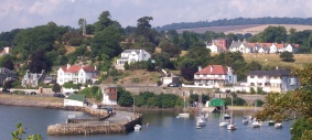
Limekilns is a village in Fife, Scotland. It lies on the shore of the Firth of Forth, around 3 miles (5 km) south of Dunfermline.

Cairneyhill is a village in West Fife, Scotland. It is 3 miles west of Dunfermline, on the A994, and has a population of around 2,510 (mid-2020 est.)

Elie and Earlsferry is a coastal town and former royal burgh in Fife, and parish, Scotland, situated within the East Neuk beside Chapel Ness on the north coast of the Firth of Forth, eight miles east of Leven. The burgh comprised the linked villages of Elie to the east and to the west Earlsferry, which were formally merged in 1930 by the Local Government (Scotland) Act 1929. To the north is the village of Kilconquhar and Kilconquhar Loch.

Buckhaven is a town on the east coast of Fife, Scotland, on the Firth of Forth between East Wemyss and Methil. Buckhaven is on the Fife Coastal Path, and near to Wemyss Caves and Largo Bay.
Saline is a village and parish in Fife, Scotland, situated 5 miles (8.0 km) to the north-west of Dunfermline. It lies in an elevated position on the western slopes of the Cleish Hills.
The Kincardine Line is a railway in Clackmannanshire and Fife, Scotland. It was originally built to serve settlements along the north shore of the Firth of Forth, between Alloa and Dunfermline.
Newburn is a civil parish in the County of Fife in Scotland. It is located on the north coast of the Firth of Forth and bounded by the parishes of Kilconquhar and Largo. It was originally a rural parish with no major settlement, but with the development of Leven as a seaside resort in the late 19th century, the population of the parish grew considerably.
Carnock is a village and parish of Fife, Scotland, 4+1⁄4 miles west of Dunfermline. It is 1+1⁄4 miles east of Oakley, Fife. The name of the village derives from Scottish Gaelic, from ceàrn ("corner"), with a suffix denoting a toponym, thus giving "[the] corner place". Carnock is known to have had military significance in antiquity. The civil parish had a population of 5,927 as of 2011.

Scoonie is a settlement and parish in Fife, Scotland, the parish contains the town of Leven. It is bordered on the north by the parishes of Kettle and Ceres, on the east by the parish of Largo, on the south by the parishes of Markinch and Wemyss, and on the west by the parishes of Markinch and Kennoway. It extends about 4+1⁄2 miles north to south. Its width varies between 5⁄8 and 2+3⁄4 mi . The parish is on the coast of the Firth of Forth, with a coastline of about 1+1⁄2 mi (2.4 km) The area of the parish is 4,107 acres.
The Railways of Kinross were a local network of three rural railways which made the town of Kinross in Scotland their objective in the 1850s.
Largo is a parish in Fife, Scotland containing the villages of Upper Largo or Kirkton of Largo, Lower Largo and Lundin Links. It is bounded on the west by the parish of Scoonie, on the north by Ceres and on the east by the parishes of Newburn and Kilconquhar. It has a coastline of 2¾ miles along Largo bay. Inland it extends 3-4 ½ miles north from the south coast of Fife. Area 7,378 acres.

Abdie is a parish in north-west Fife, Scotland, lying on the south shore of the Firth of Tay on the eastern outskirts of Newburgh, extending about 3 miles eastwards to the boundary of Dunbog parish, with which it is now united ecclesiastically and for the Community Council. It is also bounded by Collessie on the south and has a small border with the parish of Moonzie in the south-east.
Wemyss is a civil parish on the south coast of Fife, Scotland, lying on the Firth of Forth. It is bounded on the north-east by the parish of Scoonie and the south-west by the parish of Kirkcaldy and Dysart and its length from south-west to north-east is about 6 miles. Inland it is bounded by Markinch and its greatest breadth is 2+1⁄4 miles.

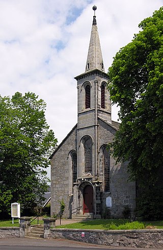
Lilias Adie was a Scottish woman who lived in the coastal village of Torryburn, Fife, Scotland. She was accused of practising witchcraft and fornicating with the devil but died in prison before sentence could be passed. Her intertidal grave is the only known one in Scotland of an accused witch – most were burned.